Ganghwa Island
Ganghwa Island, South Korea
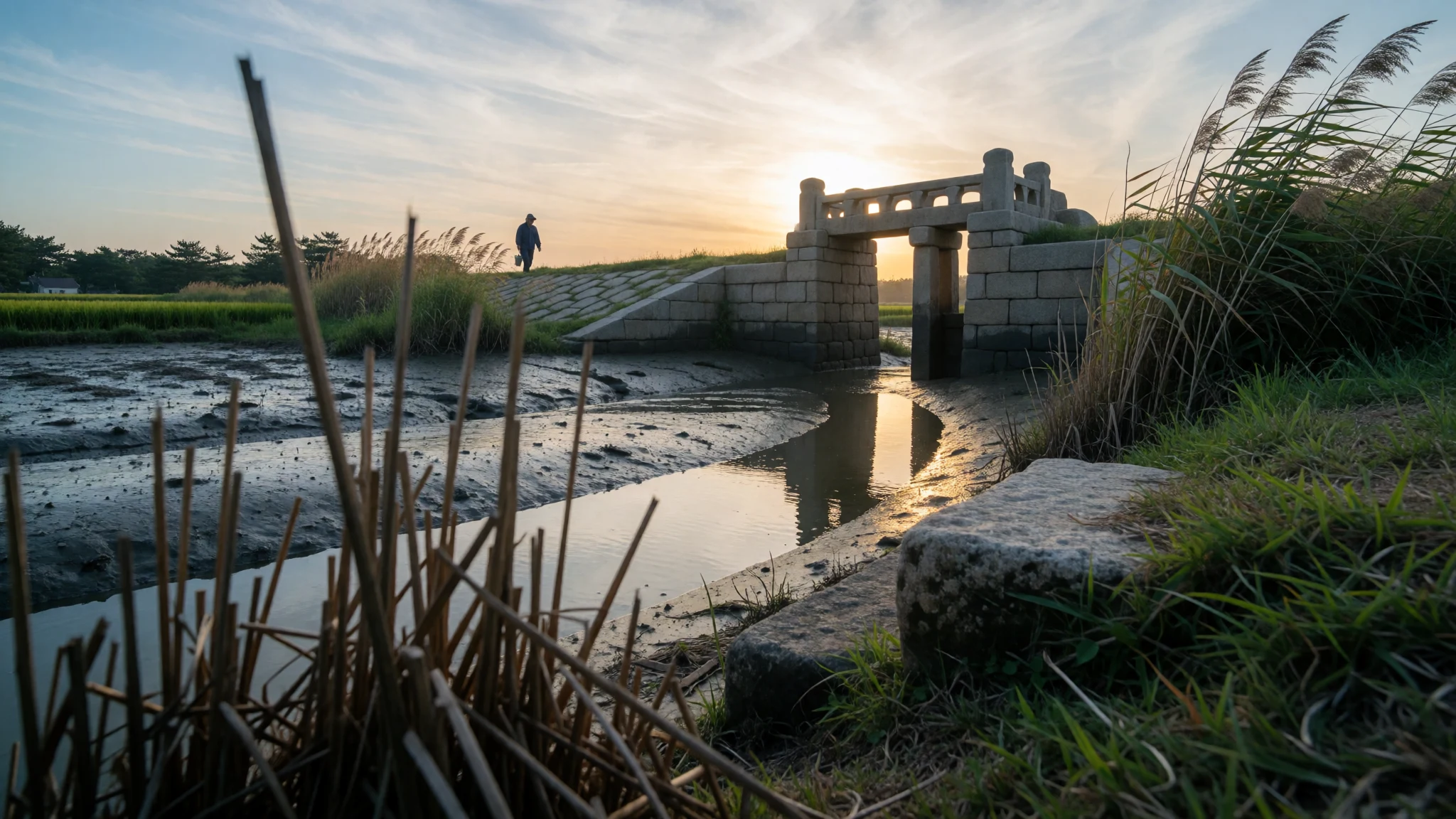
Ganghwa Island offers dolmens, a medieval refuge capital, mountain temples and tidal mudflats, all within a bus ride of Seoul.
The place
Ganghwa Island sits where the Han River meets the Yellow Sea, part of Incheon but a world away from the city's towers. It is a mostly rural island of rice paddies, low mountains and grey tidal flats, with 62,021 residents, roughly half of them in Ganghwa Town in the northeast. A narrow channel separates it from Gimpo on the mainland, and two road bridges cross it, which is why a day trip from Seoul is realistic. The island covers about 302.4 km², and its tallest peak, Manisan in the south, rises to 469 m. Other hills include Goryeosan, Hyeolgusan and Byeollipsan. Mudflats ring the shore, and centuries of reclaimed farmland have slowly enlarged the island. The north coast faces North Korea across the river, close enough that villages on the far bank can be picked out on a clear day. That border gives the northern shore a watchful mood: military posts and wire fences sit beside ordinary farms and fishing jetties. Spring brings azaleas to the hills, autumn turns the paddies gold, and winter is bare and cold with a hard wind off the sea. Summer is hot and humid. Beaches are not the point here. The appeal is open land, old stones, quiet temples and sunsets over the tide.
Its story
Ganghwa Island has served as both refuge and gatekeeper for as long as Korea has had rulers. Prehistoric communities raised dolmens here, vast stone burial monuments, and some of them are now part of a UNESCO-listed group of dolmen sites shared with Gochang and Hwasun. In 1232 the Goryeo court abandoned its mainland capital to escape the Mongol advance and settled on the island, trusting the sea channel to hold cavalry at bay. The court ruled from here for decades, building earthen walls, a palace and watchtowers, and the palace site can still be visited. Later dynasties kept the shoreline fortified because whoever held Ganghwa could threaten the water route up the Han to Seoul. That position drew foreign warships in the nineteenth century. French troops landed in 1866, and an American force followed in 1871. In 1875 an armed incident with Japan broke out off the coast, and in 1876 Korea was pressed into signing the Treaty of Ganghwa, named after the island, which opened the country to Japanese trade on unequal terms. Reading the island today means reading its shoreline, because nearly every headland has a fort, a gate or a lookout. The same strait that once sheltered a court now marks the edge of a divided peninsula.
What to see
- Bugeun-ri Dolmen — Northern Ganghwa
A prehistoric burial monument in the north of the island, where an enormous capstone rests on upright slabs in open farmland. It is large enough that standing beside it gives a real sense of scale. Local buses run from Ganghwa Town, so check the current timetable before setting out.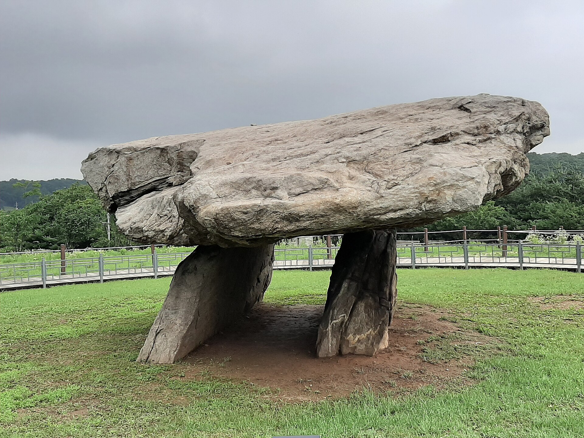
- Goryeo Palace site (Goryeogung) — Ganghwa Town
The grounds mark where the Goryeo court governed during its years of refuge from the Mongols. Little of the original palace survives, so expect restored gates, lawns and a few halls rather than grand ruins. It sits in Ganghwa Town and pairs easily with the nearby museum and fortress walls.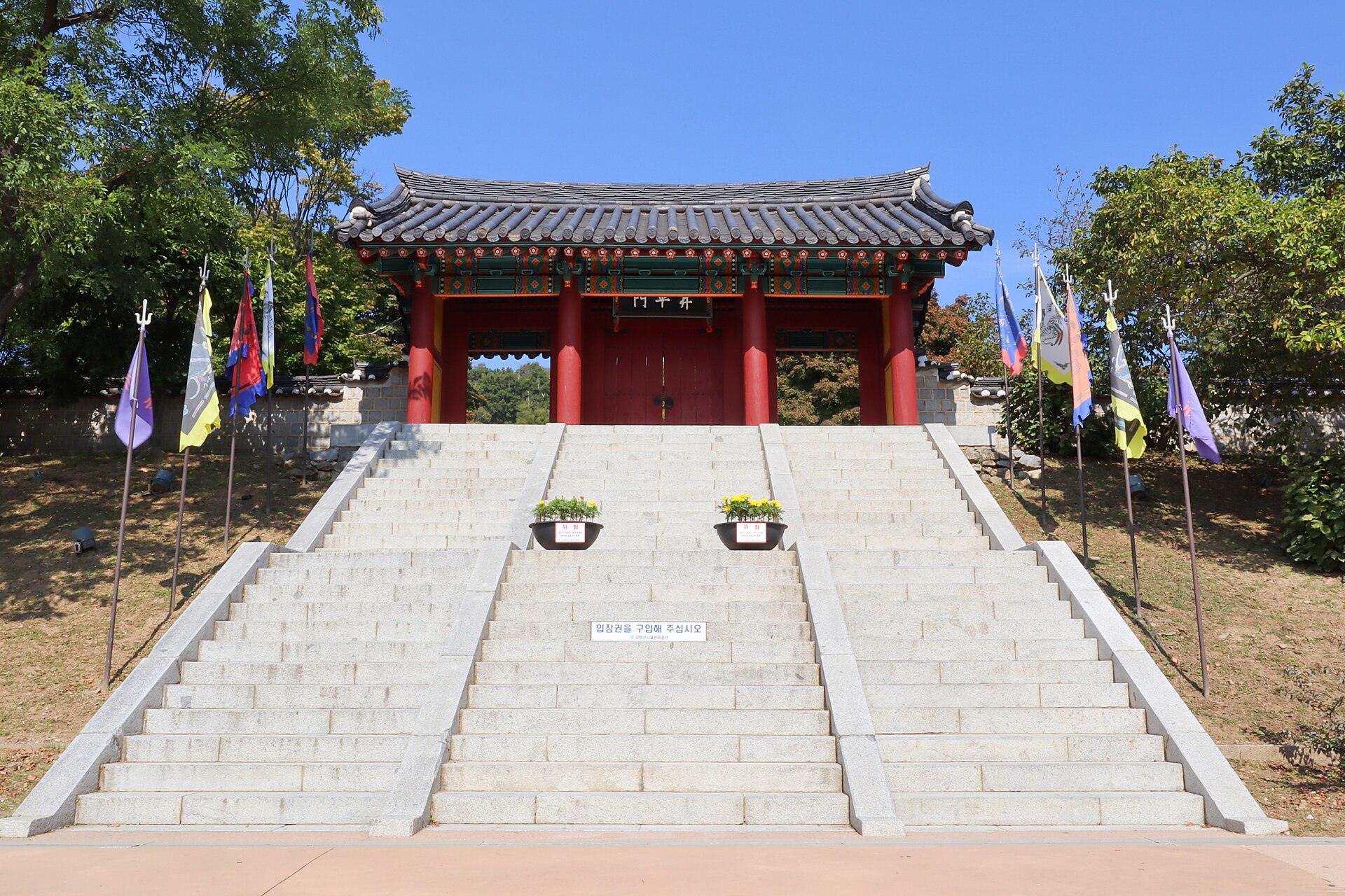
- Gapgot Dondae — Eastern coast
A coastal fortress on the strait, built to guard the water approach to the capital. The walls and lookout give wide views over the channel and mudflats, and the setting makes the island's defensive role easy to grasp. Late afternoon light on the water is especially good here. - Bomunsa, Seokmodo — Seokmodo, west of Ganghwa
A Buddhist temple on the neighbouring island of Seokmodo, set in a rocky grotto with carvings in the stone. Reaching it means a short boat crossing and then a climb, so allow most of a day. Check ferry times locally, since services depend on tides and weather. - Chamseongdan, Manisan — Southern Ganghwa
A stone altar near the top of Manisan, said to have been used for ceremonies honouring the legendary founder Dangun. The walk up is moderate and rewarded with views across the south of the island and out to sea. It is the focus of an October founding-day celebration.
Culture
Ganghwa Island carries three layers of Korean life at once: farming, Buddhism and a long habit of national memory. Rice, turnips and ginseng shape the rural calendar, and village markets still matter more than shopping malls. Temples on hillsides and islets, such as Jeondeungsa and Bomunsa, are active places of prayer rather than museum pieces, and families come to light lanterns and bow before the Buddha. Older myth sits alongside the history: Chamseongdan on Manisan is linked in tradition with Dangun, the legendary founder of the Korean people, and a foundation-day gathering is held there in early October. Other seasonal events include an azalea festival in mid-April, a salted-shrimp festival at the Oepo-ri dock in early October, and a ginseng festival in mid-October. The dolmens and fortress walls remind locals and visitors alike that this was once the seat of government. The northern coast adds a modern note, because the island lies directly beside the border. Observation points there are visited by Koreans curious about places they cannot cross, and the mood is thoughtful rather than festive. Conversation with older residents often turns to family members, harvests or the weather before anything else. Remove your shoes before stepping into temple halls, keep your voice low, and do not photograph military posts or the northern bank where signs forbid it.
What to wear
Ganghwa Island follows the national tradition of hanbok, the Korean dress made up of a short jacket (jeogori) and a full wrapped skirt (chima) for women, or a jacket and loose trousers (baji) for men. Fabrics vary with season: ramie and hemp for summer, silk for formal occasions, and padded cotton for winter. Hanbok are worn today mainly at weddings, at the Lunar New Year and at the autumn harvest festival, and visitors will often see them at palace and heritage sites. Daily dress on the island is practical and rural: work trousers, fleeces and sun hats in the fields, and trainers or boots for hill walking. Younger people dress much as they would in Seoul, in casual layers with an eye to the weather. A visitor should dress for the terrain and the season. In summer pack light, breathable cloth, a hat and sun protection, as paths and shorelines have little shade. In winter bring a windproof coat, gloves and a scarf, because the wind off the sea is cold. Sturdy walking shoes matter for fortress steps, mountain paths and muddy tideline walks. At temples and the altar on Manisan, cover shoulders and knees as a courtesy, and choose shoes that slip off easily.
What to eat
- Ganghwa turnip kimchi — Village eateries and Pungmul Market in Ganghwa Town
The island's turnips have been grown here for a very long time, and they are fermented into crunchy, mildly peppery kimchi. The root is juicy and slightly sweet. Look for it as a side dish at village eateries and for sale in jars. - Salted shrimp (saeujeot) — Oepo-ri dock and its surrounding stalls
Tiny shrimp preserved in salt are a staple seasoning for kimchi and stews, and the island is known for them. The taste is sharp and savoury, so it is used sparingly. Buy small tubs near the harbour, especially around the October festival. - Ginseng dishes — Pungmul Market and ginseng shops in Ganghwa Town
Ganghwa is a ginseng-growing area, and the root appears in chicken soup, teas and sweets. It tastes earthy and slightly bitter, softened by long cooking. Fresh roots are sold whole at markets, and a festival celebrates the harvest in mid-October. - Fresh tofu and market snacks — Pungmul Market, Ganghwa Town
Pungmul Market sells fresh tofu alongside vegetables, fish and grain. Soft tofu eaten warm with a little soy and sesame is simple and filling. Markets are best in the morning, and a loop of the stalls makes a cheap lunch. - Mudflat seafood — Seafood restaurants along the coast and harbours
Tidal flats and the Yellow Sea supply clams, crabs, fish and shellfish, served grilled, steamed or in spicy stews. Coastal restaurants often sell by weight and share platters across the table. Ask what came in that day.
Plan it
Best time. April–May for azaleas and mild weather, and September–October for golden paddies and clear air. Summer is hot and humid, and winter is cold and windy.
How long. 1–2
Getting there. Fly to Incheon or Gimpo airport, then take a bus or train into Seoul or Incheon. Direct buses run from Sinchon Bus Terminal in Seoul to Ganghwa Town in about 90 minutes, with others from Bupyeong and Incheon. Local buses then link the main sights.
Budget. low
Tips
- Check local bus timetables early, as rural services are less frequent than in Seoul
- Hire a car or bicycle if you want to reach dolmens, forts and coastal spots in one day
- Check ferry times for Seokmodo before you go, because weather and tides affect crossings
- Carry some cash for market stalls and small village eateries
- Bring water and sun protection in summer, as paths have little shade
Etiquette
- Remove shoes when entering temple halls
- Do not photograph military posts or restricted areas near the border
- Keep voices low at temples and ritual sites
Nearby
Sources
- Wikidata Q494786 (CC0)
- Wikipedia: Ganghwa Island (rev 1383778242) (CC BY-SA 4.0)
- Wikivoyage: Ganghwa Island (rev 5404997) (CC BY-SA 4.0)
- Example of a southern-style dolmen at Ganghwa Island, Taewangkorea (CC BY-SA 4.0)
- Goryeo Palace 고려궁지 입구, Mobius6 (CC BY-SA 4.0)
- A boat on the shore in Ganghwa Island, Nt (CC0 1.0)
- A Floating Boat in Ganghwa Island, Nt (CC0 1.0)
- A Forbidden Land - Voyages to the Corea (1880) - Frontispiece, Ernst Jakob Oppert (Public domain)
- A Road between Paddies in Ganghwa Island, Nt (CC0 1.0)
- A Road in Ganghwa Island, Nt (CC0 1.0)
- A rusty sign in Ganghwa Island, Nt (CC0 1.0)


