Espiritu Santo
Espiritu Santo, Vanuatu
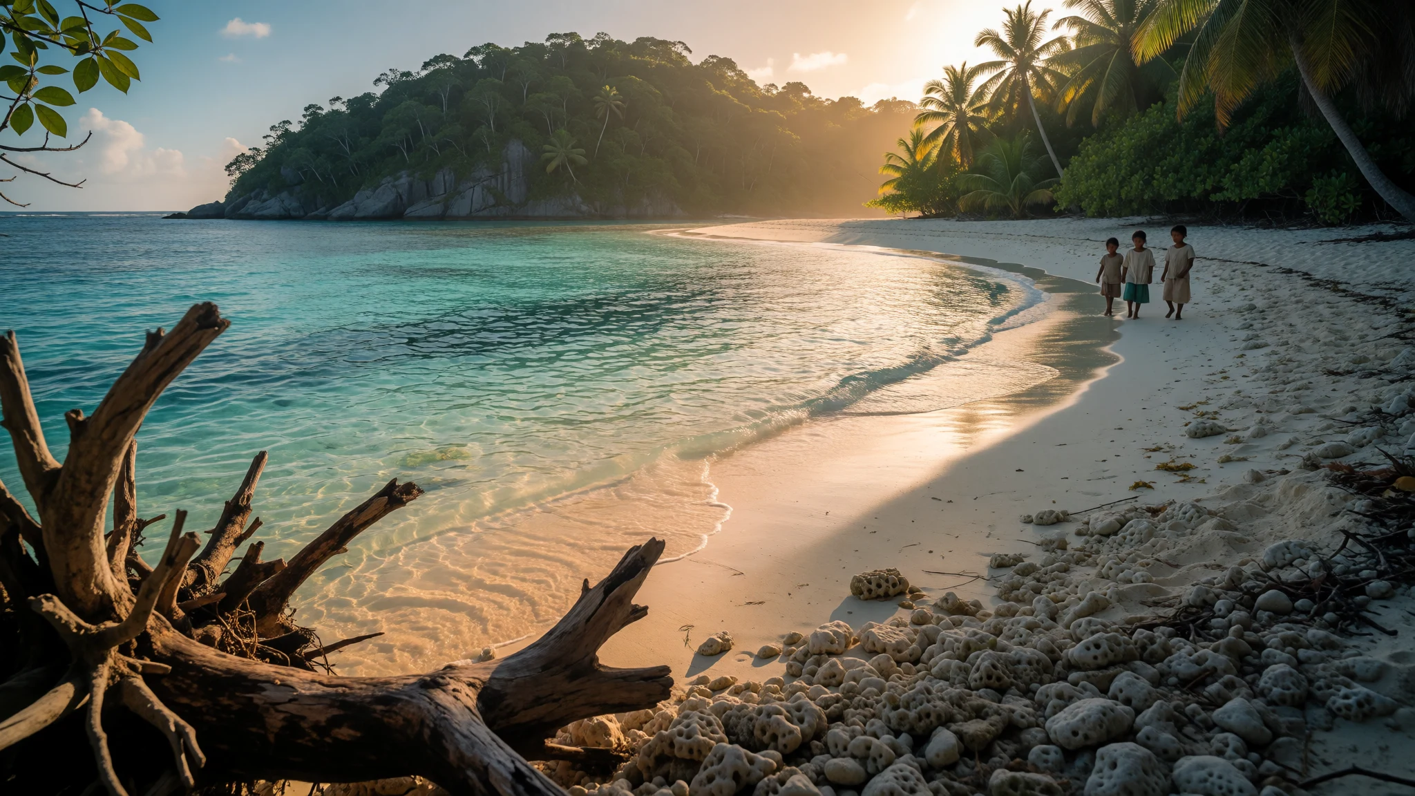
Espiritu Santo is Vanuatu's largest island, with clear reefs, wartime wrecks, caves and villages where custom still shapes daily life.
The place
Espiritu Santo, usually shortened to Santo, is the largest island in Vanuatu, in the Melanesian part of the Pacific. The capital, Port Vila, is on Efate, but Santo has the bigger footprint and a much emptier interior. Luganville, on the south-east coast, is the only true town and the seat of Sanma Province. Three main roads fan out from it: one west along the south coast to the village of Tasiriki, one round the south and east coasts through Hog Harbour and Golden Beach to Port Olry, and a third that branches inland near Turtle Bay and climbs towards Big Bay. Beyond these, much of the island has no road at all. Mountains fill the west, and Mount Tabwemasana reaches 1,879 metres. Rivers run down from the high ground to the sea, and the Sarakata flows through Luganville itself. Offshore lie many small islands and islets, among them Oyster Island, Elephant Island, Tangoa and Bokissa. Most people live by farming and fishing. Copra is the main cash crop, with some cocoa, kava and peanuts, and villages keep their own vegetable gardens, chickens and pigs. Diving and the occasional cruise ship add a second income. The international airport lies a short way east of Luganville. Even the town feels rural: a market, a few supermarkets, a waterfront, and then green country within minutes.
Its story
Espiritu Santo entered European records in 1606, when three Spanish ships under the Portuguese navigator Pedro Fernandes de Queirós anchored at Big Bay on the north coast. Queirós believed he had found the great southern continent that geographers of the time expected to exist. He named the land after the Holy Spirit and in honour of the Spanish king's Austrian ancestry. The landing went badly. A local chief tried to drive the strangers back to their ships, arrows and musket fire were exchanged, and the chief died. The expedition stayed about a month, with armed parties foraging inland for food. Queirós declared that a city called Nova Jerusalem would be founded and even named its officials, but supplies ran short and the ships left in early June. His flagship drifted away from the bay, whether from weather or mutiny, and could not return. His second-in-command, Luis Váez de Torres, searched the coast for survivors or wreckage and found none. The settlement never happened. Santo's other great chapter came in the Second World War, when it was a large Allied base. When the war ended, the American forces dumped much of their equipment into the sea, which is why divers now swim among sunken vehicles. Local people, meanwhile, have lived on the island far longer than any of these visitors, and their chiefs and customs outlasted every foreign plan.
What to see
- Champagne Beach — North-east coast
Champagne Beach, on the north-east coast, is a curve of pale sand with very clear water, good for swimming and snorkelling. It is popular enough that cruise-ship days bring crowds, so check when ships are in port and go on a quiet day or early. Other beaches nearby are emptier.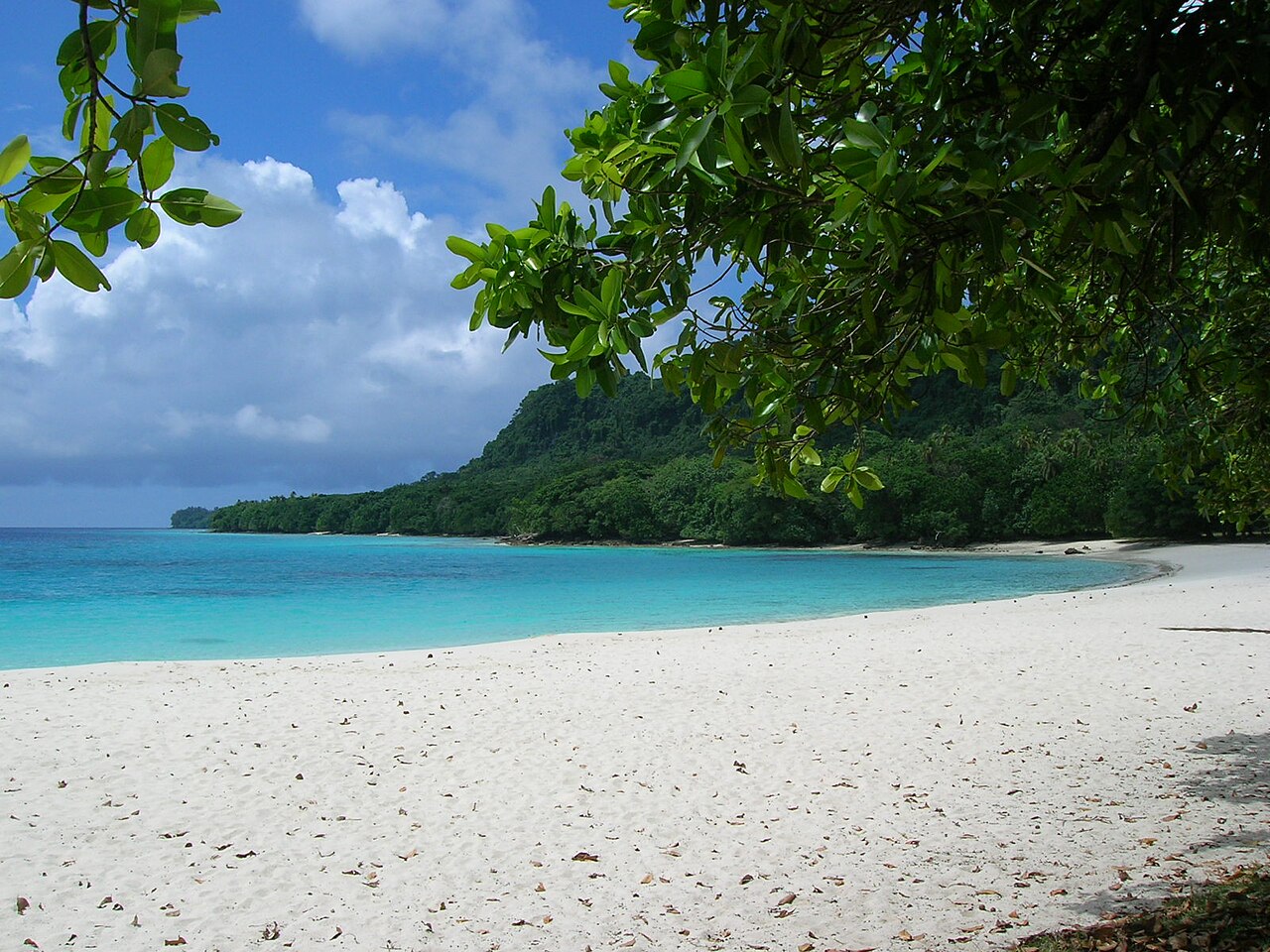
- Lonnoc Beach — North-east coast
Lonnoc Beach lies close to Champagne Beach and is usually calmer. The water is clear and shallow enough for easy snorkelling, with reef fish close to shore. Bring your own mask, water and snacks, as facilities are simple, and ask the local landowners about access before you settle in. - SS President Coolidge — Off Luganville
The President Coolidge began as a luxury liner and ended the war as a troopship, and the wreck still shows both lives. It is a deep dive that demands experience, particularly if you plan to go inside, and it should be done with a reputable operator. Non-divers can still enjoy the story ashore. - Million Dollar Point — Near Luganville
After the war, the American military pushed vast amounts of unwanted equipment into the sea here. Snorkellers and divers now find tanks, jeeps, aircraft parts and heaps of old Coca-Cola bottles on the seabed. It is a sobering, odd and easy site, far less demanding than the big wreck.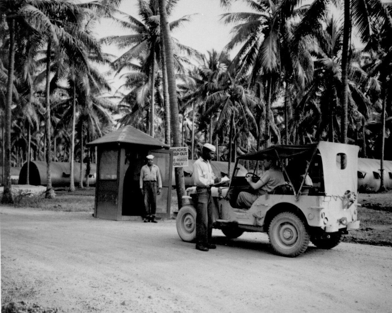
- Millennium Cave — West Santo
Millennium Cave is the best-known of the caves on the western side of the island. Visits involve a walk through bush, river crossings and dark passages, so they go with a local guide and sturdy shoes that can get wet. Expect mud, and keep a dry bag for your camera.
Culture
Espiritu Santo has more than thirty local languages, all part of the North Vanuatu group, so a few miles can mean a different mother tongue. Bislama, the national pidgin, and English or French serve as common ground. Most people are Christian, but custom runs through nearly everyone's life regardless of faith, and the chief system remains strong in most areas. Land is held through families and villages, which is why beaches, caves and waterfalls often have a named custodian who expects a conversation, and sometimes a small fee, before visitors arrive. Gardens, pigs and kava all carry social meaning, and kava is the drink of choice in many places, while alcohol is becoming more common and brings its own problems. Health services are stretched. Malaria and tuberculosis are real concerns, and many people turn to traditional healers or to mission clinics rather than the hospital. The war left its mark too: Luganville still feels shaped by the years when it hosted a large foreign base, and older residents may have family stories about that time. Life moves at village pace, with church on Sundays, plenty of time for talk, and hospitality offered easily. Greet people when you pass them on a path or road, and ask a landowner or chief before you swim, walk or camp on any beach or enter any village, and ask before photographing people.
What to wear
Espiritu Santo has no single national costume, and dress varies between villages and language groups. Traditional wear is mostly reserved for ceremonies, dances and custom events, when men may wear woven pandanus or bark belts and women grass or fibre skirts, often with feathers, shells and painted designs. Plant fibres and barkcloth were the old materials, and woven mats and baskets are still made by hand. For everyday life, most people wear light cotton clothes. Women often wear the Mother Hubbard, a loose, bright, floral dress with sleeves, introduced by missionaries and now thoroughly local. Men wear shirts and shorts or long trousers, and flip-flops are common. On Sundays people dress up for church, with clean shirts and the best dress. For visitors, the climate is hot and humid, so light, quick-drying cotton or linen is best, along with a hat and reef-safe sun cream. Modesty matters away from the beach, so cover shoulders and knees in villages, and women should wear a sarong or skirt rather than swimwear when walking through a settlement. Bring water shoes for reef, river and cave walks, sturdy trainers for bush tracks, and a light rain jacket, as showers are frequent.
What to eat
- Laplap — Village kitchens and Luganville market
Laplap is a pudding of grated root vegetable, usually yam, taro or manioc, wrapped in leaves and baked in an earth oven, often with coconut cream or meat. Ask in villages, at family feasts, or at market stalls near Luganville. - Coconut crab — Village guesthouses and waterfront eateries
Coconut crab is a local delicacy, usually cooked in coconut milk or grilled over a fire. It is sensitive stock, so ask whether it is legal and sustainable to eat before ordering. Look for it in village guesthouses and the occasional waterfront eatery. - Island cabbage — Luganville market and village meals
Island cabbage is a leafy green cooked with coconut cream, and it appears beside most meals. It has a gentle, slightly slippery texture and is a good vegetarian option. Buy it fresh at the market in Luganville, or eat it at any family table. - Tropical fruit — Roadside stalls and Luganville market
Pineapples and mangoes are sold sweet and cheap in season. Natapoa and nouse nuts are local too, the latter with sweet, fleshy fruit. Buy fruit from roadside stalls and the market, and eat it fresh with a knife. - Grilled fish with root vegetables — Beachside eateries and homestays
Fresh reef or open-sea fish is grilled or steamed and served with taro, yam or manioc. It is a simple meal, often eaten near the water. Look in small beachside eateries and at village homestays on the coast.
Plan it
Best time. May to October is the drier, cooler part of the year and the most comfortable for snorkelling, diving and bush walks. From November to April it is hotter, wetter and more humid, and cyclones are possible, so check forecasts and keep dates flexible.
How long. 4–6
Getting there. Fly to Santo's international airport, a short drive east of Luganville, usually via Port Vila or on a direct regional service; check current routes with the airlines. Taxis and minibuses cover the town, and for beaches and villages you can hire a vehicle or driver in Luganville.
Budget. mid
Tips
- Hire a local driver or guide for the north coast and caves, as most of the island has no road
- Carry cash, since card payments are limited outside Luganville
- Check cruise-ship days before going to Champagne Beach
- Take malaria advice from a travel clinic before you leave and bring insect repellent
- Book wreck dives with a registered operator and share your experience honestly
Etiquette
- Ask permission from the landowner or chief before using a beach, cave or village path
- Dress modestly in villages and on Sundays
- Ask before photographing people
Nearby
Sources
- Wikidata Q337524 (CC0)
- Wikipedia: Espiritu Santo (CC BY-SA 4.0)
- Wikivoyage: Espiritu Santo (CC BY-SA 4.0)
- Island of Vanuatu - Espiritu Santo (M. Minderhoud) (Public domain)
- Men serving on Espiritu Santo WWII (US Navy) (Public domain)
- BestPoint (Samantha Alice Morris) (Public domain)
- Champagne Beach (Jae Lee) (Public domain)
- Champagne beach - local children (Bkj1000) (CC BY 3.0)
- 1 Computer; 8 Eyes (Michael Coghlan) (CC BY-SA 2.0)
- Pilots of MAG-11 swimming at Turtle Bay (National Archives 80-G-K-2129) (Public domain)
- Albino Ni-Vanuatu (Michael Coghlan) (CC BY-SA 2.0)


