Emas National Park
Emas National Park, Brazil
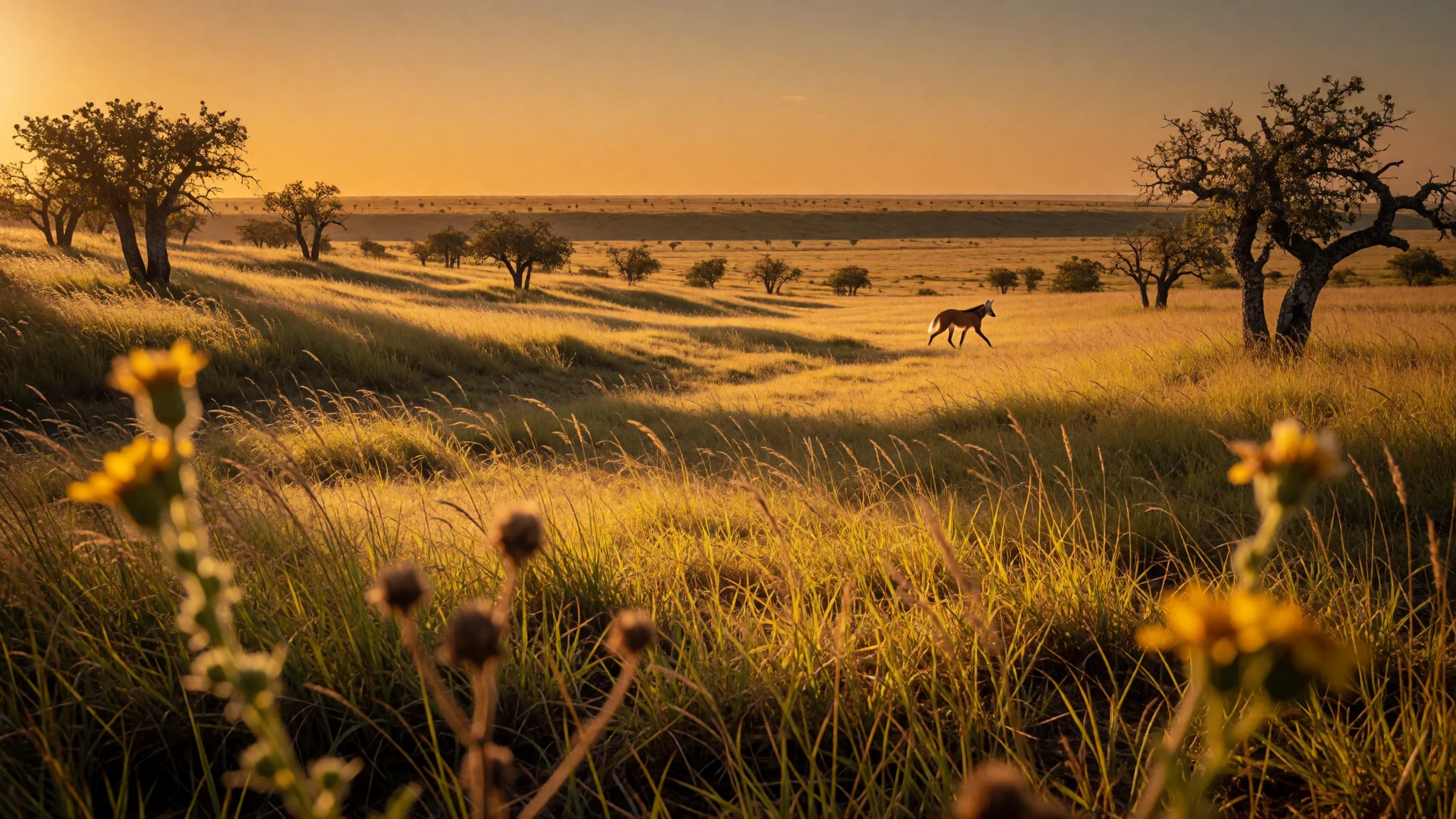
Emas National Park is wide, flat Cerrado grassland where anteaters, rheas and maned wolves are easier to spot than in dense forest, and termite mounds glow after dark.
The place
Emas National Park lies on the line between Goiás and Mato Grosso do Sul, in Brazil's centre-west, at about 816 metres above sea level. Its name comes from the ema, the greater rhea, a tall flightless bird that stalks the open grass. The landscape is cerrado, Brazil's tropical savannah: broad, almost level plateaus of grass, scattered scrubby trees, wet hollows with palms called veredas, and strips of forest along the rivers. Because the ground is so flat and the vegetation so low, the horizon feels enormous, and animals are easier to spot here than in the dense forests many people associate with Brazil. Giant anteaters, maned wolves, pampas deer and tapirs live here, alongside jaguars and pumas that are rarely seen. Emas belongs to a UNESCO-listed group of Cerrado protected areas, shared with Chapada dos Veadeiros National Park, partly because it shelters animals under threat. The park also matters for water: its streams feed river systems that run towards both the Amazon and the Paraná–La Plata basins. The edge of the park is abrupt. Beyond the boundary, giant mechanised farms grow soybeans and maize in neat geometric blocks, and the contrast is plain from the entrance roads. There is no lodge inside. People base themselves in nearby towns, go in with a guide, and spend a long, quiet day among grass and sky. It is remote, hot and open, and it rewards patience more than a tight itinerary.
Its story
Emas National Park was created in 1961, and its story since then is mostly about an island forming around it. Cerrado once covered a broad belt of central Brazil, but its flat, well-drained plateaus turned out to suit heavy machinery, and large farms spread across them. The park's grassland stayed intact while the land around it was converted to soybeans, maize and other crops. That makes Emas valuable and vulnerable at once: it is increasingly cut off from other patches of natural Cerrado, so animals with large ranges have fewer places to go. Farming still underpins the regional economy, which is why the park's neighbours are working towns such as Chapadão do Céu, Mineiros and Costa Rica rather than wilderness settlements. International recognition came later, when Emas was listed with Chapada dos Veadeiros as the Cerrado Protected Areas. That status points to what is at stake: a savannah that helps recharge underground water, feeds rivers heading in different directions across the continent, and shelters anteaters, wolves and deer. For a visitor, the history is easy to read from the road in. Crops run in perfect lines, then stop at a fence, and wild grass begins. The park's own name, the rhea, is a reminder that these plains were bird country long before they were farmland, and that the animals have no way of knowing where the boundary is.
What to see
- The open grassland — Interior plateaus of the park
The heart of Emas National Park is its campo sujo, grassland with scattered shrubs, stretching flat to the horizon. A slow drive at dawn or late afternoon is the classic way in. Rheas, deer and anteaters cross the open ground, and the light is soft. Midday is hot and mostly quiet.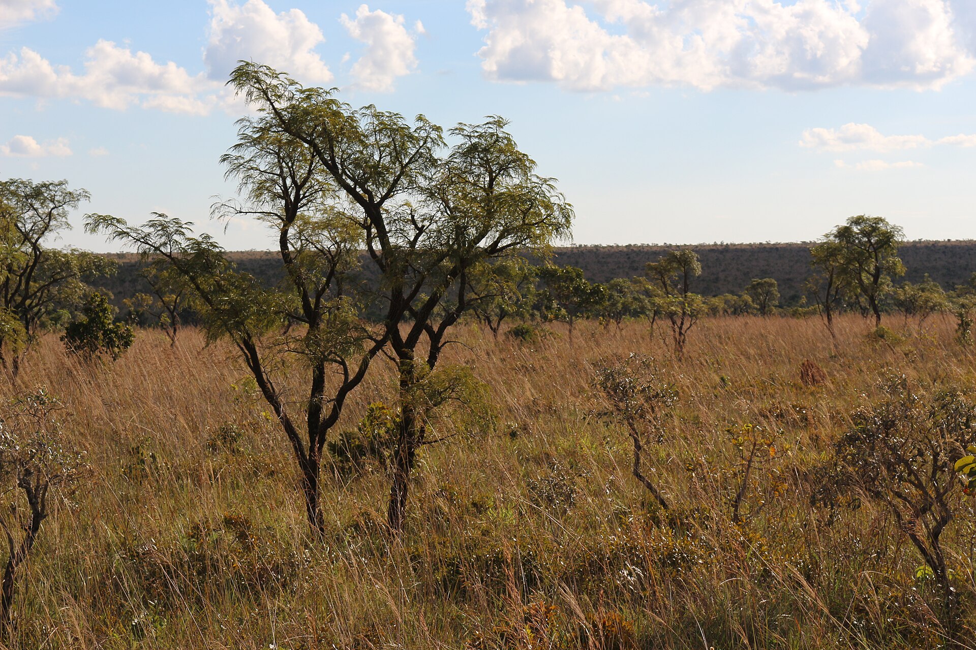
- Termite mounds and their night glow — Grassland near the Bandeira side
Tall termite mounds stand across the grassland like small earthen towers. Around October and November, depending on rain, beetle larvae in some mounds shine green after dark to lure insects. This needs an authorised night excursion, and the display varies from year to year, so ask your guide what to expect.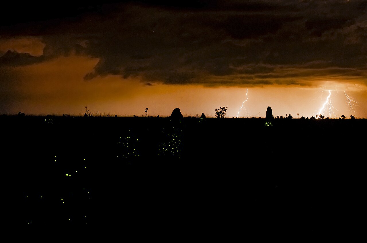
- Wildlife drive — Park tracks, guided
A guided drive is the most reliable way to find maned wolves, giant anteaters, pampas deer and tapirs, and a good guide knows the quiet corners where birds gather. Crab-eating foxes often appear near tracks. Keep your distance, stay in the vehicle where told, and never follow an animal for a better photograph.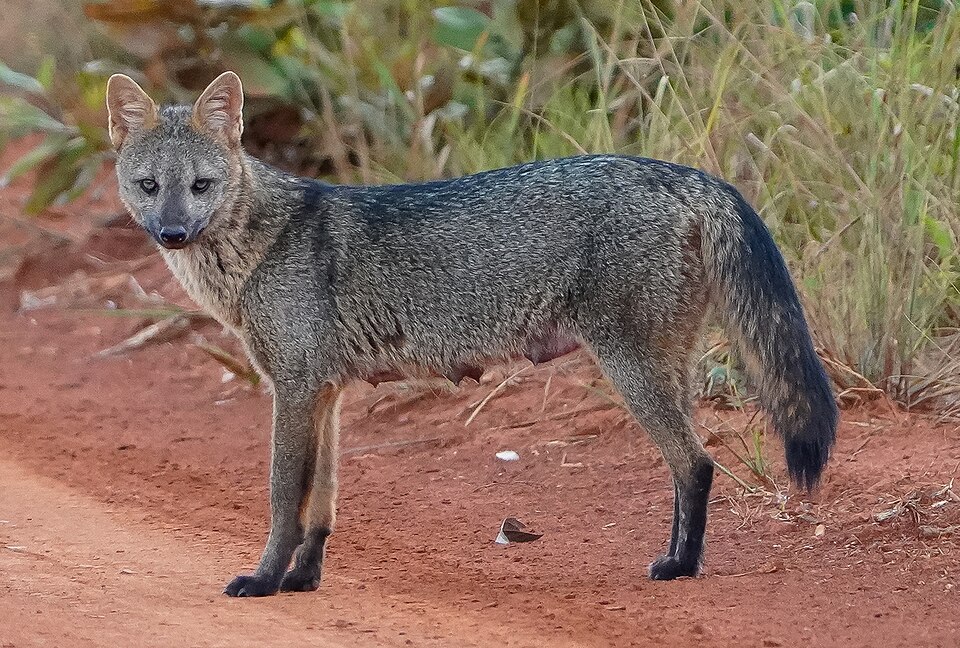
- Rio Formoso — River valley within the park
Clear water, small rapids and green riverside forest make the Rio Formoso a cool change from the dry plateau. Mist often hangs over the bend at first light. Boating, tubing and other water activities depend on an authorised guide, so arrange them in advance through a local operator.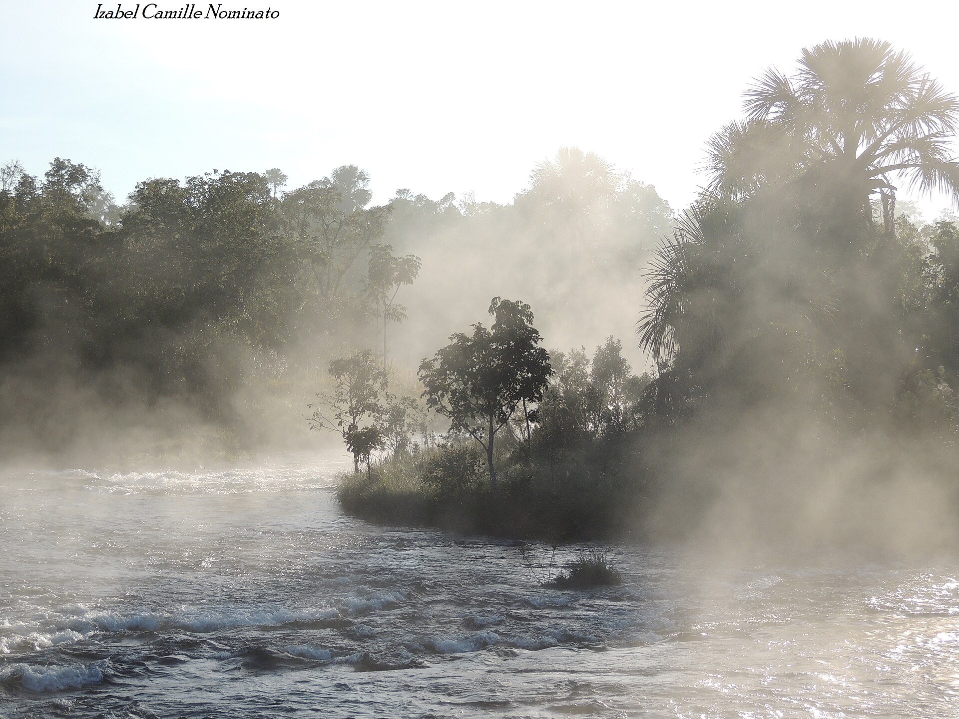
- Macaws and birdlife — Forest edges and veredas
Emas is good for birds beyond the rhea. Large macaws pass over the palms and forest edges, and smaller species work the grass and scrub. Early mornings are best, and binoculars help more than a long lens. A guide will point out species you would otherwise walk straight past.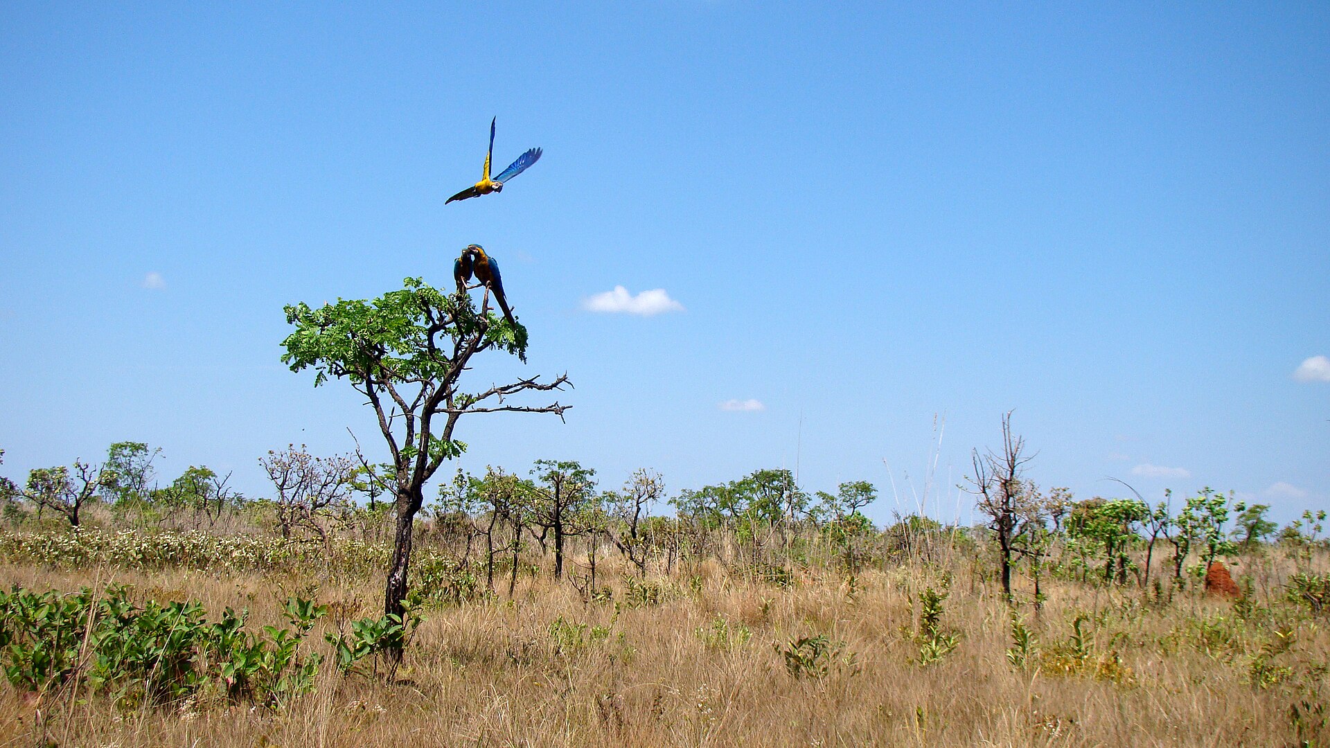
Culture
Emas National Park is a protected area first and a destination second, and the culture around it is that of Brazil's farming centre-west. Towns such as Chapadão do Céu and Mineiros grew with agriculture, so conversation often turns to harvests, rain and machinery, and many local guides combine park work with close knowledge of the land. The park is run by ICMBio, the federal conservation agency, and most activities, from night excursions to river trips, go through accredited guides. That rule is worth respecting rather than treating as a formality, since it protects both visitors and animals. Goiás has its own country-music and rodeo traditions, and small towns hold festivals through the year, so ask at your accommodation what is on. Rural hospitality is warm and unhurried, greetings matter, and a little Portuguese goes a long way because English is not widely spoken outside the tourism trade. The Cerrado also has long meaning for the people who live beside it: fruits such as pequi are gathered and cooked, and many plants have traditional uses. Visitors who show interest in these things usually find guides generous with stories. Keep to the marked routes and your guide's instructions, never feed or chase animals for a photograph, and carry all your rubbish out with you.
What to wear
Emas National Park has no single costume, but the interior of Goiás has a strong country look that locals still wear and celebrate. Traditional rural dress means wide-brimmed straw or felt hats, cotton shirts, sturdy trousers and leather boots, the practical clothes of cattle and farm work. At the June festivals, known as festas juninas, people dress up in chita, a bright printed cotton, with checked shirts and straw hats for the men and ruffled dresses for the women. Day to day, people in Chapadão do Céu and Mineiros wear what suits the heat: light shirts, jeans or work trousers, football tops, caps and sandals, with a rodeo-influenced belt and boots for a night out. Nobody expects special dress from a visitor, and there are no modesty rules in the park, though town life is casual rather than beachwear. For the grassland, the sun is the main concern. Wear light, long-sleeved, breathable shirts, long trousers, a wide-brimmed hat with a strap, and sunglasses. Choose closed, comfortable shoes with good grip and thick socks, because tracks are dusty and grass can hide insects and thorns. Muted greens and browns attract less attention from wildlife than bright colours. Bring a warm layer for cool dawns in the drier months, and a light rain jacket if you travel when storms are likely.
What to eat
- Arroz com pequi — Home-style eateries in Chapadão do Céu and Mineiros
Rice cooked with pequi, a Cerrado fruit with a strong smell and a rich, buttery flavour. The stone has sharp spines, so locals bite gently and never chew through. It is a Goiás signature and tastes best when the fruit is in season. - Galinhada — Lunchtime buffet restaurants in the park's gateway towns
A one-pot dish of chicken and rice, coloured and seasoned with turmeric or saffron-style spice and often finished with fresh herbs. It is filling, simple and made for farm workers, which is why it turns up on lunch menus across the region. - Empadão goiano — Bakeries and snack counters in Mineiros and Costa Rica
A deep savoury pie from Goiás, usually filled with chicken, sausage, cheese and sometimes other local ingredients, baked in a pastry case. A slice makes a good travelling meal, and many bakeries sell it by the piece. - Pamonha — Roadside stalls and markets in the nearby towns
Fresh sweet corn ground into a paste, wrapped in its own husks and steamed or boiled. Some versions are sweet, others filled with cheese or served savoury. It is a common roadside snack and pairs well with coffee. - Pão de queijo — Any bakery or café in Chapadão do Céu
Small, chewy baked rolls made with cassava starch and cheese. They keep well in a bag, so they suit a morning in the grassland. Buy them warm from a bakery before heading to the park, as food options inside are limited.
Plan it
Best time. July to November is the best window: roads are drier and wildlife is easier to spot in the open grass. October and November can bring the termite-mound glow after the first rains, though timing varies. Storms in the wetter months can make tracks harder and the heat heavy.
How long. 2–3
Getting there. Fly to a regional hub such as Goiânia or Brasília, then continue by road, since there is no public transport to the gates. Chapadão do Céu is the nearest town to the Bandeira entrance and usually gives the shortest morning transfer; Mineiros is the main gateway to the Jacuba entrance. Arrange a hire car or a guide transfer, and check the official site (http://www.parquenacionaldasemas.com.br) for current access.
Budget. mid
Tips
- Book an accredited guide before you arrive, as night excursions, river activities and the observation tower all need one
- Fill the fuel tank before entering and carry a spare tyre, because there is no fuel, shop or dependable mobile signal inside
- Bring far more drinking water than you expect to need, plus packed food, as the park has little shade and limited food service
- Start at first light for wildlife and cooler air, and tell your guide or accommodation your route and return time
Etiquette
- Stay within the permitted areas and hours, and follow your guide's instructions
- Never feed, follow or surround animals, and keep food in closed containers
- Take all rubbish and food scraps out with you
Nearby
Sources
- Wikidata Q752218 (CC0)
- Wikipedia: Emas National Park (rev 1365733147) (CC BY-SA 4.0)
- Wikivoyage: Emas National Park (rev 5323386) (CC BY-SA 4.0)
- Photo: Parque Nacional das Emas - Goiás - Brasil, Andreza Oliveira Borges (CC BY 3.0)
- Photo: Araras no Parque Nacional das Emas, Luciano Thomazelli (CC BY 3.0)
- Photo: Amanhecendo em Emas, Izabel Camille Nominato (CC BY 3.0)
- Photo: Arara-canindé nas cinzas do cerrado, Emilio Swany Guerreiro (CC BY-SA 4.0)
- Photo: Araras2, Lucthomazelli (CC BY-SA 4.0)
- Photo: As Brumas do Rio Formoso, Izabel Camille Nominato (CC BY 3.0)
- Photo: Bioluminescencia e raios, Ary Nascimento Bassous (CC BY 3.0)
- Photo: Cerdocyon thous, Christopher Borges (CC BY-SA 4.0)


