Death Valley National Park
Death Valley National Park, United States
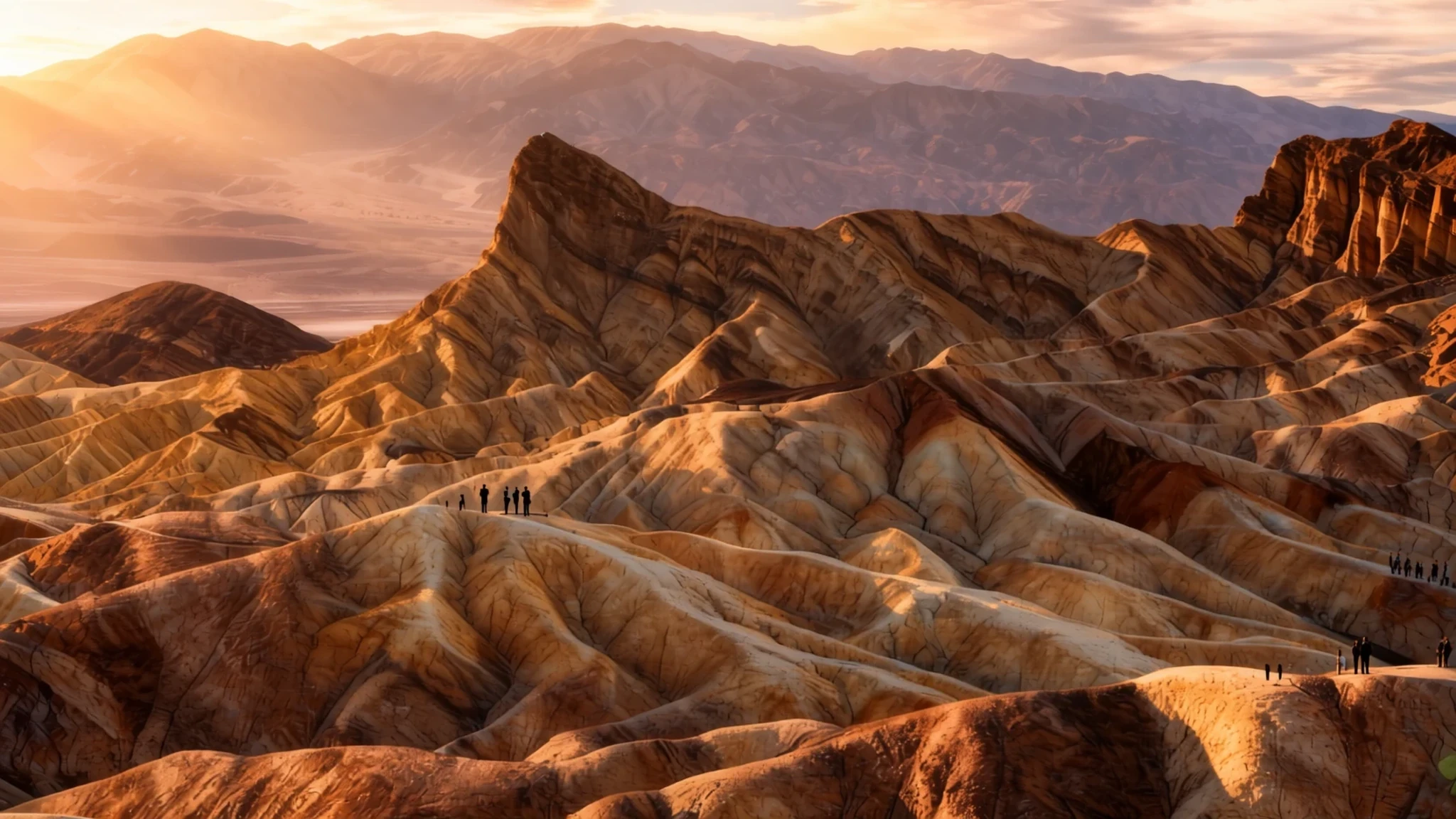
Go for heat, salt flats and rock on a scale that is hard to believe: the biggest national park in the contiguous United States.
The place
Death Valley National Park lies across the California–Nevada border, on the eastern side of the Sierra Nevada. It sits where the Great Basin and Mojave deserts meet, and it protects the north-western corner of the Mojave with its salt flats, sand dunes, badlands, canyons and mountain ranges. The park was established in 1994, though the valley had been drawing attention long before that. Its appeal lies in its extremes. It is the biggest national park in the contiguous United States and also the hottest, driest and lowest of them all. Badwater Basin, on the valley floor, lies 282 feet below sea level, the lowest point in North America. More than 93% of the park is designated wilderness, so most of it has no roads or facilities, and much of your time will be spent driving between a handful of developed areas. Life here has adapted to heat and scarcity: creosote bush, Joshua trees, bighorn sheep, coyotes and the endangered Death Valley pupfish, a small fish left over from a wetter era. Expect extremes in both directions, with fierce heat in summer and freezing nights in winter. The landscape rewards patience and good planning far more than it rewards a checklist of photo stops.
Its story
The story of Death Valley National Park starts with people who learned to live with one of the harshest landscapes in North America. Indigenous peoples lived in the area for a very long time. The Timbisha, the most recent of these groups, followed the seasons, wintering in the lowland valleys and spending summers in the highlands. The valley's name comes from a small band of European-Americans who became lost there in 1849 while searching for a shortcut to California's gold fields. They survived the ordeal, though only one of their number died, and the grim name stuck long after they had left. Mining came later. In the decades either side of the turn of the century, short-lived boom towns rose around gold and silver, and most of them faded quickly. The only mineral that proved consistently profitable was borax, carried out of the valley by teams of mules, a sight that stayed in people's memories. Visitors started coming in the 1920s, and lodgings were developed at both Stovepipe Wells and Furnace Creek. The valley then reached a wider audience through books, radio programmes, television series and films, which helped fix its dramatic reputation in the public imagination. Its designation as a national park in 1994 completed a long shift, from a place people crossed on the way somewhere else to a place protected for visitors who come to experience its extremes.
What to see
- Badwater Basin — Valley floor, south of Furnace Creek
Badwater Basin sits at the bottom of the valley, 282 feet below sea level, which makes it the lowest point in North America. The landscape is a flat expanse of white salt, and a boardwalk with signs explains the local environment before a trail heads out onto the salt itself. Go early or late in the day, bring water and a hat, and stay on the marked path.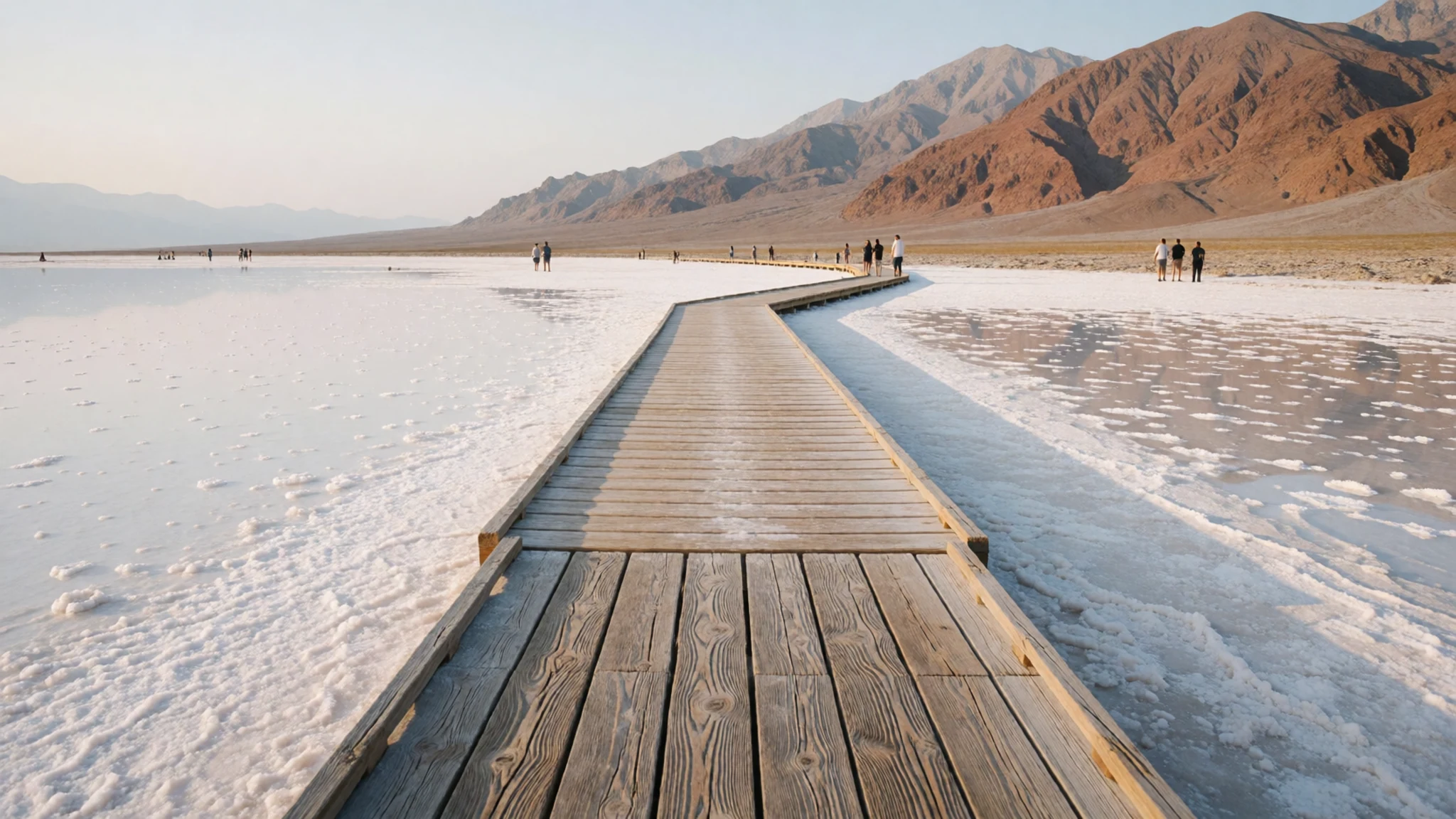
- Zabriskie Point — East of Furnace Creek
Zabriskie Point, just east of Furnace Creek, is the view most photographers come for. Its eroded hills of banded clay and sediment rise in folds that catch low sun in the early morning and late afternoon. The overlook is easy to reach by car, so expect company at sunrise, when the crowds are the price of the light.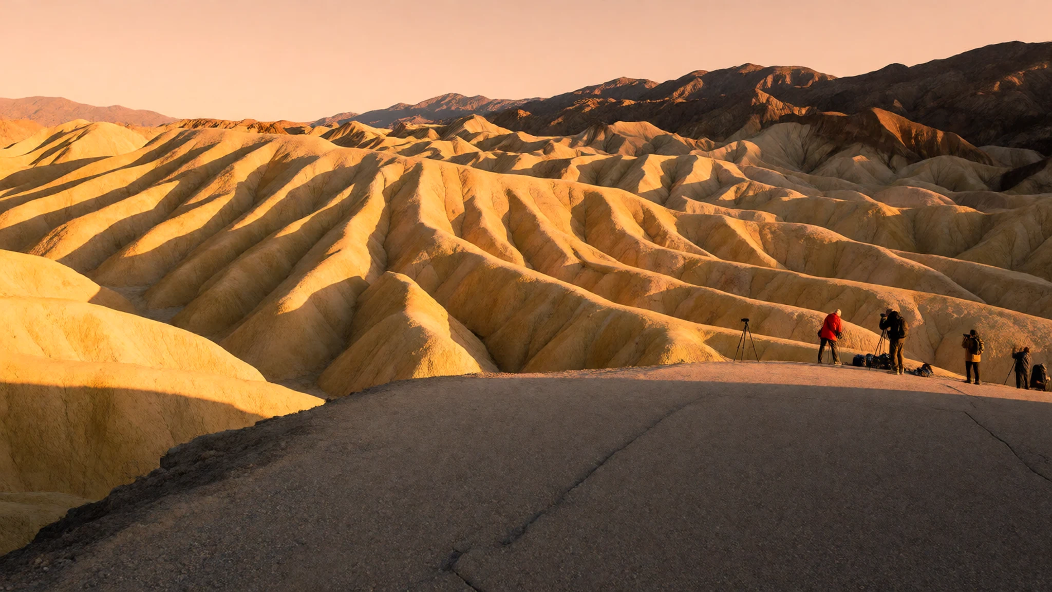
- Devil's Golf Course — Valley floor, near Badwater
Devil's Golf Course is a vast field of salt crystals on the valley floor, close to Badwater. Walk slowly and look rather than touch, because a single careless step can break crystals that take years to form again. The surface is sharp and uneven, so sturdy closed shoes matter more than fashion.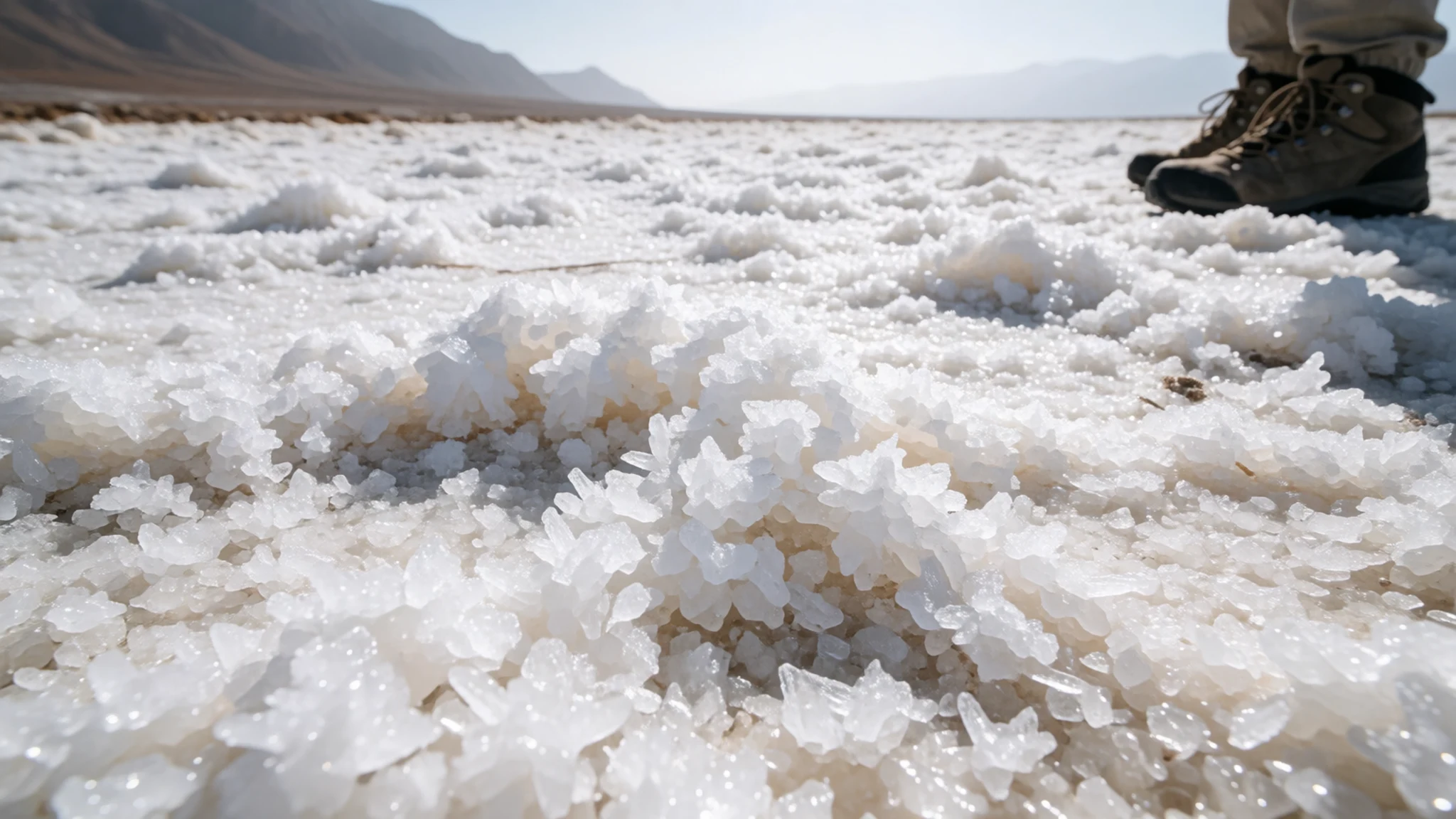
- Mustard Canyon — North of Furnace Creek
Mustard Canyon is a short hike just north of Furnace Creek, through a canyon whose rock is stained in strong colours. The best view waits at the very end, which means squeezing through narrow walls and climbing over ladders, so it suits people who are comfortable with a little scrambling. Take more water than you think you need, because shade is scarce.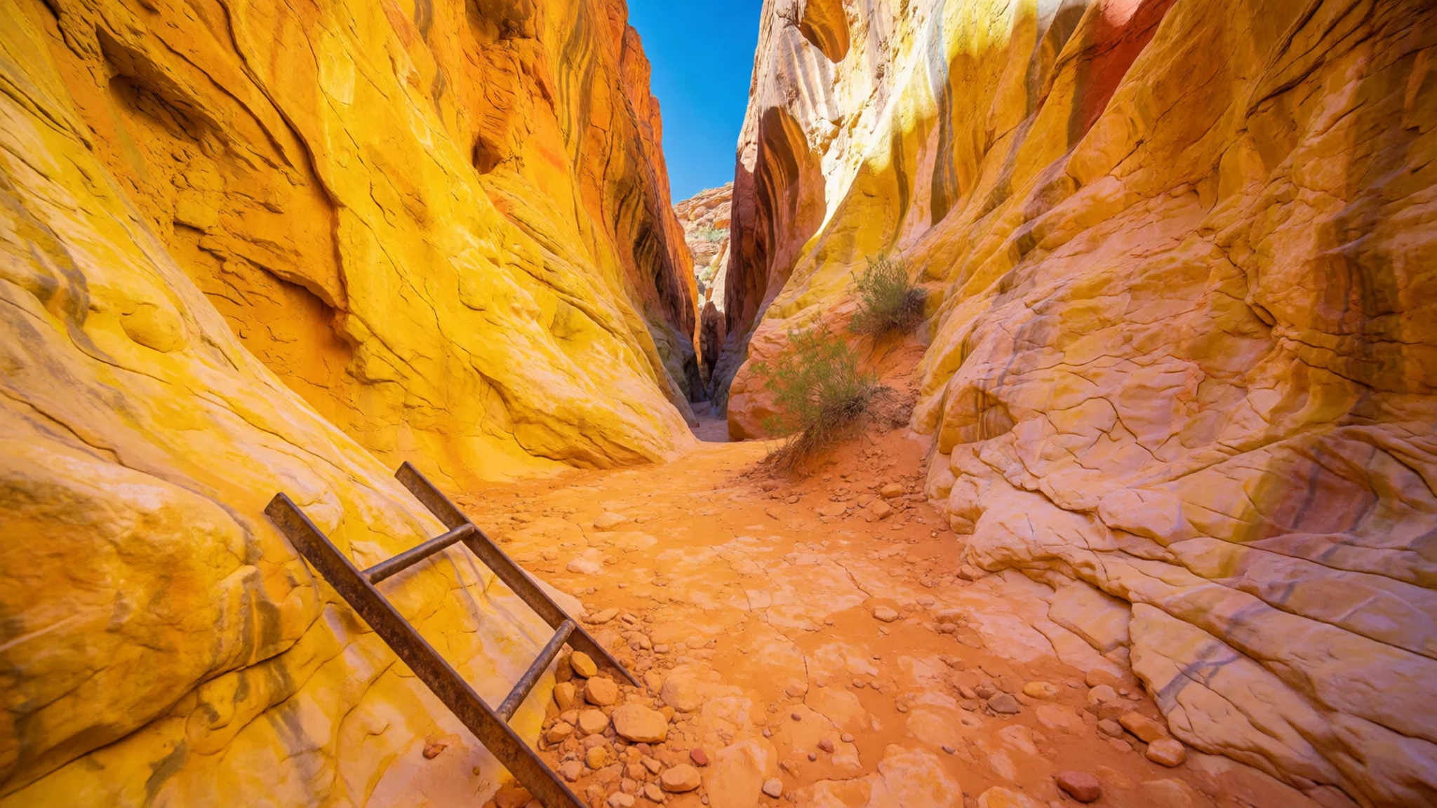
- Dante's View — Black Mountains, south of Badwater
Dante's View sits high above the valley, a drive of some distance from Badwater, and it offers a wider look across the basin than the valley-floor stops. The road is long and winding, so allow time and a full tank. Go at sunset if you want the colours shifting across the salt, and expect the wind to be cooler than you'd think at the top.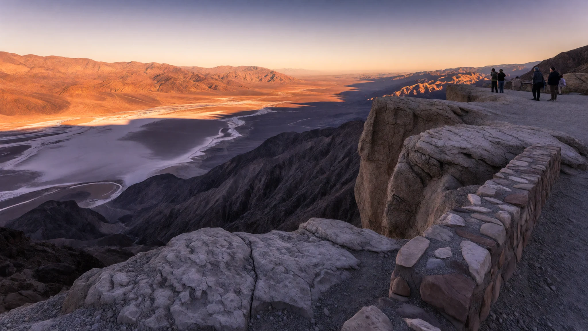
Culture
Death Valley is a wilderness with a long human history, and the Timbisha people remain part of the region's story today, so treat their homeland as more than a backdrop. Most visitors come for the scenery and the heat, but the park is shaped by a few firm rules. Stay on roads and marked routes, since the desert scars easily and tyre tracks can last for years. Leave rocks, plants and historic objects where you find them, including old mining equipment at abandoned sites, which is protected. Fuel, food and water are scarce between developed areas, so plan ahead and treat a breakdown as a serious matter rather than a quick fix. Quiet is valued too; keep music and generators away from campsites and overlooks, where the silence is part of what draws people here. Carry out everything you bring in, including food scraps, because bins are few and wildlife learns quickly from human leftovers. Above all, never walk onto the fragile salt crust at Devil's Golf Course, since one careless step can ruin crystals that take years to re-form, so keep to the marked paths and leave the surface untouched.
What to wear
Death Valley's traditional dress belongs to the Timbisha people and their Shoshone neighbours, and it was made from what the land provided. Historically, people wove fibres from plants such as yucca and shredded bark into skirts and aprons, and made warm robes from strips of rabbit skin, tied together and worn over the shoulders in cold months. Basketry, often coiled or twined, carried water and food, and it is the textile tradition most visible in museum collections today. Most people who live in the area now dress much like anyone else in the American Southwest, in jeans, work shirts and sun hats. For a visitor, the priority is the climate and the terrain rather than appearance. Daytime heat can exceed what most people expect, so choose light, loose, long-sleeved cotton or linen that covers the arms, and a wide-brimmed hat with a neck flap. Closed shoes with good grip suit the salt flats, sharp rock and gravel tracks. Layers help too, because nights in the cooler months can drop below freezing.
What to eat
- Steak at a resort dining room — Resort dining rooms at Furnace Creek and the Ranch
At Furnace Creek and the Ranch, resort dining rooms serve steak and other evening mains in a relaxed setting. Some close during the summer, so check before you plan a dinner there. Dress is informal but neat, and a light jacket is useful after dark in winter.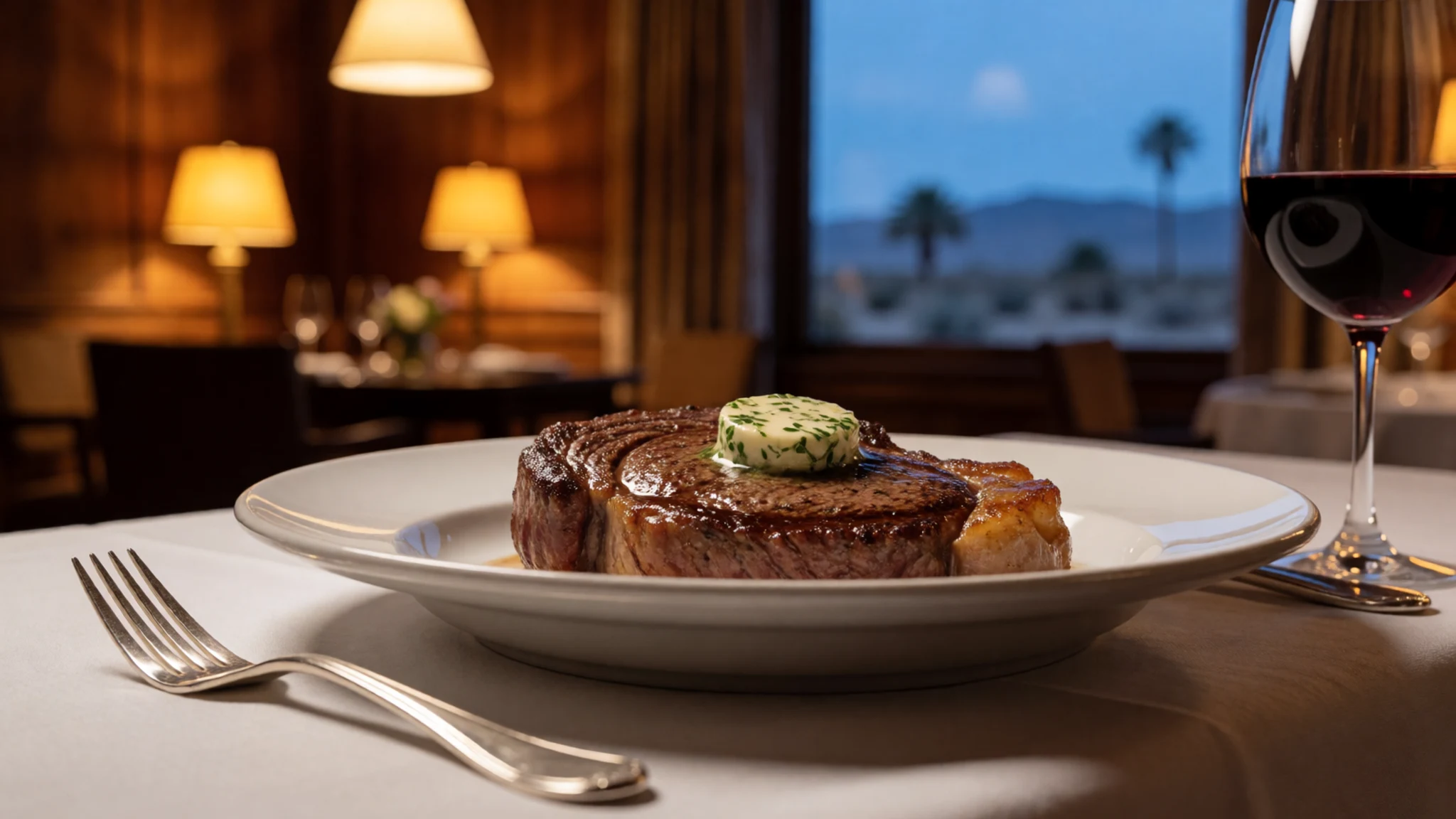
- Sandwiches and snacks from a general store — Stovepipe Wells restaurant and convenience store
Stovepipe Wells has a restaurant and a convenience store, which makes it the practical stop for a quick lunch between valley sights. Expect simple, filling food and cold drinks, and buy more than you think you need before heading onto the trails or the back roads.
- Packed lunch for the trail — Your own cooler or bag, packed before leaving the valley
Pack your own lunch for any hike in the park. Choose foods that keep well in heat, such as nuts and dried fruit, and carry them in an insulated bag. Eat little and often, because heat drains appetite as well as water. - A cold drink at the resort — Resort lounge and bar at Furnace Creek
Furnace Creek's resort has drinks on offer, a sensible place to sit in the shade after a morning out. Check opening times on arrival, since services change through the year, and do not rely on a bar for water, which you should carry in quantity.
Plan it
Best time. Late autumn through spring is the comfortable window, roughly November to April, when days are warm rather than dangerous and nights can dip below freezing. Summer is extreme: July is the hottest month, and daily temperatures of 120 °F or more are common from June into September.
How long. 2–3
Getting there. Las Vegas Harry Reid International Airport (LAS) is the nearest commercial airport, about a two-hour drive from Furnace Creek. Since there is no public transport into the park, you will need to hire a car for the last leg. The nearest Amtrak station is at Barstow, on the Southwest Chief route, and a hire car is needed from there too.
Budget. mid
Tips
- Start walks and drives early in the morning, when the valley is still cool enough to enjoy
- Carry more water than you think you need, and stock up before even a short hike in spring, summer or autumn
- Check the official site, nps.gov/deva, for lodging, road conditions and reservations before you travel
- Bring cash and plan fuel stops, since services are far apart and card payments may not work in remote spots
- Treat unpaved roads such as Echo Canyon with care, and check your vehicle suits rough tracks
Etiquette
- Stay on roads and marked routes, and keep off the salt crusts
- Carry out all your rubbish, including food scraps
- Keep voices, music and generators down at night, especially at campsites and overlooks
Nearby
Sources
- Wikidata Q242111 (CC0)
- Wikipedia, Death Valley National Park (rev 1383008607) (CC BY-SA 4.0)
- Wikivoyage, Death Valley National Park (rev 5400932) (CC BY-SA 4.0)
- Aguereberry Point - View South, Greg Willis (CC BY-SA 2.0)
- Mesquite Dunes in Death Valley National Park, Brocken Inaglory (CC BY 3.0)
- Telescope Peak in the Panamint Range, Wilson44691 (CC0 1.0)
- Tourist area around Badwater Basin, Qfl247, cropped by Beyond My Ken (CC BY 3.0)
- Petroglyphs2-above Mesquite Springs-800px.JPG, unknown author (CC BY 3.0)
- Death Valley Railroad No. 2 locomotive, Didier Duforest (CC BY-SA 4.0)
- Historic 20 mule team borax wagon train in Death Valley, unknown author (Public domain)
- Telescope & Wildrose Peaks, Emigrant Canyon Rd, Tomdonohue1 (Public domain)


