Danakil Depression
Danakil Depression, Ethiopia
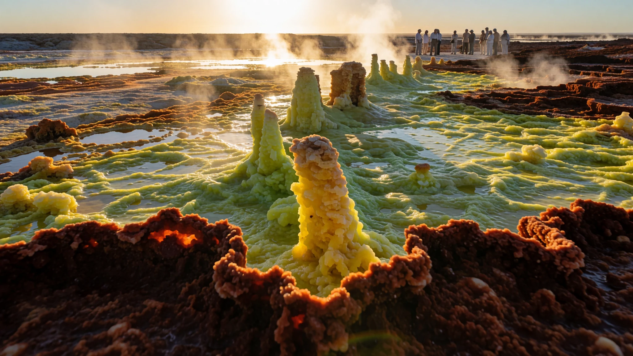
Ethiopia's lowest ground: a salt desert of hot springs, sulphur fields and an active lava lake, best seen on a guided tour.
The place
The Danakil Depression is a broad, low valley in the north of Ethiopia's Afar Region, reaching towards Eritrea. Its floor lies about 125 metres below sea level, which makes it one of the lowest places in Africa. The Ethiopian Plateau bounds it to the west, while the Danakil Alps rise to the east, beyond which lies the Red Sea.
Geologically it is a rift. The land is slowly pulling apart as the Nubian plate and a smaller block called the Danakil microplate move away from each other. The depression forms the northern end of the Afar Triangle. Where the crust has thinned, volcanic activity has built a chain of shield and stratovolcanoes, known as the Erta Ale range, in the southern part of the depression. Their rock is mostly basalt.
The surface is a patchwork of salt pans, sulphur-yellow crusts, rust-coloured ridges and steaming vents. Brine lakes sit on the floor, and white marine sediments mark where an ancient sea once stood. The ground is largely bare and water is scarce, so the colours look almost unreal in strong light.
It is best understood as a harsh desert rather than a scenic detour. It is hard on people, vehicles and supplies, and it is reached only on an organised tour with a guide and a military escort.
Its story
The Danakil Depression has been shaped by slow forces. Stretching of the crust thinned the land and let the floor sink, while sediment and lava gathered in the basin. Over long spans of time, water that flowed in evaporated and left salt and minerals behind, and those deposits are what visitors now cross.
People have lived on the margins of this desert for a very long time. The Afar, whose name the wider region carries, have herded animals and worked the salt trade across the lowlands, moving between the highlands and the coast. Salt cut from the lake beds has long been carried out by camel caravans, and a version of that trade still continues.
The modern era brought outsiders looking for minerals. Early in the twentieth century an Italian company set up a mining settlement at Dallol to work potash deposits, and it built a railway towards the Red Sea. The settlement was later abandoned, and its empty buildings now stand in the heat as a ghost town.
Since then the region has been unsettled. Foreign tourists have been attacked and killed in the area, and many governments have warned their citizens against travel in northern Ethiopia. A war in the neighbouring Tigray region ended only recently, and the security situation remains a reason for caution. Today the Depression is visited mainly on guided tours with armed escorts, so any account of it has to begin with safety as well as scenery.
What to see
- Dallol — Dallol, southern Danakil
Dallol is the sight most visitors come for, and it is sometimes called the Yellowstone of Africa. It is an active volcano with a low summit that sits below sea level. Sulphur and mineral deposits colour the ground in yellows, greens and rust, and hot springs bubble across the flats, so the air smells strongly of sulphur. Tours usually visit in the cooler morning light, following a marked path over the crust.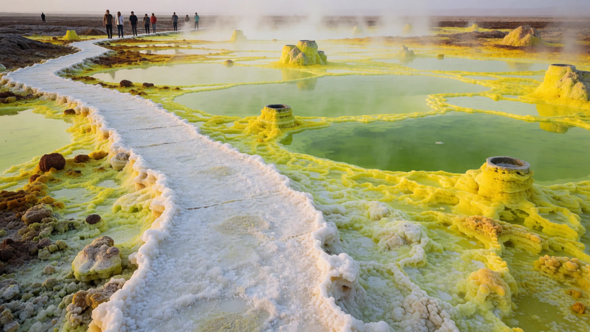
- Erta Ale volcano — Erta Ale range, south of the depression
Erta Ale is the most active volcano in Ethiopia, and its name is often translated as smoking mountain. Its crater holds a lake of liquid lava that can be seen from the rim. Reaching it means a hike of a few hours from a base camp, which is also a military camp. Camels can carry visitors along part of the route for a fee.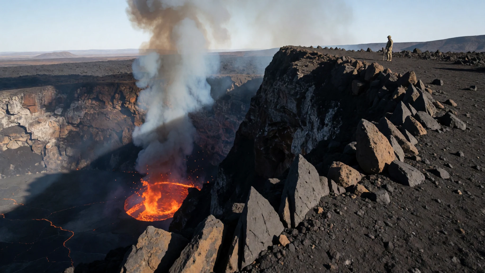
- Lake Karum — Hamad-Ela area, near Dallol
Lake Karum is a salt lake reached by a dirt track that runs across its salt crust. It is not to be confused with Lake Assal in Djibouti. The white surface is dazzling in strong light, so sunglasses and a hat are essential. Tour routes often pair it with Dallol and the nearby sulphur springs, which are a short walk from the base camp.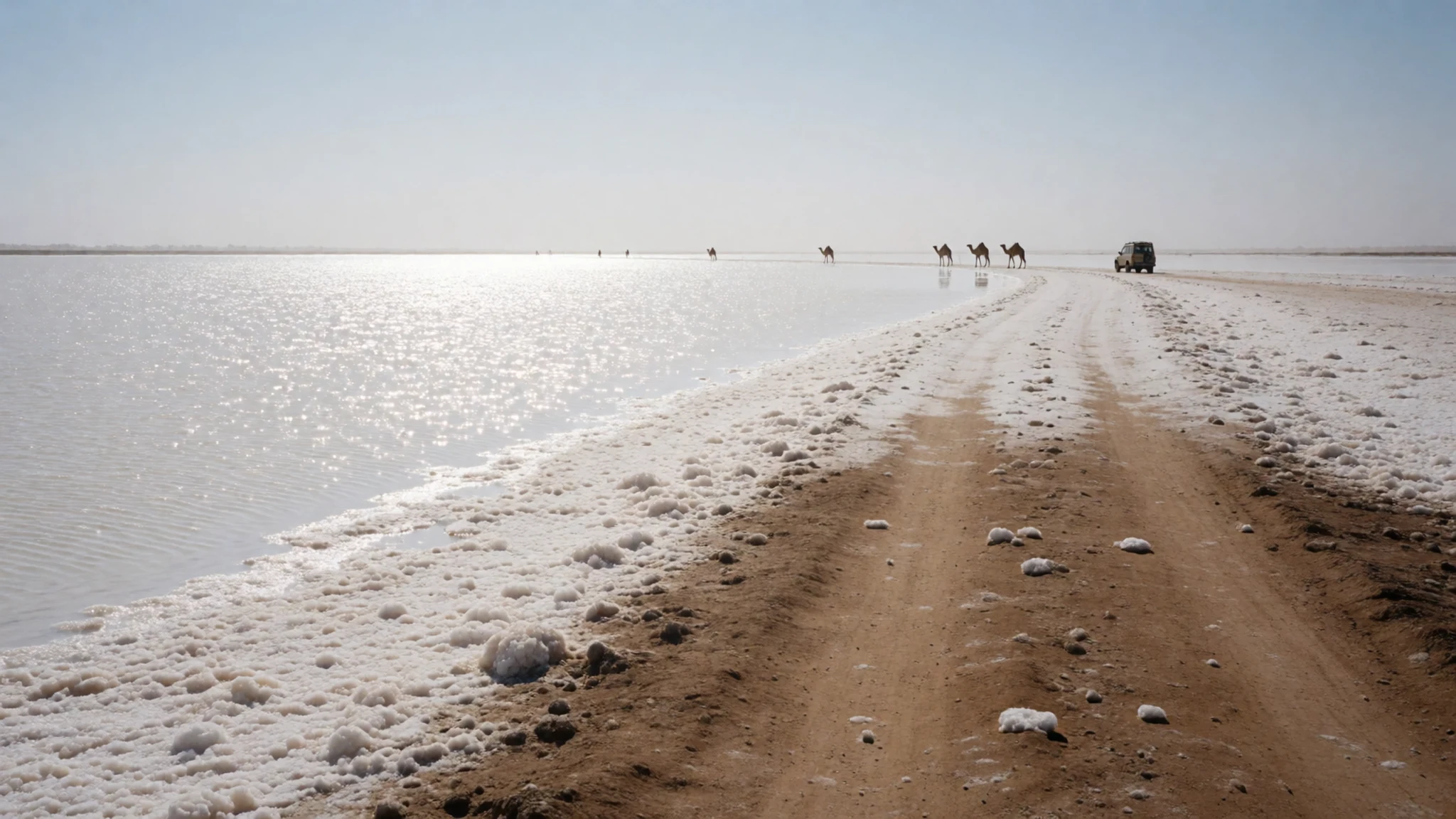
- Lake Afrera — Lake Afrera, the southern shore area
Lake Afrera is the largest salt lake in the Danakil and lies below sea level. Unlike the salt-crusted lakes, its water is open, and locals and tourists both swim in it. Visitors often say the feel of the water is similar to the Dead Sea. Salt is gathered here by letting brine evaporate rather than by digging it out of the ground.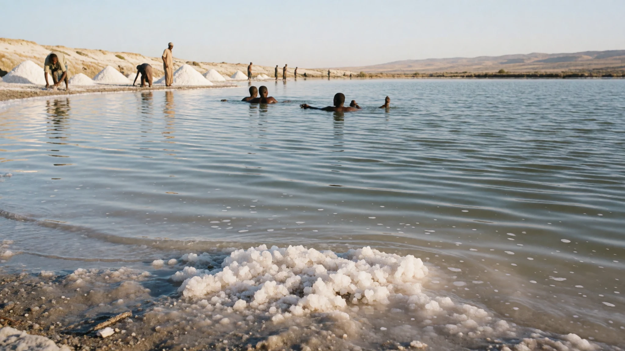
Culture
In the Danakil Depression, Afar communities have built their lives around herding, trade and the salt caravans that cross the lowlands. Work here is hard and very visible: camels loaded with salt move slowly across the flats, families travel with their animals, and roadside settlements depend partly on passing tour groups. Visitors are guests in that economy, and their conduct shapes how local people see tourism. Expect formal greetings, a slower pace than a city, and a guide who will handle most conversations. Some people may agree to be photographed, but nobody should be photographed without first asking and accepting a refusal. Visitors should also respect the military presence at base camps and stay on the routes set by their escort. Ask before photographing anyone, and accept a refusal without argument.
What to wear
Traditional dress in the Danakil reflects the demands of sun, sand and herding. Afar men and women have traditionally worn loose lengths of cotton cloth wrapped around the body and draped over the shoulders, which shade the skin and keep dust off. Men have also carried a curved knife as part of their traditional dress. The photographs in this set show young people in such cloth, and the designs are simple, usually in plain or striped weaves.
What people wear now is a mix. In the towns and along the main roads, cotton shirts, trousers, T-shirts and plastic sandals are common, while the wrapped cloth still appears at home, in the villages and in the heat of the day. Modern clothing is the everyday norm for much of the work people do.
Visitors should dress for the terrain and the climate. Long loose cotton trousers and long-sleeved shirts protect against the sun and the glare off the salt, and a wide-brimmed hat and a scarf for dust are useful. Choose closed, sturdy shoes for the sharp salt crust and volcanic rock, since sandals offer little protection. Nights at base camp can be cold, so pack a warm layer.
What to eat
- Injera with wat — base-camp kitchens and village eateries along the tour route
Injera is a sour, spongy flatbread made from teff, and it is the basis of most Ethiopian meals. It is used to scoop up spiced stews called wat, which are the usual main course on the tour route.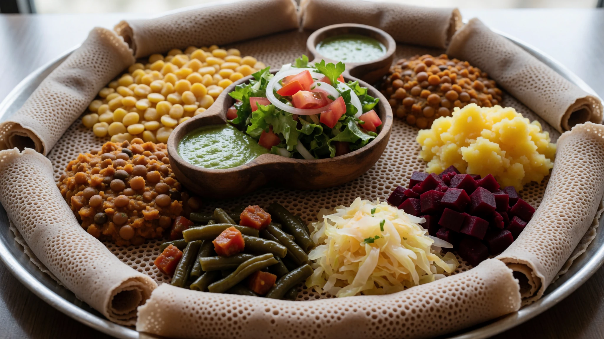
- Goat stew and roast — base-camp kitchens and village eateries
Goat appears in stews and in roasted meat, and it is among the most common proteins served on the tour menu. Stews are typically eaten with injera, while simpler meat dishes are cooked over open fires.
- Fish — eateries in Mekele, the usual tour starting point
Fish is served on the tour route alongside meat and stews. It is a welcome change from goat and pasta on longer days, and it is usually prepared simply with spices. - Pasta and rice — meals provided by the tour company at base camps
Pasta and rice are staples of tour-company meals in the Danakil, reflecting a long Italian influence on Ethiopian cooking. They are filling and reliable when fresh produce is scarce. - Traditional coffee — village houses and eateries on the route; ask your guide
Coffee is prepared the traditional way, with beans roasted in a pan and brewed in a clay pot, then served in small cups. A pour is a social moment, and it is worth asking a guide to arrange one.
Plan it
Best time. The cooler months, roughly November to February, are the usual choice, because summer heat on the salt flats is severe. Security advice can change quickly, so check current conditions before committing to any dates.
How long. 2–4
Getting there. Reach Mekele, the usual starting point for tours, by air or road. Paved roads now make the journey to the edge of the depression quicker, and the tour vehicle takes over for the final dirt track and salt crust.
Budget. high
Tips
- Book through an established tour operator, since independent travel is not advised
- Check current travel advisories and security guidance before you commit
- Start early at Dallol, when the light and temperatures are kinder
- Carry plenty of drinking water and sun protection, and plan for longer days than you expect
- Bring cash, since card payments are unlikely in villages
Etiquette
- Keep to the route and follow your guard's instructions, especially near the border areas
- Ask before photographing people, and accept a refusal
- Treat the base camp as a working military site
Nearby
Sources
- Wikidata Q14213070 (CC0)
- Wikipedia: Danakil Depression (rev 1377731050) (CC BY-SA 4.0)
- Wikivoyage: Danakil Depression (rev 5380777) (CC BY-SA 4.0)
- Map of the Danakil Depression, Val Rime (CC BY-SA 4.0)
- Landscape of the Danakil Depression, Val Rime (CC BY-SA 4.0)
- Erta Ale crater, Val Rime (CC BY-SA 4.0)
- Erta-ale lava lake 2001, Hervé Sthioul (CC BY 3.0)
- Danakil Salt Plain, Val Rime (CC BY-SA 4.0)
- A Sulphur Pond, Danakil Depression, Barrowbob (CC BY-SA 4.0)
- Afar boy, North Ethiopia, Dimbak7 (CC BY-SA 4.0)
- Afar girl, North Ethiopia, Dimbak7 (CC BY-SA 4.0)


