Cordillera Blanca
Cordillera Blanca, Peru
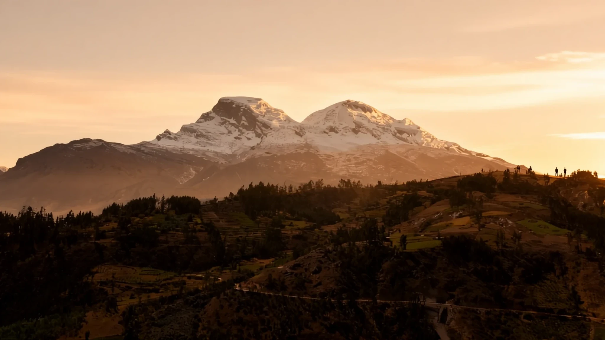
Go for the glaciers, the turquoise lakes and some of Peru's highest peaks, reached from the valley town of Huaraz.
The place
The Cordillera Blanca is a range in the Andes of Peru's Ancash region, stretching about 200 km (124 mi) north-west along the western side of the Callejón de Huaylas, the long valley cut by the Santa River. Its name means white range, and from the valley floor it is easy to see why: snow and ice sit on many of its summits, and several rise above 6,000 m. The highest of them, Huascarán, reaches 6,768 m and is the tallest mountain in Peru. The range holds 722 individual glaciers, most of them on its western side, and their meltwater is part of the year-round supply for northern Peru. Like glaciers across the Andes, they are in retreat, having shrunk by more than 15% since the 1970s. Most of the range is protected inside Huascarán National Park, created in 1975, which covers valleys, lagoons, passes and the lower slopes where forest survives. Huaraz is the usual base, a working town with guides, hostels and transport, and it sits high enough that altitude is felt on the first afternoon. The range also forms a continental divide: rivers on the western slopes flow to the Pacific, while those on the east drain toward the Atlantic.
Its story
Down in the valleys, the Cordillera Blanca is less a view than a supply line. Meltwater from its glaciers keeps rivers running through the drier months, feeding fields and towns across northern Peru. The Santa River, which drains the western side, also carries a hydroelectric plant that supplies a small but real share of the national grid, roughly 5% of Peru's electricity. The ice itself tells a story of loss. Measurements taken since the 1970s show that the glaciers have pulled back by more than 15%, a trend shared with ice fields across the Andes. Glacier lakes are the other side of that change. As ice melts, water collects behind loose rock and moraine, and when those barriers give way, the towns below are put at risk. Huaraz has grown up with that threat in mind, and it shapes how local people speak about the mountains, with respect and some wariness. Conservation came to the range in 1975 with the creation of Huascarán National Park, set up to protect the ice, the forests and the wildlife that depend on them. The park is also where the mountains meet everyday life. Farming villages, grazing land and church festivals lie within or beside its boundaries, so managing the park means balancing the needs of the people who live in the valleys with those of the glaciers above them. Visitors notice this balance on the trails, where herds, cultivated terraces and mountain shrines share the ground with the ice.
What to see
- Nevado Huascarán, south face — Huascarán National Park, viewed from the Cordillera Negra
The south face of Huascarán is the view that best explains the range: a broad wall of ice and rock rising above the valley, with the summit often wrapped in cloud. It is the highest point in Peru, and seeing it from the Cordillera Negra side gives a sense of scale that closer viewpoints cannot. Go early, while the air is clear, because the peak can disappear as the day warms.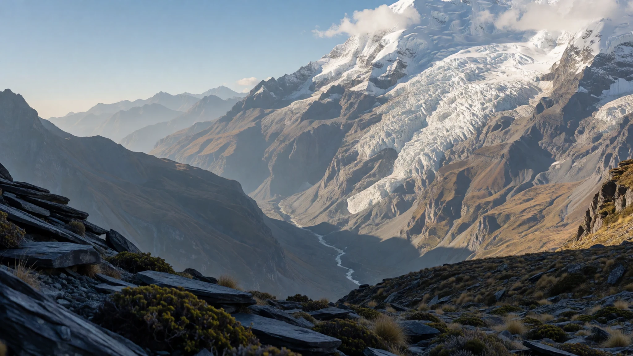
- Laguna de Chinancocha — Llanganuco valley, reached by road from Yungay or Caraz
Chinancocha is one of the lakes reached by the road up the Llanganuco valley, and its cold green-blue water mirrors the snowfields above it on a still morning. The walk to the shore is short and mostly level, which makes it a good first taste of the high country. Wind picks up through the afternoon, so keep warm layers handy and plan your return before the clouds build.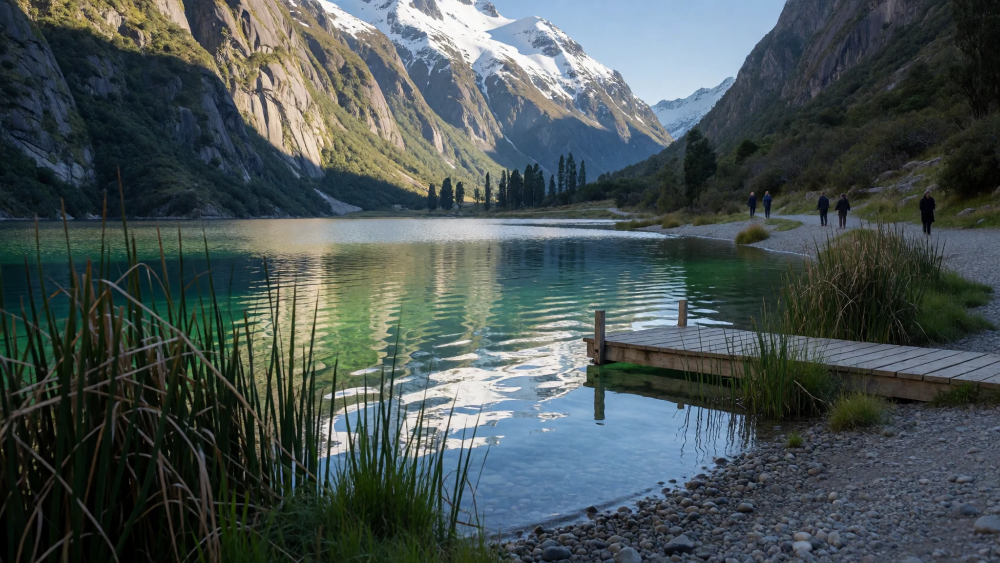
- Huandoy from the Callejón de Huaylas — Callejón de Huaylas, between Huaraz and the villages to the north
The valley road running between Huaraz and the northern villages gives the classic picture of the range. Huandoy's icy faces rise above fields, eucalyptus and small adobe farmsteads, and the scene changes with the light. Shots taken from the valley floor show the scale of the mountains better than any high viewpoint, because you can see how far the ice runs down the slopes.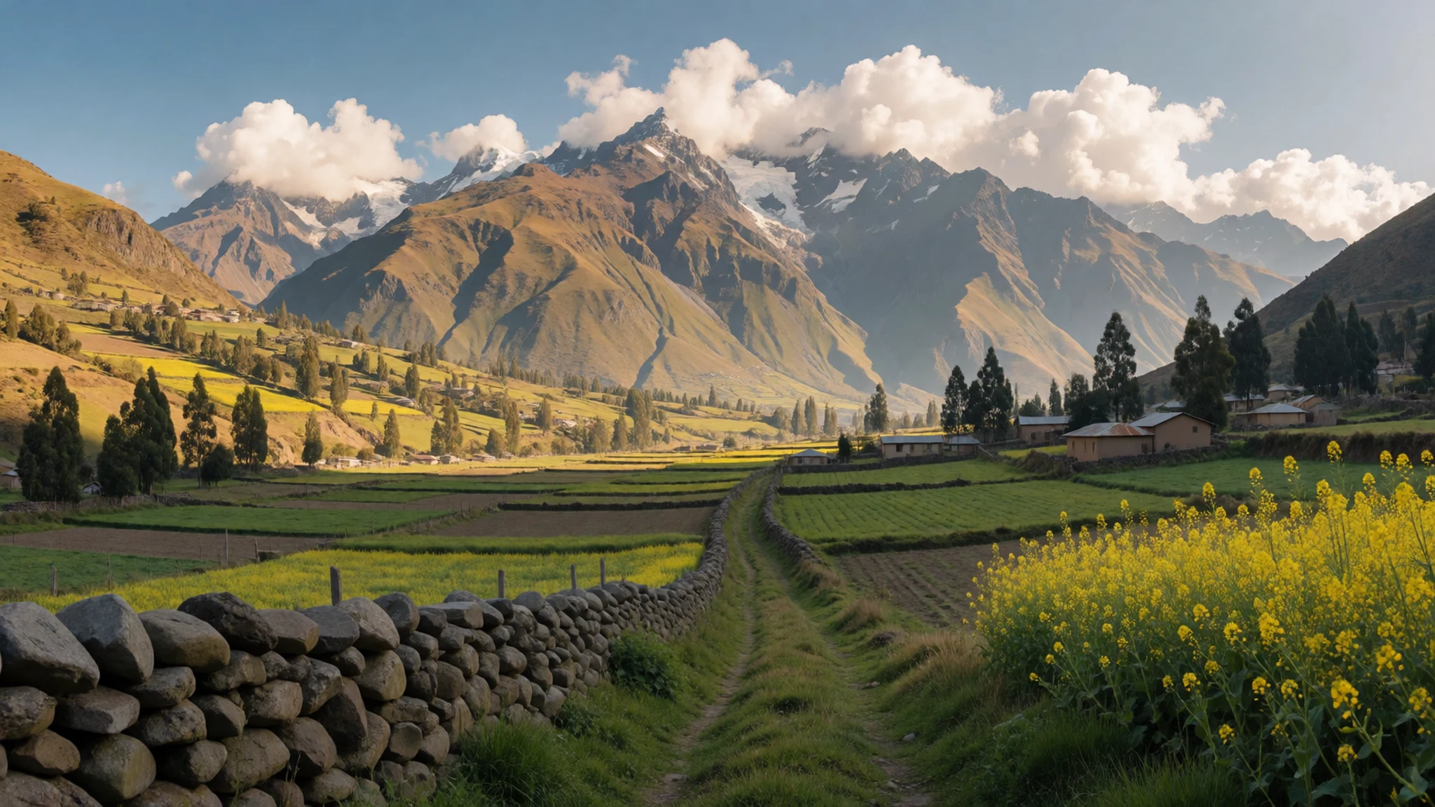
- Polylepis forest — Trails in Huascarán National Park near Huaraz
Polylepis trees, with flaking copper-coloured bark, survive at high altitude where little else grows, and their scattered stands are one of the range's quiet surprises. Some groves are protected inside the national park, and they are best seen on a walk rather than from a vehicle. Stick to the paths, keep dogs under control, and leave the bark intact, because the trees grow slowly and recover poorly from damage.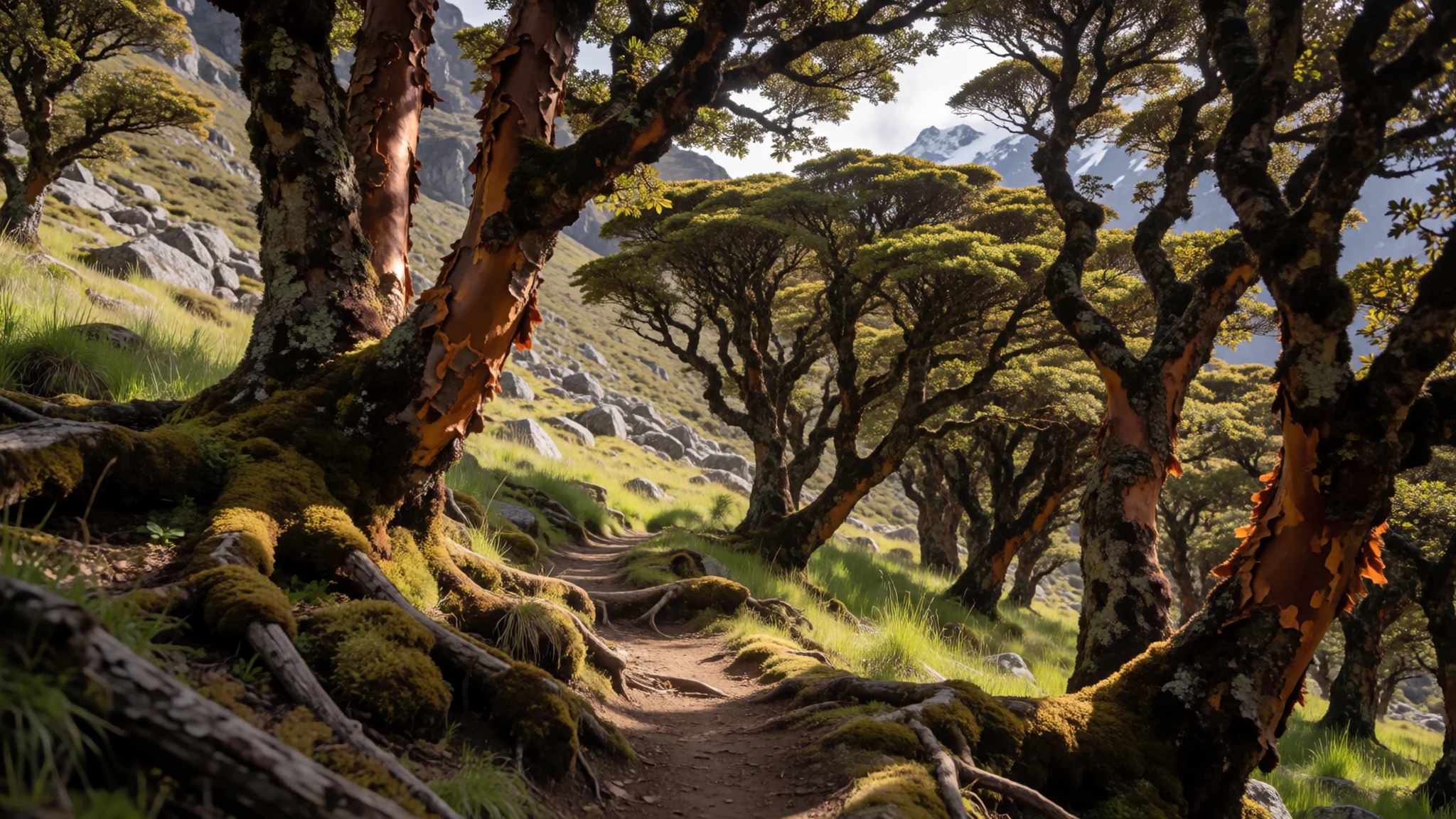
- Taulliraju and the climbing peaks — Upper valleys and approach routes in Huascarán National Park
Taulliraju is a sharp, steep peak that serves as a standard objective for climbers, and its south-west face is a common sight from the approach routes. Several other summits in the range, including Chopicalqui, draw experienced alpinists. Unless you are climbing, admire the peaks from a trek or a valley viewpoint. Guided ascents need proper equipment, acclimatisation and a reliable forecast.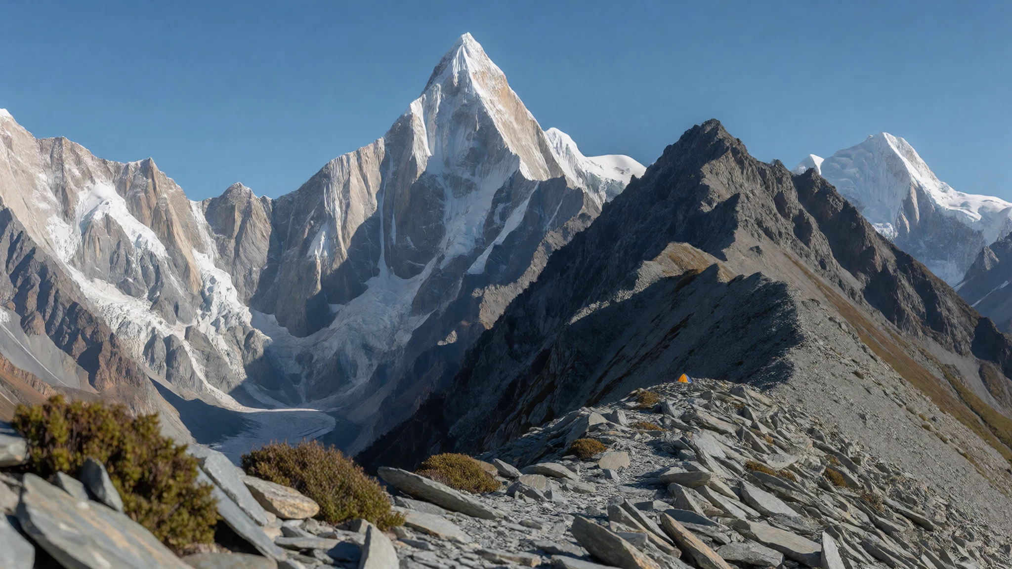
- Huaraz — Central Huaraz, the usual base for treks and day trips
Huaraz is the town where most trips begin and end. It has a compact centre, shops selling outdoor gear and tour agencies that arrange treks, transport and guides. Spend a day here before heading up, to adjust to the altitude and check the weather. The town is more relaxed than the big cities of the coast, and its market is a good place to buy snacks and water for the trail.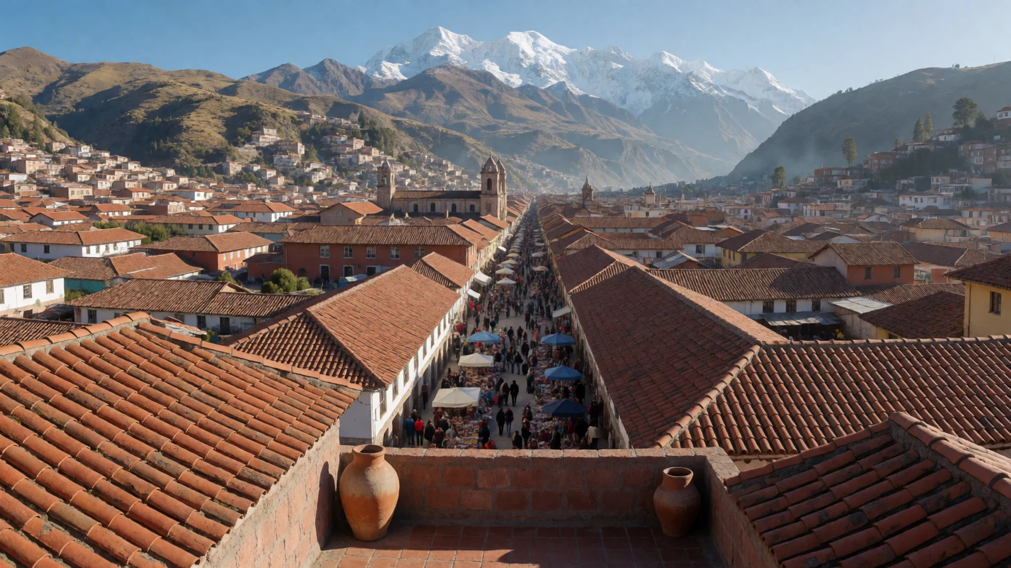
Culture
In the Cordillera Blanca, mountain life is tied to farming communities scattered along the Callejón de Huaylas, where families have long grazed animals, grown potatoes and maize on terraces, and spoken of the peaks with respect. Many visitors come to climb or trek, but the valleys also hold weekly markets, church festivals and village feasts that keep their own calendar. Expect a slower pace in villages, where greetings matter and a short conversation in Spanish opens more doors than a camera does. Huaraz is more used to outsiders, with cafés and bars catering to trekkers, but the customs of the outlying villages remain more traditional. Religious processions are taken seriously, so keep voices down and step aside to let them pass. Ask before photographing anyone, especially people in traditional dress, and pay any community access fee you are asked for without argument.
What to wear
In the Cordillera Blanca, traditional dress is worn most in the villages of the Callejón de Huaylas, where wool and cotton textiles are still made at home or in small workshops. Women have often worn full, layered skirts with embroidered blouses and shawls, while men may wear woven ponchos and knitted caps. Woven belts, usually called chumbes, and hand-spun yarn in bright colours are part of the look. Most of the wool comes from sheep or alpaca, dyed with plant and synthetic dyes, and weaving patterns vary from valley to valley. Traditional dress is still worn for festivals, market days and church events, though many people combine it with jeans and trainers. Everyday clothing in Huaraz and the larger towns is largely modern: fleeces, waterproof jackets, football shirts and sturdy shoes, with the weather setting the layers. For visitors, dress for big temperature swings. Pack a warm fleece, a waterproof shell, a sun hat and sunglasses, and boots with good grip for loose stony trails. Modest clothing is wise in villages and churches, so cover shoulders and knees, and save short shorts for the lakeside paths where they are more common.
What to eat
- Papas, potatoes in many varieties — The morning market in Huaraz
Potatoes are the foundation of highland cooking, and the market in Huaraz sells many varieties in different colours and textures. Dishes are often simple: boiled or fried potatoes served with a spicy sauce, or a hearty soup. Ask the stallholders what each type is good for, because they will happily explain the differences.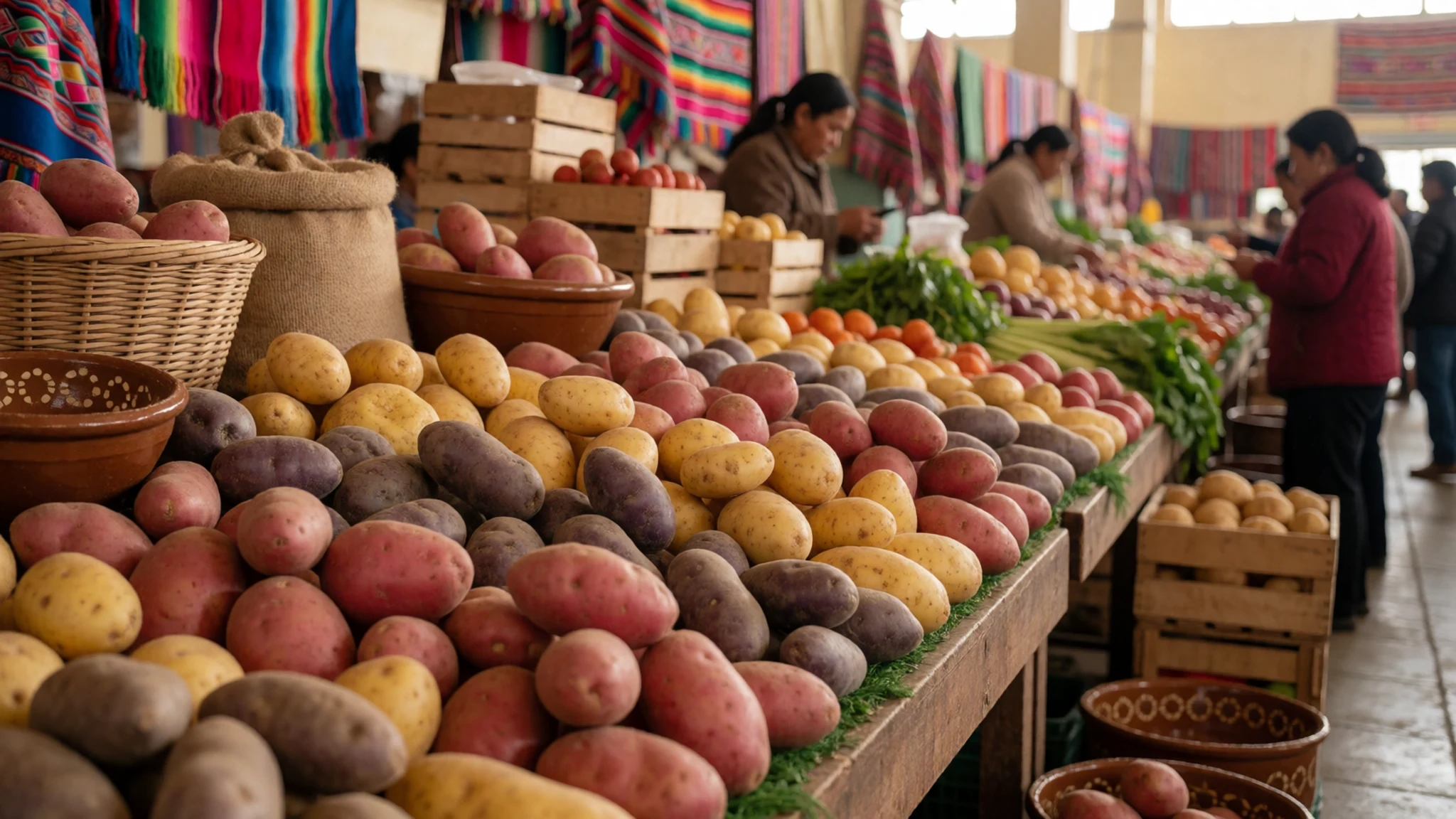
- Trucha, trout from the lakes — Simple eateries in the towns along the Callejón de Huaylas
Trout is a common lunch dish in the valleys, grilled whole or fried and served with rice, potatoes and salad. Its freshness depends on the supply, so order it where the restaurant looks busy. It makes an easy, filling meal after a morning on the trail.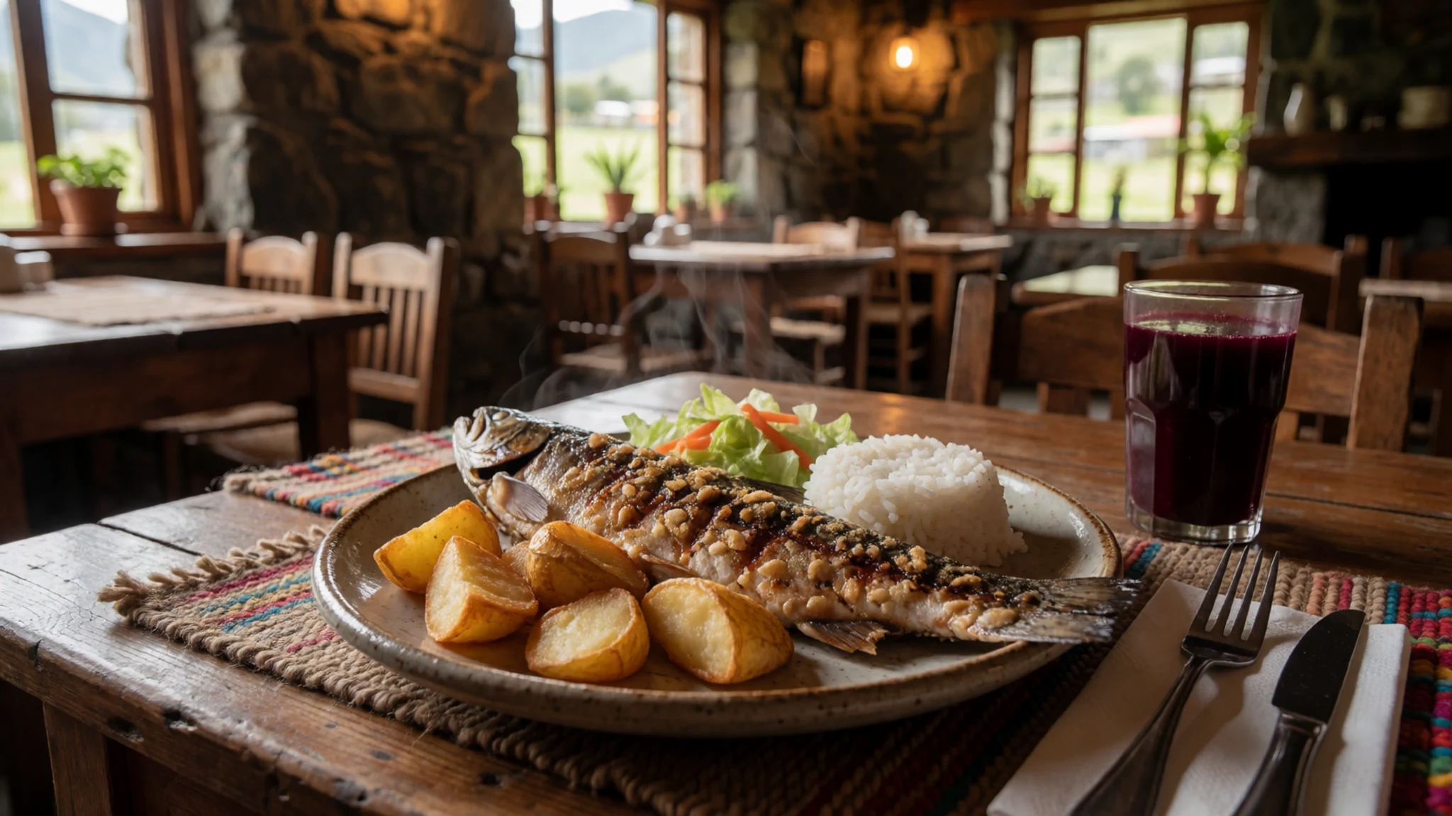
- Pachamanca, earth-oven feast — Family-run restaurants and village feasts, arranged in advance
Pachamanca is meat, potatoes and beans cooked under hot stones and earth, traditionally for festivals and shared meals. Some restaurants and village kitchens offer it on weekends, and it is best booked ahead. The food comes out smoky and tender, and the meal is usually a social event. - Mote con chicharrón — Lunch counters on the streets near the centre of Huaraz
Hominy corn served with fried pork, sweet potato and a spicy sauce is a classic lunch on the Peruvian highlands. It is cheap, filling and quick to find, and the portions are generous. Look for the stalls that cook the pork in the morning and sell out by early afternoon. - Chicha morada — Market stalls and small eateries throughout Huaraz
A deep purple drink made from purple corn, pineapple and spices, chicha morada is sold cold in jugs at market stalls and eateries. It is sweet and refreshing and goes well with a heavy lunch. Drink it from places where the jugs look clean and the ice is made from filtered water.
Plan it
Best time. May to September is the dry season, and June and July are the least rainy and most settled months, which suits trekking and clear views of the peaks. Mornings are usually the clearest time of day in any season, so plan the big walks early.
How long. 3–4
Getting there. Fly or travel by road from Lima to Huaraz; the road over the mountains is long and winding, so allow most of a day for the last leg.
Budget. mid
Tips
- Book guided treks and transport ahead in the dry season, when trails and vehicles fill up
- Spend a day or two in Huaraz to acclimatise before climbing high
- Carry Peruvian soles in cash for villages, small markets and trail fees
- Start walks early, as cloud usually builds across the peaks by the afternoon
- Carry water, sun protection and warm layers, since temperatures drop quickly after sunset
Etiquette
- Ask before photographing people, especially in traditional dress
- Pay community access fees where they are requested
- Take your rubbish back down the trail and leave lakeshores clean
Nearby
Sources
- Wikidata Q804330 (CC0)
- Wikipedia: Cordillera Blanca (rev 1369855631) (CC BY-SA 4.0)
- Wikivoyage: Cordillera Blanca (rev 5341894) (CC BY-SA 4.0)
- Perillaerea, Ondando (CC BY 3.0)
- Beauty of mount Huandoy, Inti Runa Viajero (CC BY 2.5)
- Laguna de Chinancocha, Apollo (CC BY 2.5)
- Nevado Huascarán (south view), MrBasically (CC BY-SA 4.0)
- Taulliraju, Florian Ederer (CC BY 3.0)
- Chopicalqui, Ondando (CC BY 3.0)
- Satellite image of the Cordillera Blanca, NASA (Public domain)
- Polylepis racemosa trunk, Charles Gadbois (CC BY 3.0)


