Cocora Valley
Cocora Valley, Colombia
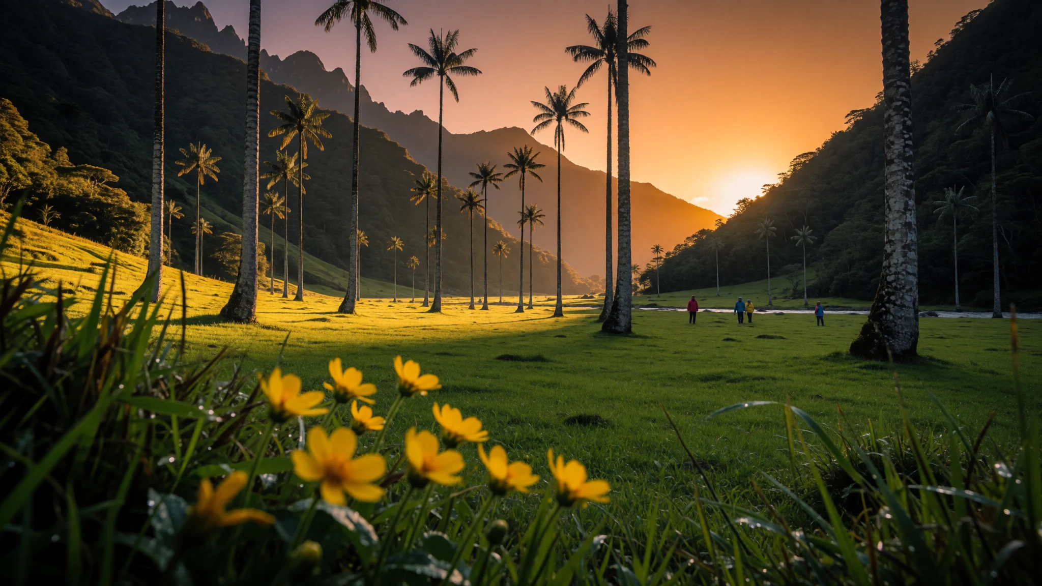
A cloud-forest valley where the Quindío wax palm, Colombia's national tree, grows tall above the Quindío River.
The place
Cocora Valley sits in the Quindío Department of Colombia, on the Central Cordillera of the Andes, at a height of roughly 1800 to 2400 metres. The Quindío River runs through its upper reaches. The name Cocora comes from a Quimbayan princess, daughter of a local chief, and is said to mean something like star of water. That legend is part of why the valley has such a strong sense of identity before anyone reaches it.
The valley lies about 24 km north-east of Armenia, the departmental capital. The usual route leaves the Armenia–Pereira highway, passes through Boquia and reaches the small town of Salento. From Salento, jeeps and private cars climb 11 km further to Cocora, a cluster of campsites and restaurants at the trailhead. Beyond that point the valley opens up only on foot or on horseback, along a web of trails.
The landscape is the main draw. Pasture covers the lower slopes, then gives way to cloud forest where the air stays damp and moss hangs from the branches. The tall palms are the reason the place is famous. The Quindío wax palm, the national tree, stands in the valley in striking numbers. The valley is part of Los Nevados National Natural Park, so the plants and animals here are protected as well.
Weather is the honest caveat. Rain falls almost daily, and temperatures can shift within a single day. Pack layers and a waterproof jacket, and expect the trails to be muddy.
Its story
Cocora Valley's story begins with the wax palm's own popularity. Its fronds were cut for Palm Sunday processions, and that pressure threatened the wider community of plants and animals that depend on the palm. In the mid-1980s the government of Belisario Betancur proposed a wildlife sanctuary and the protection of the wax palm as a national emblem.
The proposal became law in September 1985. The law made the palm the national tree and a symbol of Colombia. It also authorised the state to borrow money, sign contracts and buy private land in the Central Cordillera, so that national parks or sanctuaries could be set up to shelter the species and its surroundings. Felling a wax palm became an offence, punishable by a fine that could be turned into imprisonment in the municipality where the offence took place.
Those measures created the protected area that now forms part of Los Nevados National Natural Park. The park spans a large region, including the north-eastern part of Quindío, and the valley is the part most visitors know. Today the palms stand as a visible sign that the law has held, rising from pasture and forest that remain protected.
Legend sits alongside the paperwork. The name Cocora is tied to a Quimbayan princess and to the phrase star of water. Between the statute and the story, the valley has become a place where a national symbol and a local myth share the same slopes.
What to see
- The wax palm groves — Pasture above the Cocora trailhead
In Cocora Valley the palms are the reason most people come. Quindío wax palms rise far above the grass, pale-trunked and very tall, and they are the national tree of Colombia. Walk slowly along the pasture edges and look up. The stands look most striking when cloud drifts through the crowns. Keep off the palms and never try to strip the fronds.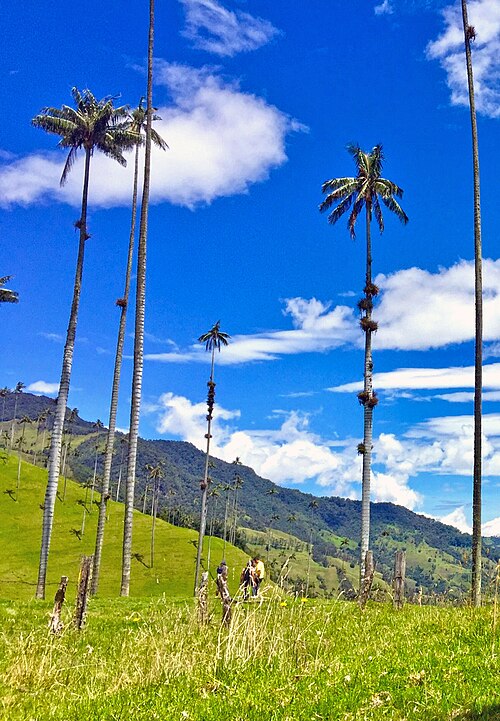
- Acaime — The turning point of the usual loop
In Cocora Valley, Acaime is a hummingbird sanctuary combined with a simple café, and it marks the turning point of the usual loop. A paid entry lets visitors watch small hummingbirds at feeders, and the café serves hot drinks and fresh cheese, a welcome break after the muddy pasture. Treat it as a pause rather than a destination, since the walk is the real draw. - Finca La Montaña — A steep farm on the return leg
The Finca La Montaña, a farm in Cocora Valley, sits on a very steep hill on the return leg, reached by a track after several river crossings. Views from its hillside repay the climb. Visitors are invited to sign a guestbook. The farm's dog is kept on a short chain but is very vocal, so give the gate a wide berth.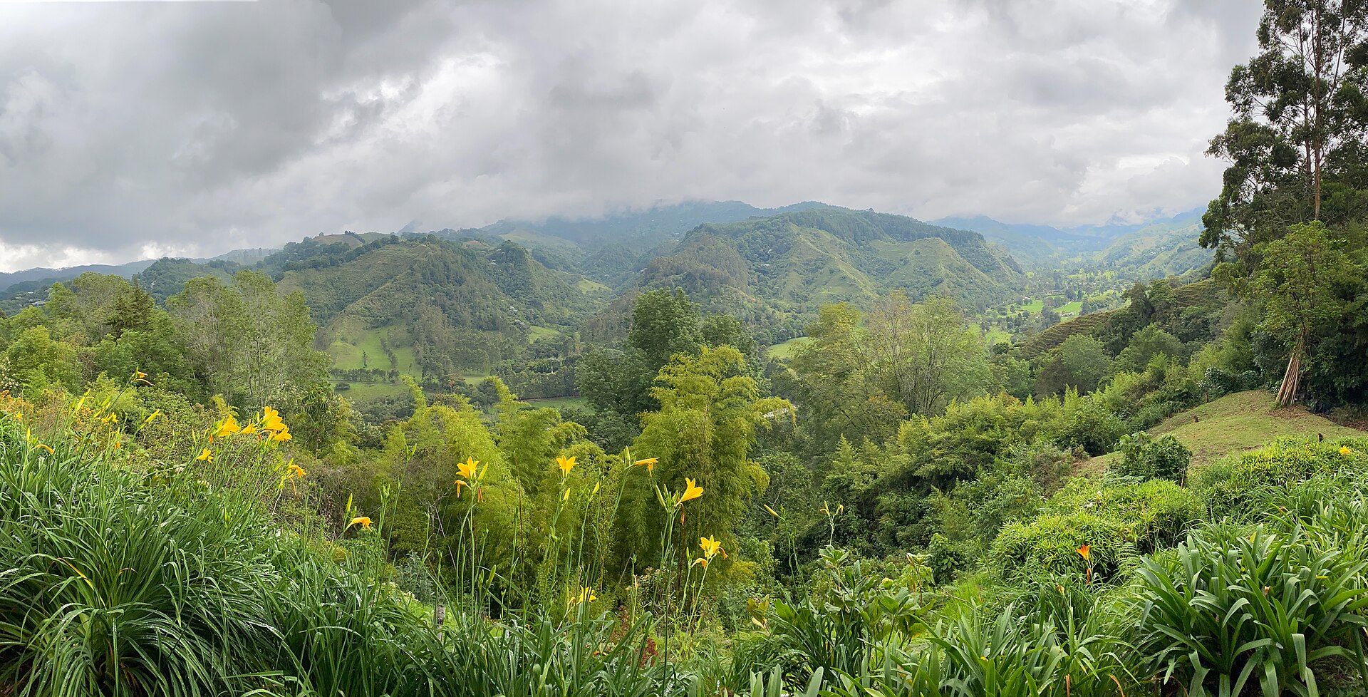
- The cloud forest by the Quindío River — The lower section of the loop
In Cocora Valley, the trail drops into cloud forest and runs beside the Quindío River, which you cross several times. The air is damp and the vegetation thick, with ferns and moss on every surface. This stretch feels most like a true forest. Boots with good grip matter more here than anywhere else on the walk.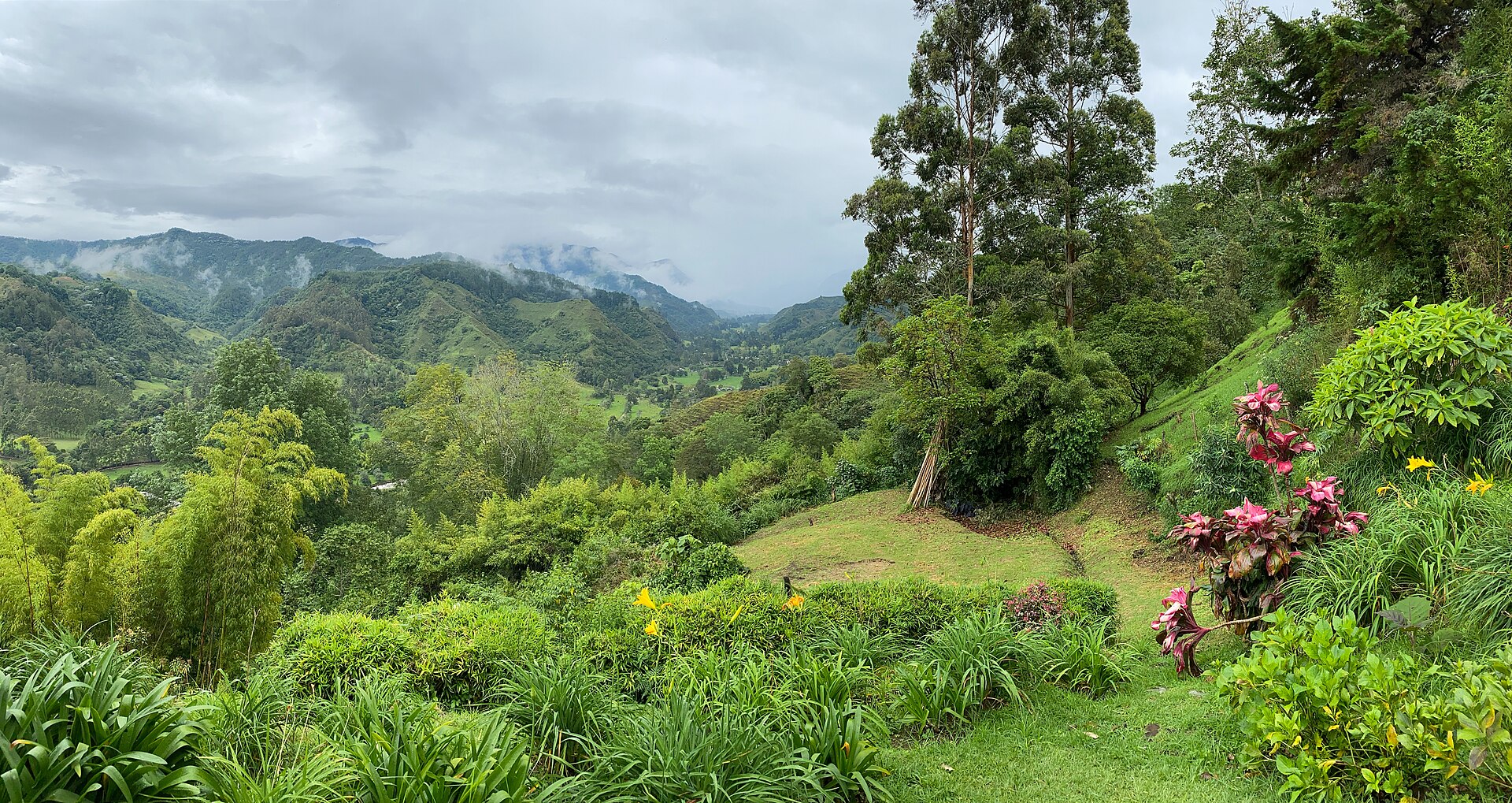
- Cocora trailhead — The road's end, about 11 km above Salento
Cocora Valley's trailhead, called Cocora, is the cluster of campsites and restaurants at the road's end. Several car parks sit near the entrance, and jeeps wait here for the return trip. The wooden gate marks the start of the loop. Buy water here if you need it, since there is little on offer beyond the gate.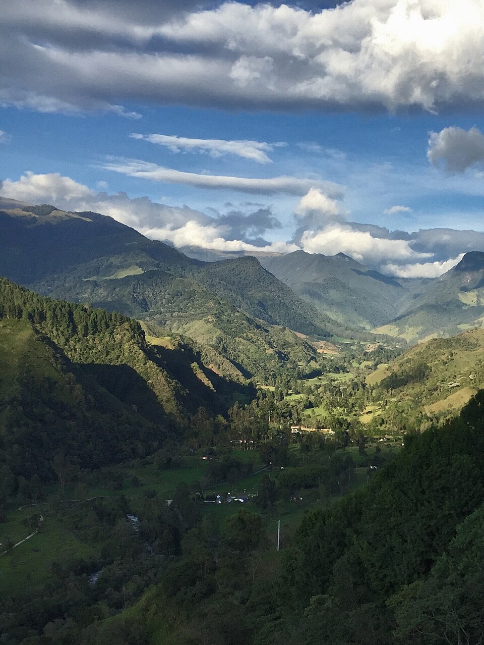
- Salento's central plaza — The town at the foot of the valley
Salento, the town at the foot of Cocora Valley, is where most day trips begin. Jeeps gather in the central plaza in the morning and leave once they are full, so there is no fixed timetable. Arriving by about 9 am leaves time for the valley. The town is a good place to buy bottled water and breakfast before setting out.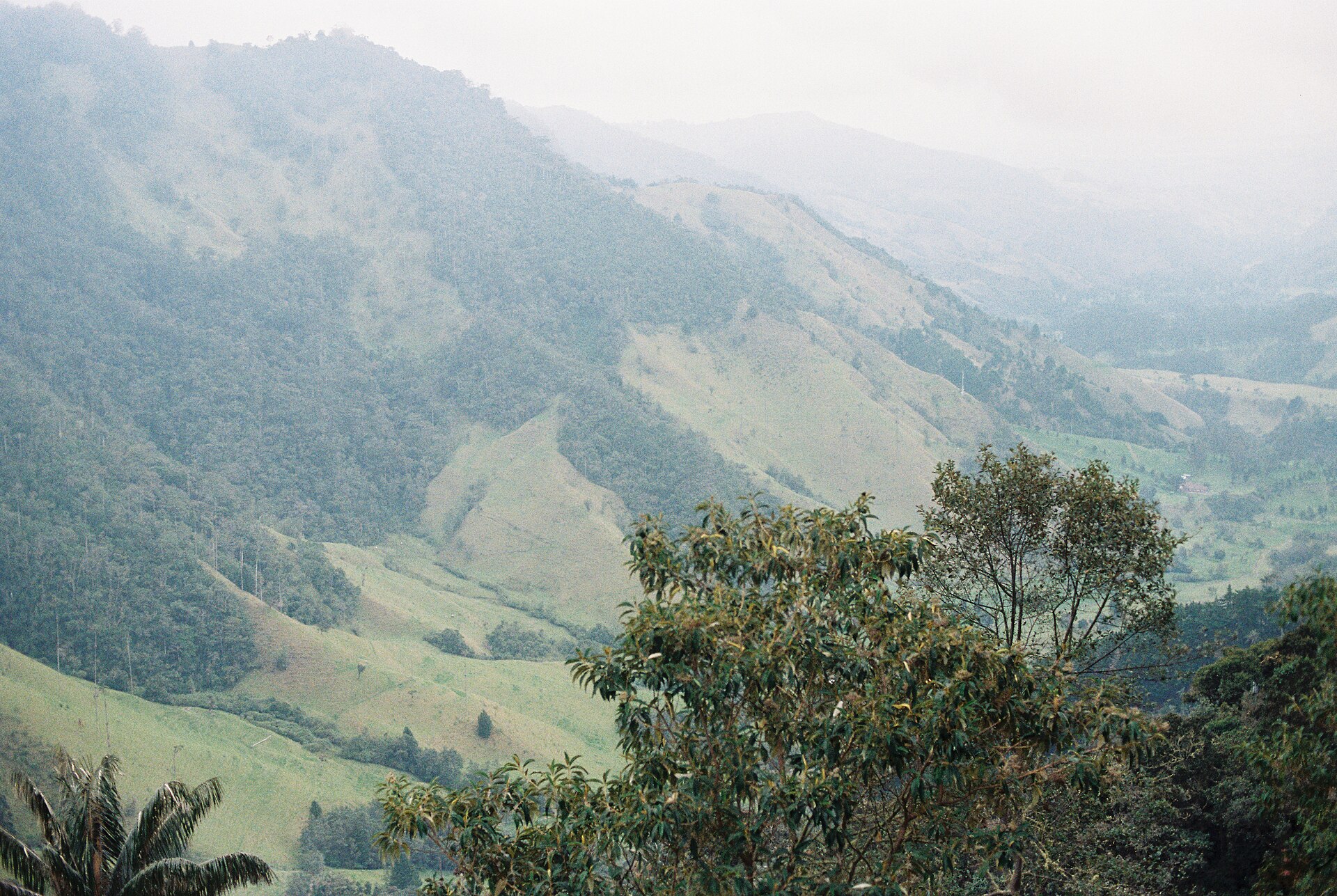
Culture
In Cocora Valley the day follows the jeeps. Colombian families, weekend walkers and small groups from Salento arrive through the morning, so the trail is busiest at midday. Much of the land is working farmland, and the pastures and houses belong to local families even where the walking route crosses them. A plain buenos días to people on the path is the usual courtesy, and farm families often answer warmly. Conversation tends to be easy and unhurried, and the café at Acaime is a natural place for it. The Quindío region takes its coffee seriously, and a cup offered at a farm is a gesture of hospitality rather than a sale. Litter is a real problem on popular stretches, so carry rubbish out of the valley. Close every gate behind you, keep to the marked trails, and ask before photographing farm families.
What to wear
In Cocora Valley and the wider Quindío highlands, traditional dress is tied to coffee and farming life. The most recognisable garment is the ruana, a heavy woollen wrap worn over the shoulders against cold mountain air. Workers in the fields wear wide-brimmed straw hats to keep off the sun. Wool and cotton are the main fibres, and the regional cloth is practical rather than decorative. Older farmers may still wear the ruana in grey or dark tones, while younger people in the valley wear jeans, T-shirts and fleece or rain jackets. Rubber boots are common on the muddy paths. A visitor should wear quick-drying trousers rather than cotton jeans, which stay wet, along with a warm layer for cool, cloudy mornings, a waterproof jacket, and trail shoes or boots with good grip. A sun hat and sunscreen help during the brief clear spells, and modest, practical clothing suits the farms and villages along the route.
What to eat
- Trucha (trout) — Simple rural restaurants on the road between the park gate and Salento
Trout, or trucha, is the local speciality around Cocora Valley, served at simple rural restaurants just outside the national park, on the road towards Salento. Usually fried or grilled whole, it arrives with simple sides and makes a good end to a long walk. - Hot chocolate with fresh cheese — The café at Acaime, inside the valley
In Cocora Valley, hot chocolate with fresh cheese, a Colombian pairing, is served at the café at Acaime, the only food stop inside. The cheese is soft and mild, and the drink is thick, sweet and warming. Most walkers settle for this combination. - Arepas for a picnic — Street stalls around Salento's central plaza, then the viewpoints on the trail
In Cocora Valley, the picnic food of choice is arepas, the flat corn cakes eaten across Colombia. Buy them hot from street vendors in Salento before you set off, then fill them with cheese or other fillings. They travel well and suit the trail's viewpoints. - A hot coffee at Acaime — The café at Acaime, at the trail's turning point
In Cocora Valley, a hot coffee at Acaime, the café at the trail's turning point, is the simplest reward on the loop. Coffee is grown across the Quindío hills, so a local cup tastes of the place. The café is basic, so expect simple service and plain seating.
Plan it
Best time. Rain falls almost daily in the cloud forest, so there is no reliably dry season. The drier stretches around January–February and July–August bring the clearest mountain views. Expect cool, changeable weather whatever the month.
How long. 1–2
Getting there. Reach Armenia, the Quindío capital, about 24 km away, then continue along the Armenia–Pereira highway through Boquia to Salento. From Salento's central plaza, jeeps climb the last 11 km to Cocora in just over half an hour, or you can hire a sedan.
Budget. low
Tips
- Reach Salento's plaza by about 9 am, since jeeps leave only when full and an early start leaves time in the valley
- Wear waterproof boots with good grip, because horses have churned the pasture into mud
- Carry water for the whole walk, as the loop is long and the only drinks inside the valley are at Acaime
- Carry cash for jeeps, parking and small stalls, as cards may not be accepted
- Take layers and a waterproof jacket, because temperatures change through the day and rain is frequent
- Walk steadily on the climbs, since the altitude of roughly 1800 to 2400 metres can leave lowland visitors short of breath; check the official park site or local operators for current entry and parking costs
Etiquette
- Keep to the marked trails and ignore unofficial side paths that cross farm land
- Close gates behind you and give farm dogs a wide berth
- Ask before photographing farm workers and families
- Carry all litter back out of the valley
Nearby
Sources
- Wikidata Q965776 (CC0)
- Wikipedia: Cocora Valley (rev 1364548557) (CC BY-SA 4.0)
- Wikivoyage: Valle de Cocora (rev 5211804) (CC BY-SA 4.0)
- Valle del Cócora general view, Angela Calle and Daniel Di Palma (CC BY-SA 4.0)
- Valle del Cocora, Jacirbadillo (CC BY-SA 4.0)
- Cocora Valley, Colombia, Bernard Gagnon (CC BY-SA 2.5)
- Wax palms in Valle del Cócora, Angela Calle and Daniel Di Palma (CC BY-SA 4.0)
- Wax palm in Cocora Valley, Bernard Gagnon (CC BY-SA 2.5)
- Cocora Valley, Colombia, Bernard Gagnon (CC BY-SA 2.5)
- Wild flowers at Cocora Valley, Jacirbadillo (CC BY-SA 4.0)
- View of Valle de Cocora, Miro Denck (CC BY-SA 4.0)


