Chimborazo
Chimborazo, Ecuador
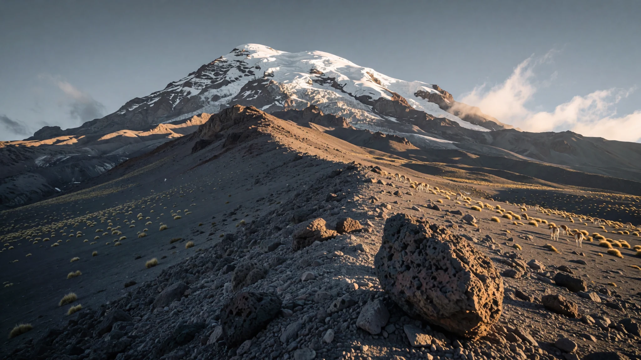
Ecuador's highest mountain is a glacier-capped volcano whose summit lies farther from Earth's centre than anything else on the planet's surface.
The place
Chimborazo is a stratovolcano in the Cordillera Occidental of the Andes, in Chimborazo Province, about 150 km south-southwest of Quito. At 6,263 m it is the highest mountain in Ecuador and the 39th-highest peak in the Andes. Its height above sea level is modest by world standards, well short of Everest, but because the Earth bulges at the equator, the summit is the point of the planet's surface farthest from the centre. The mountain rises about 2,500 m above the highlands around it, and its broad base spans roughly 20 km. Its last known eruption is thought to have taken place around AD 550, so it is considered inactive rather than extinct. The summit is ice-covered, and the glaciers feed rivers that supply water to communities in the Bolívar and Chimborazo provinces. Around the mountain, the landscape changes quickly with altitude, from dry, stony desert to wet, grassy valleys. Riobamba, about 30 km to the south-east, is the usual base for visitors. On a clear day the summit can even be seen from Guayaquil, almost 140 km away, though cloud hides it far more often than not.
Its story
Chimborazo entered European imagination long before most visitors ever saw it. In the early nineteenth century, the German naturalist Alexander von Humboldt and his companion Aimé Bonpland attempted its slopes in 1802, reaching a height that was then thought to be close to the highest anyone had climbed. Their measurements and sketches helped turn the volcano into a symbol of the Andes for readers across Europe. Humboldt also used the mountain to explore how plant life changes with altitude, a line of thought that later shaped the way scientists map vegetation zones. Maps of the period show these elevation bands across the Americas, and painters followed suit: the American artist Frederic Edwin Church produced a famous Chimborazo canvas in 1864, though the picture is often dated to the later years of his career. The first ascent to the true summit came in 1880, when Edward Whymper led a party that reached the top. That climb is remembered as a milestone in Andean mountaineering, and the refuge named after Whymper still stands on the route today. Since then, the mountain has drawn climbers, scientists and walkers, while the glaciers that Humboldt once saw have been studied for their retreat.
What to see
- Riobamba viewpoint — Riobamba, south-east of the mountain
The Riobamba viewpoint looks back at the mountain from the town about 30 km to the south-east. On a clear morning the snow-covered cone rises above the rooftops and the farmland, and it is the classic first photograph for most visitors. Clouds build up through the afternoon, so early light gives the best chance of an uncovered summit. The view is free and needs no booking.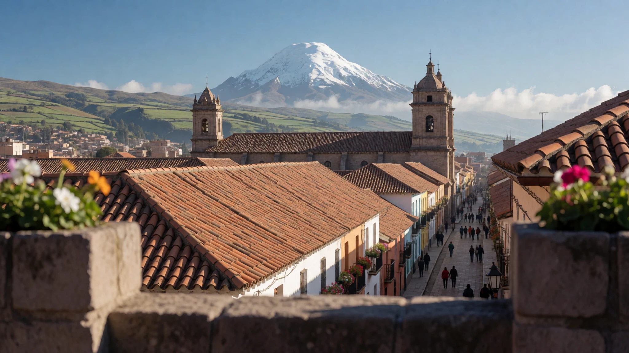
- Reserve entrance — Chimborazo reserve, on the road from Riobamba
The official entrance to the Chimborazo reserve sits at about 4,300 m, where the road reaches the park gate. You register here before going further. The reserve protects the habitat of vicuña, llama and alpaca, so keep an eye out for them on the lower slopes. Check the official site for current entry rules before you set off.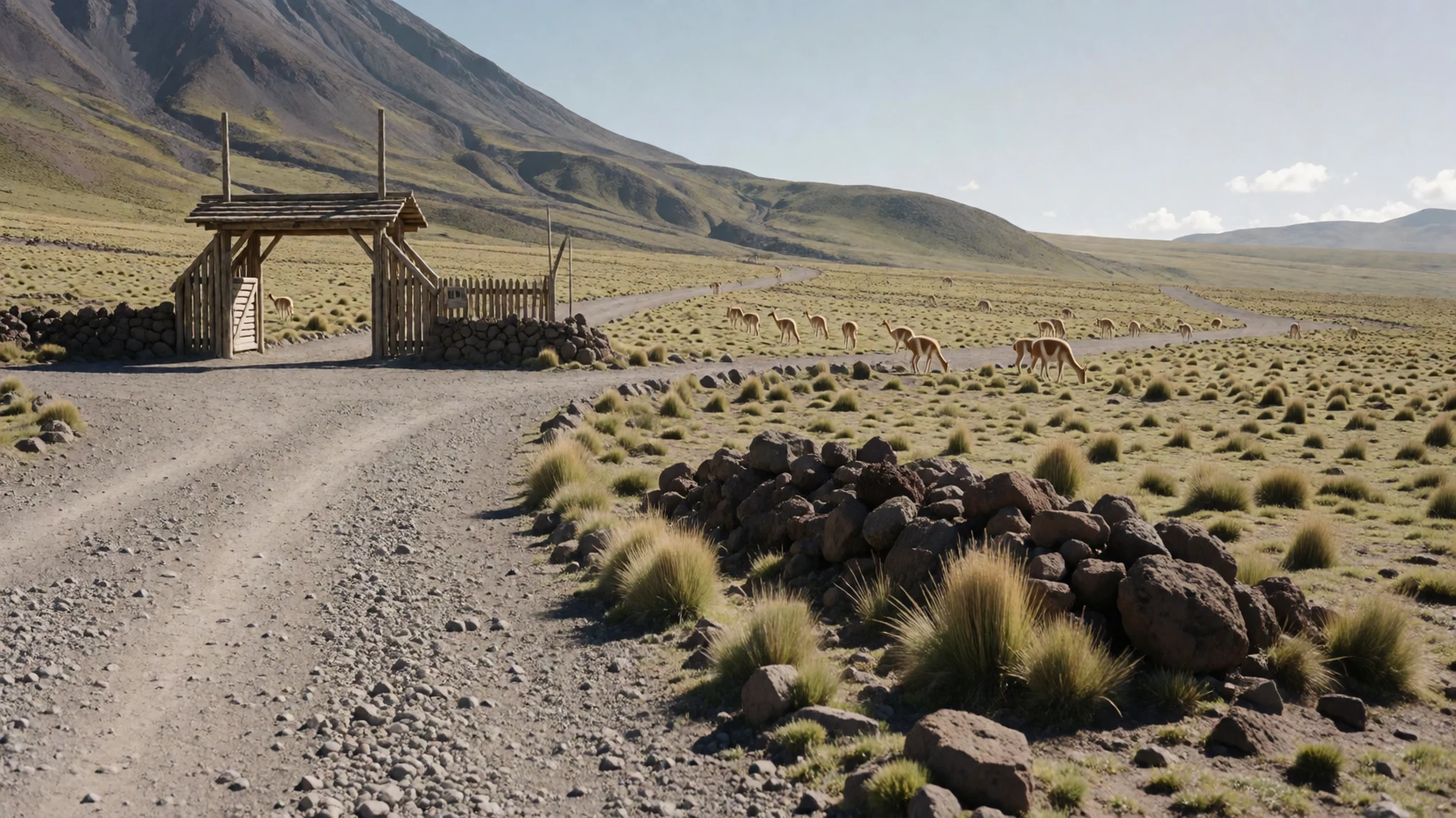
- Gran Arenal desert — Lower and middle slopes, north of the summit
The Gran Arenal is an alpine desert of loose volcanic sand and stone that lies between the forest line and the glaciers. Few plants grow here, and the wind can be strong and cold. It shows how quickly the climate changes around the mountain, from dry desert to damp valleys within a short drive. Walk slowly, because the altitude makes even gentle slopes feel hard.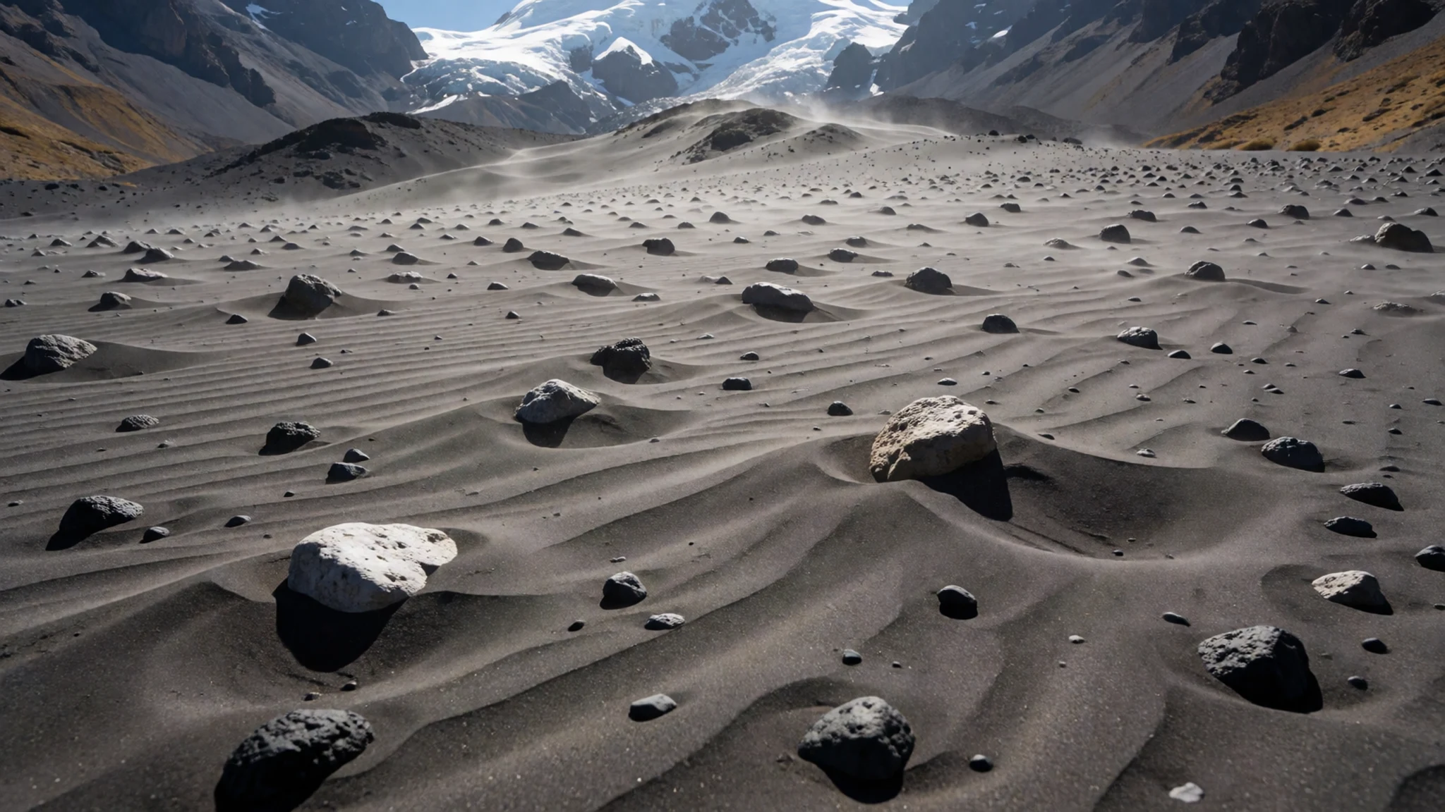
- Summit glaciers — Upper slopes and summit
The top of Chimborazo is covered almost entirely by glaciers, and some arms on the north-eastern side reach down to about 4,600 m. These ice fields are the mountain's most striking feature from a distance and the source of meltwater for nearby provinces. Without a guide and equipment, the upper ice is off limits, and crevasses make it dangerous even for experienced climbers.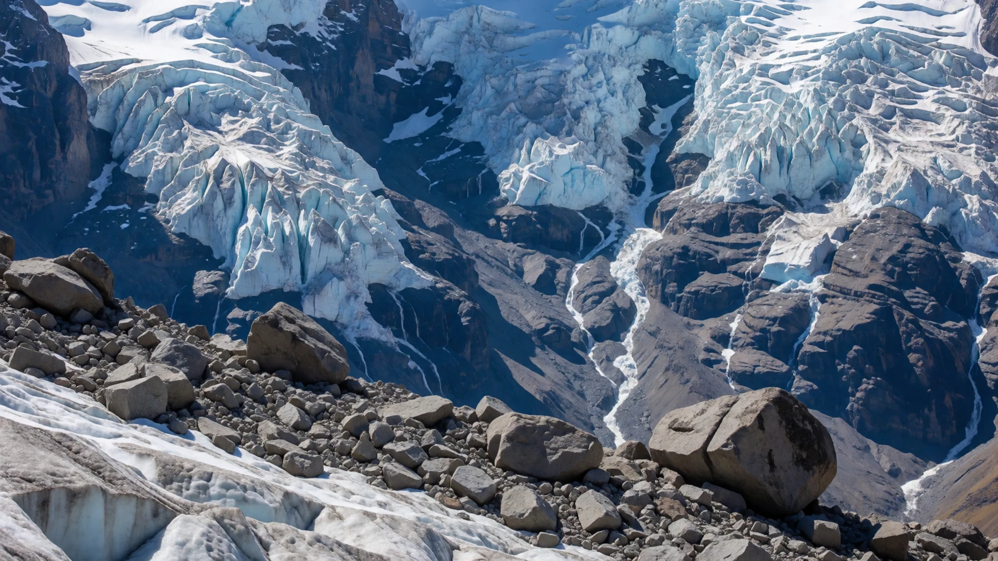
- First refuge and lower slopes — Reserve road, between the entrance and the first refuge
The first refuge sits at about 4,800 m and is the usual turning point for walkers without a guide. Most people reach it by walking the road from the reserve entrance, or by sharing a taxi for part of the way. Vicuñas are often seen on the way up and back, so many walkers choose to walk down. Some agencies also offer mountain-bike descents from this point.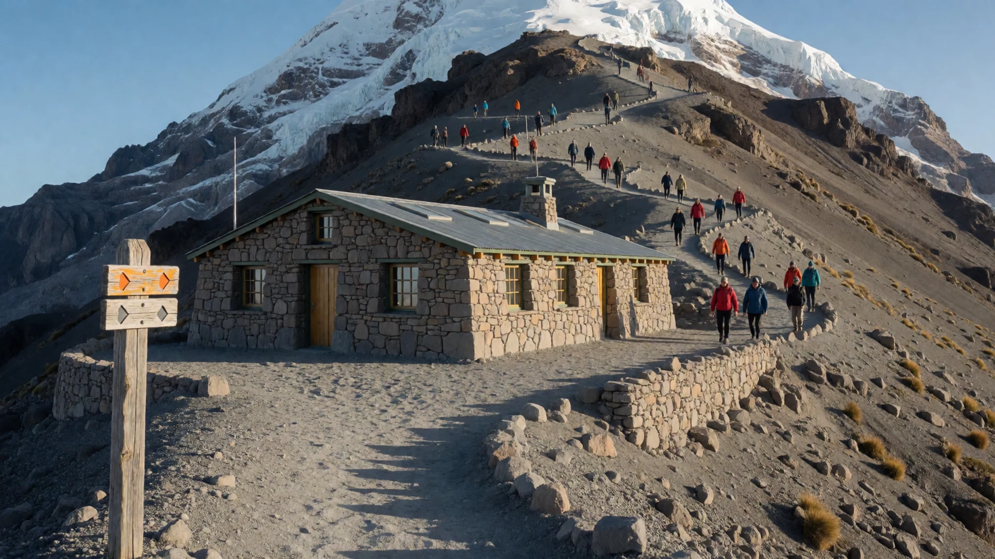
Culture
Chimborazo sits within a long-established Andean world, where Kichwa-speaking communities have farmed the highlands and herded llamas and alpacas for generations. Riobamba and the villages around the mountain are working places rather than tourist resorts, so daily life continues at its own pace. The mountain has deep cultural meaning for many people in the region, who see the volcano as a presence in the landscape. Market days in towns such as Riobamba are lively, and visitors are welcome to browse and buy food or handicrafts. Ask before photographing people, especially in rural villages, and accept a polite refusal without argument. Respect the reserve's rules and the animals it protects. Please do not feed or chase vicuñas, and keep to marked tracks so that wildlife and fragile ground are left alone.
What to wear
Chimborazo has long been the home of Andean weaving, where wool from sheep, llamas and alpacas is spun and dyed by hand into ponchos, shawls and woven belts. Many highland women in the surrounding communities still wear the traditional pleated skirt and embroidered blouse, often with a brimmed hat and a shawl tied at the back. Bright woven textiles and bowler-style hats appear at local markets and festivals, though much of the clothing for everyday use is now bought ready-made. Among younger people in towns, jeans, trainers and quilted jackets are common, mixed with the occasional traditional item. For a visit to Chimborazo, dress in layers, because the temperature can drop sharply after sunset and the wind is cold on the high slopes. Bring a windproof jacket, warm hat and gloves, and sunglasses for the glare off the snow. Sturdy waterproof boots with good grip are essential on loose volcanic ground, and a wide-brimmed hat helps against strong high-altitude sun.
What to eat
- Locro de papa — Riobamba's central market eateries
A thick potato soup flavoured with cheese, avocado and sometimes a little milk, common across the highlands. It is warming after a cold morning on the slopes. Look for it at a market eatery in Riobamba.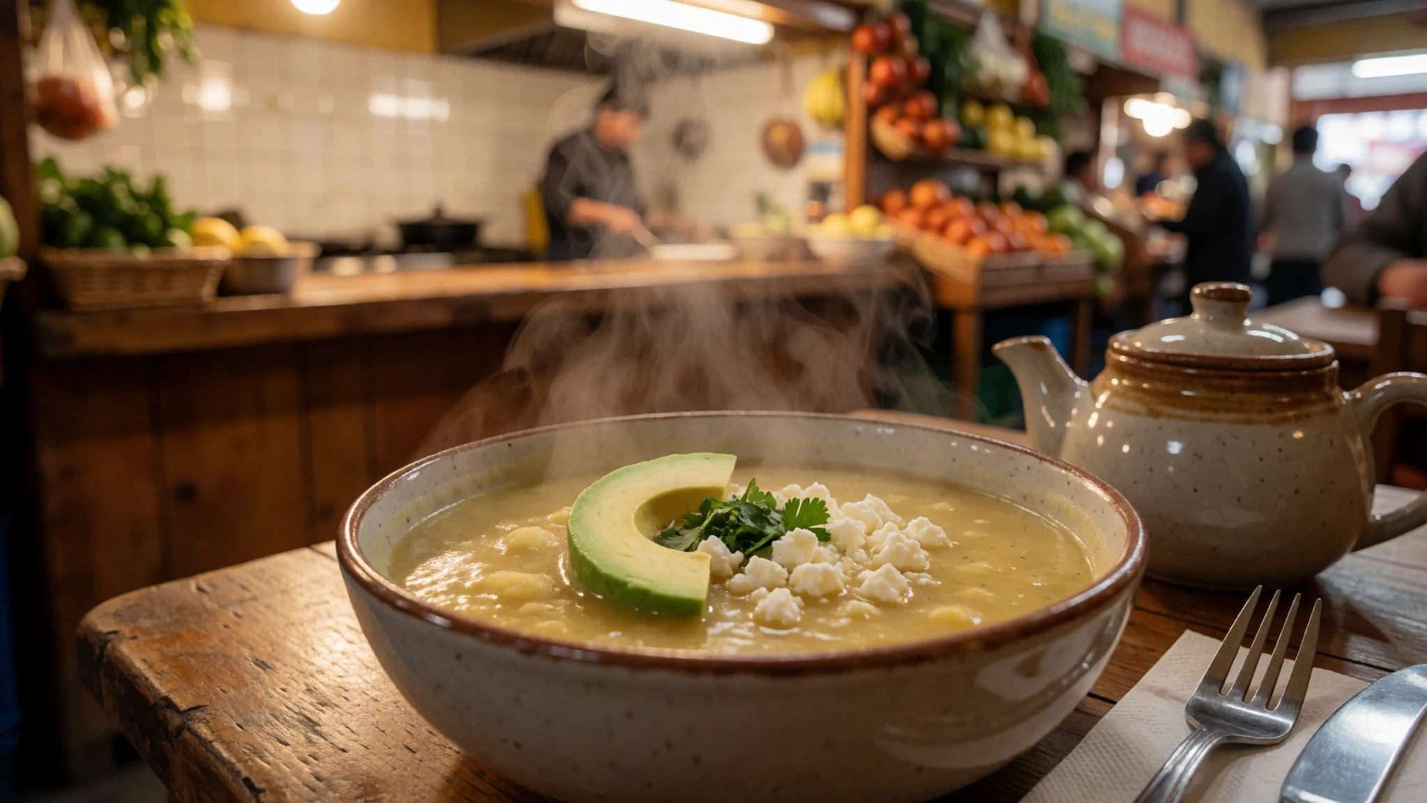
- Humitas — Street stalls near Riobamba's bus station
Sweet corn dough wrapped in corn husks and steamed until firm. Sold as a snack or breakfast, they are often eaten with coffee. Find them at the early morning stalls near the bus station.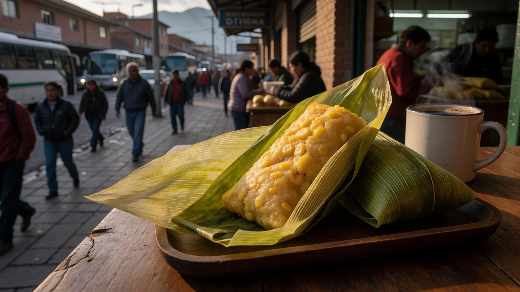
- Hornado — Traditional eateries along the main road south of Riobamba
Roast pork, slow-cooked until the skin is crisp, served with corn, potatoes and a spicy onion relish. It is a Sunday favourite in many highland homes. Try it at a traditional eatery on the main road south of town. - Canelazo — Riobamba town square, especially in the evenings
A warm drink of sugarcane spirit, cinnamon and fruit juice, served hot in cold weather. It is widely offered at festivals and on chilly evenings. Ask for it at a stall in the town square. - Cuy — Family-run eateries in villages near the mountain
Guinea pig, roasted whole and served with potatoes and salad. It is a traditional highland dish, especially for celebrations. Find it at family-run restaurants in the villages near the mountain.
Plan it
Best time. The drier months from June to September usually give the clearest mornings, which matter most for views and climbs, though weather on a high mountain can change within hours. Early starts help in every season, because cloud often builds through the afternoon.
How long. 2–3
Getting there. Fly into Quito, then take a long road journey south to Riobamba, the usual base; the mountain lies about 150 km from Quito as the crow flies. Buses run from Riobamba's bus station towards Guaranda, from where you can ask to be dropped at the reserve entrance.
Budget. mid
Tips
- Book a guide and equipment through an agency in Riobamba before any climb, as they arrange the logistics.
- Expect climbs to start around midnight so you reach the summit at sunrise and return by late morning, a round trip of about 9–10 hours.
- Walk the reserve road to the first refuge for a day trip, and keep spare time for vicuña sightings.
- Carry cash for small buses, taxis and village stalls, and check card acceptance before you travel.
- Drink plenty of water and go slowly, as altitude can cause headaches and breathlessness even on gentle paths.
Etiquette
- Register at the reserve entrance and follow the marked routes.
- Do not go beyond the lake or refuges without a guide, as the rules require.
- Ask before photographing people in villages and markets.
Nearby
Sources
- Wikidata Q14081 (CC0)
- Wikipedia: Chimborazo (rev 1371319665) (CC BY-SA 4.0)
- Wikivoyage: Chimborazo (rev 5327054) (CC BY-SA 4.0)
- Volcán Chimborazo desde Riobamba, Eduardo Navas (CC BY-SA 2.0)
- Chimborazo, aspecto norte, Dick Culbert (CC BY 2.5)
- Vista del Volcán Chimborazo desde Riobamba, Eduardo Navas (CC BY-SA 2.0)
- Chimborazo 2022-12-05, Morgen Mills (CC BY-SA 4.0)
- Tephra Layers at Chimborazo Volcano, Julia Rubinic (CC BY 2.5)
- Humboldt-Bonpland Chimborazo, Friedrich Georg Weitsch (Public domain)
- 1839 Black-Hall Map of the Mountains & Plants of America, Geographicus (Public domain)
- Chimborazo Volcano, Frederic Edwin Church 1884 (Public domain)


