Brúarfoss
Brúarfoss, Iceland
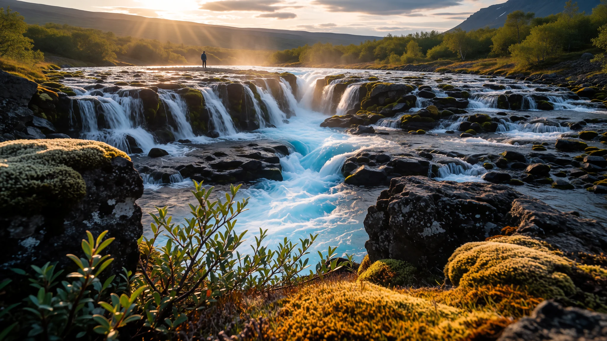
Brúarfoss enchants visitors with its intense glacial blue waters cascading into a narrow volcanic gorge along the famous Golden Circle.
The place
Brúarfoss sits tucked away in the volcanic countryside of South Iceland, flowing along the clear waters of the Brúará River. Unlike the roaring giant waterfalls that tumble over sheer basalt precipices, Brúarfoss charms with its exquisite colour and intricate geometry. Hundreds of small icy streams stream down dark rock ledges, channelling into a deep crack down the middle of the riverbed. This concentrated central rift creates an astonishing bright sky-blue chute that glows vividly against the dark volcanic landscape.
The surrounding river basin forms part of the agricultural lowlands, framed by low birch thickets, moss-draped lava rocks, and distant mountain ridges. The terrain is characteristic of the southern region, where meltwater channels carve through ancient basalt layers on their way toward the southern shore. Because the falls sit hidden within a quiet countryside valley, reaching them has historically required a rewarding walk through peaceful pastures alongside the river.
Visiting Brúarfoss offers a gentle and intimate experience of Iceland's glacial waters. Wooden footbridges cross the river directly over the foaming turquoise waters, allowing travellers to look straight into the churn where the streams meet. Watching the pale cyan froth swirl into deep navy pools reveals the sheer clarity of glacial runoff. The atmosphere remains quieter and more reflective than the crowded coach tour stops along the main ring route, inviting long pauses to take in the cold mist and the rushing sound of water.
Its story
Brúarfoss derives its name from a natural stone bridge that once spanned the river near the falls, serving as an important crossing point in Icelandic history. According to local lore, an overseer of the nearby episcopal seat at Skálholt ordered the stone arch destroyed in historical times to prevent impoverished travellers from crossing the river during a regional famine. Though the original natural bridge is long gone, wooden footbridges have since restored human passage over the churning waters.
The broader region surrounding Brúarfoss holds a central place in the historical memory of Iceland. Nearby Skálholt served as the primary seat of religious and cultural authority for centuries, drawing clergy, scholars, and travellers across the treacherous rivers of the south. Meanwhile, the open plains at Þingvellir hosted the national assembly, where chieftains gathered each summer to debate laws and settle blood feuds. The surrounding river valleys also formed the backdrop for famous medieval sagas, where legendary figures farmed the volcanic soils and navigated the shifting river crossings.
Throughout these centuries, rural life along the Brúará River revolved around sheep farming, turf housing, and adapting to the severe elements. River crossings were matters of survival in a landscape with few bridges and turbulent glacial currents. Today, modern wooden bridges span Brúarfoss once more, connecting visitors to an ancient route through the Icelandic lowlands.
What to see
- Brúarfoss Footbridge — Brúará River trail
The wooden footbridge spanning the Brúará River offers the clearest viewpoint directly above the central fissure. Standing on the timber planks, travellers look straight into the bright cyan gorge where thousands of small cascades collide into a single roaring channel. It provides an ideal vantage point for photographing the contrast between dark volcanic rock and luminous glacial water.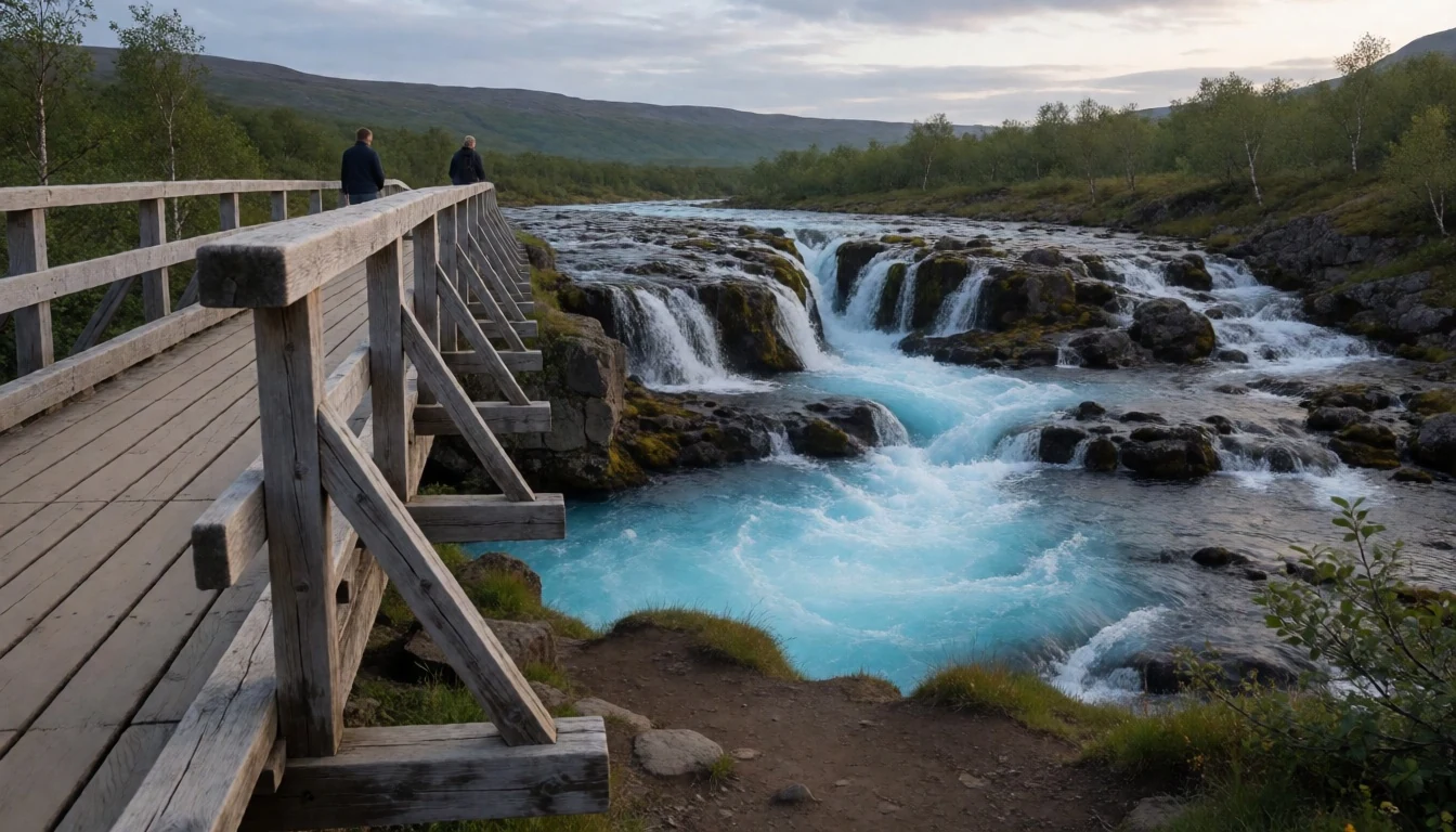
- Geysir Geothermal Area — Haukadalur Valley
Located a short drive from the waterfall along the Golden Circle route, this active geothermal valley features steaming fumaroles, bubbling mud pots, and erupting hot springs. While the Great Geysir erupts infrequently, the nearby Strokkur geyser reliably shoots columns of scalding water skyward every few minutes, surrounded by colourful mineral deposits and sulphur vents.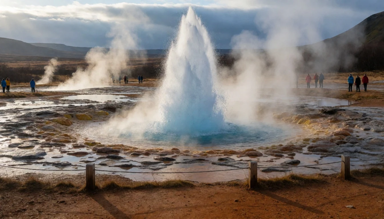
- Gullfoss Waterfall — Hvítá River Canyon
One of South Iceland's grandest natural sights, Gullfoss drops in two dramatic tiers into a deep river canyon. Walking along the rim trails provides sweeping views of the massive glacial river thunderously churning over golden-brown basalt walls. Spray from the torrent regularly creates vivid double rainbows across the gorge on clear summer days.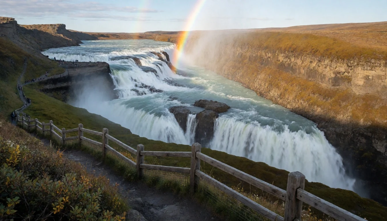
- Þingvellir National Park — Bláskógabyggð district
This historic valley marks the meeting point of tectonic plates and the home of Iceland's ancient parliamentary assembly. Visitors can walk between towering rock walls along the Almannagjá fault, explore clear spring-fed rifts, and view the serene expanse of the nation's largest natural lake surrounded by birch scrub and volcanic peaks.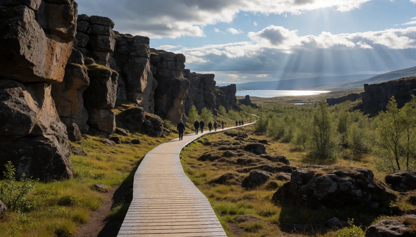
- Skálholt Historic Site — Biskupstungur region
Once the episcopal capital and intellectual hub of medieval Iceland, Skálholt sits peacefully above the river plains. A modern memorial church stands on the historic grounds, housing preserved artefacts, intricate stained glass, and a crypt revealing centuries of archaeological finds that trace the island's transition into Christianity.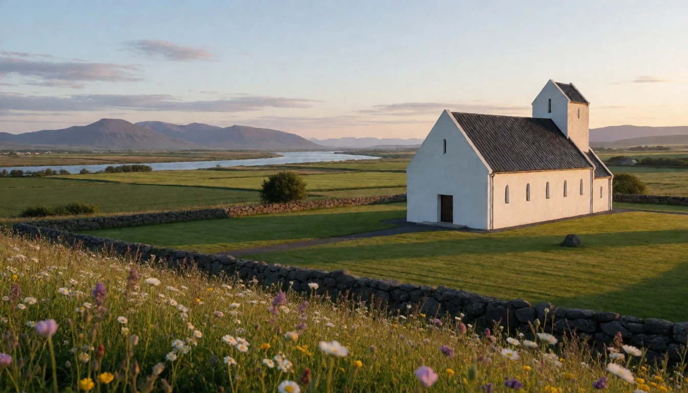
Culture
Brúarfoss sits in a countryside deeply shaped by traditional Icelandic rural culture and saga literature. For generations, life in the southern river valleys revolved around self-sufficient sheep farming, turf building techniques, and a profound respect for the unpredictable force of glacial rivers. Local folklore often attributes mysterious natural features to hidden spirits or historical figures who navigated these harsh landscapes. Today, local communities maintain strong connections to the land, balancing seasonal agriculture with hospitality for global travellers exploring the Golden Circle.
The preservation of natural waterways and quiet rural spaces remains a core value across the region. Unlike heavily developed commercial attractions, the area around Brúarfoss retains a tranquil, unhurried feel where visitors are expected to tread lightly on fragile moss and respect private farmland boundaries. Local hospitality emphasises warm community gatherings, traditional wool craft, and seasonal storytelling during long winter nights. When exploring the riverbanks and trails around Brúarfoss, stay strictly on designated footpaths to protect the delicate volcanic moss and fragile flora from erosion.
What to wear
Fashion around Brúarfoss and rural South Iceland reflects a practical balance between heritage craftsmanship and technical outdoor utility. The most famous traditional garment is the *lopapeysa*, an iconic hand-knitted sweater crafted from unspun Icelandic sheep wool (*lopi*). Celebrated for its natural water-repellent qualities, warmth, and distinctive geometric collar patterns, the sweater remains a staple of national identity, worn during rural festivals, sheep roundups, and everyday outdoor life. Historical festive dress featured intricate embroidery and silver ornaments, though it is reserved for formal ceremonial occasions today.
In daily life, contemporary Icelanders dress in casual, functional clothing suited to changing weather, favouring fleece layers, dark denim, down jackets, and sturdy leather boots.
For visitors exploring Brúarfoss, preparing for unpredictable weather and wet ground is essential. Layering is key: pack thermal base layers, a fleece sweater or wool knit, and windproof, waterproof outer jackets and trousers. Sturdy waterproof hiking boots with solid ankle support and good grip are crucial for navigating muddy clay paths and slick wet rocks near the river. Waterproof footwear allows comfortable walking along the riverbank trail even after rain.
What to eat
- Kjötsúpa (Icelandic Lamb Soup) — farm cafes and roadside diners along the Golden Circle
This hearty traditional soup features slow-cooked grass-fed lamb simmered with rutabagas, potatoes, carrots, and aromatic herbs. It is served steaming hot alongside crusty buttered bread in rural eateries across South Iceland, offering comfort after a cold walk along the river.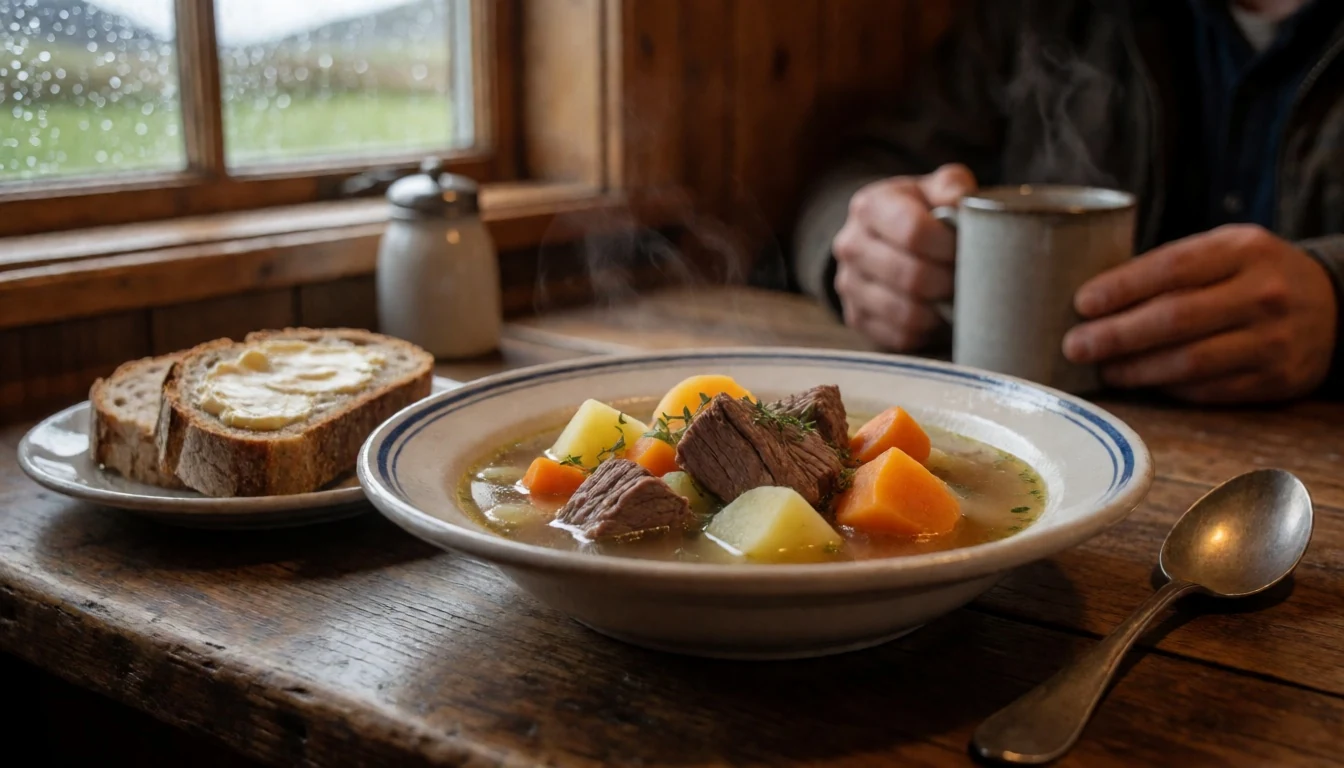
- Fresh Arctic Char — countryside restaurants and farm-to-table eateries
Sourced from local fresh-water streams and regional aquaculture, this delicate pink fish is typically pan-seared with butter, lemon, and herbs. Served with dill potatoes, it highlights the region's clean water produce in countryside dining rooms.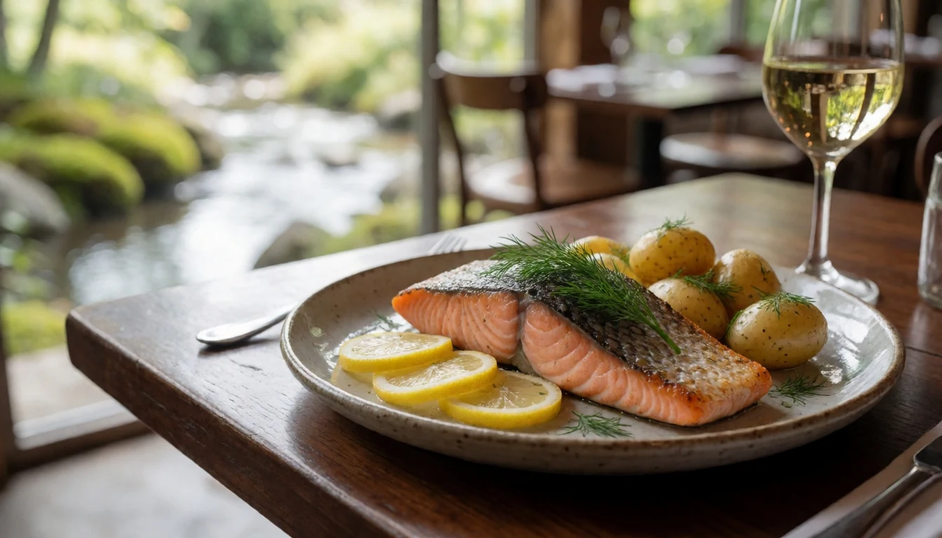
- Skyr with Bilberries — local bakeries and breakfast spots
A dense, high-protein cultured dairy product enjoyed for centuries, skyr has a smooth texture similar to thick yogurt. Served chilled with fresh cream and wild bilberries or sugar, it forms a classic Icelandic breakfast or light dessert in farm cafes. - Flatkaka með Hangikjöti — bakeries and local farmers markets
Traditional rye flatbread cooked on hot griddles, spread generously with creamy butter and topped with thin slices of smoked lamb. It is a portable, classic snack enjoyed on countryside hikes and road trips throughout the southern region. - Rúgbrauð (Geothermal Rye Bread) — geothermal bakeries and local farm kitchens
A dark, sweet rye bread traditionally baked slowly in pots buried near hot geothermal springs. Dense and cake-like, it is served warm with fresh salted butter or paired with smoked fish at local farm tables.
Plan it
Best time. June to August offers long daylight hours, mild weather, and green landscapes; September to October and March to April offer northern lights with less winter ice.
How long. 1–2
Getting there. Fly into Keflavík International Airport or Reykjavík Domestic Airport, then rent a car or join a tour heading east along the Ring Road and Road 37.
Budget. mid
Tips
- Wear sturdy waterproof boots for muddy approach paths
- Use official designated parking areas and avoid blocking narrow farm tracks
- Bring waterproof jacket layers for sudden weather changes
- Carry water and snacks as there are no shops at the falls
Etiquette
- Stay on marked paths to avoid damaging fragile moss
- Respect private property boundaries near farm plots
- Pack out all litter and food scraps
Nearby
Sources
- Wikidata Q2557346 (CC0)
- Wikivoyage South Iceland article (CC BY-SA 4.0)
- Brúarfoss photo by Milan Nykodym (CC BY-SA 2.0)
- BROER-AA (1850) photo (Public domain)
- The Bruara River photo (Public domain)
- Übergang über den Brúarár photo (Public domain)
- Blue Braurfoss Up Close photo by joiseyshowaa (CC BY-SA 2.0)
- Braurf0ss from inside photo by joiseyshowaa (CC BY-SA 2.0)
- Bruarfoss photo by salomon10 (CC BY 2.5)
- Bruarfoss waterfall photo by Lianguanlun (CC BY 4.0)
- Wikipedia (CC BY-SA 4.0)


