Banaba
Banaba, Kiribati
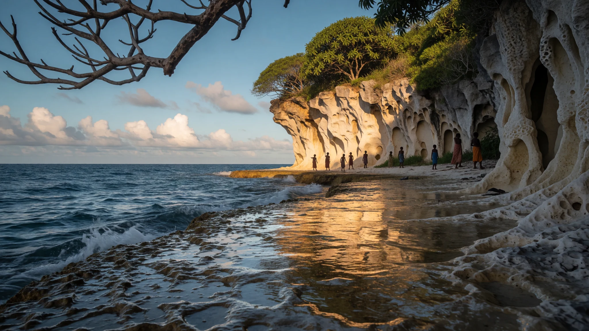
Banaba is a lone raised-coral island where mining hollowed out the interior, a place to visit for its history and its people, not for beaches.
The place
Banaba is a lone raised coral island in the western Pacific, and the westernmost point of Kiribati. The rest of the country lies far to the east, scattered along the Gilbert chain, while Nauru is the nearest land to the west. The island covers about six square kilometres, and its top, 81 metres above the sea, is the highest ground anywhere in Kiribati. That is odd for a country of atolls, and it follows from how Banaba was formed: an old reef lifted clear of the water, with limestone cliffs instead of a low lagoon rim. Its name in Gilbertese is spelt Bwanaba, and the national constitution writes Banaba, a word glossed as hollow land, which suits the interior. Many decades of phosphate mining stripped the soil from the middle of the island, leaving bare rock where nothing can be farmed or lived in. Trees and houses have retreated to the coast, where mango, flame trees, guava, tapioca and saltbush grow. The 333 residents live mainly in coastal villages; the 2010 census counted three occupied ones, Tabwewa, Antereen (also called Tabiang) and Umwa, while Buakonikai now stands empty. The climate is tropical and wet, with rain carried by winds from the north-east to south-east. The drier stretch runs from May to November, and from December to April monthly rainfall averages above 120 mm. There are no natural streams, so water has always been the island's central worry. Local time is UTC+12.
Its story
Banaba's history comes in three layers: long Pacific settlement, a short and harsh period of outside contact, and the mining that reshaped everything. Oral tradition, as set down by the Banaban writer Raobeia Ken Sigrah, holds that the Te Aka clan, with roots in Melanesia, were the first people here, before later arrivals from the East Indies and Kiribati. Settlement unfolded over many centuries and in several waves. Banabans saw their island as the buto, the navel of the world. Unusually for the Pacific, land belonged to individuals rather than to chiefs or noble families, with separate categories for land given to elders, to adopted children or at marriage. Europeans first sighted the island in January 1801, and in 1804 a ship called Ocean gave it the name Ocean Island, which stuck for generations. Whalers called for wood and water through the nineteenth century, the first recorded visit in 1832 and the last in 1904. Water was never easy: with no streams and no freshwater lens, people relied on a cave where rainwater collected. A drought that began in 1873 killed most of the population and nearly all the trees, and many survivors left on passing ships. In 1899 the Pacific Islands Company recognised that the petrified guano was high-grade phosphate rock, and extraction began. It continued for many decades. The cost to the land and its people is the story Banabans still tell.
What to see
- The mined interior — Centre of the island
The middle of Banaba is bare limestone left by decades of phosphate extraction, with no soil to speak of. It is stark rather than pretty, and it explains the whole island: why people live on the rim, why land is a sensitive subject, and why a visit is closer to a history lesson than a beach holiday. Go with a local guide. - The highest point in Kiribati — Interior highlands
The summit reaches 81 metres, the highest ground in the country. It is no mountain climb, but on a clear day it gives a sense of how small and isolated the island is, with open ocean on every side and the scarred interior below. Ask villagers about the route and who must give permission. - Old phosphate company offices — Former company area
Archive photographs show the Pacific Phosphate Company's offices on what was then called Ocean Island. Little of the colonial town may be standing, so ask locally what remains and what can be visited. The picture is still a useful way into how the mining operation was run and who it served.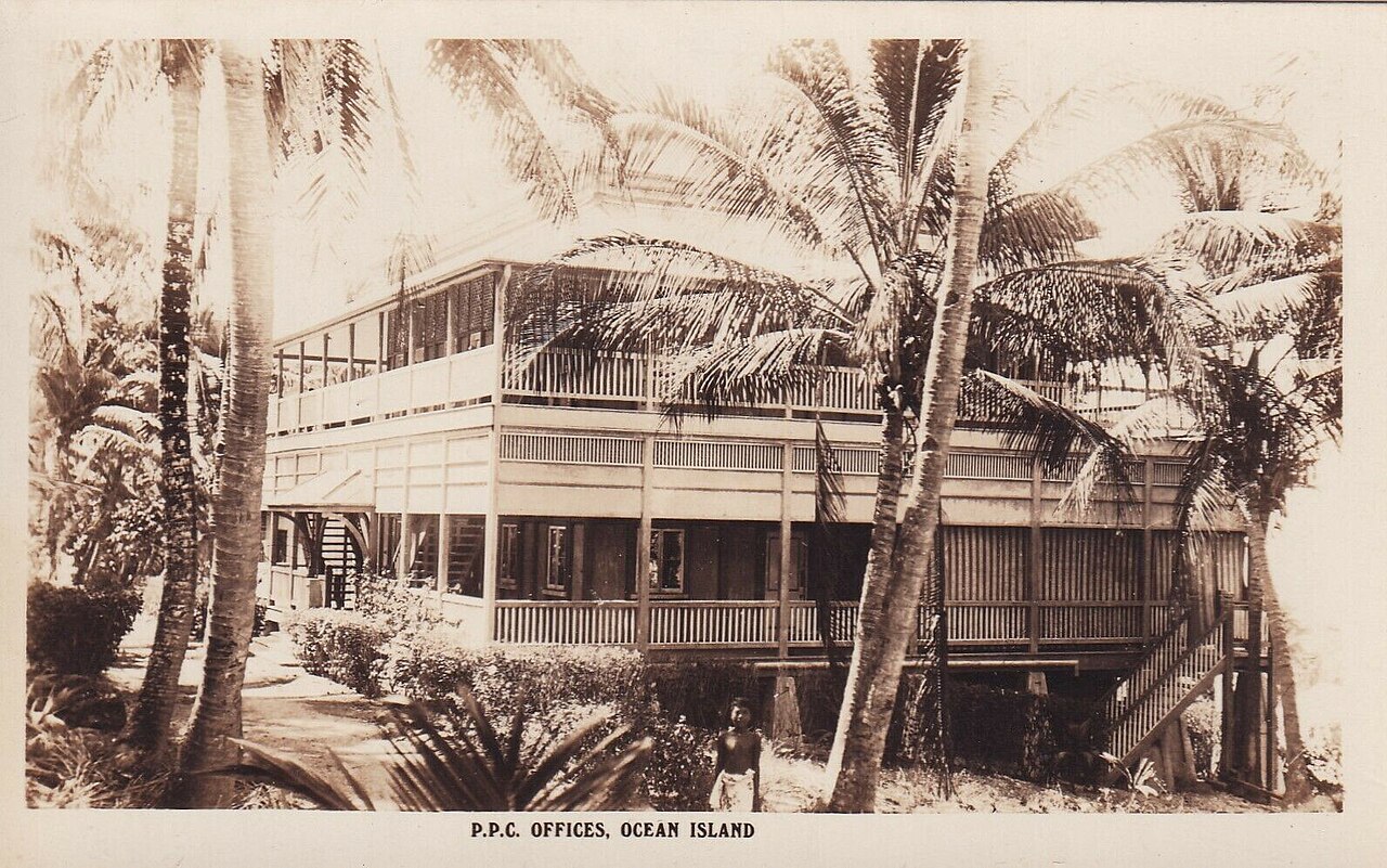
- The coastal villages — Coastal strip
The three villages occupied at the 2010 census, Tabwewa, Antereen and Umwa, sit along the shore where mango, flame trees and guava give shade. Spend time here, with permission, talking with residents about the island's story. The university map in the photo set shows how districts and villages are laid out.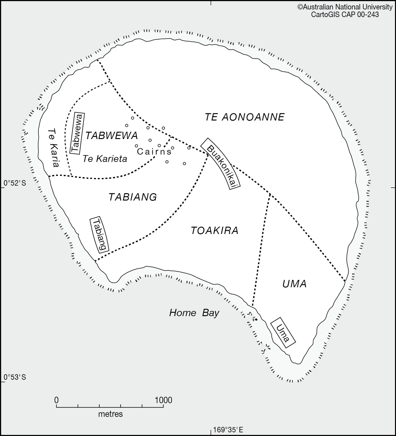
- The cliffs and the water cave — Shoreline and cliffs
Banaba's traditional water source was a cave where fresh water collected, and the cliffs around the shoreline show the raised-reef geology clearly. Ask villagers whether a visit is appropriate and who can guide you, since the cave matters to the community's history. Treat any such place as theirs first.
Culture
Banaba's culture is shaped by two facts that pull against each other: a deep sense of belonging to a small island, and the loss of much of that island to mining. Banabans traditionally saw their home as the navel of the world, and personal ownership of land, passed on through family, remains central to how people think about belonging. After the phosphate years, many Banabans settled elsewhere, with a large community in Fiji, so the island's story is held both by residents on Banaba and by relatives far away. Some Banaban voices, Sigrah's among them, argue for a separate identity from the rest of Kiribati, and that is a charged subject in national politics. A visitor does best to listen rather than debate it. Everyday life centres on family, church and the village meeting house, and hospitality is real but stretched by limited supplies and irregular transport. Songs, dance and storytelling carry the island's memory, and a visitor invited to a gathering is being trusted with something. Humour and patience go a long way. Ask the village before you cross land, photograph people or enter the mined interior, because land is individually owned and the history of the mining is still painful.
What to wear
Traditional dress in Banaba and the wider Gilbertese world uses plant fibres: skirts of plaited or shredded leaf and fibre, woven pandanus mats, and flower or leaf garlands for the head and neck. These are worn mainly for dance, feasts and church or community celebrations, not for daily life. Everyday clothing today is simple and practical: cotton T-shirts and shorts, wrap skirts or sarongs, loose dresses for women, and flip-flops. Sunday is dressed up for church, with clean shirts and modest dresses. Tinned and imported goods mean clothes often arrive second-hand or by supply boat. A visitor should pack for heat, sun and rough ground. Choose light cotton or quick-dry fabrics that cover the knees and shoulders in villages, and keep swimwear for the water, with a sarong to cover up afterwards. Bring a wide-brimmed hat and sun protection. The limestone and coral edges are sharp, so sturdy sandals or reef shoes are better than bare feet, and closed shoes help in the mined interior. A light rain jacket is worth carrying, especially from December to April when rain is heavier.
What to eat
- Fresh reef fish — Home cooking in the coastal villages
Fish caught off the reef is the island's staple protein, usually grilled over a fire or boiled with a little salt. It is simple, fresh and depends on the day's catch, so be flexible about what is on offer. - Breadfruit — Village households, shared meals
Roasted, boiled or fried, breadfruit is a starchy staple that fills the plate the way potato or rice does elsewhere. It is available when the trees are fruiting, so ask what is in season. - Coconut water and flesh — Village trees and homes
Drinking coconuts are the easiest safe refreshment on the island, and the flesh is eaten fresh or cooked into dishes. Ask a host to cut one for you, and say thanks, as every tree belongs to someone. - Mango and guava — Coastal village yards
Mango and guava trees line the coastal area where people live, and ripe fruit is an easy snack when in season. Ask before picking, since trees are owned, and expect sweetness and strong sun. - Rice with tinned fish — Village homes and small shops
Because supplies arrive by sea or air, rice and tinned fish or meat are everyday food, often served with the local catch when there is one. It is filling and honest island fare, so bring snacks from the capital for variety.
Plan it
Best time. May to November is the drier stretch, so June to October is the sensible window. From December to April rain is heavier, and rainfall varies a lot from year to year. Heat and humidity are constant.
How long. 3–5
Getting there. Fly into Kiribati's main airport on Tarawa, then arrange the onward leg to Banaba, which is remote and served irregularly by air or sea. Confirm current options with Kiribati's transport operators and the Banaban community website before booking anything.
Budget. mid
Tips
- Arrange a host and permission to visit before you travel; there is little tourist infrastructure
- Allow slack in your schedule, since flights and boats can be delayed or cancelled
- Carry cash in small notes, as cards are unlikely to work
- Bring drinking water, snacks, sun protection and any medicines, because supplies are limited
- Check the community website, http://www.banaban.com, for contacts and current guidance
Etiquette
- Ask before entering the mined interior, private land or any village gathering
- Dress modestly in villages and ask before photographing people
- Do not pick fruit or take coconuts without asking, since trees are owned
Nearby
Sources
- Wikidata Q271901 (CC0)
- Wikipedia: Banaba (rev 1381377335) (CC BY-SA 4.0)
- Wikivoyage: Gilbert Islands (rev 5268202) (CC BY-SA 4.0)
- Pacific Phosphate Company offices on Ocean Island (Banaba), Aussie~mobs (Public domain)
- Map of Banaba, CartoGIS, ANU (CC BY-SA 2.0)
- Banaba Island Marplot, Mr Minton (CC BY 2.5)
- Washington Island - Banaba, ISS Expedition 6 Crew (Public domain)


