Atauro Island
Atauro Island, Timor-Leste
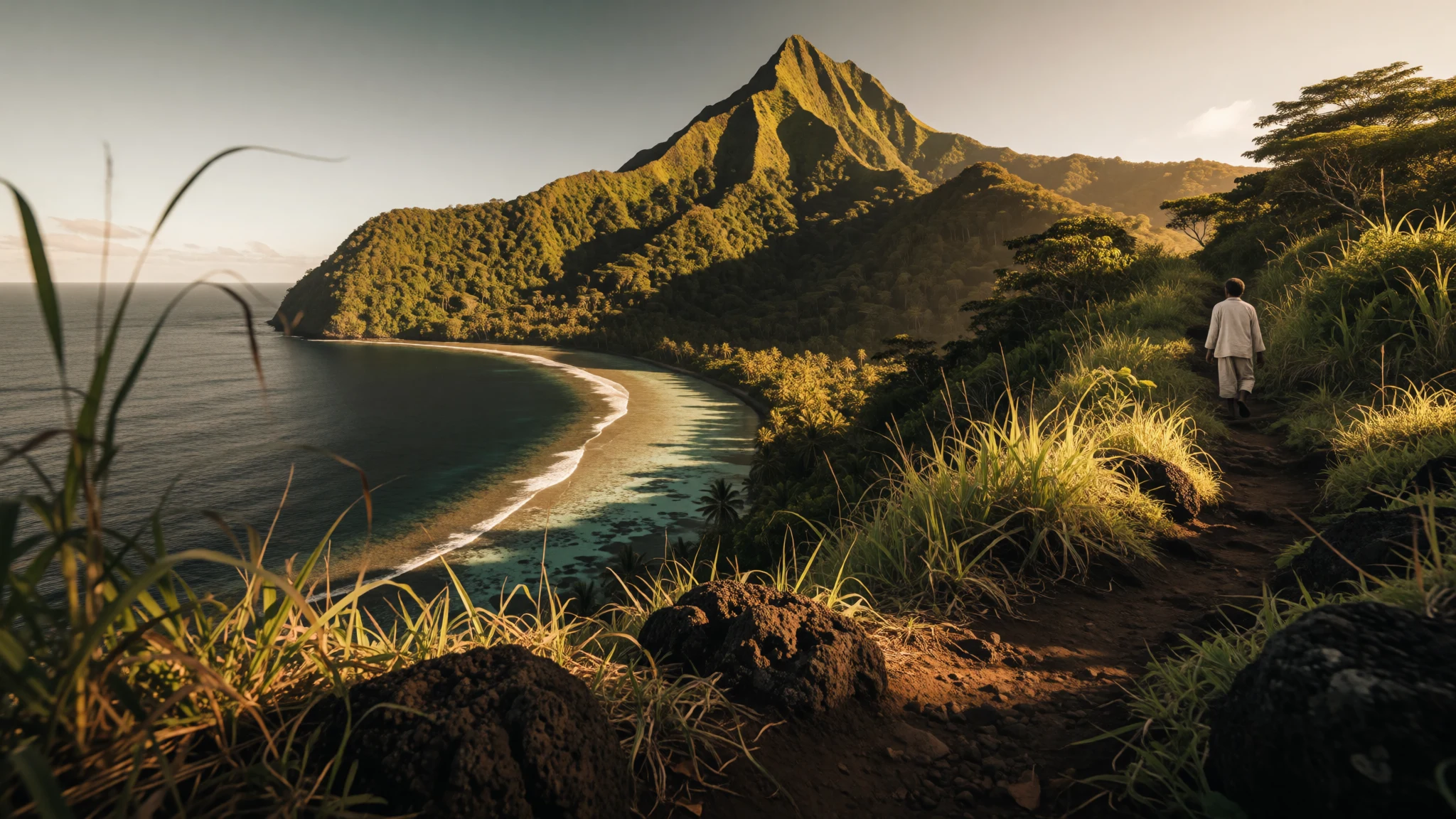
Atauro Island is a quiet volcanic island just across the water from Dili, with reefs, village walks and almost no traffic.
The place
Atauro Island lies in the sea north of Dili, the capital of Timor-Leste, on a volcanic arc that runs on into eastern Indonesia. It is small and steep. A mountainous spine climbs to Mount Manucoco, the island's high point, and fishing villages sit wherever the slopes leave a strip of flat ground. Indonesian islands are close on the far side, so on a clear day land shows on more than one horizon.
About 9,300 people live here, spread over several sucos, the local administrative units, each built around a village. Vila Maumeta on the southeast coast is the largest settlement and the base for government offices and aid organisations. Beloi in the north is the ferry port and has the most places to stay. Between Vila and Pala runs the island's single sealed road, and almost everything else is reached on foot along coastal and mountain paths.
That shapes the rhythm of a visit. There is little traffic, plans bend around the boat, the weather and how far anyone fancies walking, and evenings are quiet once the light goes. Electricity and phone signal can be patchy away from the main villages, so it suits people who like a slow, simple trip.
Atauro became a municipality in its own right in 2022; before that it was an administrative post of Dili. For a reader drawn here by the idea of waterfalls and lakes, a straight word: the water on Atauro is the sea. The draw is clear shallow water, reefs close to the shore and a rugged, lightly built coast, not falling rivers or still lakes. Diving and snorkelling are the main reasons people make the crossing, with hill walking a close second.
Its story
Atauro's early story is one of defence and rivalry. The island was split into separate domains, each made up of family clans: Makili in the southeast beneath Manucoco, Macadede in the southwest, and Mandroni across the north and centre. Raiders and pirates from neighbouring islands, along with slavers sailing from further afield, made the coast a dangerous place. When outsiders came, the clans tended to close ranks. When they did not, they argued among themselves over the island's limited resources, and that competition helped shape the three domains.
Portugal and the Netherlands settled the question of who owned Atauro by treaty, and Portugal's claim was recognised. The flag was raised in a formal ceremony only some years afterwards, and local people began paying taxes later still. Soon after Portuguese settlement the island was used as a place of confinement for prisoners, a role that sits uneasily beside its present calm.
Tax collection brought trouble. The Portuguese gave the job to outside domains, and Macadede refused to pay the government in Dili. Fighting followed. Makili and Mandroni were recruited by the colonial authorities and defeated Macadede's forces, a reminder that old clan divisions were used by colonial administrators as much as they were healed by them.
Another layer arrived through religion. A Dutch Calvinist mission crossing from Alor left a Protestant community in the north, unusual in a mostly Catholic country. In recent times the island has changed administratively rather than dramatically, becoming its own municipality in 2022 after years as part of Dili.
What to see
- Vila Maumeta — Southeast coast
The island's main town on the southeast coast is small and easy to read: unpaved streets, bright flowering shrubs, a few guesthouses and the offices of government and aid groups. It makes a sensible base for walks and boat trips, and the mountain rises straight behind it.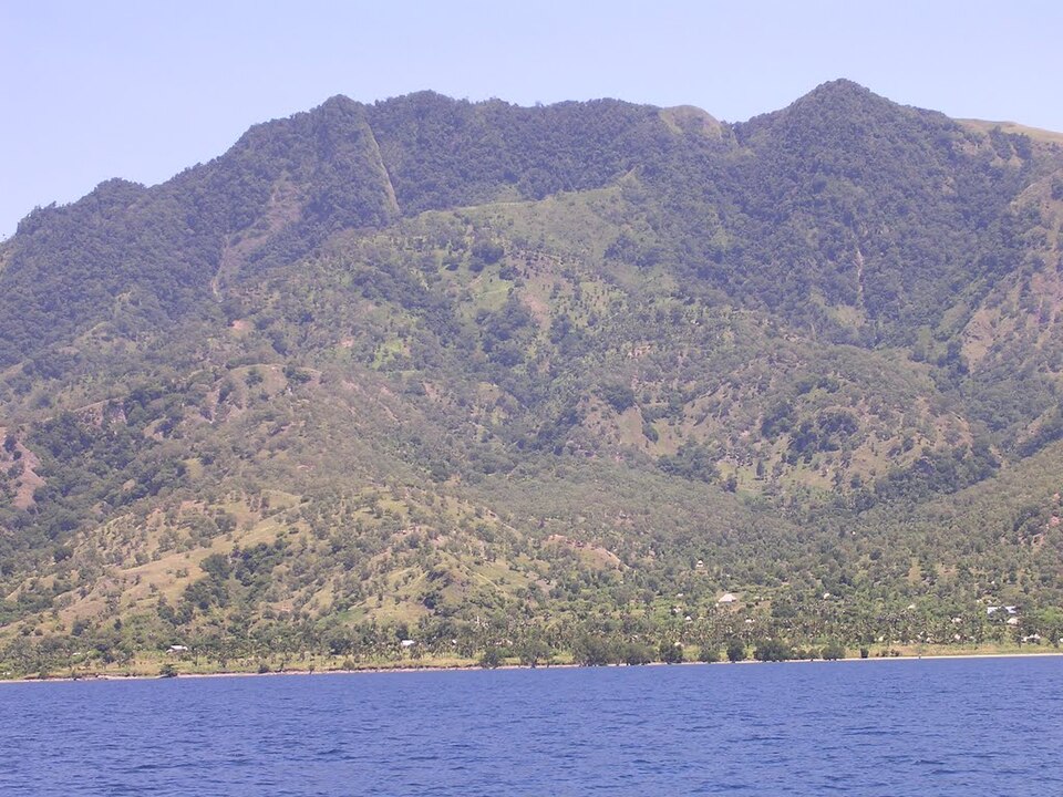
- Beloi — North coast
Beloi is where most visitors step off the ferry, and the quay becomes a small market whenever a boat comes in. It has the widest choice of homestays and simple places to sleep, so it suits a first night, a supply stop or a base for the northern villages. - Maquili — Southeast coast
This fishing village sits south of Vila, reached on foot along a rugged stretch of coast that is half the point of going. The path is rocky and exposed, so start early and carry water. Maquili is known locally for woodwork, and a few carvings make light, practical souvenirs. - Adara — West coast
Adara is a tiny west-coast village with a white sand beach and a pace of life noticeably slower than the eastern side. A hammock facing the water is the whole programme. It also works as a stopover on a multi-day walk, with the neighbouring village of Atecru within easy reach on foot. - Mount Manucoco — Central uplands
The island's high point is a forested volcanic massif that dominates the skyline from Vila and from Dili. Walking routes climb through the highest settlement, Anartutu, where the views over the surrounding slopes and sea repay the effort. Go with a local guide, leave early and expect heat on the lower slopes.
Culture
Atauro's culture is shaped by the sea, by clan ties and by an unexpected religious mix. In most of Timor-Leste the Catholic Church dominates, but many people in the north are Protestant, the legacy of a Dutch Calvinist mission that arrived from the Indonesian island of Alor. Some Protestants live in the south as well. Church services, hymn singing and Sunday rest are therefore a visible part of village life, and visitors who arrive on a Sunday will find the pace slower than usual.
The island's languages are another marker of identity. Local people speak four related dialects of Wetarese, a language family that came originally from Wetar in Indonesia, alongside Tetun, the national lingua franca, and Portuguese in official settings. This is not the Timor-Leste of the mainland highlands, and islanders are keen to say so.
Older social structure survives in the clan houses called uma lisan, which link families to land, ancestors and obligations. Hospitality is real but unforced: homestays are run by families, meals are shared, and guests are expected to be polite, patient and curious rather than demanding. Fishing, small-scale farming, woodcarving and weaving fill most working days, and a growing number of families earn part of their income from visitors.
Ask permission before photographing people, their homes or a church service, and cover your shoulders and knees when walking through a village or entering a church.
What to wear
Traditional dress across Timor-Leste is built around tais, hand-woven cloth made on a backstrap loom, usually from cotton in bold geometric bands. Wrapped as skirts, sashes or shawls, tais appears at weddings, funerals, church occasions and community ceremonies, and each region has its own colours and patterns. On Atauro the cloth is part of that wider tradition; ask a local weaver or host family about the designs they use rather than assuming a standard pattern. Beadwork and carved ornaments sometimes accompany ceremonial dress.
Day to day, people on Atauro dress for heat, work and the boat. T-shirts, shorts or knee-length skirts, sarongs, flip-flops and wide-brimmed hats are normal, and fishermen often work in old shirts and rolled trousers. On Sundays many families put on their best clothes for church, often with a piece of tais, and the villages look noticeably smarter.
Visitors should pack for sun, salt and rough paths. Light, quick-drying cotton or linen is the sensible base layer, with a long-sleeved shirt for sun and insects. Villages are modest places, so keep swimwear for the beach and boats, and carry a sarong or scarf to cover shoulders and knees when walking through a settlement or visiting a church. Sturdy sandals with a grip or light trail shoes suit the rocky coastal and mountain paths. Add a hat, sunglasses and reef-safe sun protection, plus a light rain layer.
What to eat
- Grilled fresh fish with rice — Homestays and small village eateries, especially Beloi and Vila Maumeta
The staple meal on an island where boats land the catch each morning. Reef fish or tuna is grilled over wood, served with rice and a spoonful of chilli. The simplest version is the best, so ask what came in that day. - Ikan sabuko — Family homestays, on request
A Timorese-style fish stew, tangy with tamarind and often lit with chilli. It is a good way to taste local cooking beyond plain grilling, and it comes with rice. Availability depends on the catch and the cook, so order ahead. - Batar da'an — Village homes and guesthouses
A comforting maize and bean stew, sometimes with pumpkin or greens, that sits at the heart of Timorese home cooking. It is filling, mild and generally suits vegetarians when no meat is added, so ask before it is cooked. - Cassava and sweet potato — Small markets and the quayside stalls when a ferry arrives
Root crops grown on the slopes are boiled, fried or roasted as side dishes and snacks. Fried cassava with chilli sauce is a common accompaniment to fish. These are everyday foods rather than special ones, and they are cheap and filling after a walk. - Timorese coffee — Guesthouses, homestays and small roadside kiosks
Timor-Leste grows coffee in its highlands, and a strong, sweetened cup is the usual welcome in a home or guesthouse. Atauro's own supply is brought in rather than grown on the island, but the habit is just as strong.
Plan it
Best time. The drier months, roughly June to October, are the most reliable for calm sea crossings, clear water for diving and comfortable walking. The wet season brings heavier rain, rougher boat trips and muddier paths, and some services slow down. Heat is a factor all year, so plan walks for early morning.
How long. 3–4
Getting there. Fly into Dili, then cross to Atauro by fast boat run by dive operators, by public ferry from the Dili ferry port, or on a small scheduled flight run by Missionary Aviation Fellowship. Ferries and boats land at Beloi, and walking or local transport covers the last leg. Schedules change, so confirm them locally before travelling.
Budget. low
Tips
- Book accommodation ahead through tourist information offices or homestay contacts, as rooms are few and some villages have only family-run beds.
- Carry enough cash from Dili, since cards and cash machines are scarce on the island.
- Bring drinking water or a purifier, sun protection and a torch, as supplies and electricity can be limited.
- Start walks early to avoid heat, and hire a local guide for Manucoco and the longer coastal routes.
- Check ferry and flight timings at the ticket offices and have a spare day in case weather disrupts the return.
Etiquette
- Ask before photographing people, homes or church services.
- Dress modestly in villages and cover shoulders and knees at church.
- Respect Sunday as a quiet day and agree prices for food, guides and beds before you start.
Nearby
Sources
- Wikidata Q753794 (CC0)
- Wikipedia: Atauro (rev 1374755665) (CC BY-SA 4.0)
- Wikivoyage: Atauro (rev 5393968) (CC BY-SA 4.0)
- Photo: Atauro (Yu Hui) (CC BY-SA 2.0)
- Photo: Locator map of Atauro municipality (J. Patrick Fischer) (CC BY-SA 4.0)
- Photo: Karte des Verwaltungsamtes Atauro (Public domain)
- Photo: Mt Manucoco above Vila (Colin Trainor) (CC BY 3.0)
- Photo: Atauro clear beach (Maria Auxilia) (CC0 1.0)
- Photo: Atauro island (Maria Auxilia) (CC0 1.0)
- Photo: Hütte auf Atauro (Serafim Lopes Ribeiro) (Public domain)
- Photo: Entre Berau e Vila (Jose Fernando Real) (CC BY-SA 4.0)


