Atacama Desert
Atacama Desert, Chile
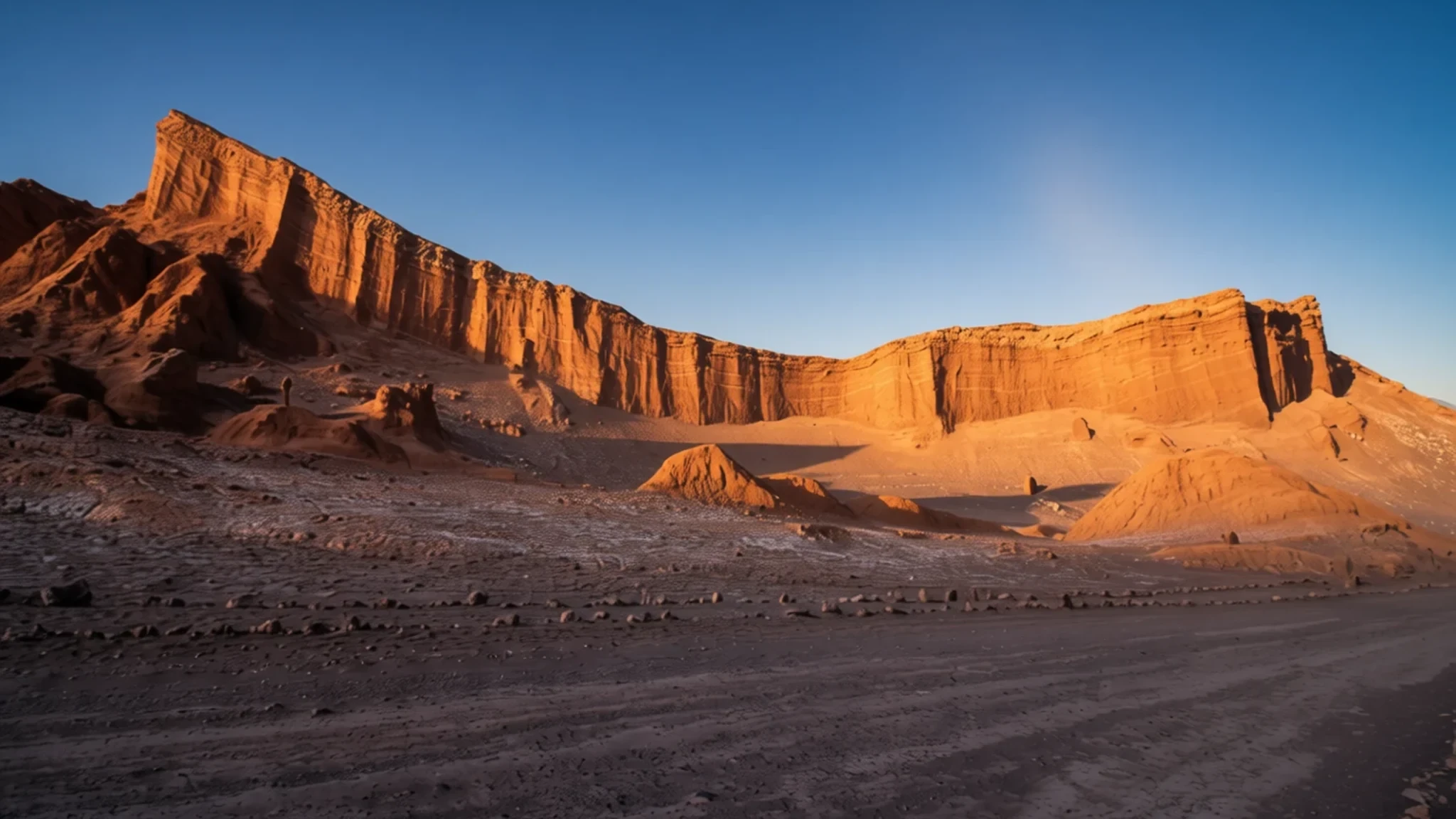
Chile's desert plateau is one of the driest places on Earth, with mild days, clear skies and wide, stony plains that feel unusually empty.
The place
The Atacama Desert sits on a high plateau along the Pacific coast of northern Chile. It runs for roughly 1,600 km in a long strip, squeezed between the Pacific and the Andes, and it reaches the foothills of those mountains on its eastern edge. The reference elevation is 2,657 m, so many of the towns and roads you will use lie well above sea level, and the air is thin and dry.
What makes the place so striking is the near absence of rain. Some weather stations have never recorded a drop, and the central part of the desert has gone years at a time without any. Two mountain chains block moisture arriving from the ocean and from the east. A cold current running north along the coast keeps the air stable, and high pressure over the Pacific reinforces that stillness. The result is a landscape of gravel plains, salt crusts, dunes and eroded rock, with fog from the sea feeding the odd patch of life on the coastal hills.
Temperatures are more moderate than you might expect. Days are warm rather than punishing, nights can turn cold at altitude, and the seasons change less than they do in most deserts. Most people arrive through San Pedro de Atacama, a small town that works as a base for valleys, viewpoints and night skies. The coast, with its beaches and old port towns, and the inland mining areas form a different, grittier side of the same region.
Its story
For a long time the desert was known mainly for what it held underneath. Nitrate-rich caliche was mined here in the saltpetre era, and the workers' towns that grew up around the works are still standing. Humberstone and Santa Laura, east of Iquique, now form a UNESCO site, and the dry air has kept many of their buildings in surprisingly good shape. Visitors walk through empty houses, a market hall and industrial structures that once ran a fierce export trade.
The mining boom faded, and many towns emptied. Yungay, once a settlement inland, was abandoned, and its ruins now sit among the scientific stations that study the ground. The University of Antofagasta runs a desert research station in the area, and researchers come to test instruments and sample soils where little grows. The landscape's resemblance to parts of Mars has made it a favourite site for expedition simulations, because teams can practise working in harsh, dry, isolated conditions.
The desert's age is part of its appeal. Scientists suggest it may be the oldest desert on Earth, shaped by a cold ocean current and a stable atmosphere for a very long time. Rain is so rare that even a wet winter can transform the ground. In some years seeds that have waited for decades bloom across the plains, most famously at Desierto Florido near Copiapó. The desert's history, then, is one of extremes: long dry spells, sudden colour, and people who have learned to work with both.
What to see
- Valle de la Luna — San Pedro de Atacama area
Valle de la Luna, near San Pedro de Atacama, is the classic first stop. Its ridges, salt-crusted hollows and sand dunes glow in the late afternoon, and walking trails let you climb to viewpoints over the whole basin. Go in the early morning or near sunset to avoid the midday glare, and bring more water than you think you need.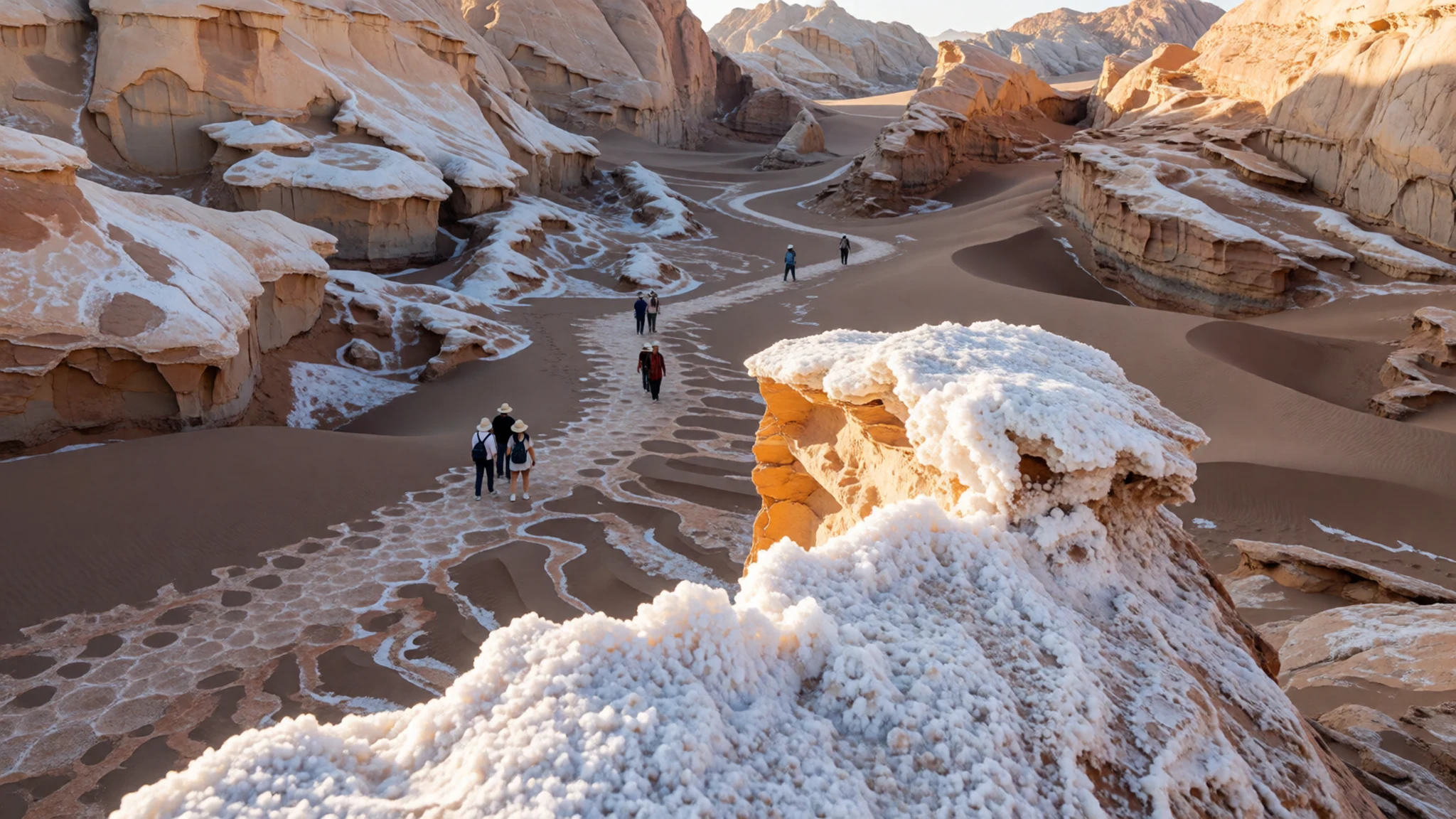
- Nevado Ojos del Salado — eastern border area, Atacama Region
This dormant volcano rises to 6,893 m and is the highest point in Chile. It is the world's tallest volcano and the second-highest mountain outside Asia. You will not climb it casually, but many travellers see it from high roads and viewpoints near the Argentine border, and it gives a sense of how sharply the land climbs out of the desert.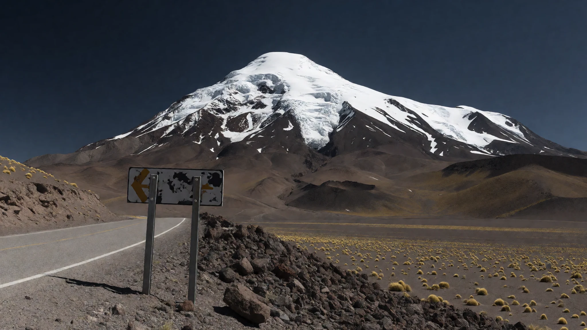
- Desierto Florido — south of Copiapó
This desert reserve south of Copiapó turns into a field of flowers in the years when rain has fallen. The blooms are short-lived and depend entirely on the weather, so check recent reports before you travel. Even without flowers, the open ground and low hills make a good half-day walk.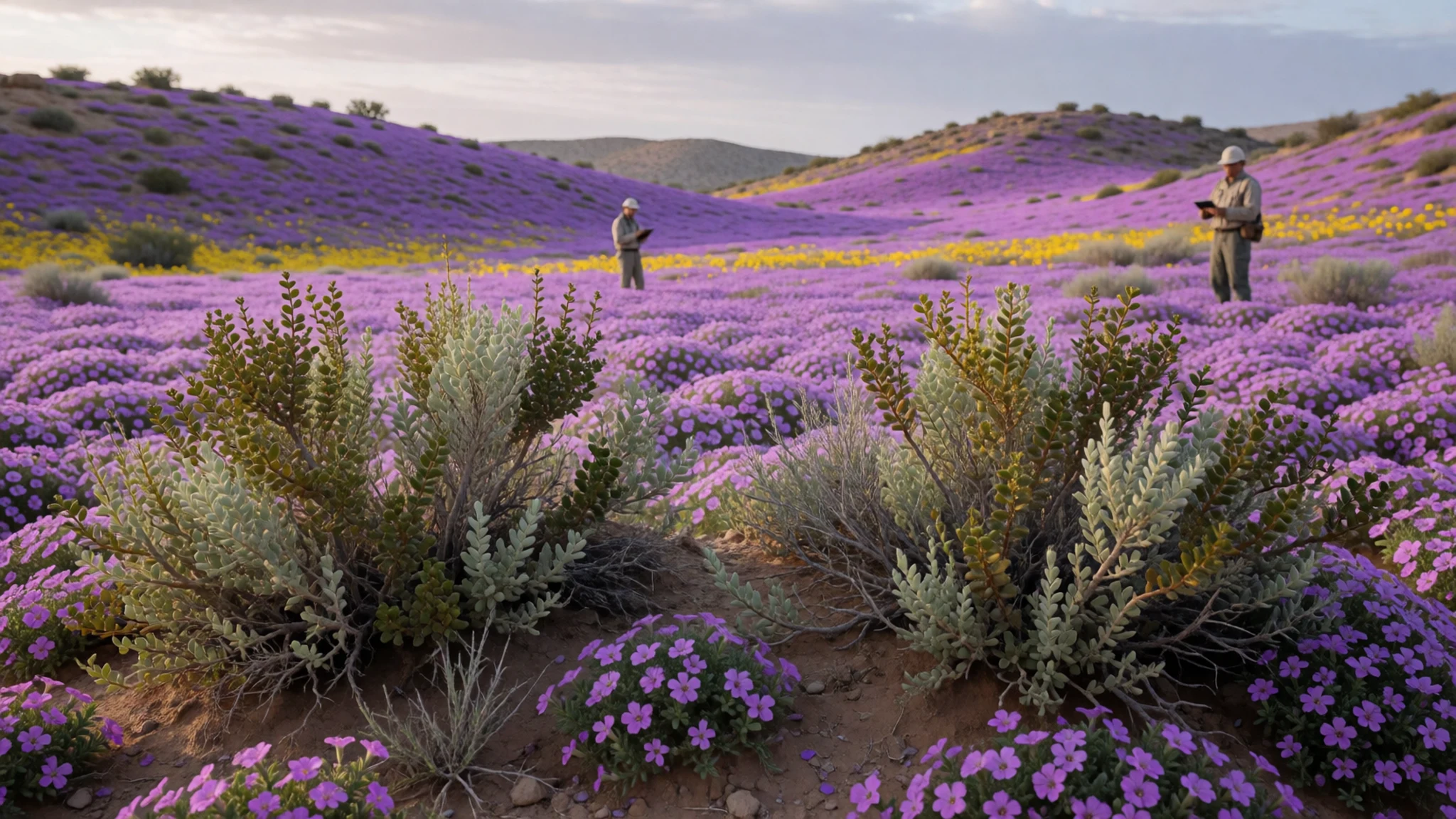
- Humberstone and Santa Laura — east of Iquique
These saltpetre works east of Iquique are a UNESCO site with rows of worker housing, offices, a market and processing buildings. Guided tours explain the history of the nitrate trade, and walking around the old streets in the dry air gives a strong sense of how much was left behind when production stopped.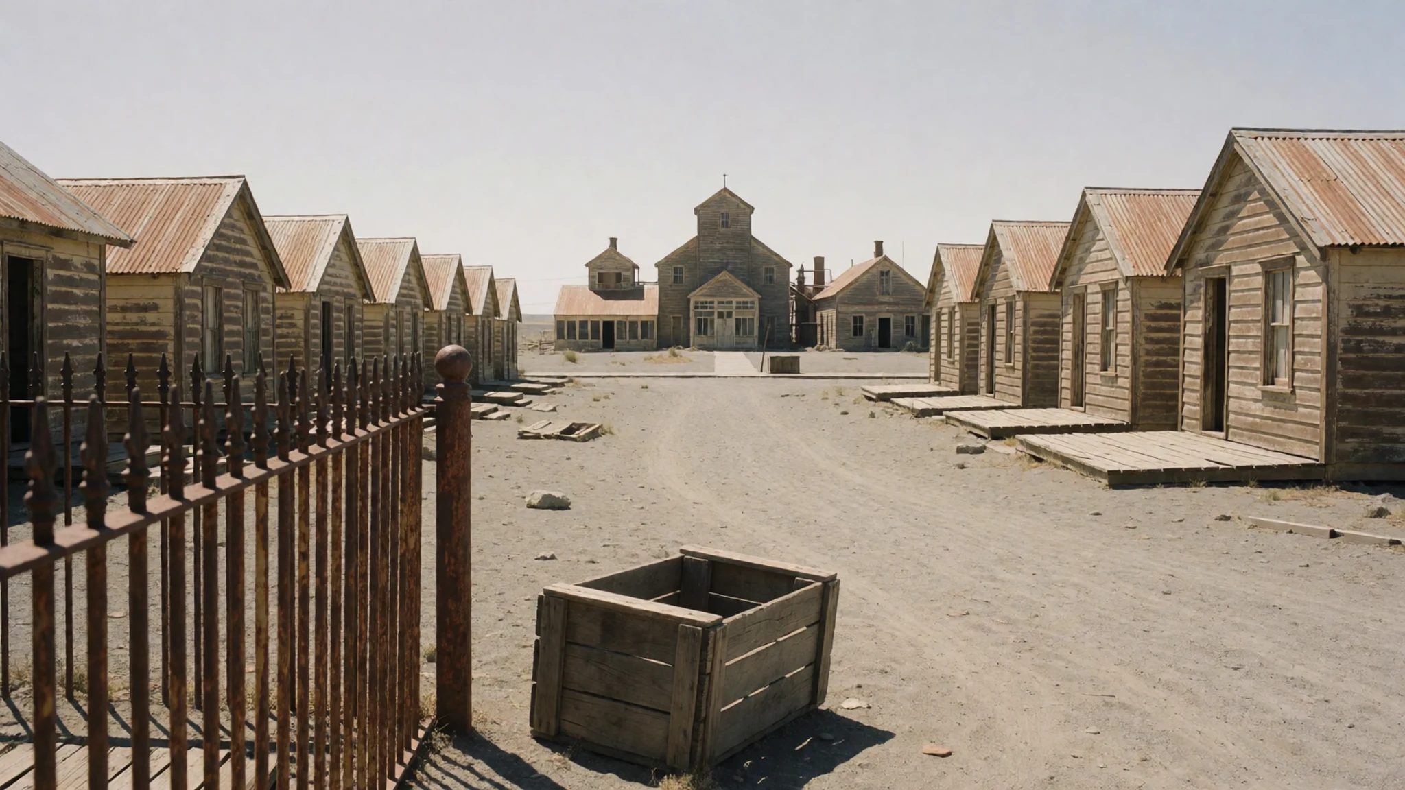
- Pan de Azúcar National Park — Atacama coast
This park on the coast gives a different picture: desert meets the Pacific, with rocky headlands, sandy coves and wildlife along the shore. Expect wind and sun, and carry water and sun protection. It is a good counterpoint to the inland plateau, and the coast can feel noticeably cooler.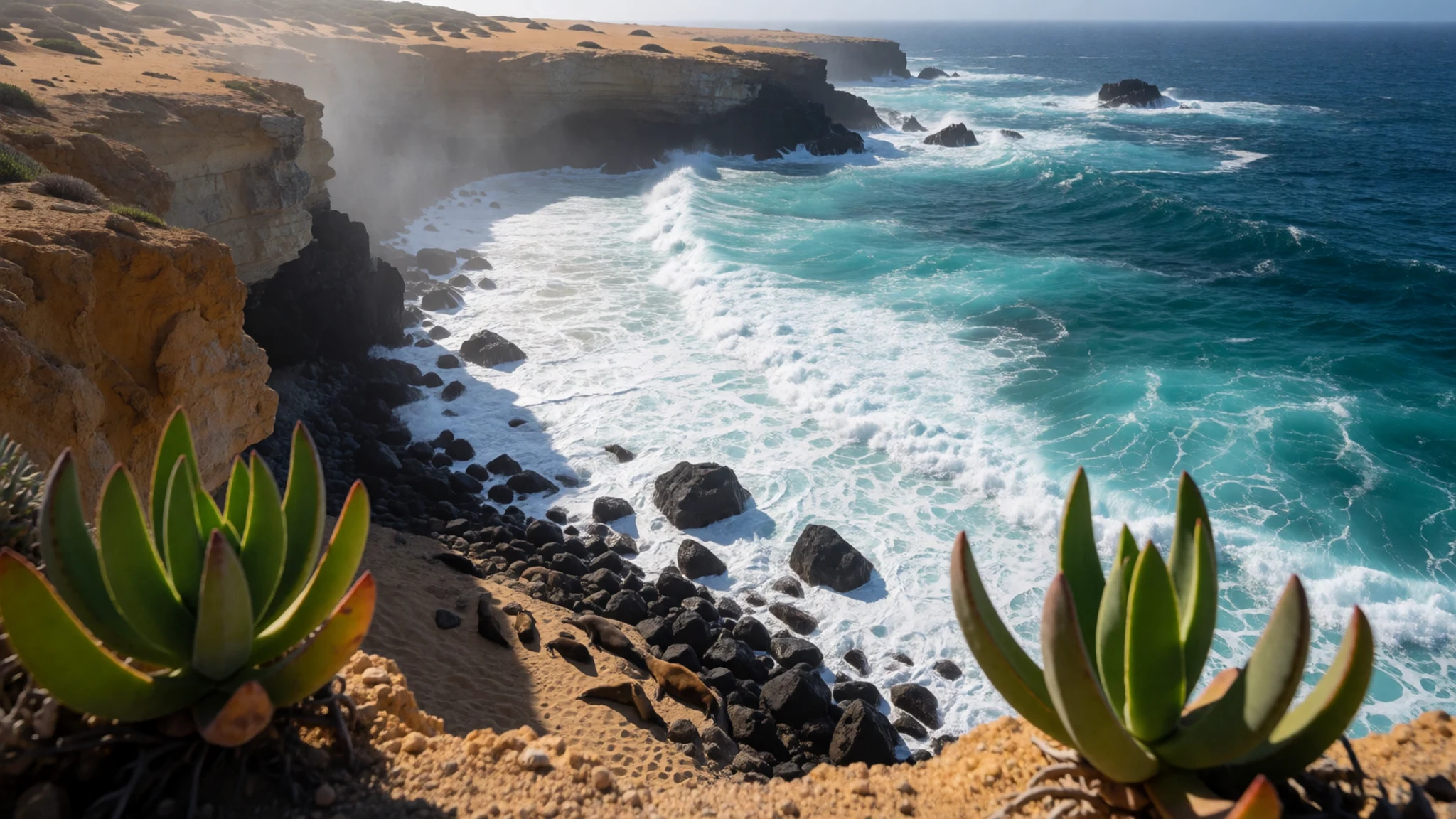
Culture
The Atacama is home to Indigenous communities whose roots reach back long before the mining towns and highways. In San Pedro de Atacama and villages such as Caspana, you will see adobe houses, small churches and fields irrigated by channels that have been maintained for generations. Local life is tied to farming, herding and tourism, and many residents are proud of their language and customs. The region also has a strong mining culture, visible in the old workers' towns and in the mine-owned villages that still operate. Tourism has brought crowds to a few sites, and the people who live there deal with the consequences every day. Respect for the land is part of daily life. Water is scarce, and villages depend on careful use of their supply, so take shorter showers than you might at home and never leave litter in the desert, because a bottle or a bag can stay put for a very long time. Ask before photographing people, especially in villages and at religious festivals, and always stay on marked paths in the reserves.
What to wear
The traditional dress of Atacameño communities has been shaped by high-altitude life, with woven wool and layered clothing suited to cold nights and strong sun. Andean weaving traditions, using llama and alpaca wool, produce warm textiles and bags, often in bold colour bands. Festival clothing in the region draws on these older styles, mixed with Catholic and local ceremonial dress. Today most people in towns like San Pedro dress much as people in any Chilean city do, in jeans, jackets and trainers, with woollen items for the evening. Some wear woven hats, shawls or local textiles for special occasions, and craft shops sell them to visitors. For your own clothing, think in layers. Days can be warm and bright, nights can be cold at altitude, and the sun is strong at any time of year. Bring a warm fleece or light down jacket, a sun hat, sunglasses, and long sleeves for the middle of the day. Wear sturdy walking shoes with grip for gravel, dust and salt crust, and carry a light scarf to keep sand out of your face on windy days. Modest dress is expected in churches and in villages during festivals, so cover shoulders and knees in those settings.
What to eat
- Empanadas de pino — bakeries and street stalls in San Pedro de Atacama and along the main road
These baked or fried pastries are filled with beef, onion, raisin, olive and boiled egg. Chilean versions tend to be generously spiced and taste best hot from a bakery or a street stall. They make an easy lunch while you walk between viewpoints, and you will find them almost everywhere in town.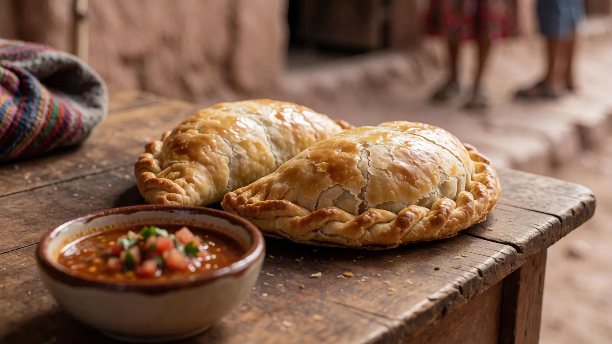
- Cazuela — family restaurants and cafés in the towns
A hearty soup of meat, pumpkin, potato and corn, often served with rice and a good dose of coriander. It is comfort food for cold evenings at altitude, and many family-run restaurants serve it as the daily main dish. Order it when the wind picks up or the evening chill arrives.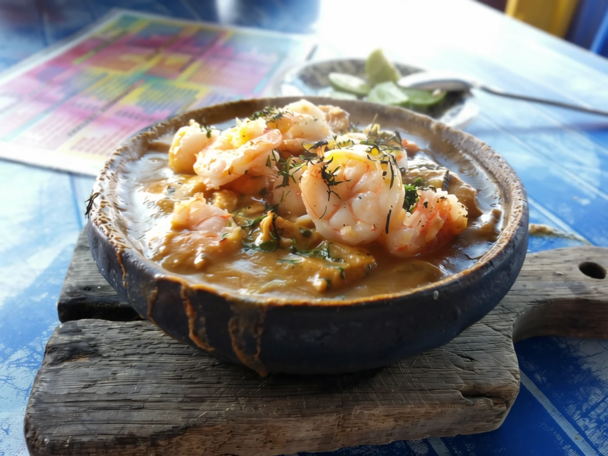
- Pastel de choclo — traditional eateries in the towns of the region
A corn-based pie with a sweet, creamy corn top over a savoury filling of meat, onion and sometimes olives and egg. It is a national favourite and a good way to try a filling dish after a day in the sun. Ask for it at a traditional eatery, where it is usually baked in a clay dish.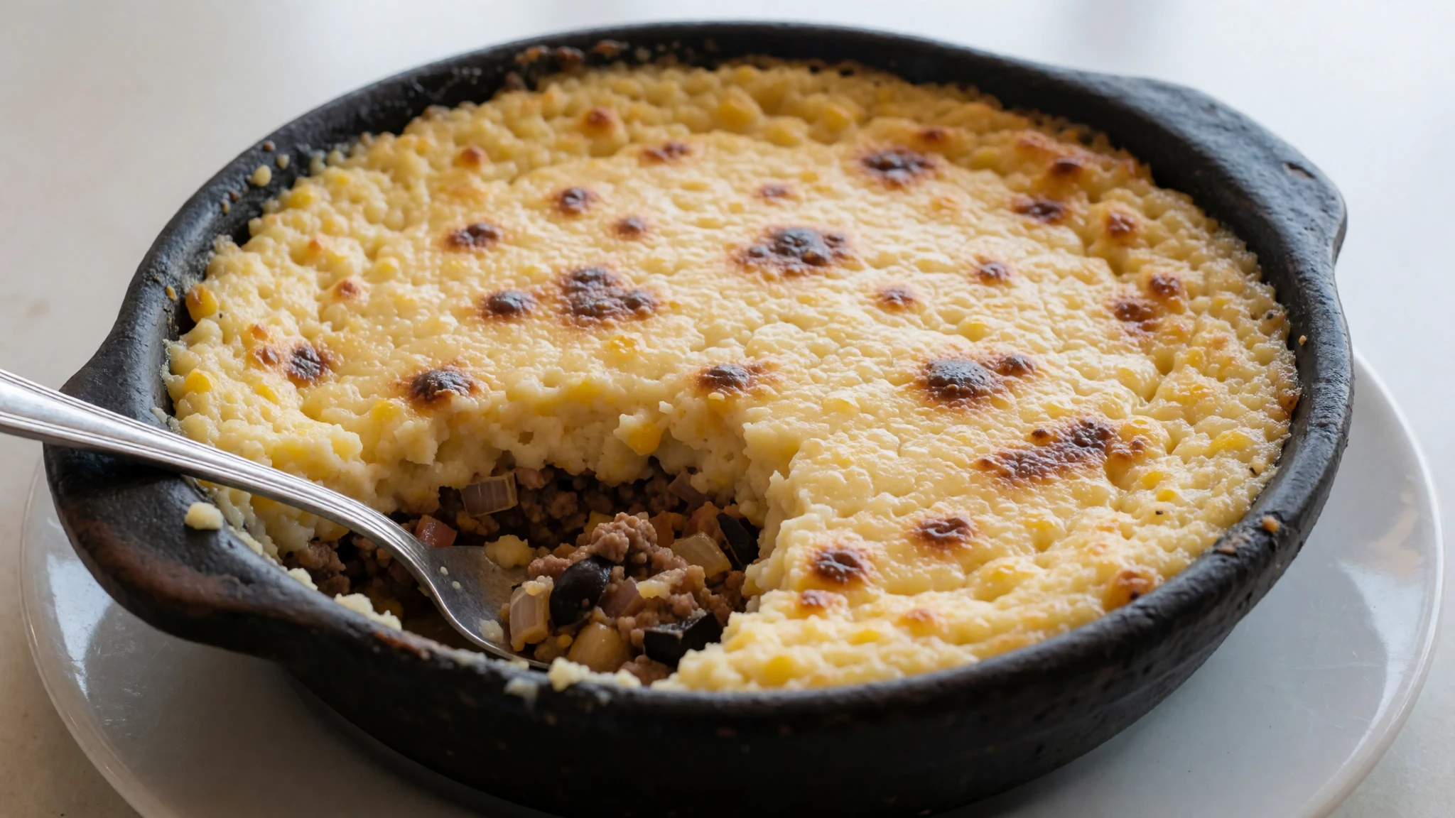
- Ceviche — fish markets and seafood eateries on the coast
Chilean ceviche is raw fish or shellfish cured in lime juice with onion and coriander. Along the coast it is at its best when made with the morning catch, so eat it early in the day. Coastal fishing towns near the beaches are the best places to find it fresh.
Plan it
Best time. Temperatures change little across the year, so the desert itself is a reasonable choice in most months. Days are mild and nights can be cold at altitude, and the main variable is the wind and the amount of sun you can handle. The flowering at Desierto Florido happens only after rain, so if you want that, check recent reports rather than picking a month.
How long. 3–4
Getting there. Fly to Calama (El Loa Airport) for San Pedro de Atacama, or to Antofagasta or Iquique for the coast. The last leg is usually a bus or a hire car, since the desert is spread out and public transport between towns is limited.
Budget. mid
Tips
- Acclimatise slowly, since many roads climb above 4,000 m and altitude sickness is a real risk
- Carry more water than you think you need and drink regularly in the dry air
- Mobile coverage is limited outside towns, so download maps and tell someone your route
- Book one-day tours in advance and check that they are run by reputable operators
- Start hikes early in the morning, when it is cooler and the light is better
Etiquette
- Stay on marked paths in reserves and do not remove rocks, fossils or plants
- Ask before photographing people in villages and at ceremonies
- Take all your litter out with you
Nearby
Sources
- Wikidata Q47141 (CC0)
- Wikipedia: Atacama Desert (rev 1382462364) (CC BY-SA 4.0)
- Wikivoyage: Atacama Desert (rev 5322296) (CC BY-SA 4.0)
- Photo: Snow Comes to the Atacama Desert (ESO/S. Guisard) (CC BY 4.0)
- Photo: Atacama Desert between Antofagasta and Taltal (Valerio Pillar) (CC BY-SA 2.0)
- Photo: Paisajes cerca de Calama (Diego Delso) (CC BY-SA 4.0)
- Photo: A trip to Mars (ESO/S. Lowery) (CC BY 4.0)
- Photo: Desierto florido (Javier Rubilar) (CC BY-SA 2.0)
- Photo: Pan de Azúcar National Park (Aaron Bornstein) (CC BY 2.5)
- Photo: Atacama lizard (unknown author) (CC BY-SA 2.0)
- Photo: Caspana (Robin Fernandes) (CC BY-SA 2.0)


