Annapurna Conservation Area
Annapurna Conservation Area, Nepal
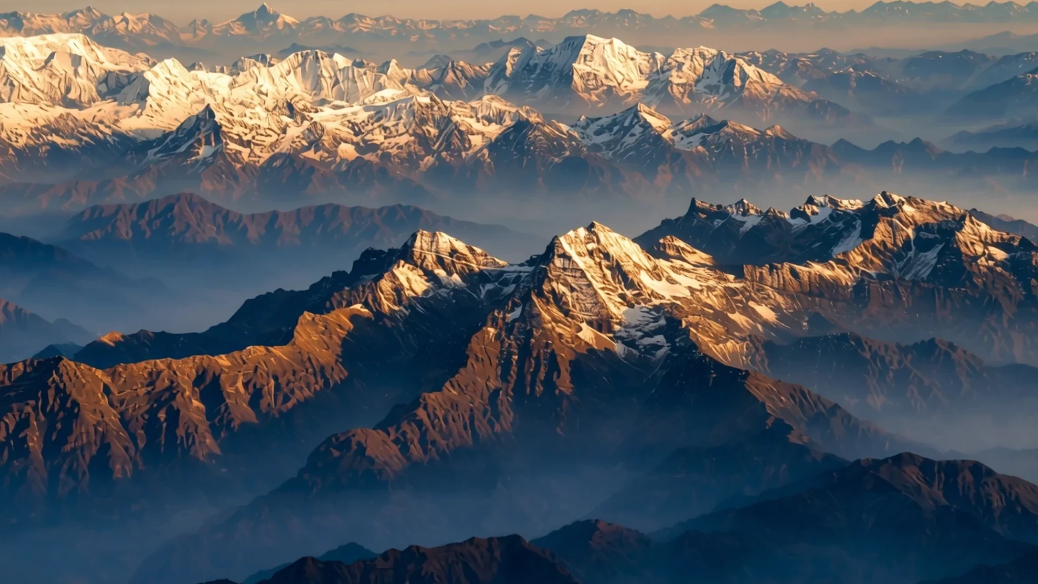
Journey from subtropical lowland forests to high-altitude Tibetan plateaus past some of the highest Himalayan peaks on earth.
The place
Annapurna Conservation Area stands as Nepal's largest protected sanctuary, spreading its immense territory across towering mountain ranges, deep river valleys, and remote high-altitude settlements. The region encompasses a staggering range of environments, shifting rapidly from lush subtropical greenery at lower elevations up to barren, wind-scoured plateaus that mirror the stark landscapes of the Tibetan plateau. Travellers navigating these mountain paths cross through multiple administrative districts, including Kaski, Manang, Mustang, Myagdi, and Lamjung. At the heart of the geography lies a dramatic collision of topography, where massive river systems like the Kali Gandaki and the Marsyangdi have carved earth's deepest gorges right between giant Himalayan subranges. To the west, the immense Dhaulagiri range rises sharply, while to the east, the Annapurna massif dominates the skyline with multiple summits scaling dizzying heights. Glaciers feed roaring torrents below, while stone villages cling precariously to steep mountain ridges. The terrain transitions continuously, offering visitors an unmatched cross-section of Himalayan ecology and human settlement within a single protected zone. Every valley presents a distinct microclimate, shifting from monsoon-drenched southern slopes covered in dense forests to the deep rain shadow of the northern peaks, where stone houses, fluttering prayer flags, and ancient monastic traditions define daily life against a backdrop of permanent ice and snow.
Its story
The formal preservation of this dramatic mountain ecosystem began in the mid-1980s, transforming how conservation and rural communities interact in the Himalayas. Rather than adopting a fenced-off model that excludes local residents, the management framework was established to balance environmental protection with the sustainable livelihoods of the indigenous communities living across the valleys. Historically, these high-altitude trade routes served as vital arteries connecting Tibetan salt markets with the hill towns and plains of Nepal, carrying merchants, pilgrims, and pack animals through deep gorges and high mountain passes. The Sanskrit roots of the central mountain name speak directly to ancient agrarian reverence, translating to the provider of grain or the goddess of harvests, traditionally viewed as an avatar of Durga. For generations, local Thakali, Gurung, and Tibetan communities adapted their farming, herding, and trading strategies to the severe vertical geography, terracing steep hillsides for crops and building stone architecture designed to withstand heavy winter snowfalls and fierce valley winds. When modern trekking opened up the region, these traditional trade paths evolved into world-famous walking routes. The establishment of the protected area ensured that the influx of travellers supported local tea houses, improved trail maintenance, and safeguarded fragile alpine forests from unchecked firewood harvesting, creating a living heritage model where ancient mountain cultures persist alongside modern international tourism.
What to see
- Annapurna Himal — Kaski District
Gaze upon the magnificent ice walls and sharp ridges of the main subrange, visible from multiple vantage points across the lower foothills. The peaks tower dramatically over surrounding river valleys, creating an unforgettable backdrop of permanent snow and hanging glaciers against the bright blue Himalayan sky.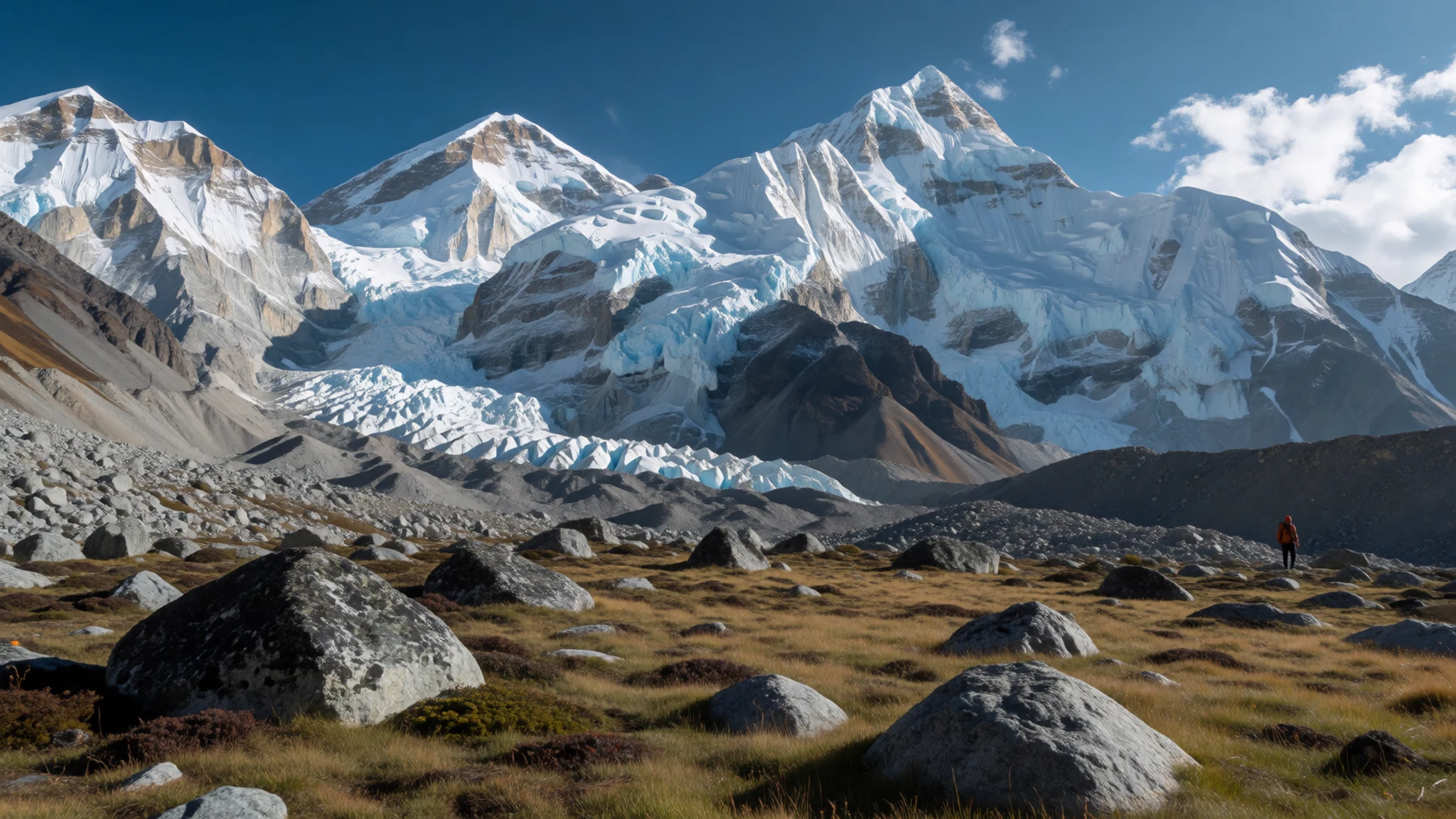
- Poon Hill — Myagdi District
Climb up the forested ridge trails early in the morning to reach this famous viewpoint, where sunrise illuminates the surrounding giants in shades of gold and pink. From this vantage, both the massive ice faces and deep river valleys spread out beneath you in a panoramic sweep.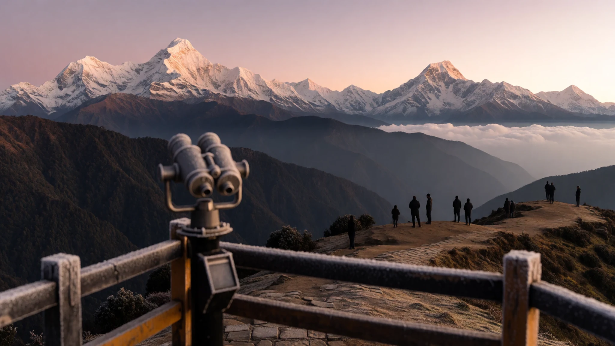
- Jomsom Gompa — Mustang District
Explore the brightly painted Buddhist monastery that overlooks the northern approaches of the administrative centre, featuring traditional murals and prayer wheels. The gompa stands as a striking cultural landmark against the stark, windy landscapes of the upper valley.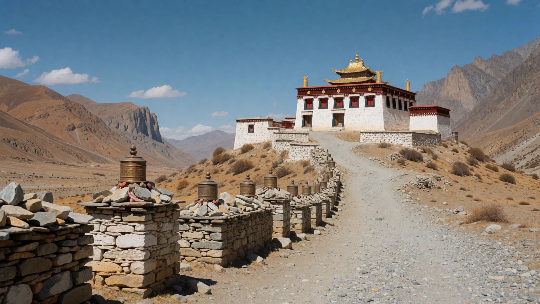
- Kali Gandaki River Suspension Bridges — Tatopani area
Walk across the impressive, high-tension suspension bridges that span the roaring waters of the deep river gorge, framed by dramatic rocky cliffs. These crossings link remote stone villages and provide thrilling perspectives of the deep canyon carved between massive Himalayan peaks.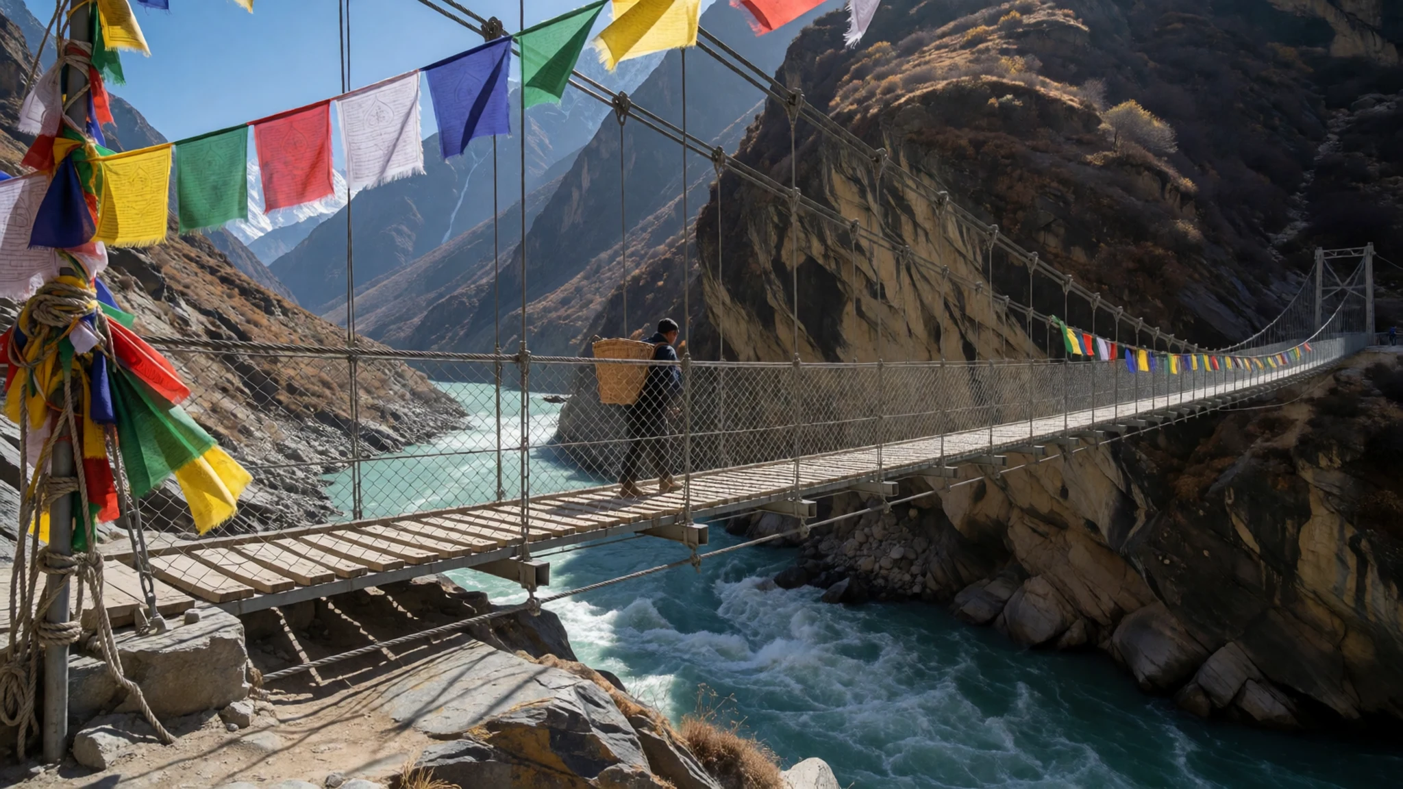
- Tadapani Ridge — Kaski District
Rest among dense rhododendron forests on this elevated ridge, where the sacred fish-tail peak of Machhapuchhare rises directly across the valley. The location offers stunning viewing angles for studying the complex mountain topography and deep forested gorges characteristic of the southern slopes.
Culture
The cultural fabric of the conservation area is woven from diverse ethnic groups, including Gurung and Magar communities in the southern hills, Thakalis along the central trade corridors, and Tibetan-influenced populations in the northern high valleys like Mustang and Manang. Buddhism and Hinduism intermingle throughout the region, visible in the stone mani walls, fluttering prayer flags, spinning prayer wheels, and small hillside shrines that dot every trail. Hospitality is deeply ingrained in mountain life, with tea houses serving as communal hubs where travellers share dining tables with local families. Traditional dress reflects the practical demands of high-altitude living, featuring sturdy woven woollens, layered garments, and distinctive handmade boots suited for rough terrain and cold weather. Visitors are warmly welcomed into these highland communities, provided they show respect for local customs, sacred spaces, and fragile natural resources. Always remove your shoes before entering monastic prayer halls or local homes, and ask permission before photographing village elders or religious ceremonies.
What to wear
Traditional attire across the mountain settlements is built for survival against biting alpine winds and freezing winter temperatures, relying heavily on thick homespun wool, felted textiles, and sturdy animal skins. Local villagers often wear wrapped garments, heavy woolen waistcoats, and patterned blankets pinned at the shoulder, accompanied by durable footwear designed for navigating steep rocky trails and scree slopes. In daily village life now, younger generations mix traditional woven items with practical modern outdoor wear, such as fleece jackets, windbreakers, and sturdy walking boots sourced from regional markets. For visitors tackling the trails, proper gear is essential rather than a fashion statement: layered moisture-wicking clothing, insulated down jackets for chilly evenings, windproof outer shells, and broken-in hiking boots with good ankle support are indispensable. When visiting monasteries, sacred shrines, or traditional villages, both men and women should dress modestly by covering shoulders and knees out of respect for local religious customs and conservative mountain sensibilities.
What to eat
- Dal-bhat-tarkari — Any local tea house or lodge along the trail
The ultimate staple of the mountains, consisting of steamed rice smothered in lentil soup alongside spiced vegetable curries. It is safe, highly nutritious, cheap, and famously eaten twice daily by local porters and guides for sustained trekking energy. - Tibetan Fried Bread — High-altitude tea houses and village bakeries
Thick, golden rounds of dough fried until crispy on the outside and soft within, often served hot with honey, jam, or butter for a comforting morning breakfast or high-energy trail snack. - Oatmeal Porridge — Morning dining rooms in mountain lodges
A warming, hearty bowl of rolled oats cooked with milk or water, frequently topped with local honey or fresh fruit when available to provide a solid start before a long morning climb.
- Chang — High valley homesteads and local teahouses
A traditional local beer brewed from fermented millet, best enjoyed when served piping hot with boiling water to ward off the chill of high-altitude evenings in remote mountain settlements. - Kha-ja — Small village shops and roadside stalls
A simple, crunchy local snack resembling popped corn made from indigenous varieties of maize, valued by travellers for being inexpensive, filling, and easily carried along the trail.
Plan it
Best time. March to April offers blooming rhododendrons and clear mountain views, while late October to November provides stable weather and crisp air after the monsoon.
How long. 7–14
Getting there. Fly into Kathmandu or Pokhara, then take a local bus or private taxi to trailheads like NayaPul, or catch a short morning mountain flight to Jomsom airport.
Budget. mid
Tips
- Obtain your conservation area permit in Kathmandu or Pokhara before starting the trek
- Acclimatise carefully and watch closely for symptoms of altitude sickness at higher elevations
- Carry sufficient cash in local currency, as ATMs are virtually non-existent on the trails
- Purify or boil all drinking water thoroughly along the route to avoid illness
- Start your daily walks early in the morning to beat afternoon winds and cloud cover
Etiquette
- Always walk clockwise around mani stones, stupas, and sacred Buddhist monuments
- Ask permission before taking photographs of monks, elders, or religious rituals
- Remove your shoes before stepping inside any monastery or local home
Nearby
Sources
- Wikidata Q2982581 (CC0)
- Wikipedia (rev 1380748420) (CC-BY-SA 4.0)
- Wikivoyage (rev 5361176) (CC-BY-SA 4.0)
- Photo 01 (CC BY 4.0)
- Photo 02 (CC BY-SA 4.0)
- Photo 03 (CC BY-SA 4.0)
- Photo 04 (CC BY-SA 4.0)
- Photo 05 (CC BY-SA 4.0)
- Photo 07 (CC BY-SA 4.0)


