Andros
Andros, The Bahamas
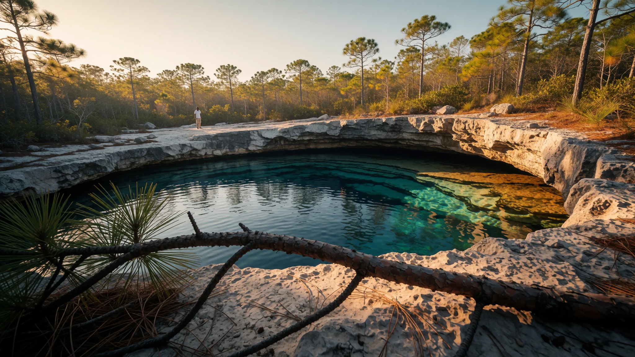
Andros is the Bahamas at its widest and quietest: a mangrove-threaded island of blue holes, reef and bonefish flats with very few people.
The place
Andros is the largest landmass in The Bahamas, though calling it one island is generous. It is really an archipelago: three big islands, North Andros, Mangrove Cay and South Andros, divided by tidal channels called bights, with hundreds of small cays and mangrove creeks filling the gaps. Politically it counts as a single island, and its area exceeds that of all the other Bahamian islands put together. It runs about 167 km from end to end and about 64 km across at its widest. Elevation is almost nothing, around 7 m, so the horizon is mostly sky, pine, scrub and water. Nassau lies to the east across the deep Tongue of the Ocean, close enough for a short flight yet a different world. Fewer than ten thousand people live on Andros, mostly in small settlements along the east coast, such as Nicholl's Town, Fresh Creek and Congo Town. Offshore on that side runs a long barrier reef, while inland and under the shallows the limestone is pocked with blue holes, flooded sinkholes that open into cave systems. To the west the Great Bahama Bank spreads out as a pale, shallow flat where bonefish are hunted. Fishing, small farms and government work carry the local economy, and visitor lodging is modest and scattered rather than gathered into big resorts. Distances are long, the main road is a single ribbon, and the beaches are often empty.
Its story
Andros was home to the Lucayans, a branch of the Taíno people who lived across The Bahamas before Europeans arrived. Their traces survive in Morgan's Cave on North Andros and in the Stargate Blue Hole on South Andros, where remains and artefacts have been found. Spain claimed the islands after Columbus's first crossing, and the Italian navigator Amerigo Vespucci, sailing on a Spanish charter at the turn of the sixteenth century, charted part of the island's eastern shore. The real catastrophe followed within a few years. Spanish settlers on Hispaniola had worn down their own enslaved workforce, and the crown approved bringing in people from neighbouring islands. Lucayans were seized across The Bahamas and shipped away to labour there. Within about two years the southern islands were largely empty, tens of thousands had been carried off, and a later Spanish expedition found only a handful of people left. Andros then stayed mostly uninhabited for well over a century. British colonial rule began in the middle of the seventeenth century, and The Bahamas became independent in 1973. Resettlement was slow and tied to the sea, with families living from fishing and small-scale farming along the coast. Hurricanes have kept punctuating that story. The great storm of the late 1920s is still remembered locally as the Great Andros Hurricane, and Matthew in recent years flooded the northern settlements badly.
What to see
- Blue Holes National Park — North Andros
A protected area on North Andros built around freshwater and tidal blue holes set in pine and hardwood forest. Some holes are swimmable, others are strictly for looking into. The water is startlingly clear and layered in colour. Go with a local guide, as tracks are rough and signs sparse.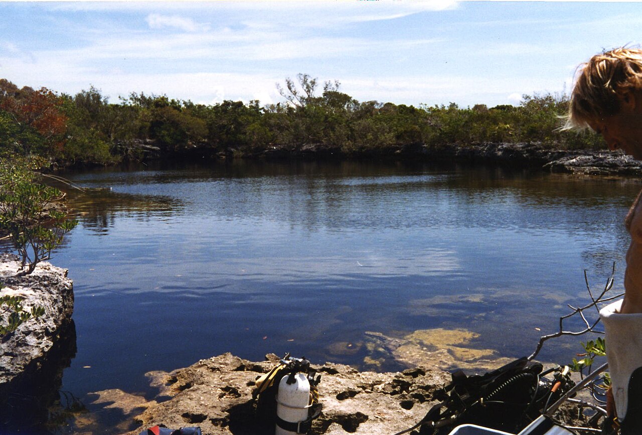
- West Side National Park — West coast, central and south Andros
A vast, wet wilderness of mangrove, creek and shallow flat on the island's western edge, facing the Great Bahama Bank. It is bonefish and birding country rather than beach country. Reaching it normally means a boat and a local guide, and the reward is silence, wide skies and wading birds. - Morgan's Bluff Beach — Morgan's Bluff, North Andros
A quiet northern beach near the settlement that hosts the annual regatta, when sailing sloops race and the shoreline fills with food stalls and music. On ordinary days the sand is nearly empty. Hurricane damage has left its mark on parts of this coast, so expect simple facilities. - Nicholl's Town Beach — Nicholl's Town, North Andros
A long, easy beach beside one of the main northern settlements, handy for a swim after a morning of driving. Local eateries and shops are a short walk away. Shade is limited, so bring a hat, and ask locally about currents before swimming beyond the shallows. - Mars Bay Blue Hole and Beach — Mars Bay, South Andros
On the southern island, a blue hole sits close to a quiet beach in a fishing community. It is an easy place to combine a swim with a look at a sinkhole without a long expedition. Roads in the south are sparse, so confirm the route and fuel before setting off.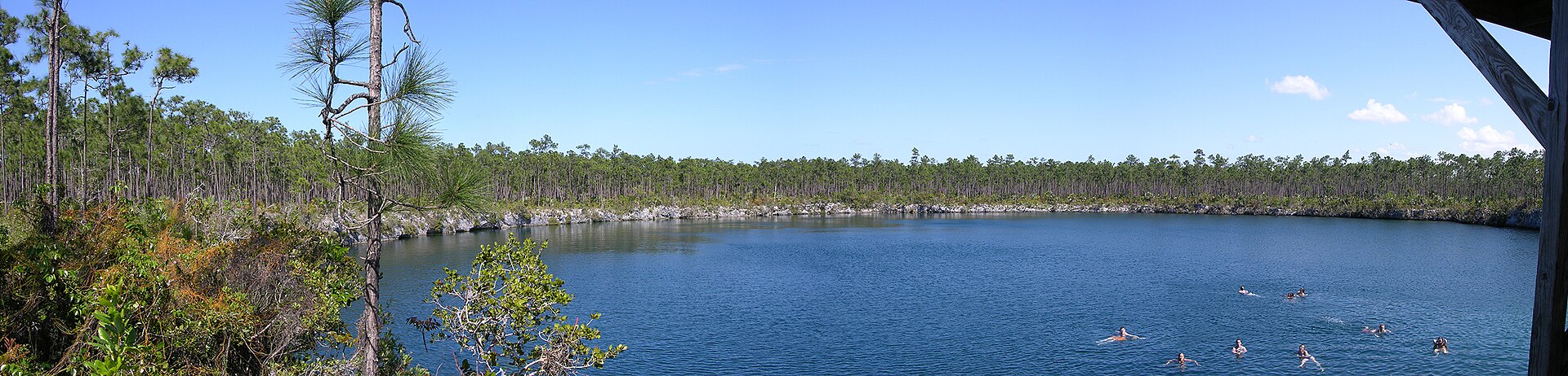
Culture
Andros life runs on the sea, church and community calendars. Settlements are small, everyone seems to know everyone, and a visitor is usually noticed, greeted and asked where they are staying. The year is marked by festivals, many of them tied to food and boats. Crabfest at Fresh Creek comes each June, Morgan's Bluff holds an annual regatta where traditional sailing boats race, and there is a Conch Festival, a Pirates' Festival and a Seafood Splash that carries the name of the Chickcharnie, a folklore creature said to live in the pine forests. Between Christmas and New Year, Junkanoo and Goombay bring rushing music, cowbells, drums and costume to the streets in the Bahamian way, in a local form. Conservation groups also run ecologically minded events, and many residents take quiet pride in protecting the reef, the blue holes and the bonefish flats that draw outsiders. Sunday matters. Church services are well attended, many small businesses close, and the pace slows further. Storytelling about storms, spirits and old sailing days is a favourite pastime, so a little patience over a conversation is rewarded. Fishing is both livelihood and pleasure, and what is landed, whether conch, lobster or snapper, is shared and sold with pride. Greet people with a good morning or good afternoon before asking for anything, and ask permission before photographing someone, their home or their catch.
What to wear
The best-known textile on Andros is Androsia, a hand-made batik produced in a factory at Fresh Creek. Wax-resist patterns of shells, flowers, fish and sea colours are dyed onto cotton, and the cloth has become part of how The Bahamas dresses itself on national occasions. It appears in shirts, dresses, headwraps and table linen, and is worn for celebrations and by staff of many offices and businesses. The other traditional costume belongs to Junkanoo, when groups make elaborate, shimmering outfits from crepe paper and cardboard that are worn for the Christmas-to-New-Year parades and then retired. Everyday dress on the island is plain and practical: shorts, T-shirts, light cotton shirts and sun hats for fishing and farm work, and rubber boots or water shoes on the flats. On Sundays many people dress up smartly for church, with pressed shirts, dresses and hats. A visitor should pack light, quick-drying clothes, long sleeves and a wide-brimmed hat against sun and insects, and swimwear that is kept to the beach or boat. Away from the shore, in settlements and churches, shorts of reasonable length and covered shoulders show respect. Reef shoes or sturdy sandals help on sharp limestone around blue holes, and winter evenings can turn cool enough to want a light jumper. A rain jacket is worth having in summer.
What to eat
- Cracked conch — Small eateries near the fishing docks
Conch pounded thin, battered and fried until crisp, usually served with lime and hot sauce. It is the island's signature plate, made from shellfish landed locally. Order it at a settlement takeaway or a small seaside eatery near the docks. - Conch salad — Waterside stalls in the larger settlements
Raw conch chopped with onion, pepper, tomato and plenty of sour orange or lime juice, made to order. It is fresh, sharp and a little spicy. Watch it prepared at a stall by the water in Nicholl's Town or Fresh Creek. - Grilled or steamed snapper and grouper — Village eateries and guesthouse dining rooms
The local reef and bank fish, cooked whole or in fillets with peppers, onions and herbs. Steamed versions come in a light tomato broth, grilled ones with lime. Ask at a village eatery what was caught that morning. - Crab dishes — Fresh Creek festival tents and home-style eateries
Land crab is the star around Crabfest each June, appearing stewed, curried or baked back into its shell with seasoning. It is rich and fiddly to eat. Outside the festival it turns up on home-style menus in season. - Peas and rice — Any local lunch counter or church-fundraiser meal
Rice cooked with pigeon peas, onion, thyme and tomato, served beside nearly every fish or chicken plate. It is the everyday staple, filling and gently savoury. Eat it as a side wherever local plates are served on a Sunday.
Plan it
Best time. December to April, the drier winter season, when days are mild and nights can turn cool. May to November is hot, humid and carries the hurricane risk, which on Andros is real, as storms strike roughly every couple of years.
How long. 3–5
Getting there. Fly from Nassau to one of the island's airports; two are served by scheduled flights from Nassau, and Congo Town and San Andros are among the landing points. Boat services also cross from Nassau. Once on Andros, distances are long, so arrange a car or transfer in advance.
Budget. mid
Tips
- Book lodging and flights well ahead, as options are few and small planes fill up
- Hire a local guide for blue holes, the west side flats and fishing, as tracks are rough and unmarked
- Carry cash, because card machines are rare outside lodges and larger shops
- Bring insect repellent, sun protection and drinking water for long drives and boat days
- Check the weather and hurricane forecast before travelling in summer and autumn
Etiquette
- Greet people before asking questions or favours
- Ask before photographing people, homes or their catch
- Respect local fishing rules and take rubbish away from beaches and blue holes
Nearby
Sources
- Wikidata Q514070 (CC0)
- Wikipedia: Andros, The Bahamas (rev 1363880989) (CC BY-SA 4.0)
- Wikivoyage: Andros (Bahamas) (rev 5262742) (CC BY-SA 4.0)
- Photo: Andros island (Robert Stein III) (CC BY 3.0)
- Photo: Andros 2022 OSM map (Kelisi) (CC BY-SA 4.0)
- Photo: Andros Island shaded topographic map (Lithium6ion) (Public domain)
- Photo: Bananaquit in Andros (Matt MacGillivray) (CC BY 2.5)
- Photo: Guardian Blue Hole (R Pollack) (Public domain)
- Photo: Church's Blue Hole (Tim Horton) (CC BY-SA 2.5)
- Photo: Airport Congo Town S. Andros (Oscar Flowers) (CC BY 3.0)
- Photo: Saddleback Cay (Tim Horton) (CC BY-SA 2.5)


