Waipiʻo Valley
Waipiʻo Valley, United States
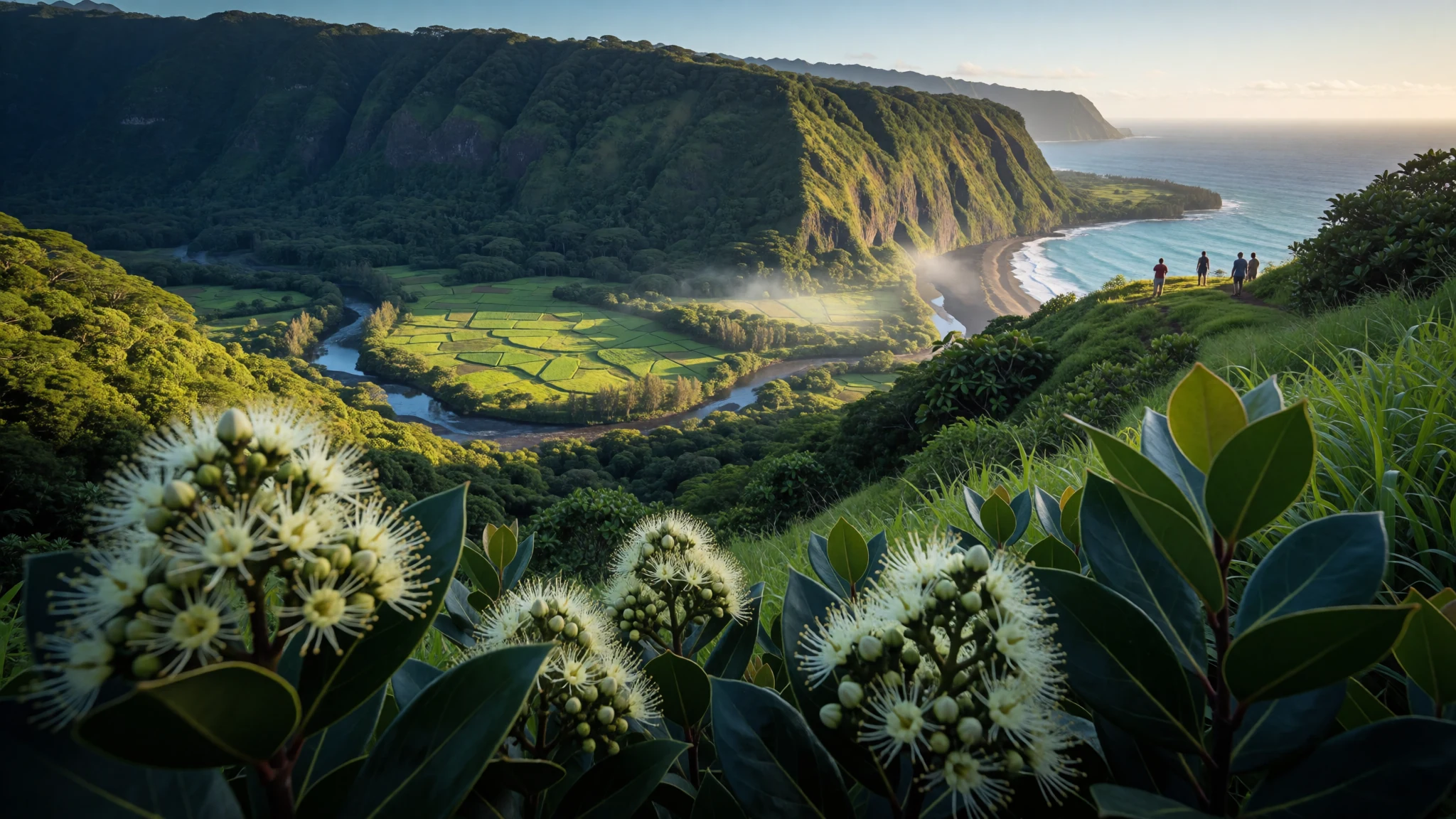
Waipiʻo Valley feels carved out of the Big Island’s basalt, with black-sand surf, taro plots and big-water falls under sheer cliffs.
The place
Waipiʻo Valley is on Hawaiʻi Island, in the Hāmākua District. The name “Wai piʻo” translates as “curved water” in Hawaiian, which matches the way the valley holds streams and rainfall before everything drops down toward the sea.
The landscape is the headline: the valley floor sits nearly at sea level, while the surrounding land rises steeply. In practical terms, it is a long, dramatic descent—part rainforest, part working valley—because the terrain is literally cut into weak basalt lava that came from the Kohala volcano. Erosion by streams shaped the gorge over time, leaving tall walls that can feel close even from the top lookout.
At the shoreline, the beach is black sand and draws surfers. Inland, the valley is still used for small-scale taro farming, so it’s not only a wild postcard. Water runs through the valley system too: several large waterfalls feed the river that flows out to the ocean, with one of the most famous drops at the back where access is far more constrained.
This is also a place with cultural weight. Waipiʻo was home to early Hawaiian aliʻi (chiefs/kings) for many centuries, and the valley’s traditions and stories still shape how locals talk about the landscape. Today, it’s quieter than it used to be, partly because the region’s plantation-era economy shifted after the closure of the Hāmākua Sugar Company.
Its story
Waipiʻo Valley isn’t just scenery; it’s where power, legend and geology all sit in the same tight space. Historically, the valley served as a capital and a permanent home for many early Hawaiian aliʻi (chiefs and kings) until the time of King ʻUmi. In that era, Waipiʻo was described as celebrated for the nioi tree (Eugenia reinwardtiana), linked with a local name, Nioi wela o Pakaʻalana (“The burning Nioi of Pakaʻalana”).
The valley also held ritual and political life at the scale of community. At its peak it likely supported 10,000 people on 800 acres of taro—enough farming and settlement to make the place feel like a living centre rather than a remote ravine. Stories add another layer: Waipiʻo appears in local folklore as a hidden gateway connected with Lua-o-Milu (the Underworld), concealed from view by sand.
Not all chapters were gentle. In the 18th century, Kahekili II of Maui raided Waipiʻo and burned sacred trees. Even later, the valley’s entrance and access have been affected by major geological events. The 2006 Kiholo Bay earthquake caused part of the cliff near the entrance of the valley to collapse into the ocean, and rock falls also hit the access road leading down.
Put simply: Waipiʻo has a rhythm of rising importance, conflict, and natural change—its waterfalls and terraces carrying both water and memory.
What to see
- Waipiʻo Valley Lookout — lookout centre at the top of the cliff
The Waipiʻo Valley Lookout gives the big-picture view: sheer cliff faces dropping into the valley, with the coastline and black-sand shore far below. It’s the easiest place to understand the scale before attempting the steep descent. Go in daylight with clear visibility for the best read of the terrain.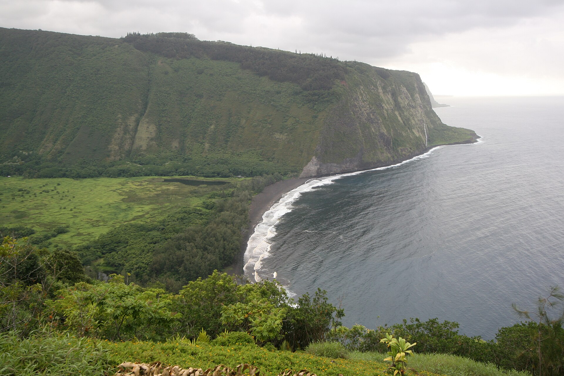
- Road down to Waipiʻo Valley — access road to the valley floor
The descent road into Waipiʻo is steep and tightly graded, so it feels more like terrain navigation than a drive. Access is described as 4WD-only terrain for getting down to the valley floor, where the black-sand beach and taro areas start to appear. Conditions can be changeable after heavy rain.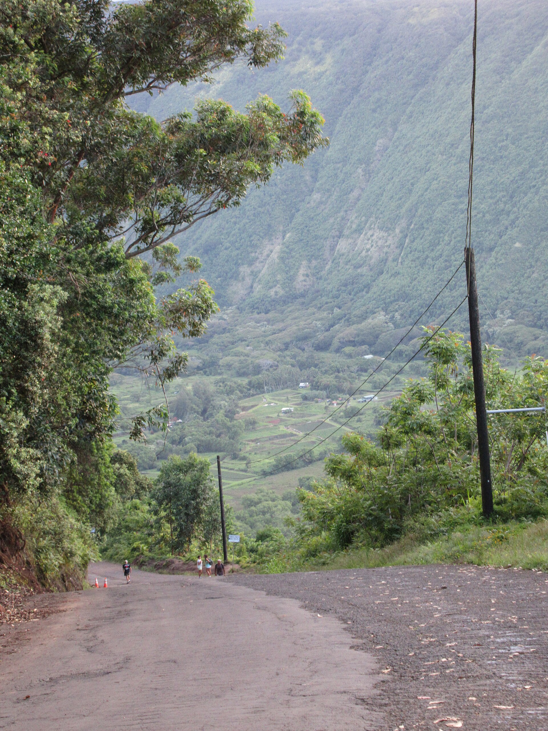
- Black sand beach at the shore — the valley shoreline
Waipiʻo’s shore is known for black sand, and it’s popular with surfers. From the valley side, the beach reads as a stark strip of dark colour meeting the sea’s lighter water. If the surf is up, you’ll often see people timing waves, while the taro fields and stream lines remain inland.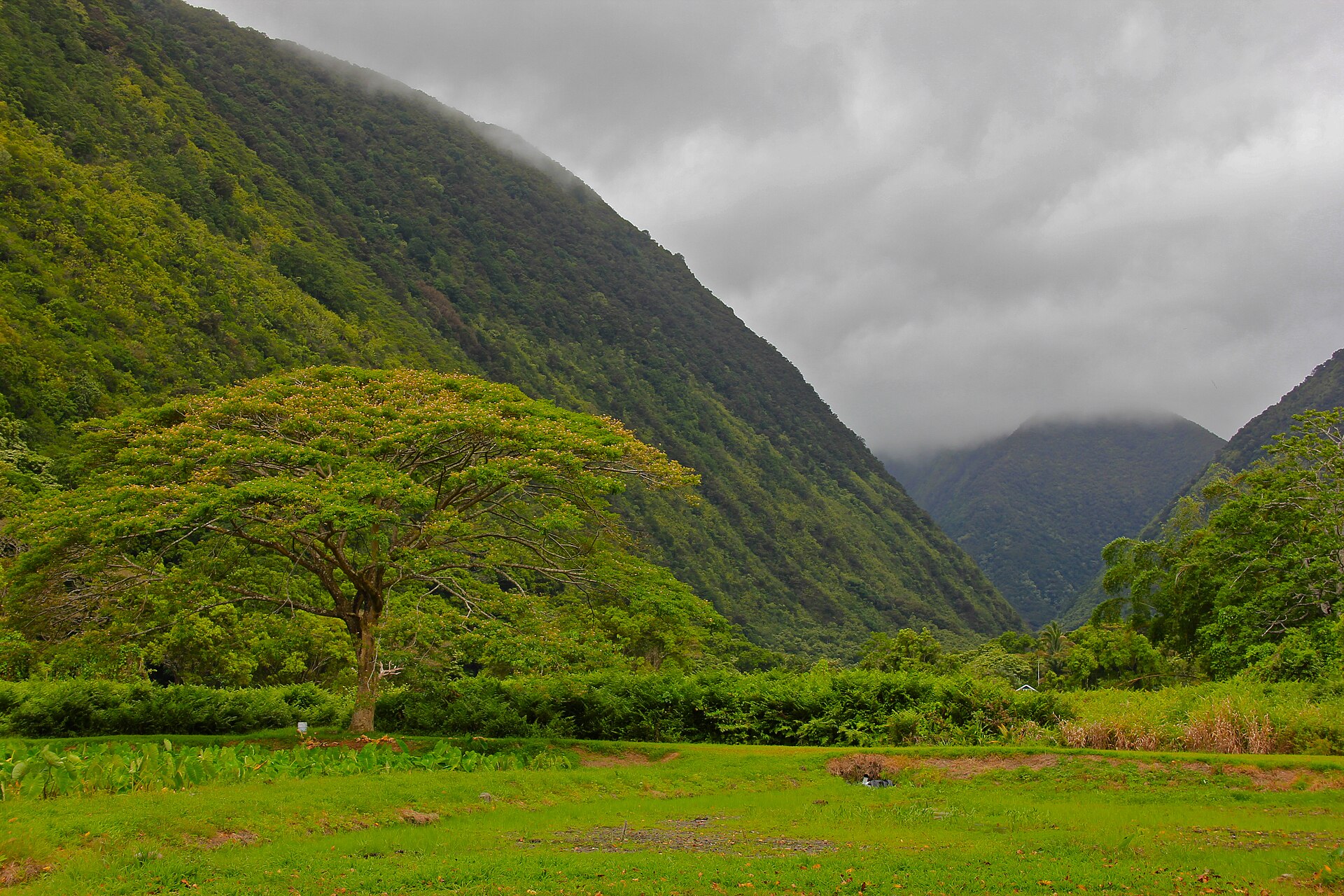
- Up-valley river and waterfall approaches — the upper valley interior
Water is the constant in Waipiʻo: a river system runs out from the back of the valley, fed by large falls that drop into the gorge. Trails and routes follow the valley’s waterlines, and some of the most famous cascades are only visible from within the valley or from the air, so the best “views” often come from being there at the right vantage points.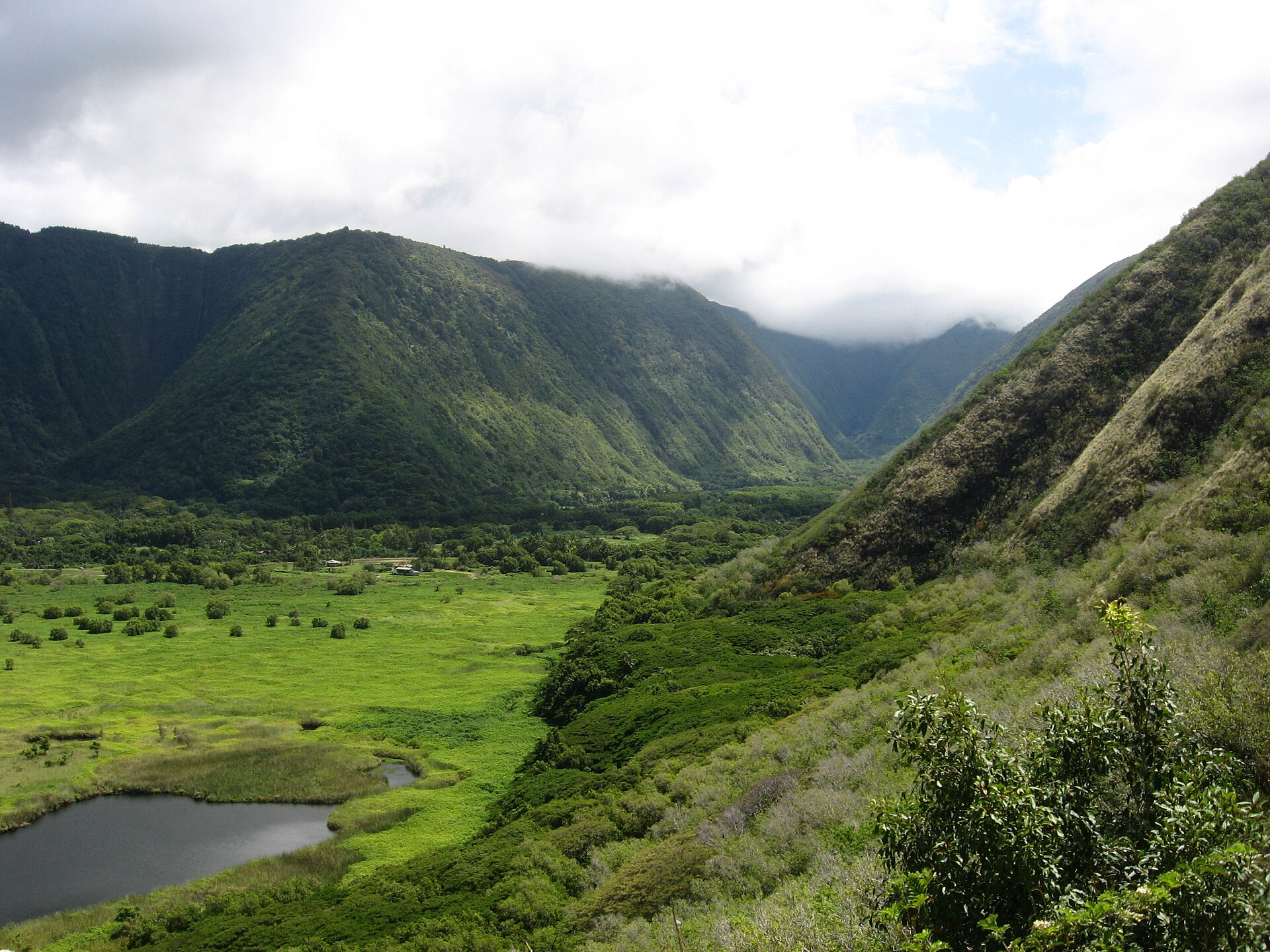
- Hiʻilawe Falls — back of the valley
Hiʻilawe Falls sits deep in Waipiʻo and is described as the most famous waterfall in the valley. It drops from around the back of the valley, and visibility is typically limited to viewpoints within the valley or from above. Expect the walk-in to be the main experience, with mist and wet ground as part of the deal.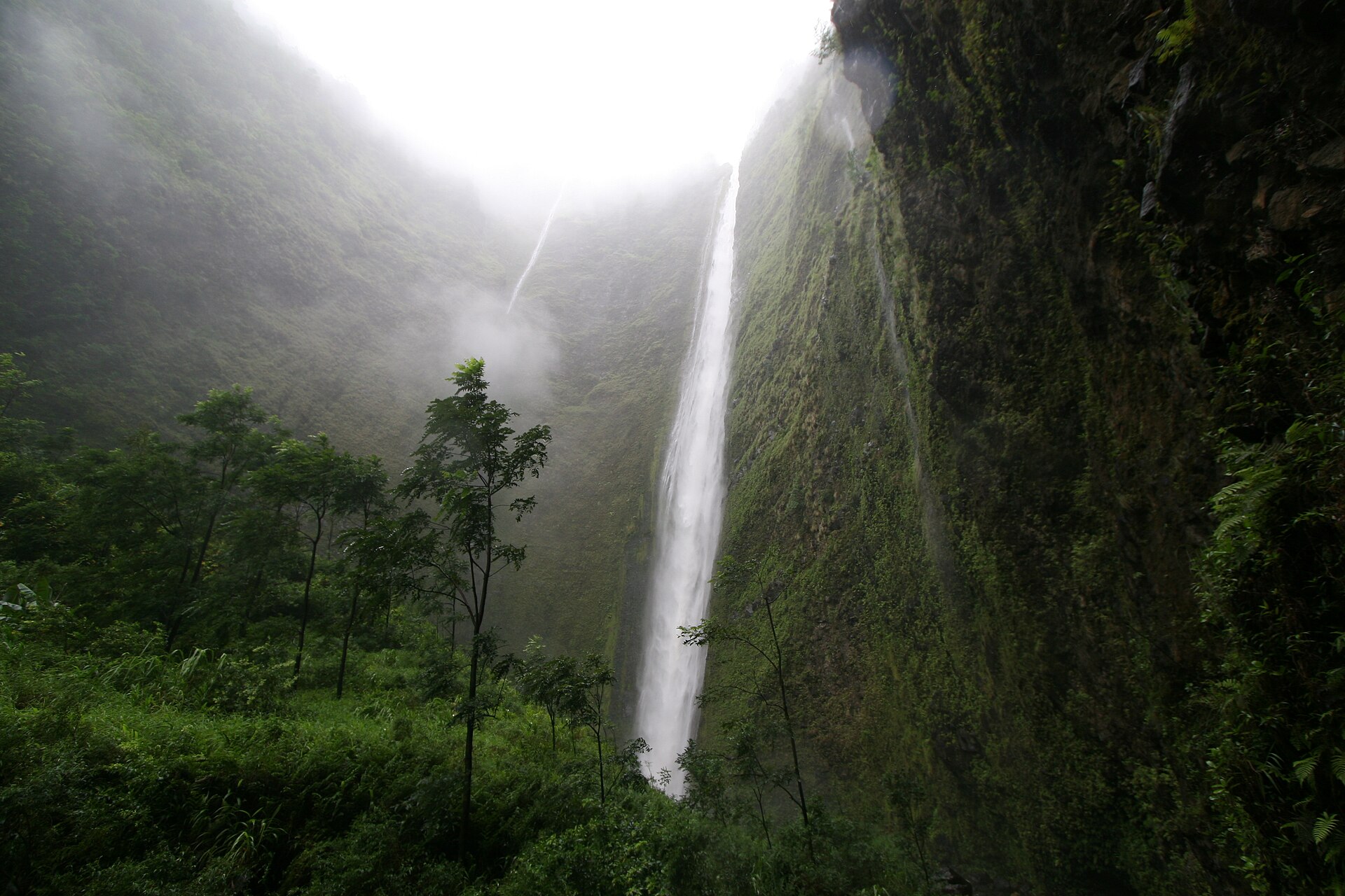
Culture
Waipiʻo Valley is sacred country in Hawaiian history, not just a nature reserve. The valley was used by early aliʻi as a capital and permanent residence, and it carries stories tied to the nioi trees and to the idea of a hidden gateway connected with Lua-o-Milu (the Underworld). Even today, many visitors feel the place is “active”: water moves continuously, and the valley looks managed even where it’s remote.
Respect here is less about costume and more about conduct. Stick to clear paths and avoid trampling taro plots or farm areas—these are working landscapes. If you’re listening to or reading local stories, keep your tone steady; this is a place that locals remember as more than an attraction. Rain is common, so take care near edges and steep sections: slipping isn’t just dangerous, it also disturbs ground used by plants and people.
Photography is part of how visitors connect with Waipiʻo, but don’t treat residents and workers like background extras. Give space, ask before filming anyone up close, and keep noise low when you’re near people and homes.
Visitor etiquette: keep to marked routes and ask permission before photographing or approaching anyone working in the valley.
What to wear
Waipiʻo Valley’s fashion is mostly dictated by weather and ground, because the valley can be wet and the descent routes are steep. Traditional Hawaiian dress is often associated with the context of celebration and ceremony. Visitors may see garments like pāʻū skirts and hula-related attire, typically made with layered natural fabrics and decorated with patterns that reflect local motifs. The common thread is lightweight, breathable textiles that move well—useful in a tropical climate, even if that’s not the same as what people wear day-to-day.
Now, what you’ll actually see at Waipiʻo is practical travel clothing. People wear quick-dry tops, shorts or lightweight trousers, and footwear with grip—particularly because the terrain can be muddy and slick after rain. Some visitors bring a light rain jacket even when the sky looks bright.
For a visitor, dress for slippery steps, not for photos. Choose trainers or hiking shoes with traction, bring a waterproof layer, and consider long sleeves if the air feels humid and insects are active. If visiting areas that feel more community-centred, keep clothing modest and avoid anything overly revealing near people and homes.
What to eat
- Malasada (filled Portuguese-style doughnuts) — local eateries in Honokaʻa
Malasada are deep-fried, sugar-coated doughnuts—often filled with sweet creams or other fillings. A good place to look for them is local eateries in Honokaʻa, where you’ll hear them discussed as a signature snack for visitors passing through. - Saimin (Hawaiian noodle soup) — Hawaiʻi-style diners in Honokaʻa
Saimin is a comfort bowl of noodles in a light, savoury broth, the kind of meal that keeps well after a day walking and driving. For a straightforward introduction, check Hawaiʻi-style diners around Honokaʻa, where locals grab it for lunch. - Hawaiian burger with pineapple — drive-ins and casual cafés in Honokaʻa
A Hawaiian burger typically comes with a pineapple slice, giving a sweet-savoury contrast. It’s the sort of plate-lunch option you’ll find at local drive-ins and casual cafés in Honokaʻa, convenient before or after heading back up from the valley. - Plate lunches at a drive-in — drive-in style eateries near Mamane Street, Honokaʻa
Honokaʻa is known for simple plate lunches—often rice and a main with sides—served in a “get fed quickly” way. If you want an easy sit-down option after a long day, look for drive-in style places on Mamane Street or nearby. - Vegetarian sandwiches with local organic fillings — vegetarian-focused cafés in Honokaʻa
If the day’s walking has the appetite chasing “something clean”, look for sandwiches filled with local organic vegetables. Vegetarian-friendly spots in Honokaʻa can be a good reset between the coast and the inland roads.
Plan it
Best time. March–April and October–November are comfortable for a trip because these are among the best months listed; June is part of Hawaiʻi’s wetter stretch, and late summer can be hot and humid.
How long. 2–3
Getting there. Fly to Hilo International Airport, then travel by car or bus toward Honokaʻa; from Honokaʻa you follow the route north via Hawaii Belt Road (HI-19), with the last leg involving the steep valley access roads.
Budget. mid
Tips
- Plan for a longer day than expected: the descent is steep and routes can be slow.
- Build in a buffer for weather and mist—heavy rain changes how safe the ground feels.
- Bring water and snacks for the valley approach areas, then eat in Honokaʻa after.
- If you want waterfall views, start early to maximise daylight for walking routes.
Etiquette
- Stay on paths and avoid farm areas; taro plots are part of daily life, not an exhibit.
- Keep voices down near homes or when workers are present.
- Ask before filming or photographing people up close.
Nearby
Sources
- Wikidata Q3554006 (CC0)
- Wikipedia (Waipiʻo Valley) (CC BY-SA 4.0)
- Wikivoyage (Hāmākua) (CC BY-SA 4.0)
- Photo photos/01-waipio-lookout-view.jpg (CC BY-SA 2.5)
- Photo photos/02-waipioroad.jpg (Public domain)
- Photo photos/03-waipiovalley.jpg (CC BY-SA 2.0)
- Photo photos/04-waipio-valley-uphill.jpg (CC BY 3.0)
- Photo photos/05-hi-ilawe-falls.jpg (CC BY-SA 2.5)
- Photo photos/06-2006-hawaii-earthquake.jpg (CC BY-SA 2.5)
- Photo photos/07-2021-10-10-15-55-27-feral-foal-in-the-forest-of-waipio-valle.jpg (CC BY-SA 4.0)
- Photo photos/08-base-of-waipi-o-valley-33632700956.jpg (CC BY 2.5)


