Suðuroy
Suðuroy, Faroe Islands
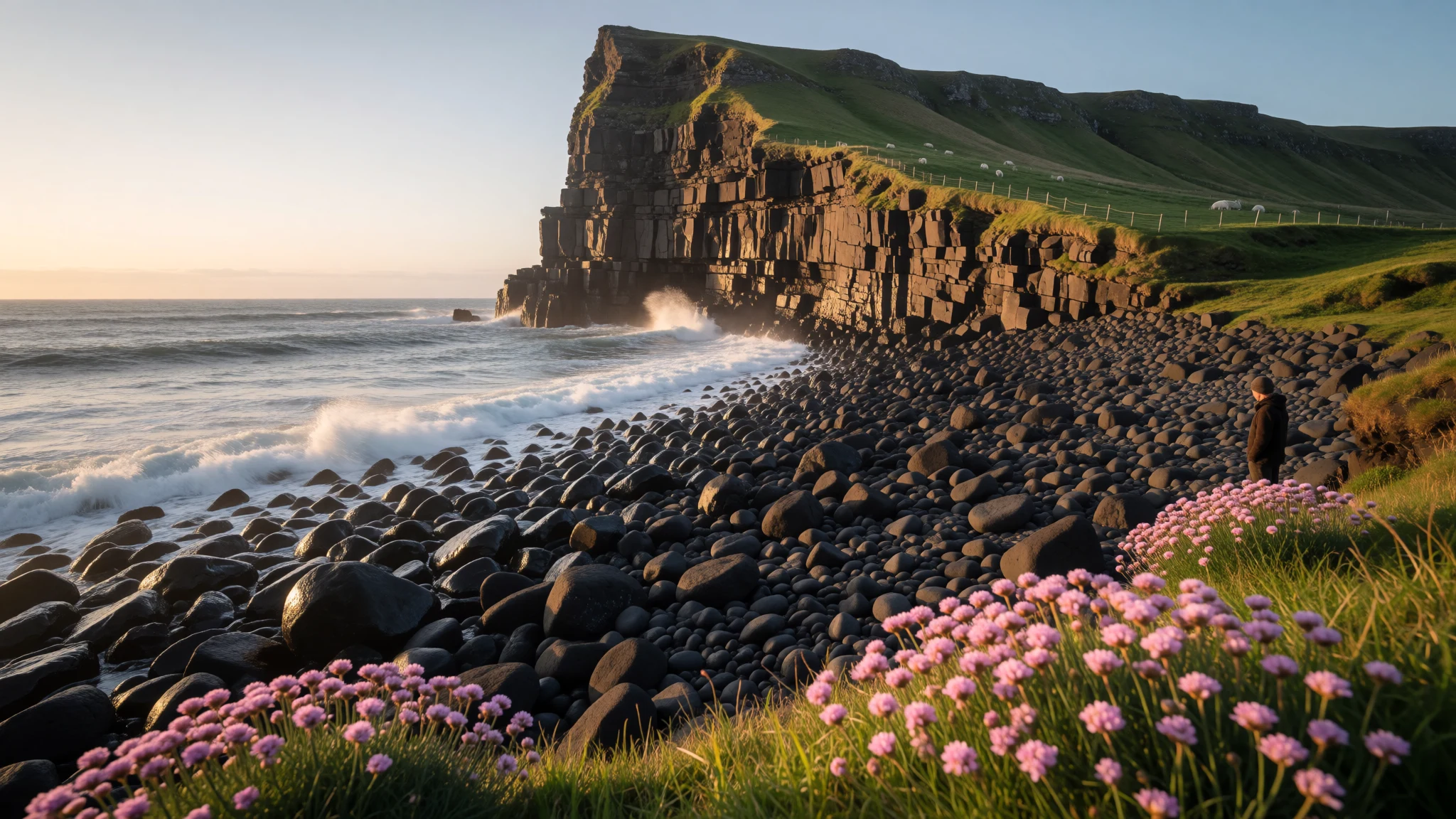
Suðuroy is the Faroes' quiet southern island, where steep sea cliffs, small villages and a ferry ride from Tórshavn make a slow, weather-led trip.
The place
Suðuroy, whose name means South Island, sits at the bottom of the Faroese chain and has about 4,600 residents. They live in a string of small villages, from Sandvík and Hvalba in the north down to Lopra and Sumba near the tip. The east coast is the gentler side, with sheltered fjords and the two largest settlements, Tvøroyri and Vágur, each built around a working harbour. The west coast is another matter: mountain slopes run green and then simply stop, dropping straight into the Atlantic. The highest summit is Gluggarnir at 610 metres, but local poets have made a different peak the island's emblem, the sea cliff of Beinisvørð above Sumba. Suðuroy is also the only Faroese island with coal, and one mine near Hvalba still works, a surprise in a landscape that otherwise looks entirely pastoral. Villages here are small and tend to be quiet, so a day often means a few conversations, a lot of walking and plenty of weather. Fog arrives fast, sheep wander onto the road, and the cliffs give little warning. In return there are few other visitors, even in summer, and a sense of an island that is still lived in rather than staged for tourists.
Its story
Suðuroy has a history of loss and return that shows in its map. Akraberg, a settlement on the southern tip, was abandoned around 1350 after the Black Death. Tradition says its people had come from Friesland, and some families in Hørg, in Sumba, still trace their roots to it. In the 17th century the island suffered raids by North African pirates, whom the Faroese called Turks. Women and children were taken, famine followed, and many islanders died. Hvalba served as a base for the raiders, and Danish warships arrived only after they had sailed. Settlement later crept back. Sandvík was re-established in the 19th century, and Botni and Tjaldavík were founded in the twentieth, though both have since been left empty again. Coal mining, fishing and fish processing shaped working life for generations, and the harbours of Tvøroyri and Vágur grew with them. Since the 1970s the population has drifted downwards, as young people leave for Tórshavn or abroad, which explains the shuttered houses in some villages. Even so, Suðuroy keeps a strong identity, and in Fámjin the first Faroese flag is still kept in the church, a reminder that this small island has long counted for more than its size suggests.
What to see
- Fámjin church and the first flag — Fámjin
Fámjin is a village on the west coast, and its wooden church from 1876 holds the first Faroese flag on its wall. Two young men made the flag in 1919. The building is small, so go for the story and the quiet harbour-side setting rather than a long visit.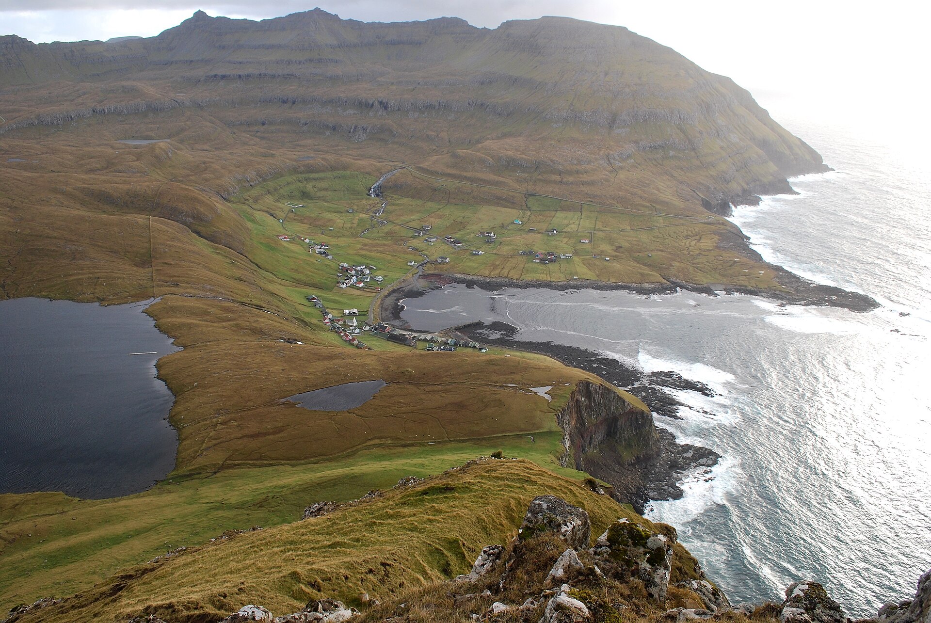
- Prestgjógv, the Gorge of the Priest — Fámjin
Just north of Fámjin, Prestgjógv is a narrow cleft where vertical cliffs meet breaking waves only a few steps from the houses. It needs no hiking, but the edges are unfenced and can crumble, so keep well back and avoid it in fog or strong wind. - Hovsegg basalt columns — Hov
Above the village of Hov, rock layers show columns of basalt, in places standing upright and in places zig-zagging like folded cloth. They are easiest to see from the road just before it bends around the mountain, so a short stop by the verge is enough to look closely. - Beinisvørð sea cliff — Sumba and Lopra
Beinisvørð is the cliff that Faroese poets have praised, rising above the sea north-west of Sumba. The classic views are from the shore near Lopra and from the hills above Vágur, where the green slopes break off into open sky. Wind is strong here, so dress warmly.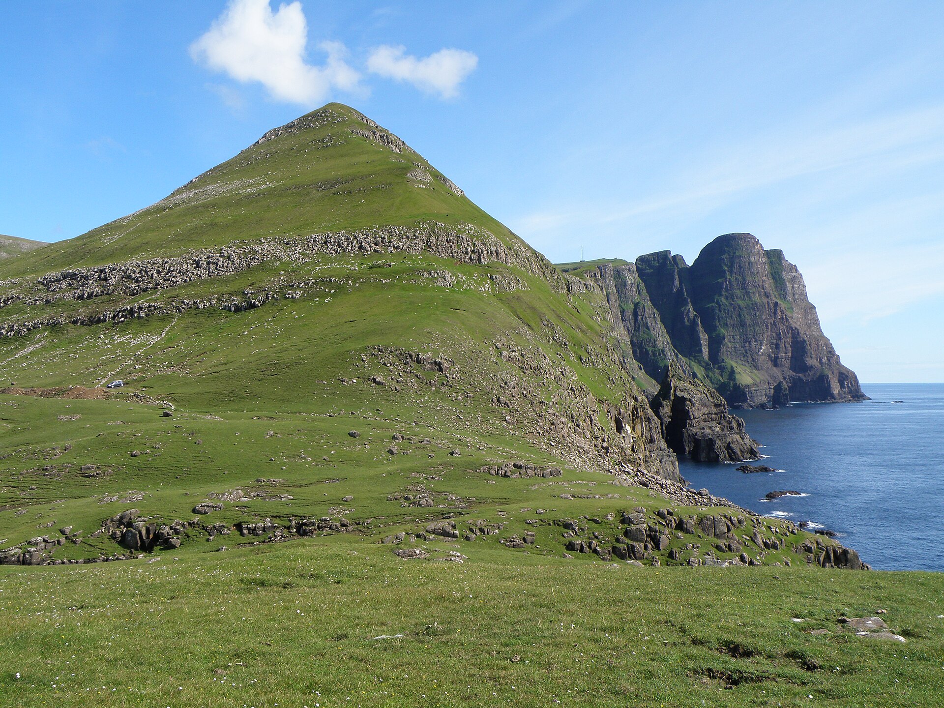
- Akraberg lighthouse — Akraberg, near Sumba
Akraberg lighthouse stands on the headland at the island's southern tip, close to where the medieval settlement was abandoned. The walk across open grass gives long views south over the sea and back up the coast. Fog can erase it completely, so check the weather before setting out.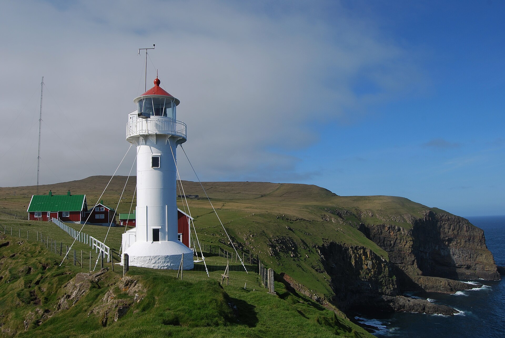
Culture
Suðuroy shares the wider Faroese culture of sheep, sea and song, but with a local accent. Residents of the south are known for speaking a distinctive dialect, and the island's own identity is strong. Village life revolves around the harbour, the church and the football pitch, and in summer rowing races between villages draw crowds to the quayside at Vágur and elsewhere. The wooden church in Fámjin matters beyond its parish, since the first Faroese flag was made by two young men from the village, and the story is told with some pride. Old assembly sites, such as the former Thing meeting place on the way to Fámjin, recall a tradition of local self-government that long predates modern politics. Coal mining gave the island a working-class character unusual in the Faroes, and mining families still shape local memory. The bays at Øravík, Trongisvágur, Fámjin, Vágur and Hvalba are legally designated for the traditional pilot whale hunt, known as the grind, which is a contested subject; visitors will meet strong opinions on both sides and are best advised to listen before offering their own. Hospitality is real but unshowy, and offers of coffee are usually sincere. Treat the outfield and the sheep as working land: stay on paths, close every gate behind you, and ask before crossing a hay field or walking near a house.
What to wear
Suðuroy shares the Faroese national dress, called the búni, and it is mostly seen on special days rather than in daily life. Women's versions use fine wool with embroidered bodices, shawls and silver fastenings, while men's costume includes dark wool breeches, a waistcoat and a knitted cap. Wool is the core textile because the islands' sheep supply it, and the Faroese knitting tradition produces patterned jumpers and shawls that are still worn and sold. The costume appears at weddings, confirmations and national celebrations, particularly around Ólavsøka in summer. Everyday clothing on the island is practical: waterproof jackets, wool jumpers, sturdy boots and a hat, since wind and rain can arrive on any day. Smart clothes come out for church and family gatherings, but nobody expects formal wear from a visitor. For a trip, pack layers rather than one heavy coat: a base layer, a wool or fleece mid layer and a proper waterproof shell with a hood. Waterproof walking boots with good grip are essential on wet grass and loose scree, and a spare pair of dry socks is worth carrying. Even in summer an evening on a headland can feel cold, so bring gloves and a warm hat. In church or at a service, dress neatly and keep to quiet colours.
What to eat
- Skerpikjøt — guesthouses and village shops
Skerpikjøt is mutton that has been hung to dry in the sea wind for months, giving a dense, strongly savoury meat that is sliced thinly. It is a traditional Faroese food rather than a daily one, so ask at local guesthouses or at a village market. - Ræstur fiskur — home-style guesthouse dinners
Ræstur fiskur is fish that has been left to ferment slowly in cool air before it is dried or boiled, with a pungent aroma and deep flavour. It is an acquired taste, and a good way to try it is as a small portion at a family-style meal. - Fresh fish with boiled potatoes — harbour cafés in Tvøroyri and Vágur
Haddock or cod, simply boiled or fried and served with potatoes, is the everyday fish dish across the islands. Harbour towns such as Tvøroyri and Vágur are the best bets, since the catch comes in close by and cafés buy it directly. - Lamb and root vegetable soup — village cafés and guesthouses
A thick lamb soup with potatoes, carrots and swede is the classic warming meal after a wet day on the hills. It is often made at home, but guesthouses and village cafés sometimes offer it as the dish of the day. - Rhubarb cake — gallery cafés and village bakeries
Rhubarb grows well in the cool Faroese gardens, and a tart, crumbly rhubarb cake with whipped cream is a staple with afternoon coffee. Look for it at cafés attached to galleries or museums, and in small bakeries when they open.
Plan it
Best time. June to August, when days are long, the weather is at its mildest and ferries and walking paths are at their most dependable; even then expect wind, rain and sudden fog, and winter brings short days and rougher crossings.
How long. 2–3
Getting there. Fly to Vágar Airport, reach Tórshavn by road, then take the public ferry to Suðuroy, which takes about 2 hours and runs several times a day. A helicopter service also links Tórshavn and Vágar Airport with the island a few times a week; check the operator's current timetable and fares before you travel.
Budget. mid
Tips
- Check the ferry timetable and book a car space early if you are bringing a vehicle
- Watch for sheep on the road, especially black ones at dusk
- Keep well back from cliff edges, which can collapse, and avoid headlands in fog
- Carry food and water for long walks, as villages are small and shops may be closed
- In an emergency dial 112
Etiquette
- Close gates behind you and stay on paths across grazing land
- Ask before photographing people or going near private houses
- Respect local feelings about the whale hunt and listen before commenting
Nearby
Sources
- Wikidata Q210309 (CC0)
- Wikipedia: Suðuroy (rev 1384745049) (CC BY-SA 4.0)
- Wikivoyage: Suðuroy (rev 5419209) (CC BY-SA 4.0)
- Photo: Lopranseiði and Kirvi, Eileen Sandá (CC BY 3.0)
- Photo: Elverkið í Botni, EileenSanda (CC BY 3.0)
- Photo: View from Eggjarnar, Eileen Sandá (Public domain)
- Photo: Fámjin, Erik Christensen (CC BY 3.0)
- Photo: Pál Joensen, Eileen Sandá (CC BY-SA 2.0)
- Photo: Rowing competition in Vágur, Eileen Sandá (CC BY 3.0)
- Photo: Akraberg lighthouse, Erik Christensen (CC BY-SA 1.0)
- Photo: Suðuroy view south, kallerna (CC BY-SA 4.0)


