Slītere National Park
Slītere National Park, Latvia
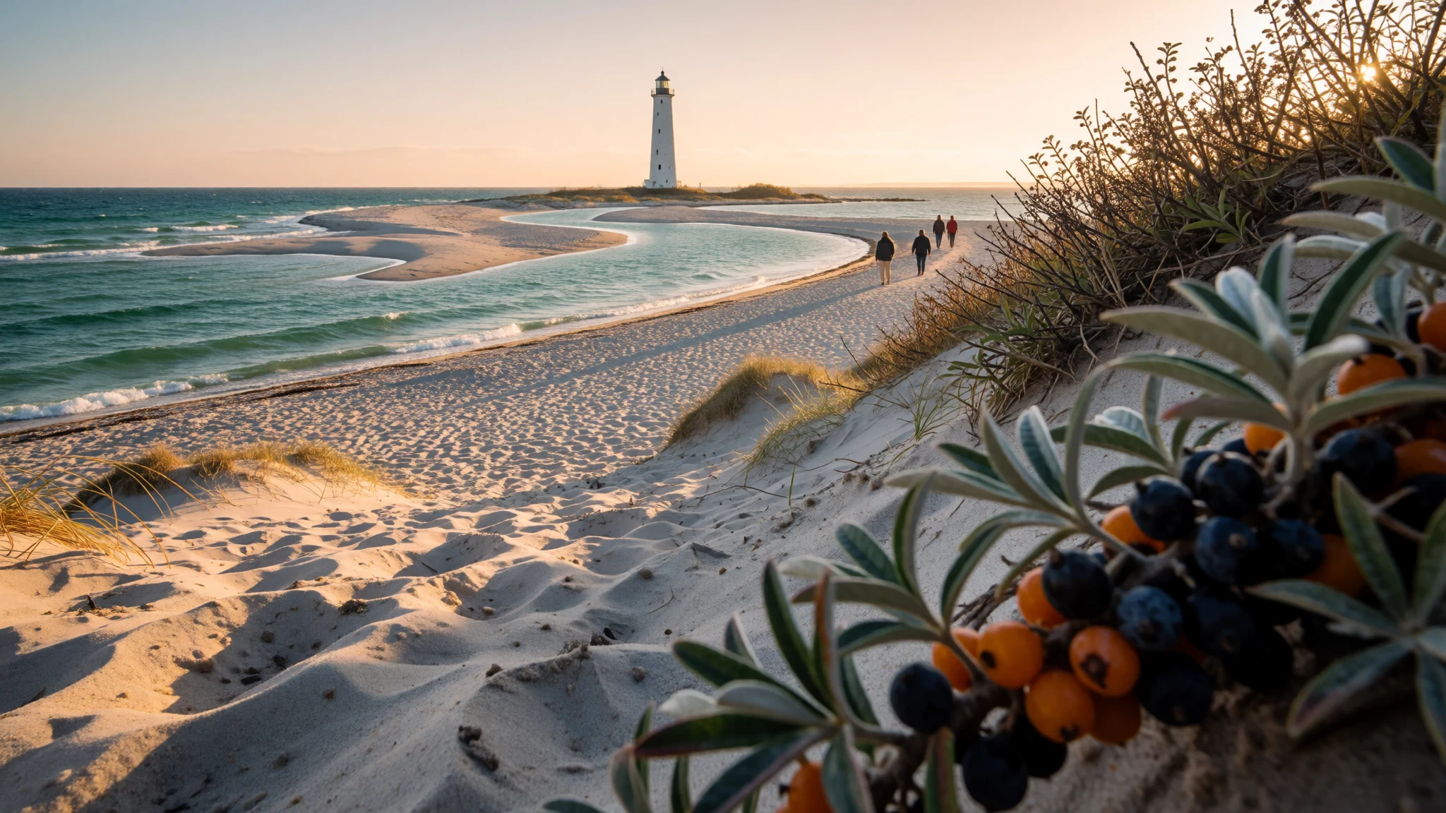
Slītere National Park offers quiet pine forest, bogs and an empty Baltic shore at the tip of Latvia's Courland peninsula, with a living Liv heritage.
The place
Slītere National Park sits at the north-western tip of Latvia's Courland peninsula, in Talsi Municipality, where the Baltic Sea and the Gulf of Riga meet through the narrow Irbe Strait. It is the smallest of the country's national parks, and a good share of it is open sea, so the land reads less as one landscape than as a patchwork of forest, bog and shore. Pine and mixed woodland fill the interior, broken by wetlands and small lakes. Inland of the coast runs a low ridge called the Blue Hills (Zilie Kalni), which marks an old shoreline from the time when the Baltic was an ice-dammed lake. The Irbe River, stained brown by moorland water, reaches the sea inside the park, and its sandbanks keep shifting. Lynx, elk and wolves live here, but they are wary and sightings are rare; tracks, birdsong and silence are the likelier rewards. Infrastructure is modest. Roads are a mix of asphalt and gravel, signage is plain, and services are thin outside the villages along the coast. Riga is several slow hours away by road, so the park suits people who want to stay a night or two rather than rush through. It is a place for walking, birdwatching and long grey-green views, not for facilities or crowds.
Its story
The story of Slītere National Park is one of protection arriving early and quietly. In 1921 the young Republic of Latvia set aside the Zaļie Kalni reserve around the Blue Hills. Under Soviet rule it was enlarged and became the Slītere Nature Reserve. During those decades the whole Courland coast was a border zone, and visitors needed a pass, which kept casual traffic away from the shore. When Latvia regained independence, the reserve became the national park in 2000. The older layers of the land are just as striking. Roughly 40 million years ago the climate here was sub-tropical, and fossilised amber from that age still turns up on the beach after heavy storms stir the seabed. Later, the ridge of the Blue Hills was the edge of an ice-age lake. The people of this coast are part of the story too. The Livs, who spoke a Finno-Ugric language related to Estonian, lived in fishing villages along this shore, and Mazirbe is still regarded as the main settlement of the Liv Coast. Their language has no native speakers left, yet people who identify as Livs remain, and the park's villages hold small museums and a folk house that keep the memory in daily view.
What to see
- Cape Kolka — Northern tip of the Courland peninsula
Cape Kolka is where the peninsula ends in a sandbank and two seas meet. A lighthouse stands on an artificial island offshore, and the point is popular with birdwatchers. Fishing villages nearby sell smoked fish, and there is a café and boat hire. Expect wind, shifting sand and a sense of land running out.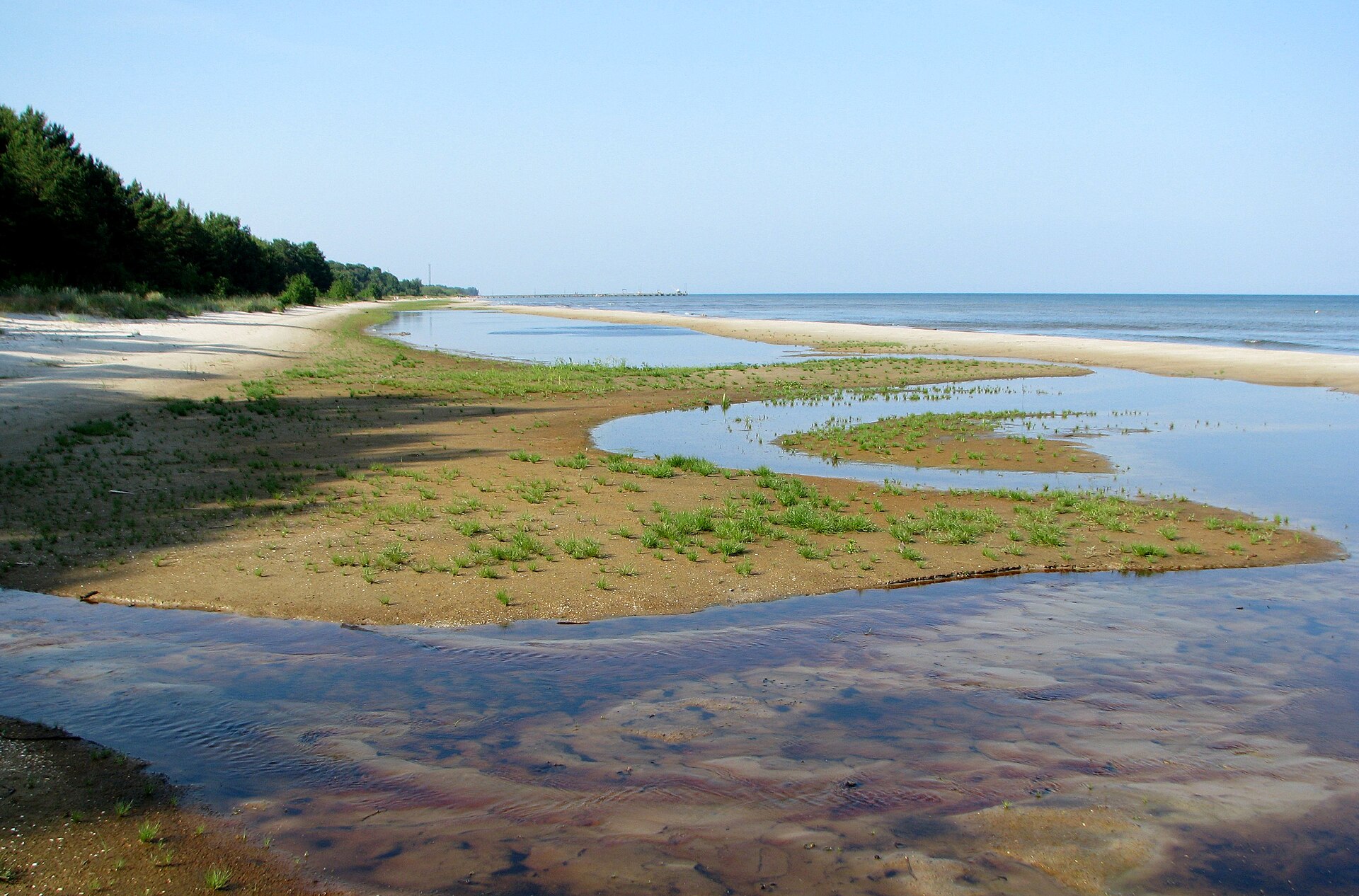
- Slītere Lighthouse — Near the Blue Hills, inland from the coast
The lighthouse stands about 5.3 km from the sea, among forest near the Blue Hills. Its fifth floor is around 100 m above sea level, and the view takes in the treetops of the park and the Baltic beyond. It is the best single vantage for understanding how the park is laid out.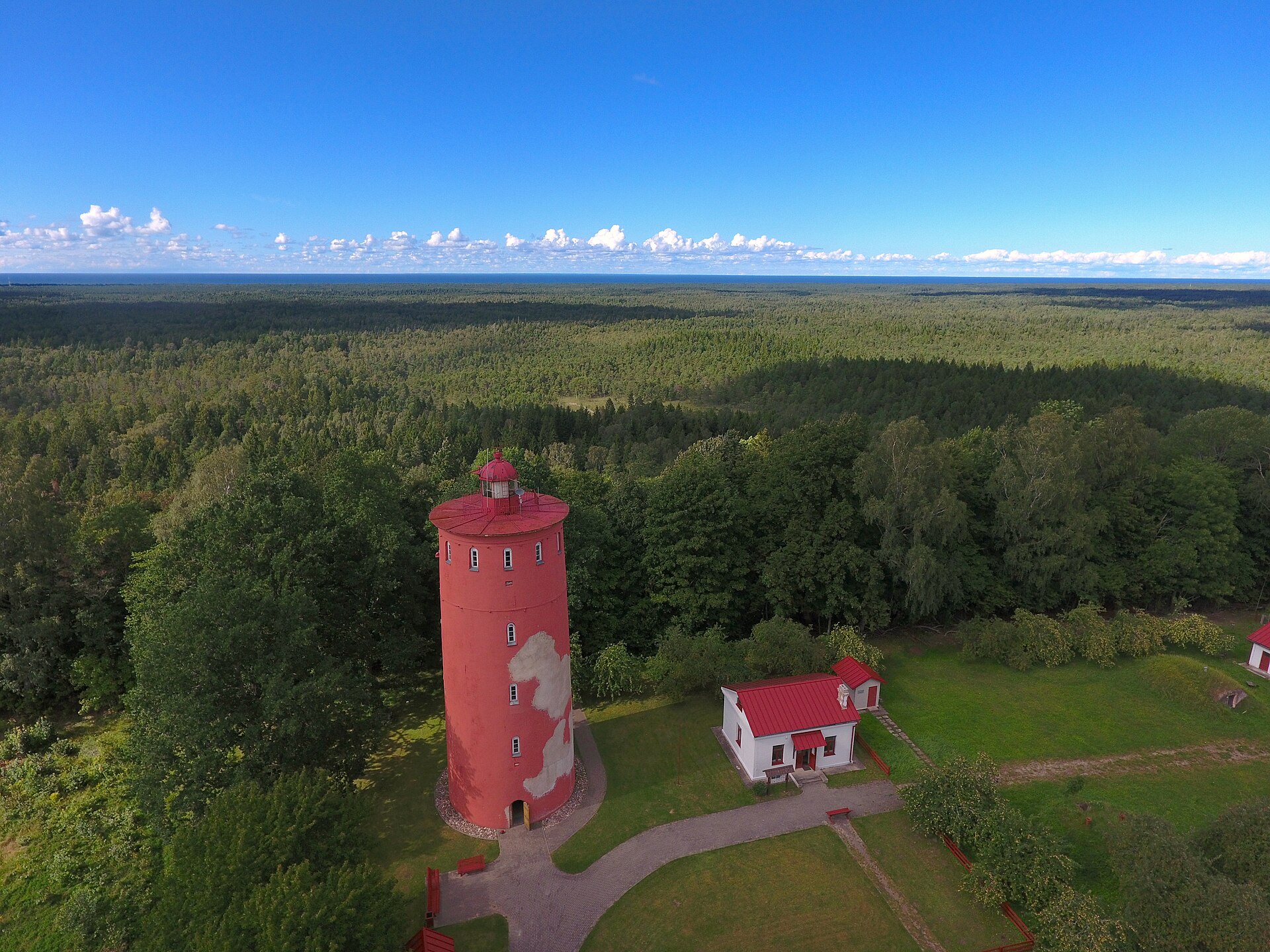
- Blue Hills (Zilie Kalni) — Western part of the park
The Blue Hills are a wooded escarpment, the old shore of an ice-age lake, now several kilometres from today's sea. Marked paths follow the slope and drop through damp forest. The climb is gentle by mountain standards, but roots, mud and steps can be slippery after rain.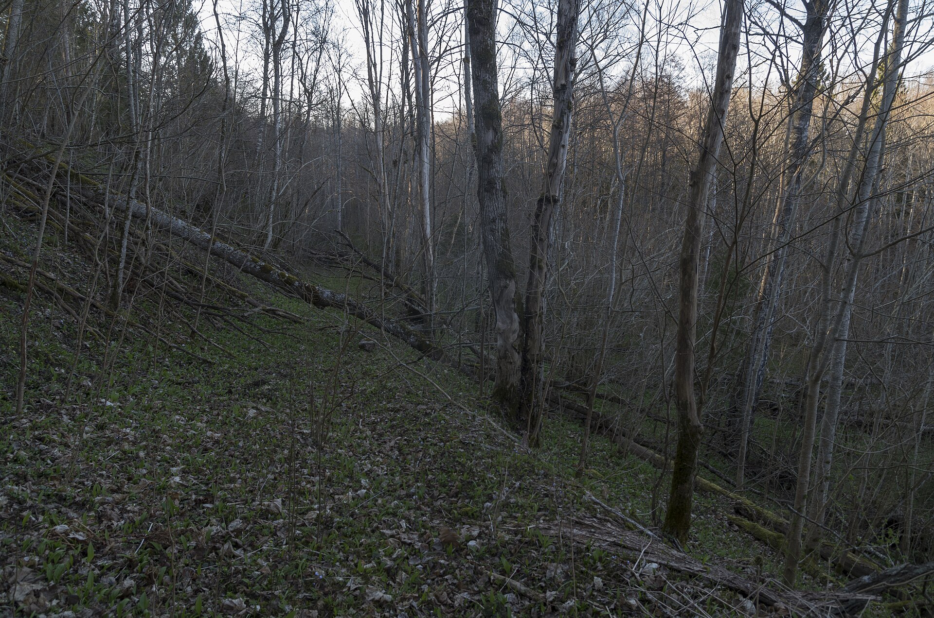
- Bažu bog — Eastern interior of the park
Bažu bog is the largest wetland in the park, covering 1,880 hectares. It is less dramatic than some better-known Latvian moorland, but worth the detour for the open sky, pools and stunted pines. Stay on boardwalks and paths, as the ground is soft and fragile.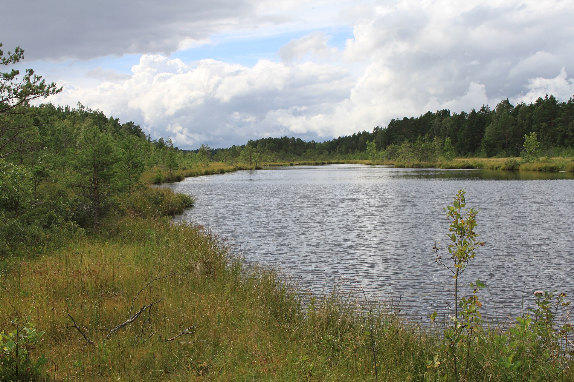
- Livonian Folk House, Mazirbe — Mazirbe, Liv Coast
The Livonian Folk House in Mazirbe is described as the only one of its kind in the world. It shows household objects and exhibitions on Liv life, and is used for Liv celebrations. Opening times vary, so check locally before travelling, and treat it as a way to meet the people behind the coast.
Culture
Slītere National Park is shaped as much by people as by pine and bog, and the key thread is the Liv story. The Livs, a Finno-Ugric people, once lived along this shore, fishing from small villages. Their language has effectively died out, with no native speakers left, yet families who identify as Liv still live on the coast, and Mazirbe remains the centre of that heritage. There is a small Liv museum, a separate Liv culture house and the folk house, where exhibitions and seasonal gatherings keep customs in use. Beyond Liv identity, the wider Courland coast carries a fishing tradition of smoked fish, wooden boats and wind-bleached villages. Border-zone restrictions in the Soviet decades left their mark, and older residents may remember when a pass was needed to reach the sea. Latvians generally value quiet, nature and self-reliance, and the habit of walking in forest for its own sake is deeply ingrained. Visitors will find people polite but reserved, and conversation tends to warm slowly. Many locals speak some English, especially younger ones, though a few Latvian words are always appreciated. Heritage buildings here are small and often run by volunteers, so patience helps. When visiting Liv sites or villages, ask before photographing residents or private farmsteads, and keep voices low in museums, forest and on the shore.
What to wear
Slītere National Park has no dress code of its own, but the Liv and wider Latvian tradition is worth knowing. Latvian regional folk dress is made largely from wool and linen, with woven belts, shawls and patterned bands, and each district has its own colours and motifs. Liv-style costume belongs to the same northern European tradition, and it appears today mainly at Liv gatherings, festivals and cultural events rather than in daily life. Everyday clothing on the coast is practical: fleeces, windproof jackets, rubber boots, caps and wool jumpers, since fishing, farming and forestry reward comfort over display. Visitors should dress for weather rather than occasion. The coast is exposed and the wind can feel cold even in summer, so layers and a waterproof shell matter in every season. Sturdy walking shoes or light boots are better than sandals, because forest paths and bog edges stay wet and muddy. Long trousers and socks help against ticks and mosquitoes in the vegetation, and repellent is sensible from late spring through summer. A hat and sunglasses help on the open beach. No special modesty rules apply at the sights, though a tidy, quiet appearance is respectful when entering a village museum or folk house.
What to eat
- Smoked fish — Fishing villages and roadside stalls around Cape Kolka
Smoked fish is the signature taste of the Courland coast. Fresh catch is hot-smoked over wood, and is usually eaten by hand with dark bread. Look for stalls and small smokehouses in the fishing villages; availability depends on season and the day's catch. - Rupjmaize (dark rye bread) — Village shops and bakeries across Courland
Rupjmaize is Latvia's dense, slightly sweet dark rye bread. It is the usual partner for smoked fish, cheese or soup. A loaf from a local bakery or village shop makes a sensible picnic base for walks in the forest. - Sklandrausis — Bakeries and cafés in Courland towns
Sklandrausis is a traditional rye-crust tart filled with carrot and potato, spiced with caraway. It is more savoury-sweet than most pastries. It is associated with western Latvia and is worth trying with tea after a walk. - Pelēkie zirņi ar speķi — Traditional Latvian restaurants and roadside eateries
Grey peas with fried bacon pieces is a rustic dish, hearty rather than refined. The peas are soft and earthy, and often served with onion or kefir on the side. It suits cold, wet days well. - Pizza in Mazirbe — The pizzeria in Mazirbe, on the Liv Coast
Choice is limited in the park, so the pizzeria in Mazirbe is a practical stop for hikers who want a plain hot meal. Check opening times locally, and bring snacks if staying overnight in the wilder parts.
Plan it
Best time. May–September, when paths are drier and daylight is long; late spring and early autumn are quieter, while winter is dark, cold and wet underfoot, with limited services.
How long. 2–3
Getting there. Fly to Riga International Airport, then drive. The usual route is via Tukums and along the P131 coast road to Kolka. An alternative is via Kuldīga or Talsi to Ventspils and then the P124. Both roads are slow and take several hours from Riga. Public transport is limited, so check current bus timetables before relying on it.
Budget. low
Tips
- Allow more driving time than maps suggest, as roads mix asphalt with gravel
- Stock up on food and cash before arriving, since services are thin outside the coastal villages
- Carry waterproofs, insect repellent and check yourself for ticks after forest walks
- Climb the lighthouse on a clear day for the best view, and check opening arrangements locally
- Download offline maps, as mobile signal can be patchy in forest and bog
Etiquette
- Stay on marked paths and boardwalks, especially in bogs, to protect fragile ground
- Ask before photographing residents or private farmsteads in Liv villages
- Take all rubbish with you and keep noise low to avoid disturbing wildlife
Nearby
Sources
- Wikidata Q1643261 (CC0)
- Wikipedia: Slītere National Park (rev 1362908244) (CC BY-SA 4.0)
- Wikivoyage: Slīteres National Park (rev 5415111) (CC BY-SA 4.0)
- Photo: Pēterezera dabas taka, Dace Kundrāte (CC BY-SA 4.0)
- Photo: Baltic sea Riga gulf western coast near Kolka, Evita wiki (CC BY-SA 4.0)
- Photo: Mazais Pēterezers, Biafra (CC BY-SA 4.0)
- Photo: Slīteres bāka (2), Edgars Šulcs (CC BY-SA 4.0)
- Photo: Slīteres nacionālais parks, Edgars Šulcs (CC BY-SA 4.0)
- Photo: Košrags, Edgars Šulcs (CC BY-SA 4.0)
- Photo: Bij. zemescēļš pa Šlīteres Zilo kalnu krauju, 13.04.2019 (49365972296), Dāvis Kļaviņš (CC BY-SA 2.0)
- Photo: Bij. zemescēļš pa Šlīteres Zilo kalnu krauju, 13.04.2019, Dāvis Kļaviņš (CC BY-SA 2.0)


