Senja
Senja, Norway
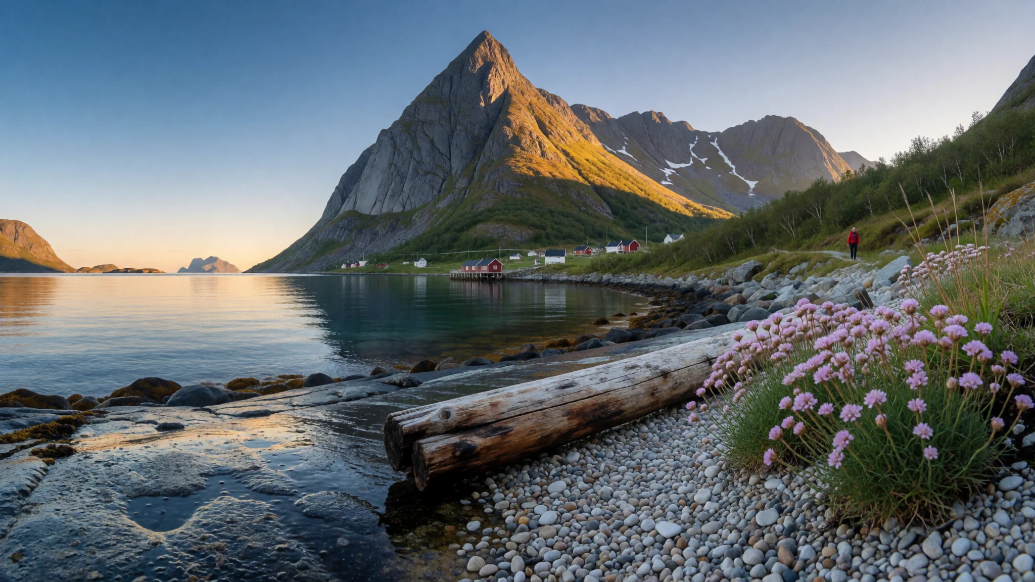
Senja pairs a steep, Atlantic-facing western coast of fishing villages with a gentler, wooded east, all reachable by road from the mainland.
The place
Senja sits off the coast of Troms county in northern Norway, an island the Sami call Sážžá. It has two distinct characters. The western side faces the open Atlantic, where steep mountains drop almost directly into the sea and fishing villages such as Gryllefjord and Husøy fill the few flat patches between rock and shore. The eastern side is softer, with forest, lakes, rounded hills and most of the people. Silsand is the largest settlement, and the mainland town of Finnsnes lies just across the Gisund strait, joined to the island by the Gisund Bridge. About 15,000 people live here, and the island's recorded high point is 1,017 m. In the south, Ånderdalen National Park is small but varied, with coast, inland terrain and a pine forest. Senja is often compared with neighbouring Lofoten, and the western coast earns the comparison, yet far fewer travellers make the trip. That quiet comes with conditions. The coastal road is narrow and twisting, weather can change fast, and services thin out between villages. Fishing remains the backbone of the economy, with graphite mining and potato processing alongside it. The island suits people who like driving slowly, walking steep ridges and stopping wherever a view opens up.
Its story
Senja's story is one of fishing, small farms and a long Sami presence on the northern coast. The island's Sami name, Sážžá, still sits beside the Norwegian one. At Kaperdalen, a restored farm of turf huts shows how households once lived close to land and water, long before the roads arrived. Along the shore, boats and drying racks shaped the villages, and fish remains the economic base. Processing companies at Senjahopen and Husøy still handle the catch today. Timber churches at Torsken and Tranøy were built to serve scattered fishing communities, and they remain among the few sights in the traditional sense. For a long time the island was split between separate municipalities, named Lenvik, Berg, Torsken and Tranøy, and these were later merged into a single Senja Municipality. A bridge over the Gisund strait now carries traffic to the mainland near Finnsnes. Ferries still matter, though. A year-round car ferry links Brensholmen, near Tromsø, with Botnhamn in the north, and in summer another crosses from Gryllefjord to Andenes. Newer industries sit beside the old ones: graphite mining at Skaland, potato products at Silsand, and a fibreglass insulation plant at Sollia that sells across Norway and abroad. The island is still thinly settled, and its reputation for unlocked doors comes from that.
What to see
- Segla and Fjordgård — Fjordgård, west coast
Segla is the mountain most visitors climb on Senja, rising above the hamlet of Fjordgård with a long view over the fjord. The route is steep and exposed in places, so check the forecast and leave early. Barden, Hesten and Kongan are other popular ridge walks nearby.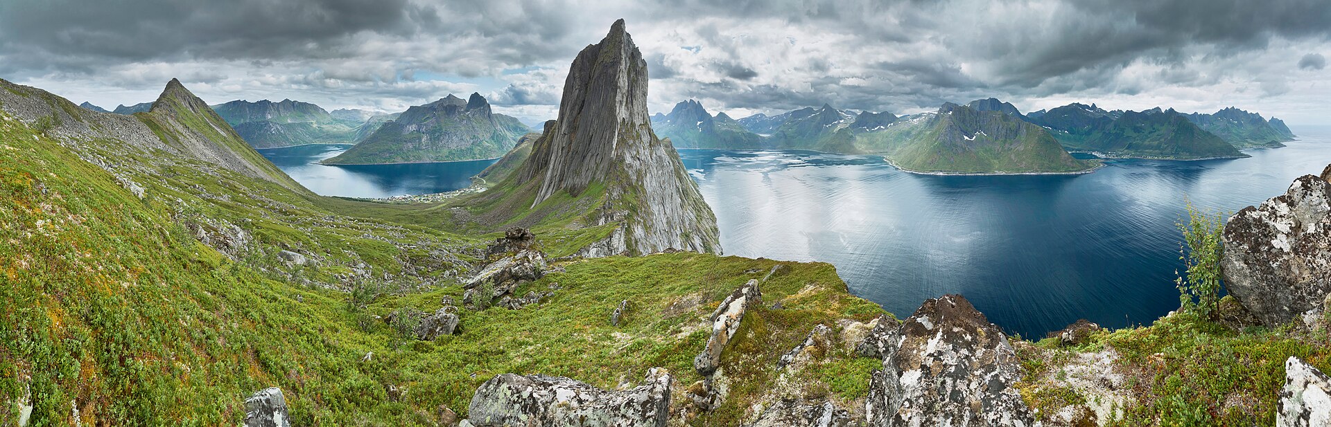
- Husøy — Western coast, a detour off the main road
Husøy is a working fishing village on a small island, with a harbour, a processing plant and a café overlooking Øyfjord. It shows west-coast Senja at close range: boats, racks and mountains standing right behind the houses. Go for the setting and a slow coffee rather than a list of sights. - Torsken Church — Torsken, near Gryllefjord
Torsken Church is an old wooden church in a fishing community on the island's outer edge. It is modest in size, and its interest lies in what it says about life here: a single building serving farms and boat crews strung along a wild coast. Check locally whether it is open before making a special trip. - Kaperdalen Sami Museum — Kaperdalen, between Finnsnes and Sifjord
Kaperdalen is a restored Sami farm built from turf huts, set midway between Finnsnes and the west coast. It gives a ground-level view of earlier Sami life on the island, in a landscape of forest and water. Opening arrangements vary, so check with the municipality before setting out. - Tranøy Church — Tranøy island, off the south coast
Tranøy Church stands on a small island off Senja's southern shore, another old timber building that served a fishing community. Reaching it adds a short detour to a trip around the southern side, where the landscape is gentler than the dramatic west. It suits travellers who enjoy quiet places with a bit of history. - Ånderdalen National Park — Southern Senja
Ånderdalen National Park is small, but it packs in coastal and inland scenery, including a pine forest, which is unusual for an island otherwise known for bare peaks. It works well for a calmer day of walking, away from the exposed western ridges. Weather and terrain still call for proper preparation.
Culture
Senja's culture rests on the sea, on Sami roots and on the habits of small communities spread thinly across a big landscape. Sami heritage appears in the island's second name, Sážžá, and in places such as the turf-hut farm at Kaperdalen. Norwegian coastal life shows in the working harbours of Husøy, Gryllefjord and Torsken, where boats, fish landings and drying racks set the rhythm of the day far more than any attraction does. Timber churches anchor villages that are otherwise far apart. Local people are used to weather and to relying on one another, and the island's reputation for unlocked doors reflects trust inside tight communities rather than an invitation to be careless. Many businesses are small and seasonal. Village pubs open mainly for the tourist season, so evenings outside it can be very quiet. Outdoor life is the common pastime: hiking, fishing from boats, kayaking on the inland lakes. Talk about weather is practical rather than small talk, since storms, rocky ground and few people around are real hazards. Visitors who plan around that, and who treat the working harbours as workplaces rather than scenery, tend to be welcomed warmly. Enter any open church quietly, ask before photographing people at work in the harbours, and carry your rubbish off the trails and out of the beauty spots.
What to wear
Traditional dress on Senja has two strands. The Sami gákti is a tunic made from wool or felt, trimmed with woven bands in bright colours and worn with a belt. It is put on for festivals, confirmations, weddings and Sami events, and its colours and patterns can signal the wearer's family and area. The Norwegian bunad, an embroidered wool costume, appears on national days and at family celebrations. Everyday clothing is practical. People wear wool base layers, fleeces, windproof jackets and rubber boots, and in the harbours fishing crews favour heavy waterproofs. In Finnsnes and Silsand, dress is plain and weather-led, much as elsewhere in Norway. Visitors should pack for changeable wind and rain even in summer. Layers work best: a wool or synthetic base, an insulating mid layer, and a waterproof jacket and trousers, plus a hat and gloves for evenings and ridges. Footwear matters more than anything else. Broken-in waterproof hiking boots with good grip suit Segla and the other steep walks, and trainers are a poor choice on wet rock. Spare dry socks in a small pack are worth the weight. Churches and villages expect nothing formal, but beachwear is out of place.
What to eat
- Skreimølja — Village eateries and harbour cafés on the west coast, in winter
A winter dish of cod, roe and liver cooked together, tied to the season when cod is caught. It is plain, rich and rustic, and best eaten where the fish is landed. Ask locally which eatery is serving it, as it is seasonal. - Seimølja — Fishing villages along the west coast, in summer
The summer counterpart to skreimølja, made with coalfish, also called saithe, in place of cod. Fish, roe and liver are cooked together in the same way. It reflects the island's habit of eating whatever the season brings to the harbour. - Feskekake — Cafés and village shops
Fish cake, sometimes described as a fish burger, made from minced white fish. It is lighter and less rustic than the boiled fish dishes, and easy to find as a casual lunch. Expect it served simply, often with potatoes or bread. - Kvæfjordkake — A harbour-side café such as the one at Husøy
A sweet cake layered with rum-flavoured cream and meringue, often called the national cake of the region. It turns up in village cafés with coffee, and makes a good reward after a windy walk along the coast.
Plan it
Best time. June to September is the practical window, when the summer ferry to Andenes runs, village pubs and cafés are open, and mountain walks are most usable. Winter is the season for cod and skreimølja, but storms and rocky terrain call for much more caution.
How long. 3–4
Getting there. Fly from Oslo to Bardufoss airport, then travel on to Finnsnes, which is joined to Senja by the Gisund Bridge. Catamarans also run from Tromsø and Harstad, and a year-round car ferry connects Brensholmen, near Tromsø, with Botnhamn in northern Senja. In summer, a car ferry crosses from Gryllefjord to Andenes.
Budget. mid
Tips
- Allow extra time on the west coast, where the road is narrow and winding, and larger vehicles may struggle.
- Check the weather forecast and safety advice before any hike or fishing trip, and turn back if conditions worsen.
- Confirm ferry and catamaran times with the operators, as some run only in summer, and see the official site, https://www.senja.kommune.no/, for local information.
- Plan food and fuel ahead, since services thin out between the villages.
Etiquette
- Enter churches quietly, and check locally whether they are open.
- Ask before photographing people at work in the harbours.
- Take all rubbish with you from trails and viewpoints.
Nearby
Sources
- Wikidata Q935821 (CC0)
- Wikipedia: Senja (CC BY-SA 4.0)
- Wikivoyage: Senja (CC BY-SA 4.0)
- Photo: Aerial view over Sørreisa and Lenvik (Bjoertvedt) (CC BY 3.0)
- Photo: Senja satellite view (EOX IT Services GmbH) (CC BY 4.0)
- Photo: View from a ridge between Segla and Hesten (Ximonic, Simo Räsänen) (CC BY-SA 4.0)
- Photo: Bergsfjorden on Senja (Chmee2) (CC BY-SA 1.0)
- Photo: Kistefjellet i Lenvik (Chmee2) (CC BY-SA 1.0)
- Photo: Seashore on Senja (Chmee2) (CC BY-SA 2.5)
- Photo: Okshornan, Senja (Per-Ivar Knutsen) (CC BY-SA 2.5)
- Photo: Silsand (Per-Ivar Knutsen) (CC BY-SA 2.5)


