Santa Cruz Island
Santa Cruz Island, Ecuador
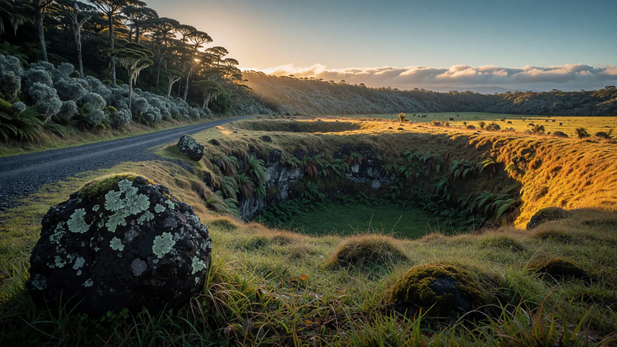
Santa Cruz Island is the practical base for the Galápagos: a working port town, giant tortoises in the highlands and sea lions on the quay.
The place
Santa Cruz Island lies at the centre of the Galápagos archipelago in Ecuador, and it is where most visitors who sleep on land end up. It is a broad shield volcano rising to 864 m, and about 15,701 people live here, most of them in Puerto Ayora, the port town on the south coast. Only Isabela is larger. The island changes in bands as the ground climbs. The coast is dry and rocky, with cactus, lava shelves and mangrove edges where marine iguanas, crabs and white-tip reef sharks work the shallows. Inland the land turns green and damp, with farms, cattle pasture and cloud forest; the smaller villages up here live mainly from agriculture and cattle. Near the summit, collapsed pits and cinder cones show a volcano that has been active in recent geological time, with lava flows on the north side that may be only a few thousand years old. Position makes the island a hub. Ferries run from Puerto Ayora to San Cristóbal and Isabela, and day boats reach smaller islets nearby. Planes do not land on Santa Cruz itself but on little Baltra, across the Itabaca Channel, so every arrival involves a bus and a short boat crossing before the road down to town. Puerto Ayora is busy, a little pricey and very practical, with a fish landing, dive shops, restaurants along the waterfront and sea lions asleep on benches. A research station, a white beach and a volcanic canyon all lie within a short walk or taxi ride, which is why the town suits a first trip.
Its story
Santa Cruz Island has been shaped twice over, first by fire and then by people deciding what to protect. The fire came from below: the island is one volcano built up from successive lava flows, its summit caldera now largely buried under younger craters, and two huge sinkholes, Los Gemelos, mark where a magma chamber emptied and the roof fell in. A lava tube more than 2,000 m long runs under the farmland, a reminder that this rock was once liquid and moving. The human chapter is newer. English-speaking sailors knew the island as Indefatigable, one of several names it has carried, before the Spanish Santa Cruz became standard. Settlers later cleared the damp highlands for farms and cattle, and that pattern still explains why the interior looks so different from the dry coast. The tortoises are the thread running through everything. Giant Galápagos tortoises once roamed in far larger numbers, and the island's population is now a conservation project as much as a wildlife sight. The Charles Darwin Research Station, just outside Puerto Ayora, keeps a breeding area and exhibits on the natural history of the islands, and its work has made Santa Cruz a place where science and tourism share the same streets. The result is a town that depends on visitors yet is also managed around the animals they come to see, which is why the rules about paths, distances and guides are strict.
What to see
- Charles Darwin Research Station — Puerto Ayora, west of the centre
The research station stands about 1.5 km west of the centre of Puerto Ayora, along a shaded road from the waterfront. It combines a tortoise breeding area with exhibits on island ecology and conservation, and it makes a sensible first stop because it explains what the rest of the island is trying to protect. Go early, before the heat builds.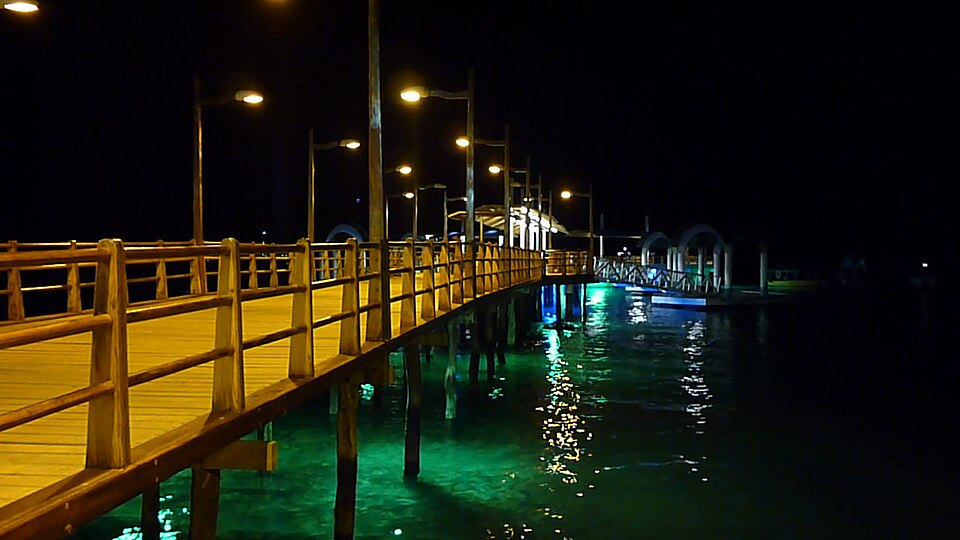
- Tortuga Bay — Southwest of Puerto Ayora
Tortuga Bay is reached on foot from Puerto Ayora along a 2.5 km trail. The first beach has a strong undertow and is for walking, not swimming. About 1 km further on, Playa Mansa is a calm bay for gentle paddling, with marine iguanas, birds and crabs along the shore, and mangroves where sharks and tortoises can sometimes be seen. Carry water and shade. - Las Grietas — Across the harbour from Puerto Ayora
Las Grietas is a narrow crevice between volcanic rock, flooded with clear emerald-green water that locals use as a swimming hole. It is good for snorkelling in the cool, still water. It lies a short way from Puerto Ayora, reached by a water taxi across the harbour and a walk over lava rock, so shoes with grip are worth wearing. - Los Gemelos — Highlands, on the road between Santa Rosa and Baltra
Los Gemelos are two sunken craters in cloud forest on the high road between Santa Rosa and Baltra, about 7 km from Santa Rosa. They formed when the roof of a magma chamber collapsed, and the pits sit close to the road, so the walk is short. Mist is common, so early light and patience help.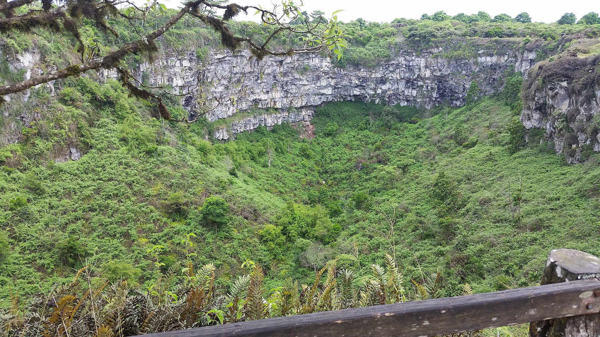
- El Chato Tortoise Reserve — Highlands near Santa Rosa
El Chato is a private reserve about 3 km from Santa Rosa where giant tortoises can be seen in the wild, moving slowly through pasture and pools. Two lava tunnels run through the property. Paths turn muddy after rain, so bring waterproof shoes, and check current entry details locally before setting out.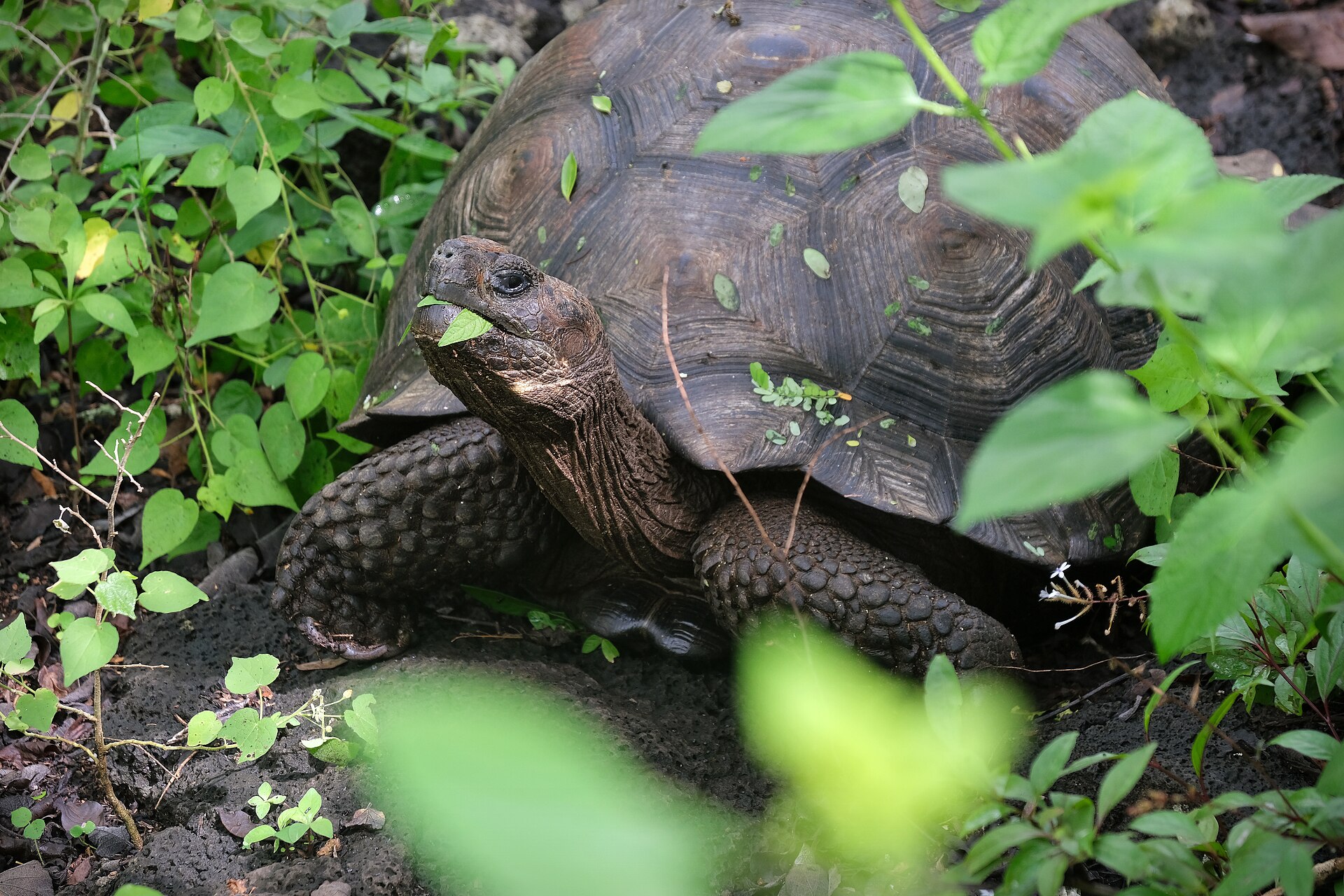
- South Plaza — Islet off Santa Cruz's east coast, by boat
South Plaza is a small islet near Santa Cruz with a dry landing on a concrete pontoon along a rocky shore. Sea lions, marine iguanas, sally lightfoot crabs and lava herons crowd the shoreline. It is visited by boat on a day tour from Puerto Ayora, so book through a licensed operator and check what the tour includes.
Culture
Santa Cruz Island is a community of fishers, farmers, guides and boat crews, and its culture is Ecuadorian in language and habit, shaped by newcomers from the mainland and abroad. Spanish is the everyday language, evenings are social, and the waterfront fills with families once the heat drops. Music and dancing are part of nightlife; salsa is played in town bars, and locals are usually happy to see a visitor attempt the steps. Working life follows the sea and the seasons. Boats leave early, highland farms start at dawn, and many residents work in tourism, so greetings and small courtesies matter. A second strand is the conservation ethic. Residents live beside a national park, and rules about paths, distances from animals and licensed guides are part of daily life, not just notices on a board. Children grow up learning about tortoises and iguanas, and the research station is a point of local pride. Water is a practical concern too, since the supply in Puerto Ayora is poor and bottled water is the norm for drinking and brushing teeth. Plans on the island bend to weather and sea conditions, and ferries leave when conditions allow. Taking this in good humour is part of being a good guest. Stay on marked paths and keep the distance your guide sets from every animal, and never touch or feed sea lions, iguanas or tortoises.
What to wear
Santa Cruz Island has no dress of its own; its settlers came from mainland Ecuador, so traditional clothing here borrows from there. In the Andes, women wear embroidered blouses, wrapped wool skirts and shawls, and men wear woollen ponchos and felt hats, often woven in highland towns such as Otavalo. The straw hat known as the Panama hat is woven in Ecuador from toquilla palm fibre. These are mostly festival wear on the mainland and rarely seen on the island. Day to day, people on Santa Cruz dress for heat and work: shorts, cotton or quick-dry shirts, caps, sandals or sturdy trainers, and a fleece for boat rides and cool highland evenings. Guides and boat crews often wear sun shirts and wide hats. Visitors should dress for strong equatorial sun and mixed terrain. Pack a long-sleeved sun shirt, a hat with a strap and reef-friendly sun cream. Closed shoes with grip help on sharp lava and muddy highland paths, while sandals suit the town and beaches. A swimsuit and rash vest are useful for snorkelling, and a light waterproof covers sudden showers and sea spray. There are no strict dress codes in Puerto Ayora, but locals put on a shirt and shorts over swimwear when walking through town, and visitors do well to do the same.
What to eat
- Ceviche — Casual waterfront eateries in Puerto Ayora
Raw fish or prawns cured in lime juice with onion and coriander, served cold with popcorn or plantain chips. On Santa Cruz it is usually made from the day's catch, so ask what came in that morning. - Grilled catch of the day — Seafood grills in Puerto Ayora, near the fish landing
Local fish, often a white fish such as snapper, grilled and served with rice, salad and fried plantain. Seafood grills are a staple of the town, and the quay shows what the boats brought back. - Encebollado — Family-run eateries on the back streets of Puerto Ayora
A tuna and cassava soup topped with pickled red onion, an Ecuadorian coastal staple eaten at breakfast or lunchtime. Look for simple places serving set lunches away from the waterfront. - Bolón de verde — Breakfast cafés in Puerto Ayora
A ball of mashed green plantain filled with cheese or pork crackling, then fried or griddled. It is a filling mainland-style breakfast, usually eaten with coffee, and good fuel before a long beach walk. - Highland coffee — Cafés in Puerto Ayora and farms in the highlands near Santa Rosa
Coffee grown on the island's damp upland farms, served black or with milk. Agriculture is the main livelihood up the slopes, and some farms welcome visitors for a cup and a look at the plants.
Plan it
Best time. March–May and December are warm and sunny with calmer seas, good for snorkelling and beaches. June–November is cooler and greyer in the highlands, with choppier water on boat crossings.
How long. 3–5
Getting there. Fly to Seymour Airport on Baltra, take the airport bus to the Itabaca Channel, cross by ferry or small water taxi, then ride a bus or taxi across the island to Puerto Ayora. Ferries link Puerto Ayora with San Cristóbal and Isabela.
Budget. high
Tips
- Drink and brush your teeth with bottled water only, as tap water in Puerto Ayora is poor
- Buses from Puerto Ayora to the Itabaca Channel run only in the morning, so for an afternoon flight plan on a taxi and check locally a day ahead
- Inter-island boats can be rough and noisy; take a seasickness pill if you are prone and sit towards the back
- Book accommodation and guided boat tours ahead in busy months, and expect taxes on top of room rates
- Carry some cash for water taxis, small reserves and local eateries, as cards are not accepted everywhere
Etiquette
- Keep to marked paths and the distance your guide sets from wildlife
- Never touch, feed or chase sea lions, iguanas or tortoises
- Cover up over swimwear when walking through Puerto Ayora
Nearby
Sources
- Wikidata Q713127 (CC0)
- Wikipedia: Santa Cruz Island (Galápagos), rev 1364198016 (CC BY-SA 4.0)
- Wikivoyage: Santa Cruz (Galapagos), rev 5417346 (CC BY-SA 4.0)
- Photo: Los Gemelos, Isla Santa Cruz, Galapagos Islands (Pi3.124) (CC BY-SA 4.0)
- Photo: Puerto Ayora dock at night (David Adam Kess) (CC BY 3.0)
- Photo: Giant Galápagos tortoise, Chelonoidis niger donfaustoi (Kevin Gepford) (CC BY-SA 4.0)
- Photo: Lava tunnel on Santa Cruz Island (David Adam Kess) (CC BY 3.0)
- Photo: Santa Cruz from the air, leaving Baltra (David Adam Kess) (CC BY 3.0)
- Photo: Santa Cruz, Baltra and the Itabaca Channel from the air (David Adam Kess) (CC BY 3.0)
- Photo: Ardea herodias cognata, Santa Cruz (Diego Tirira) (CC BY-SA 2.0)
- Photo: Arthonia cinnabarinum on bark, Santa Cruz highlands (Jason Hollinger) (CC BY 2.5)


