Picos de Europa
Picos de Europa, Spain
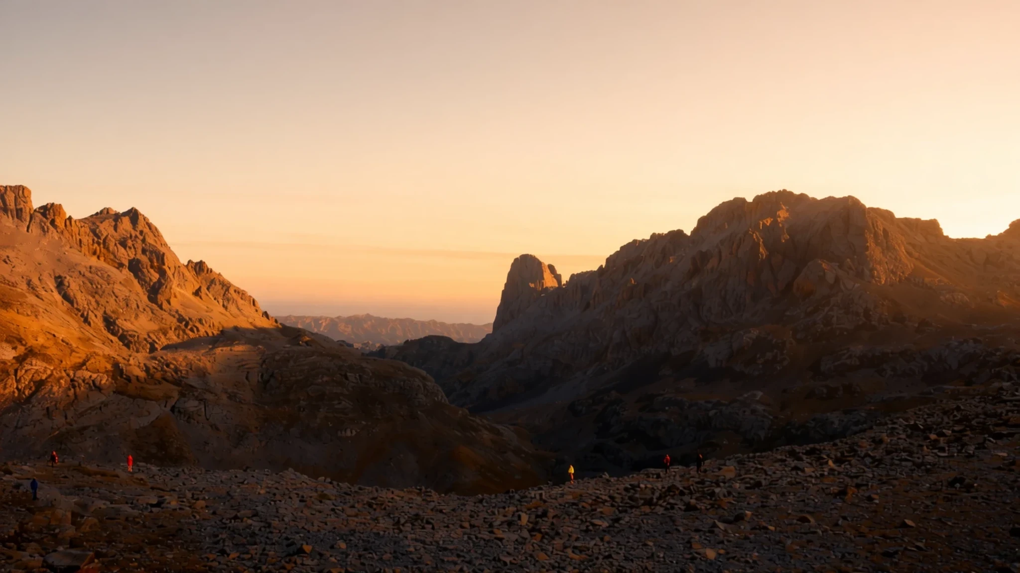
Limestone peaks, deep gorges and a cool, wet Atlantic climate make the Picos de Europa a rewarding base for walkers who can handle changeable weather.
The place
The Picos de Europa, or Peaks of Europe, form a compact limestone range of about 20 km across northern Spain, part of the Cantabrian Mountains that run parallel to the coast. The range is made up of three massifs, the Central, Eastern and Western, and it spans three regions: Asturias, Cantabria and Castile and León. Its highest summit, Torre de Cerredo, reaches 2650 m, and many neighbouring peaks pass 2600 m.
Nearly all the rock is limestone. Water and glacial action have produced karst, with caves, sinkholes and sharp ridges, and the landscape changes sharply from one valley to the next. Where the Central and Western massifs part, the Cares Gorge cuts a trench about 1.5 km deep, with the hamlet of Caín at its head. Much of the gorge's water rises from caves in the rock, and some of it is diverted into a hydroelectric canal along the northern wall.
The mountains catch moist air moving in from the Atlantic, so the northern side of the range is green and wet, and the weather can turn quickly. A clear morning can become fog and drizzle by lunchtime, and trails can disappear in cloud. Mountain refuges are spread across the range, and the Naranjo de Bulnes, a rock tower in the Urrieles massif, is one of the best-known climbing objectives in Spain.
Its story
Long before the Christian kingdoms, the mountains around the Picos were home to the Cantabri, a Celtic people known for resisting Roman advances and for a hard way of life suited to high pastures and steep valleys. Their reputation for independence has stayed with the region, and locals still speak of the mountains as a place that held out.
The next decisive episode came in the eighth century. In 722 a force of Visigothic rebels under a leader named Pelagius met a Moorish army near the shrine now called Covadonga. The legend credits the Virgin Mary with the victory, and the cave became a symbol of the Reconquest, the long Christian campaign that followed. Historians give a more practical account. The Moorish army had already been defeated at Toulouse in 721, and it attacked through a narrow valley where defenders above could drop rocks and loose stone onto the column below. The terrain did more for the Asturians than any miracle.
The name Covadonga comes from a Latin phrase meaning the Cave of Our Lady, and the legend has outlasted the military details. The Reconquest it inspired lasted around 800 years. Today the shrine draws visitors who come for the church, the cave and the mountain setting, while the limestone that once sheltered the defenders still shapes the walls, caves and gorges all around.
What to see
- Covadonga shrine and lakes — Covadonga, Cangas de Onís, Asturias
The shrine at Covadonga marks the place where the Reconquest legend begins. Its name comes from a Latin phrase meaning the Cave of Our Lady, and it sits in a mountain setting that many visitors reach by road. In summer, go early in the day, because the parking and the lakeside paths fill up quickly. Lago Enol is a fine short walk from the shrine area.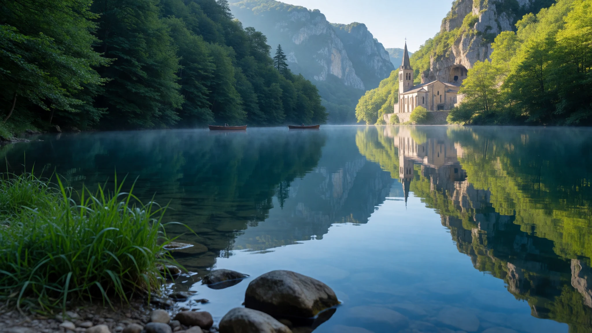
- Naranjo de Bulnes (Picu Urriellu) — Urrieles massif, Cabrales, Asturias
The Naranjo de Bulnes, also called Picu Urriellu, is a limestone tower in the Urrieles massif and one of the best-known climbing objectives in Spain. Most visitors see it from the Pozo de la Oración viewpoint above the Cabrales valley. Climbing the rock needs proper equipment and experience, but the walk to the viewpoint suits most people, and the views are clearest in the morning.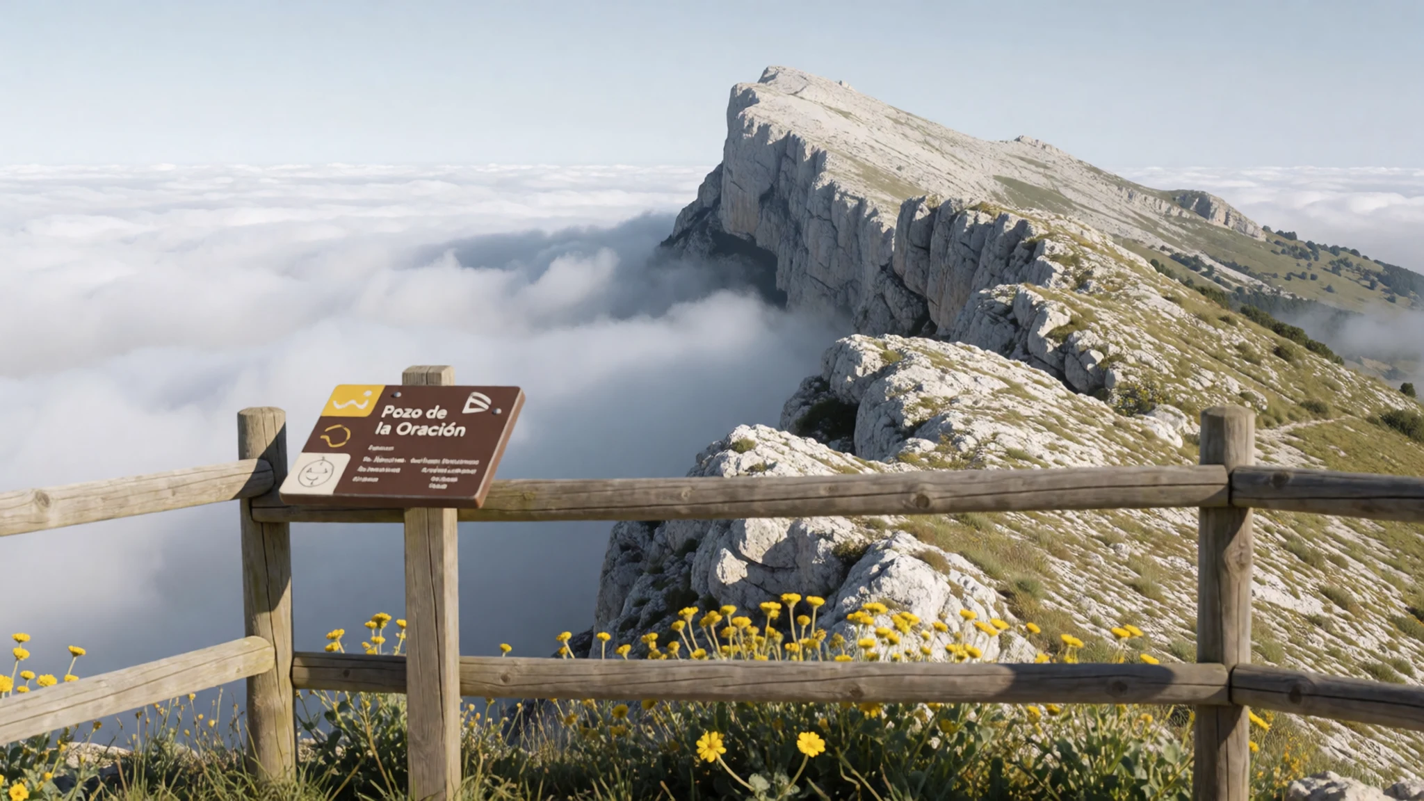
- Cares Gorge — Between Caín and the Central massif, on the Asturias–Castile and León border
The Cares Gorge, or Garganta del Cares, separates the Central and Western massifs and runs about 1.5 km deep. The walking route follows a path along its walls, and the village of Caín sits at its head, which makes it a common starting point. The river is fed largely by cave resurgences. Expect a long day, steep sections and exposed stretches on the walls, so set off early with plenty of water.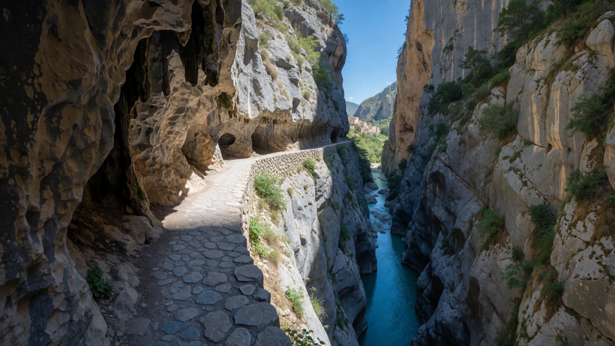
- Pre-Romanesque churches near Oviedo — Oviedo and its surroundings, Asturias
Asturias keeps pre-Romanesque churches more than a thousand years old, which reflect a Christian region that stayed independent of Moorish rule. Two of the finest stand near Oviedo. Later centuries added Romanesque, Gothic and Baroque buildings, from cathedrals to small wayside shrines. Oviedo's Archaeological Museum is a useful place to see the wider Stone Age and medieval story before you go looking at the churches.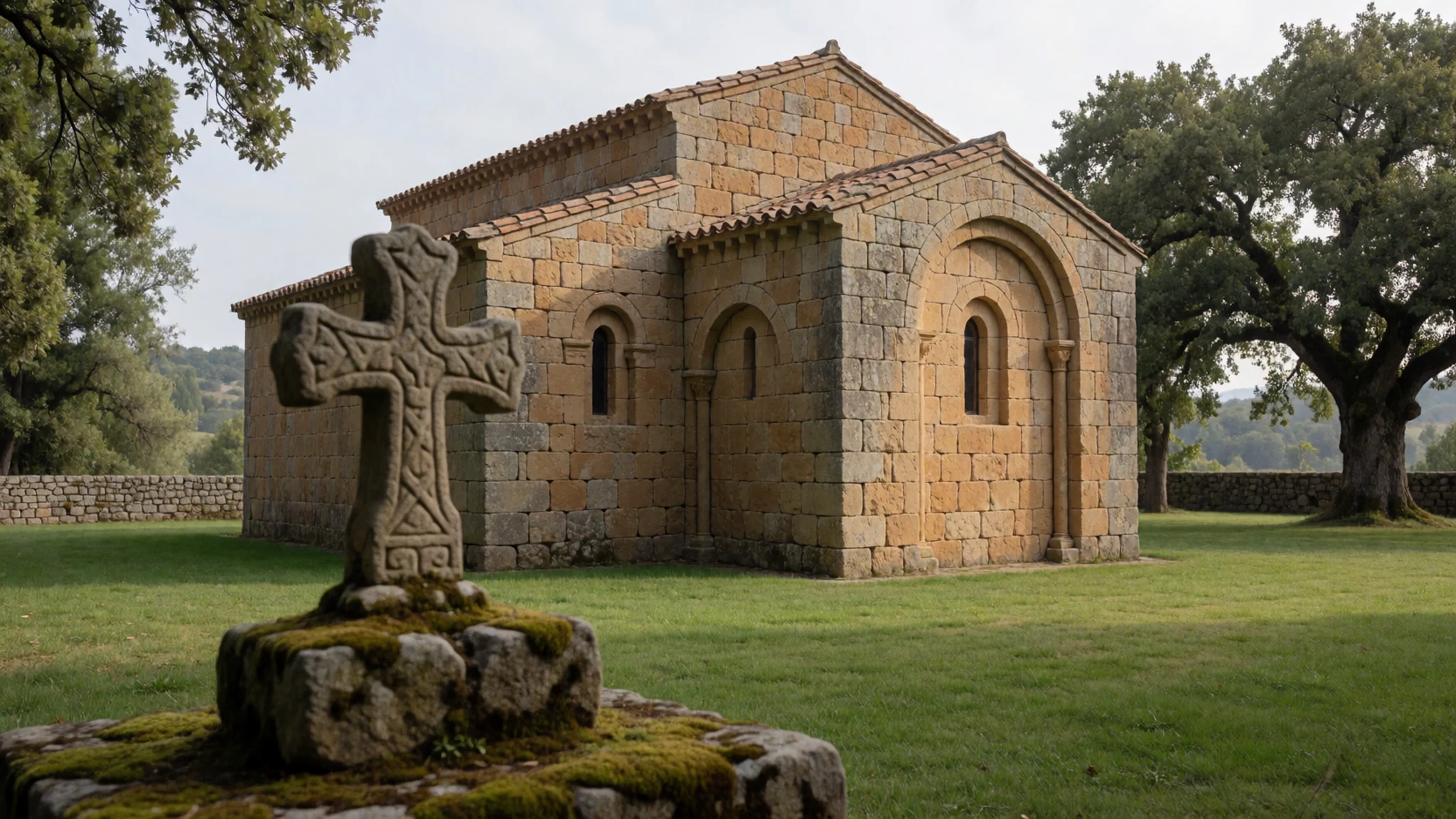
- Tito Bustillo Cave — Ribadesella, on the Asturian coast
Tito Bustillo Cave in Ribadesella holds some of the region's most remarkable prehistoric art, the work of Cro-Magnon people who lived here well before the first farmers. It is a reminder that the Stone Age story here survives underground rather than in standing stones. Visits are arranged through the official site, so check there for times and booking before you travel.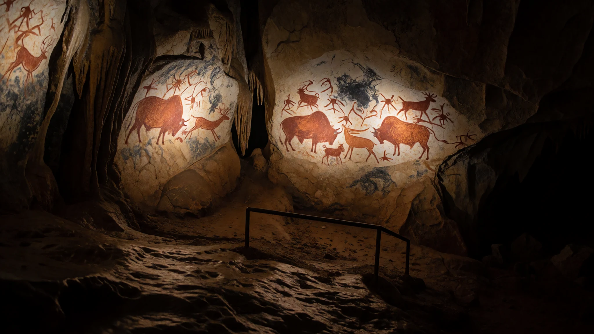
Culture
The Picos de Europa are shared by three regions, and valley life follows village rhythms: a church at the heart of every community, feast days marked by processions, and a strong habit of eating and drinking together. Many churches are still active places of worship, so step inside quietly and keep your voice low. Festivals mix the religious and the secular. Easter is the big one, and each town holds a patron-saint day when a large image of the Virgin is carried swaying through the streets, followed by music, food and often dancing late into the night. Mountain refuges are communal, with shared dormitories and dinner tables, so keep torch use and early starts considerate. On the pilgrim trails the albergues are basic but welcoming, and some admit only people holding a pilgrim credential. Ask before photographing people at prayer or during a procession, and do not walk into a service with a camera raised.
What to wear
Traditional dress in the Picos de Europa is mostly seen at festivals, folk-dance groups and religious processions rather than in everyday life. Rural clothing across Asturias and Cantabria was traditionally made from wool and linen, cut for work on steep fields and long days in the pasture. Feast-day outfits were typically more formal, darker versions of working clothes, and many families still keep a set for patron-saint days and church occasions.
Today people in the valleys dress much like anyone in Spain. Jeans, fleece, walking boots and waterproof jackets are everywhere, especially on the trails and in the cider houses, and nobody expects formal clothes for a meal.
Visitors should plan for weather rather than style. Pack a waterproof shell, a warm fleece or light down layer, and boots with real grip, because the limestone is slippery when wet and fog can roll in fast. Churches expect covered shoulders and no beachwear. For the Easter and patron-saint processions, dress a little more carefully, since local people often turn out in their best clothes.
What to eat
- Fabada — Family restaurants in villages and towns across Asturias
A slow-cooked stew of white beans with chorizo sausage, morcilla black pudding and diced bacon. It is the classic Asturian main course and is served in family restaurants throughout the villages, as well as in the towns. It is a filling, heavy dish, so order it when you have an appetite and time to sit.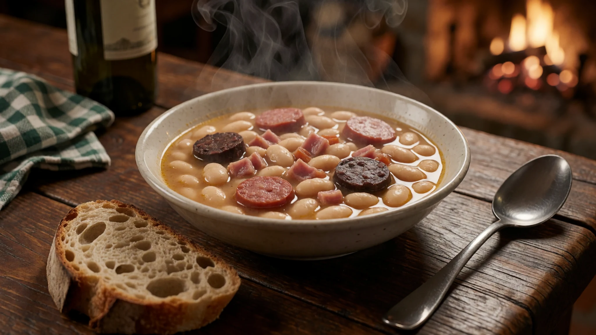
- Cachopo — Restaurants in Asturian towns and coastal villages
Breaded veal cutlets, rich and generous, and a common feature of restaurant menus in Asturian towns and along the coast. Portions are large, so share one between two if you want to try the local cooking without losing room for dessert.
- Cabrales cheese — Village shops and markets in the mountains of eastern Asturias
A strong blue cheese, classically made from goat milk, though sheep or cow milk versions exist. It is crafted solely by several villages within the eastern Asturian mountains, so buy it from village shops and markets there. Gamoneu is a related cheese with a light smoky flavour.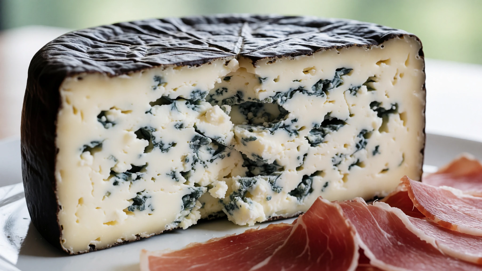
- Cider and the escanciar pour — Any sidrería, the traditional cider house, in almost any town
Cider is the staple drink of the region, made from local apple varieties. Escanciar is the ritual of serving it: the bottle is held high and the cider is poured into a glass held low, which aerates it. Drink the fizzy pour in one gulp, then set your glass down on the table for the next serving. - Frixuelos — Cafés and cider houses across Asturias
Thin pancakes similar to French crêpes, eaten as a dessert. They turn up on dessert menus in cafés and cider houses, and they are a good way to finish a long lunch after a big plate of fabada or cachopo.
Plan it
Best time. Late June to September gives the most settled conditions for walking, with refuges open and higher trails more likely to be clear of snow. Fog and rain can arrive on any day of the year, so pack for both, and expect the coast to be cooler and windier than you might hope.
How long. 3–4
Getting there. Asturias airport (OVD) is about 10 km west of Avilés and has frequent flights from Madrid and Barcelona, with buses onward to Oviedo and Gijón. Santander airport has budget international flights and is about 3 hours by bus from Oviedo. Renfe high-speed trains from Madrid reach Oviedo in around 3 hours, and ALSA buses take about 5 hours, with a local bus or hire car needed for the mountain villages.
Budget. mid
Tips
- Book refuge beds ahead for summer weekends, when the huts fill
- Start walks early, because fog can settle in the afternoon even after a clear morning
- Pack a waterproof and a warm layer whatever the forecast says
- Carry some cash for village restaurants and cider houses
- If you walk the pilgrim trails, check whether an albergue needs your credential and whether it is open in your month
Etiquette
- Stay on marked paths and keep dogs under control near grazing sheep and chamois
- Leave gates as you find them and carry out all of your litter from the refuges
- Keep noise low at refuges and after dark, since bunk rooms are shared
Nearby
Sources
- Wikidata Q1141172 (CC0)
- Wikipedia: Picos de Europa (rev 1369599436) (CC BY-SA 4.0)
- Wikivoyage: Asturias (rev 5378529) (CC BY-SA 4.0)
- Photo 01-picu-urriellu.jpg, Evölah (CC BY 3.0)
- Photo 02-asturian-sheep.jpg, Eduard Solà (Public domain)
- Photo 03-sotrespanorama.jpg, mixpix (CC BY 3.0)
- Photo 04-rebecos-en-picos-de-europa-bk1d3929.jpg, Juan Lacruz (CC BY 3.0)
- Photo 05-mustela-1.jpg, Juan Lacruz (CC BY-SA 4.0)
- Photo 06-pviejapanofull.jpg, Juan Lacruz (CC BY-SA 4.0)
- Photo 07-urriellu-desde-el-pozo-de-la-oracion.jpg, Juan Lacruz (CC BY 3.0)
- Photo 08-covadonga-lago-enol-11.jpg, Zarateman (CC BY 3.0)


