Nordaustlandet
Nordaustlandet, Norway
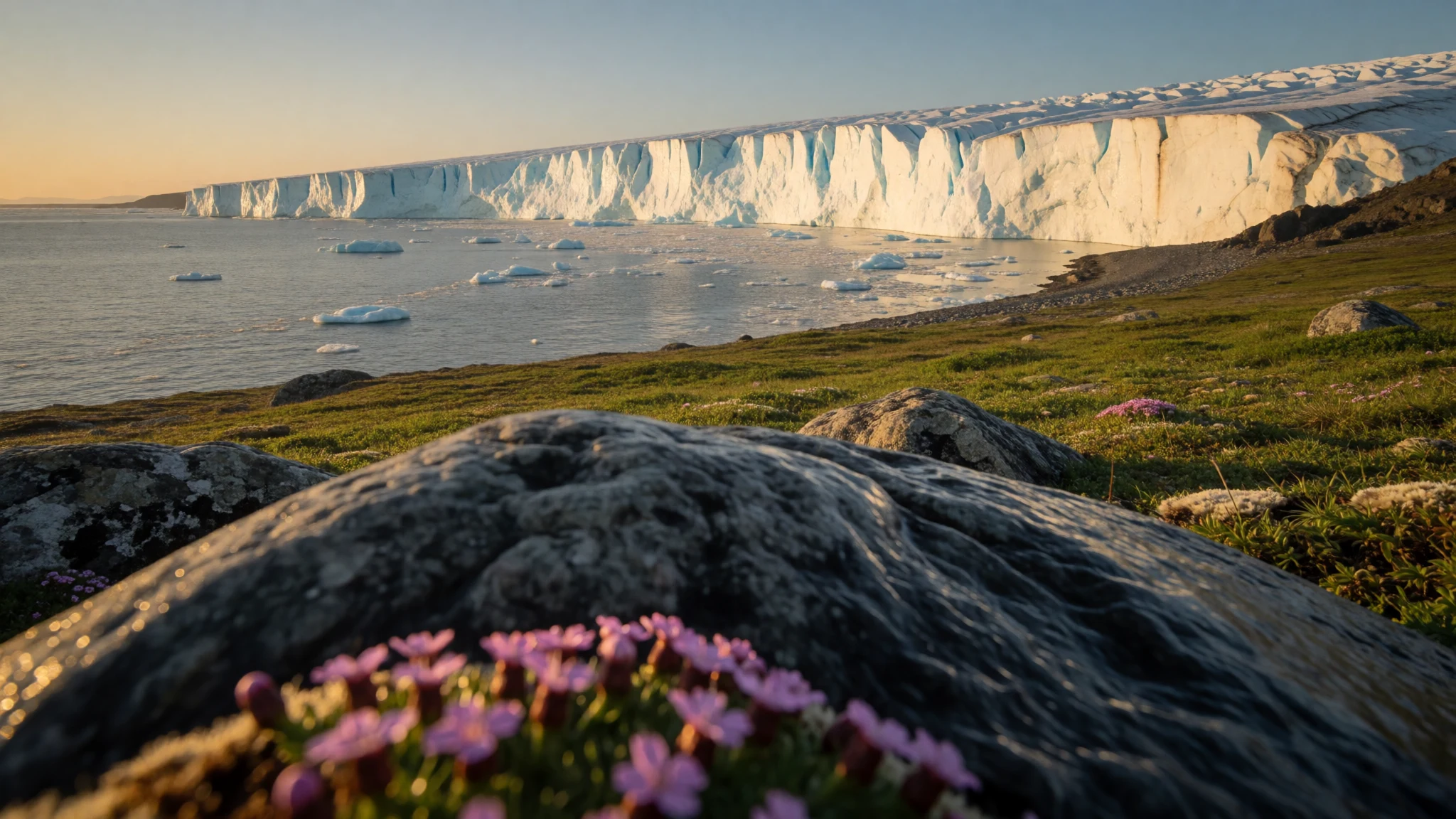
Nordaustlandet is an uninhabited Arctic island of ice caps, tundra, walruses and red granite, reached only by a guided voyage from Svalbard.
The place
Nordaustlandet, also called North East Land, is an island in Svalbard, Norway. It lies north-east of the main island, Spitsbergen, across the Hinlopen Strait. With an area of 14,443 square kilometres it is the second largest island in the archipelago. Nobody lives there, and the whole island sits inside the Nordaust-Svalbard Nature Reserve. Most of the land is buried under ice. Two ice caps, Austfonna and Vestfonna, dominate the map, and the ground left bare in the north is tundra where reindeer graze and walruses haul out along the shore. The rock beneath is varied. The north is old crystalline basement of marble, quartzite, mica schist, gneiss and granite. Volcanic rocks turn up on the Botniahalvøya peninsula and east of Duvefjorden, while around Rijpfjorden the bedrock is a distinctive red granite, pink with feldspar and emplaced in late Silurian times. Layered gabbro and dolerite of Silurian age show at Kapp Laura, on Storøya and on Kvitøya, where Andréeneset is mostly gneiss and granite. This is not a place of towns, paths or shops. It is wilderness approached by sea, where ice, tundra and animals are the whole attraction, and weather and polar bears set the terms. Svalbard offers little infrastructure outside its settlements, so a trip here means going with an organised, guided expedition.
Its story
Nordaustlandet entered European records through whalers and walrus hunters. English hunters sighted its southern point in 1617. The Muscovy Company's map of 1625, built on discoveries made up to about 1622, labelled the land Sir Thomas Smyth's Iland and marked a northern headland as Point Purchas. Dutch cartographers then reshaped the picture. A map of 1662 called it Oostlandt, meaning East Land, and one the following year drew the west and north coasts more clearly, separating them from the Seven Islands, or Sjuøyane. By 1710 a Dutch map showed the island accurately and gave it a name close to the modern one, Het Noord Ooster Land. Its naming is really a story of coastline pieced together slowly from ship decks, with each chart correcting the last. A stranger chapter came in the Second World War. In August 1944 eleven German soldiers were landed on Nordaustlandet to send back weather reports. When the fighting ended they heard of Germany's surrender by radio and asked to be collected. No answer came for months, and they were finally taken off when Norway sent a whaling ship. Their long wait on an empty, ice-bound shore is one of the odder footnotes of the northern war.
What to see
- Austfonna and Vestfonna ice caps — Across the island, seen from the coast
Two ice caps cover much of Nordaustlandet, and from the water the island reads as a long white edge meeting dark sea. Views are normally from a ship or small boat, since the ice itself is for specialists. Cliffs of ice can calve, so guides keep vessels at a careful distance.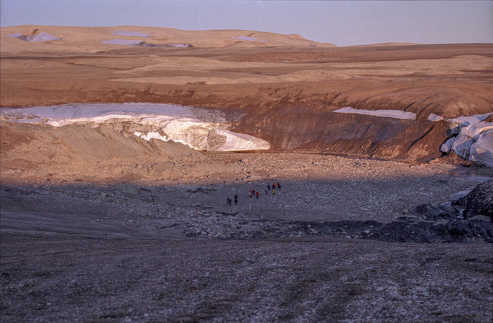
- Walrus haul-outs — Northern tundra shores
The tundra shores of the north are walrus country, and a colony lying on the beach is a sight that guides plan landings around. The animals pile together, heavy and slow on land. Binoculars or a long lens do more than any step closer, and reindeer may graze behind.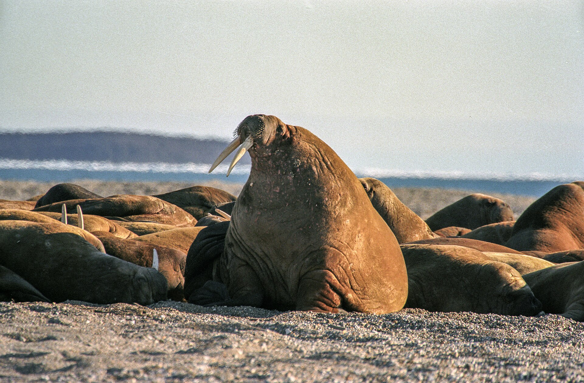
- Rijpfjorden red granite — Rijpfjorden, north coast
Around Rijpfjorden the bedrock is a distinctive red granite, medium grained, with pink feldspar, quartz and two kinds of mica. Seen from the shore, the colour stands out against grey sea and white ice. It is a good stop for anyone curious about how the island was built. - Hinlopen Strait and its wildlife — Between Nordaustlandet and Spitsbergen
The strait between Nordaustlandet and Spitsbergen is the sea passage to watch from deck. Svalbard's waters hold humpback whales, orcas, belugas and narwhals, best looked for in late summer, and seabirds such as Arctic terns, fulmars and puffins. Sightings are never guaranteed, so patience helps. - Kapp Laura, Storøya and Kvitøya — Eastern Nordaustlandet and nearby islands
At the far east of the island and on neighbouring Storøya and Kvitøya, layered gabbro and dolerite of Silurian age form the shoreline. On Kvitøya's Andréeneset the rock is mostly gneiss and granite. These are remote landings, chosen by expedition leaders according to weather and ice. - Rock specimens in the Barentsburg museum — Barentsburg, Spitsbergen
For a closer look at the island's geology without landing, the museum in Barentsburg holds finds from Nordaustlandet, including eye-gneiss and pegmatite from the Duvefjorden complex, probably Middle Proterozoic. Barentsburg is a Russian mining settlement on Spitsbergen, reached from Longyearbyen by cruise or snowmobile.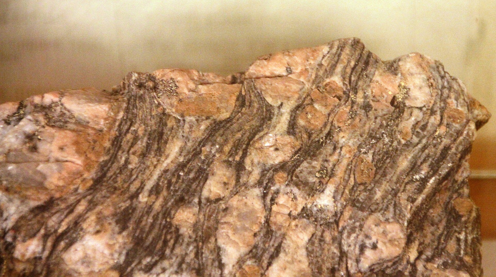
Culture
Nordaustlandet has no residents, so its culture is that of Svalbard and of the people who come to work, research and travel there. The island lies wholly inside the Nordaust-Svalbard Nature Reserve, so the rules of the place are about protection more than hospitality: the animals, tundra and ice are the occupants. Svalbard is Norwegian territory, yet under the Svalbard treaty citizens of many signatory countries can visit and even work there without a visa, and that mix shows in the settlements. Longyearbyen has museums and the world's northernmost church, while the Soviet-era towns of Barentsburg and Pyramiden carry a Russian mining heritage, Lenin statues included. Everyday manners are practical. Indoors, boots come off, and a rack of muddy footwear by the door is the usual signal; some places offer plastic overshoes instead. Out in the wild the culture is one of caution. A rifle is required outside the settlements because of polar bears, and most visitors go with professional guides who know the ground and the rules. Quiet, watchful behaviour is the norm around wildlife, since walrus colonies on the shore are easily disturbed. Conversation on board expedition ships tends to centre on weather, ice and what was seen that day. Take your boots off at the door of buildings in Svalbard, and on a landing keep well back from walruses and follow your guide's instructions without exception.
What to wear
Nordaustlandet has no population, so it has no local dress of its own, and nothing is woven or embroidered there. The nearest thing to tradition in Svalbard is the working clothing of trappers, miners and scientists: wool, windproof cloth and hooded jackets, chosen for use rather than show. Norway's national costume, the bunad, belongs to the mainland and appears at celebrations there. What people wear now in Longyearbyen is plain outdoor kit: technical jackets, insulated boots, wool socks, hats and gloves, with socks or slippers indoors because shoes come off at the door. Visitors heading for Nordaustlandet should dress for wind, spray and cold even in the short summer. Layers work best: a wool or synthetic base, a fleece or down middle layer, and a waterproof, windproof shell with waterproof trousers for boat landings. Add a warm hat, gloves, a neck warmer and sunglasses, because glare off ice and water is strong. Boots should be waterproof, warm and grippy for wet shingle and tundra. Expedition operators often lend rubber boots, so ask before buying. There are no religious sites or modesty rules to plan around on the island itself.
What to eat
- Reindeer — Restaurants in Longyearbyen
Reindeer is a local speciality served in Longyearbyen's restaurants. The animals are the short-legged Svalbard type that also graze Nordaustlandet's tundra. Expect it as a main course, and expect Norwegian prices, since all food in Svalbard is dear. - Seal — Restaurants in Longyearbyen
Seal is the other traditional meat offered at Longyearbyen's restaurants, a reminder of the hunting economy that first brought Europeans north. It is a strong, dark meat. Menus change, so ask what is available. - Drinks with glacier ice — Glacier cruises from Longyearbyen
A popular trick on glacier cruises is a drink served over ice taken from the glacier itself, purified over thousands of years by natural processes. It is a novelty rather than a dish, but it is a pleasing way to mark a day in the Arctic. - Russian vodka — Bars and shops in Barentsburg
In Barentsburg, Russian vodka can be cheap, which stands out in a place where most things are expensive. It is a good accompaniment to a visit to the old mining town and its Soviet-era sights. - Craft beer and wine — Nordpolet, beside Svalbardbutikken, Longyearbyen
Alcohol is duty-free in Svalbard, and the Nordpolet shop in Longyearbyen stocks a wide choice, from craft beers to fine wine. Keep the airline ticket from your arrival, as it is signed to track the purchase allowance.
Plan it
Best time. The short Arctic summer, roughly July and August, when snow has melted from the milder ground, tundra flowers appear and boats can reach the coast. Late summer is also when whales are most often seen. Winter is dark and cold, and not the season for a trip to Nordaustlandet.
How long. 7–10
Getting there. Fly to Longyearbyen Airport (LYR) on Spitsbergen, the only airport taking passenger flights from outside Svalbard; SAS and Norwegian fly from Oslo and Tromsø. Nordaustlandet itself is uninhabited, so the last leg is a guided expedition voyage across or around Spitsbergen to the Hinlopen Strait and the island's coast.
Budget. high
Tips
- Book a guided voyage well ahead and ask the operator about landings, permits and the rules of the nature reserve
- Keep the plan flexible, since weather and ice decide where a ship can land
- Carry a passport: flights go through Norwegian immigration, and Svalbard is outside the Schengen area, so visa-needing travellers need a multiple-entry Schengen visa
- Pack for wind and spray, with sunglasses for glare off the ice
- Budget for Norwegian prices; food and drink in Longyearbyen are expensive
Etiquette
- Take your boots off at the door in Svalbard's buildings
- Keep a distance from walruses and all wildlife and follow your guide's instructions
- Leave nothing behind and do not walk onto the tundra outside agreed routes
Nearby
Sources
- Wikidata Q207374 (CC0)
- Wikipedia: Nordaustlandet (rev 1364054804) (CC BY-SA 4.0)
- Wikivoyage: Svalbard (rev 5341871) (CC BY-SA 4.0)
- Svalbard, Nordastlandet — Jerzy Strzelecki (CC BY 3.0)
- Svalbard, Nordaustlandet, walruses colony — Jerzy Strzelecki (CC BY 3.0)
- Eye-gneiss, Duvefjorden complex — Bjoertvedt (CC BY 3.0)
- Pegmatite, Duvefjorden complex — Bjoertvedt (CC BY 3.0)
- Basissletta — Lars Holmer (CC BY 3.0)
- Camp — Lars Holmer (CC BY 3.0)
- Helicopter — Lars Holmer (CC BY 3.0)
- I am the Walrus — Rob Oo (CC BY 2.5)


