Mount Wilhelm
Mount Wilhelm, Papua New Guinea
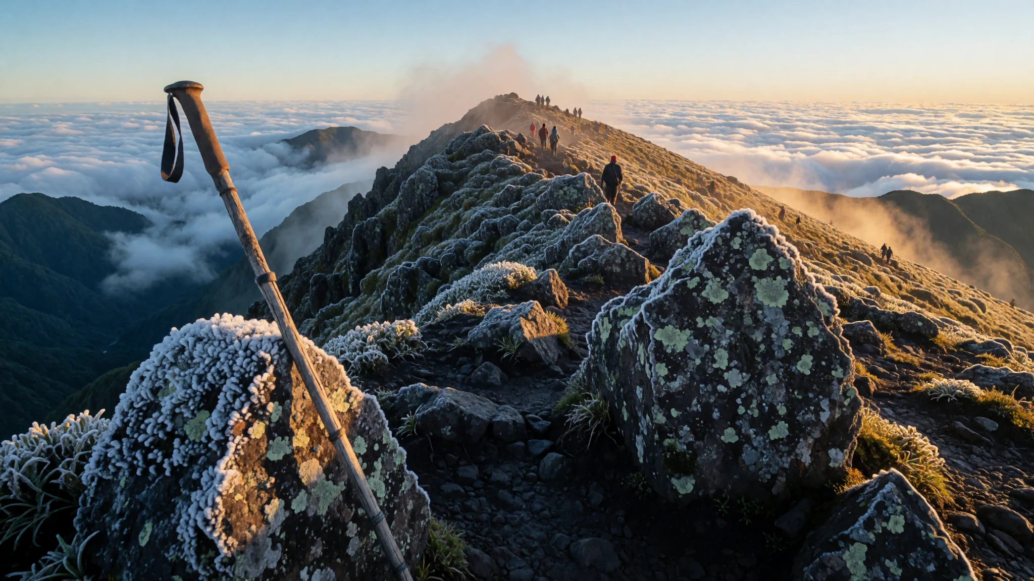
A short, heavy trek to Papua New Guinea’s highest peak, standing at 4,509 m in the Bismarck Range.
The place
Mount Wilhelm rises high above the lush, wet jungles of the Eastern Highlands in Papua New Guinea. Reaching 4,509 metres, it is the country’s tallest mountain and sits at the meeting point of Chimbu, Jiwaka, and Madang provinces. The mountain is part of the Bismarck Range, a series of peaks that often holds rain and cloud around its upper slopes, even when the valleys below are clear. Local people know the peak by names like Enduwa Kombuglu or Kombugl'o Dimbin, reflecting its importance in the region’s oral traditions. Because it lies close to the equator, the weather on the mountain can shift quickly. Trails start in mild, humid lowlands but move rapidly up into cool, fern-filled subtropical forest. As the path climbs further, the air drops, and the landscape opens into alpine zones with patches of native orchids and tree ferns. Vistas from the summit reveal both the northern and southern coasts of the island on clear days. The mountain draws a steady stream of hikers from across Oceania and beyond. Most treks are guided by local porters and chefs who know the terrain well. Lodges on the mountain route and in the nearby Highlands towns provide a mix of local and Western food. This makes the climb an accessible introduction to high-altitude survival without requiring heavy technical gear, just a strong pair of legs and a warm layer for the freezing summit. The journey is about as much about the journey up the steep, muddy track as it is about the view from the top.
Its story
The name Mount Wilhelm has German roots. In 1888, the journalist Hugo Zöller climbed the Finisterre Range and named the Bismarck Range after Otto von Bismarck. He then named four high peaks after his family, including Wilhelmberg, which later became Mount Wilhelm. He thought the nearby Ottoberg was the highest, but surveys later showed Wilhelm to be much taller. The first recorded ascent by a Westerner took place in August 1938. Leigh Vial, a government patrol officer in Papua New Guinea, reached the summit with two local guides, Namba Wan Bare Kuakawa and Gend. Vial noted that snow was present at the very top, a rare sight for a mountain so close to the equator. The mountain has also witnessed tragedy. During World War II, an American F-7A aircraft named 'Under Exposed' crashed into the mountain at 4,000 metres. The pilot was flying too low from Nadzab airbase. Everyone on board perished, and the majority of the debris fell into a high-altitude lake. Some metal parts from that crash can still be seen there by hikers today. An Australian army sergeant died attempting to climb in 1971. A plaque marks the spot where he was last seen. These events show how the mountain demands respect. It is closer to sea level in terms of its base, but the rapid change in altitude is tough on unacclimatised bodies. Hikers must be aware of the history of the terrain they are treading, moving past the ghost of a fast-paced technological shock that left its mark on the silent landscape above the clouds.
What to see
- Summit Plateau — Eastern Highlands
The flat crest of the mountain at 4,509 m is the highest point in Papua New Guinea. On clear days, you can see the blue expanse of the coasts to the north and south. The sky here often parts to show the bright blue, but the summit rocks are frequently covered in fog or frost, making the conditions icy and beautiful. It is the emotional core of the trek, offering a sense of standing above the entire island.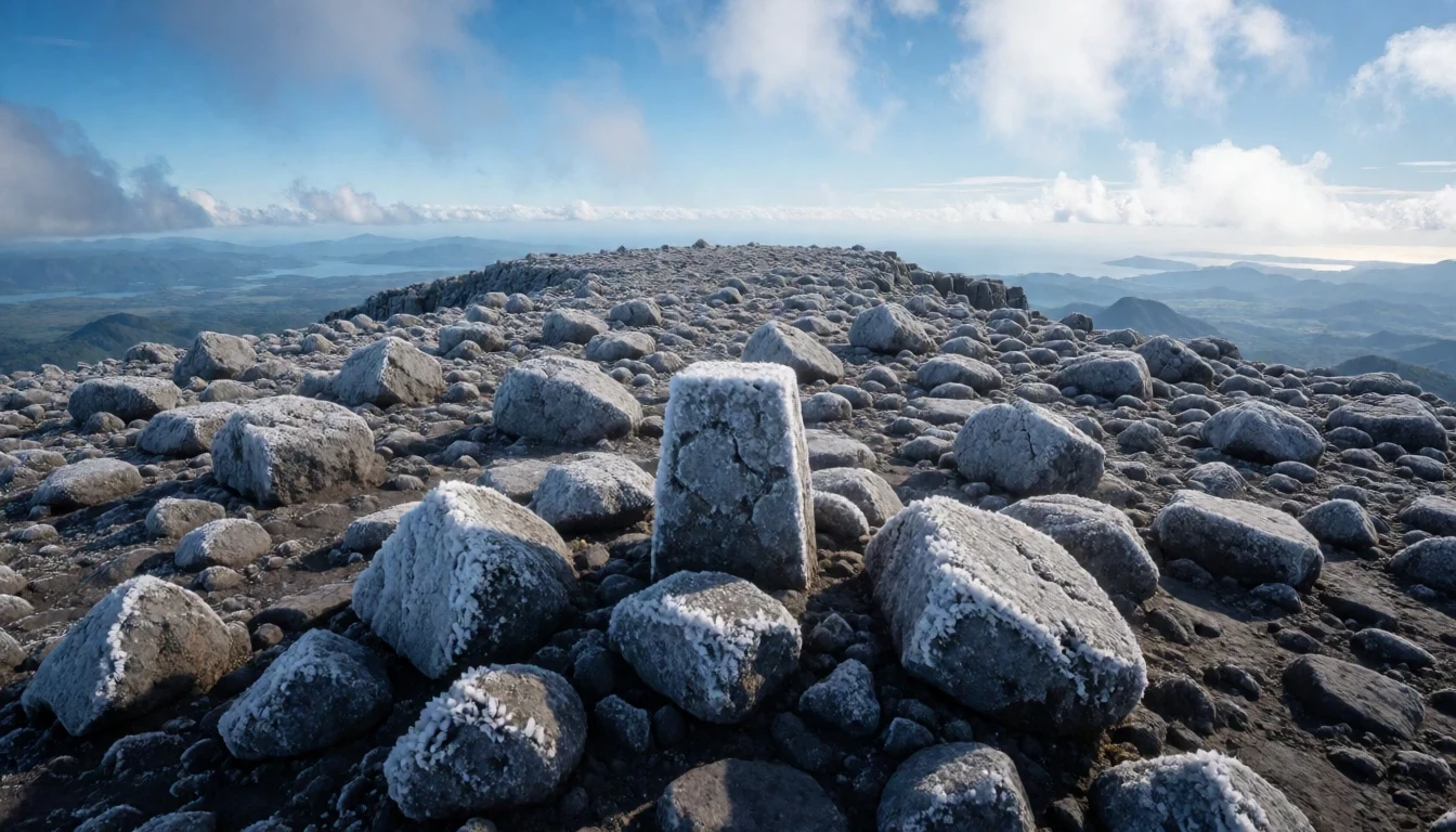
- Twin Lakes — Upper slopes
High on the mountain are two natural lakes that hold the memory of a wartime crash. Most of the wreckage from a 1944 explosion lies submerged in the water. The lakes are quiet and surreal, a frozen place in the high altitude where the wind is cold and sharp. The metal parts remaining on the shore serve as a stark historical marker in an otherwise undisturbed alpine environment.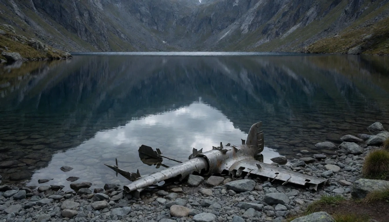
- Montane Forest — Lower valley
The trail begins with a steep push up through the dense, green lower slopes. The trees here are heavy with moss, and ferns reach high into the canopy. It is a walk through a living, dripping world where the air is thick with water vapour. This part of the climb is slow and exhausting, testing the muscles with the steep, muddy grades typical of the tropical environment.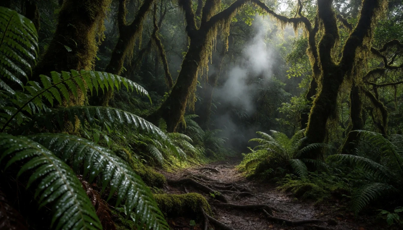
- Open Grasslands — Alpine zone
Above the tree line, the landscape opens into stony, windswept grasslands. This alpine zone is dotted with hardy shrubs and some of the island's native orchids. The views expand dramatically here, and the cold bites deeply into the skin, requiring the heaviest layers of the entire pack. It is a different world compared to the warm, damp forest below.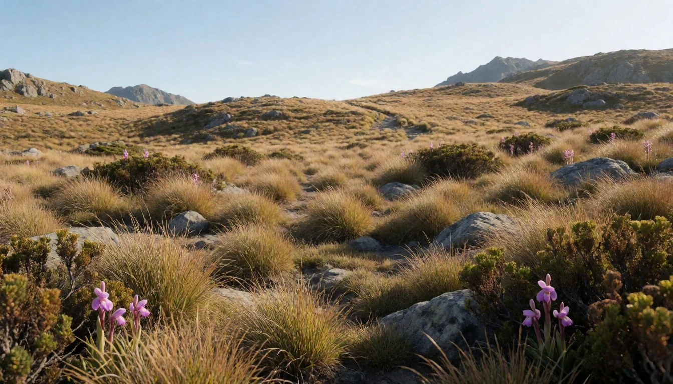
- Reef and Clouds — Viewpoint trail
From the high ridges, the cloud line often sits below, creating a white sea that swallows the valleys and lower forests. This unique atmospheric view makes the mountain feel elevated above the entire region. Watching the sun rise through this thick blanket is a defining moment of the journey, illuminating the green peaks that emerge like islands in the mist.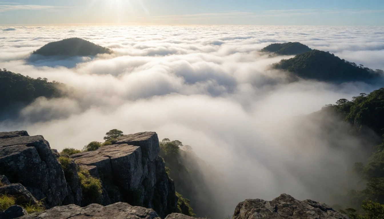
Culture
Papua New Guinea is a complex collection of distinct cultural regions. The Highlands are famous for their unique traditions, traditional dances, and elaborate body paint ceremonies. The people living around Mount Wilhelm follow specific local customs that have been passed down for generations. Interactions in the region often centre on community and respect for the land, which is viewed not just as a resource but as an ancestor. Gengha gestures and shared meals are important ways to build trust and show respect in local villages and at the low-end tourist lodges. Visitors often learn to share a meal from a traditional earth oven during rest days at the lodges. The local tradition is deep and rooted in the landscape. It is a meeting place where history and living traditions mingle, making the area one of the most culturally rich in the Pacific. Visitors should note that making eye contact can be viewed as a sign of disrespect by some people in the Highlands. Always ask for permission before taking photographs of people, even if they are spectacularly dressed for a local festival.
What to wear
Mount Wilhelm country is home to several tribal groups, each with their own style of dress and material culture. Local artisans make intricate items like bilums from tree bark or vines, often with bold, geometric patterns that identify a wearer’s specific lineage. These woven bags are functional and practical, used for carrying items daily. However, for visitors, the climate is the primary focus. The weather near the summit is cold and often wet, so clothing needs to be built for comfort and warmth. Bring multiple layers: a quick-dry base layer, a fleece for the base, and a waterproof shell for the highs. Hikers need sturdy, ankle-high hiking boots because the trails are often steep, rocky, and very muddy. A hat and gloves are essential for the summit. Because the mountain is near the equator, summer means the lowlands are hot, but the high peaks are cold and frequently freezing, so plan for temperature changes from a boiling day to an icy overnight stay.
What to eat
- Mumu — Village gatherings or tourist lodges
A traditional earth oven meal involving meat, kumara (sweet potato), and vegetables buried in hot stones and covered with banana leaves. It takes hours to cook slowly, making it perfect for rest days. The smoky, rustic flavour is a characteristic highland food.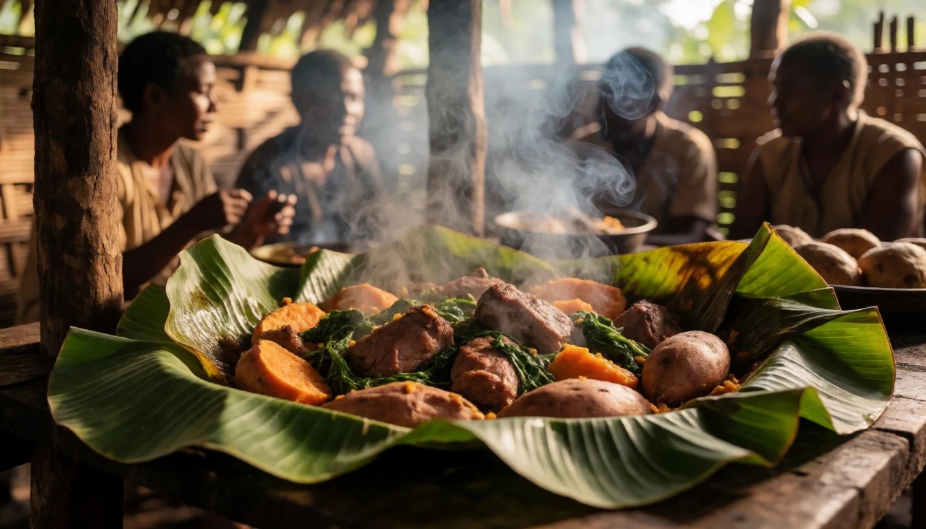
- Kaukau — Highland farms
Cooked sweet potatoes that are a dietary staple across the Highlands. They provide high energy for the hours of climbing required each day. Often served simply boiled or baked in the mumu.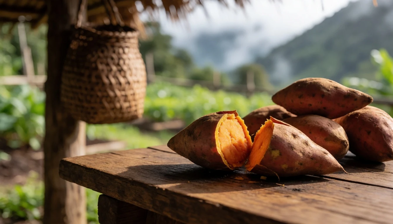
- Fried Fish — Lodges
Fresh catch from the rivers or the nearby large reservoirs, typically cooked with a simple sauce. It provides essential protein and completes the daily meal with a light, local option that is widely available on the mountain routes. - Highland Coffee — Lodge dining halls
Rich, dark coffee grown in the misty highlands. The warmth of a hot cup is appreciated both at the beginning of the morning hike and in the rare warm moments around the evening fire.
Plan it
Best time. The dry months from May to September are the best times to climb Mount Wilhelm. These months bring drier weather and a higher chance of clear skies at the summit, though climbing in late winter brings significant cold.
How long. 3–4
Getting there. Fly into Mount Hagen Airport from Port Moresby, which is closer to the mountain than the capital. From the airport, a 4x4 vehicle drives up steep, winding tracks to the entry point of the trail in the Wapim Valley.
Budget. mid
Tips
- Book the trek three to four months in advance, as slots are controlled by local guides and government permits
- Contact local lodge operators to confirm which months are open to visitors due to seasonal road closure
- Take plenty of cash, as credit cards are generally not accepted in the highlands outside of major towns
- Bring a light water purifier, as boiling water on the mountain is the standard practice
- Altitude sickness is a real risk; start the journey slowly and elevate at dusk
Etiquette
- Show respect for local landowners, as the mountain passes through tribal land
- Do not leave any modern trash on the mountain; bring all waste down with you
- Pay attention to the safety of the guide and porters, who know the local conditions best
Nearby
Sources
- Wikidata Q277441 (CC0)
- Wikipedia (CC BY-SA 4.0)
- Wikivoyage (CC BY-SA 4.0)
- Nomadtales (CC BY-SA 2.1 au)
- Jon Evans (CC BY 2.5)
- Jon Evans (CC BY 2.5)


