Mount Kerinci
Mount Kerinci, Indonesia
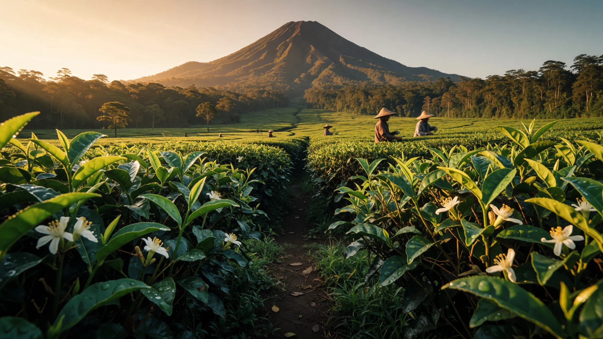
Sumatra’s highest peak offers a rugged volcanic trek through protected forest to a broad crater rim.
The place
Mount Kerinci is an active stratovolcano located in the west-central part of Sumatra, Indonesia. As the highest mountain on the island, it stands at 3,805 metres above sea level. The peak sits on the border of Kerinci Regency in Jambi province and South Solok Regency in West Sumatra province. It forms the most prominent feature of Kerinci Seblat National Park, rising from pine-forested slopes between 2,400 and 3,300 metres to its summit. The base of the cone is 13 kilometres wide and 25 kilometres long, elongated in a north–south direction. At the top, a deep crater 600 metres wide dominates the landscape. This crater is often partially filled by a small lake on its northeast side. The volcano is part of the Barisan Mountains, a chain of volcanoes that spans from Aceh in the northwest to Lampung in the southeast of the island. The surrounding area is known for its lush forest, which supports several endangered species. This includes the Sumatran tiger, which inhabits the lower elevations of the park. The terrain varies significantly from the basin to the summit, requiring hikers to adjust to changing climate zones. The region is remote, with the nearest major cities being Padang to the north and Jambi to the south. Travel to the base requires navigating rural roads and small airstrips. The park protects a vast ecosystem, ranging from lowland rainforest to alpine moorland near the crater. Visitors come primarily for the trekking experience, which usually involves several days of hiking. The summit offers a panoramic view of the surrounding Barisan range and, on clear days, of the distant coast. The volcano has been active in historical times, adding a sense of caution to the adventure. Safety guidelines in the park emphasise weather awareness and proper equipment for the high-altitude section.
Its story
Mount Kerinci has shaped the cultural and geographical identity of central Sumatra for centuries. Local communities in the Kerinci Regency have lived alongside the volcano for generations, adapting their agriculture and traditions to its presence. The mountain is not merely a physical landmark but a central figure in the cosmology of the Kerinci people. In local legend, the volcano is associated with a dragon or spirit that guards the land. This spiritual connection influences how villagers interact with the forest and the mountain’s slopes. Historically, the isolation of the region protected the Kerinci people from external conflicts, allowing their distinct customs to survive. The forested slopes of Kerinci Seblat National Park served as a buffer zone, limiting interaction with coastal trade routes. This seclusion helped preserve traditional ceremonies, language, and craft, which are still practiced in the village of Kerinci. However, the mountain’s activity has also brought danger. Eruptions in the past centuries forced settlements to relocate and altered the landscape significantly. The modern era saw the area become a focus for conservation, recognising the threat posed by logging and hunting to species like the Sumatran tiger. Today, the balance between preservation and access is a central theme. The national park status aims to protect the biodiversity while allowing sustainable tourism. Hikers now follow trails that were once used by traders and spiritual seekers. The journey to the summit has evolved into a symbol of endurance, attracting climbers from across Indonesia and beyond. The story of Mount Kerinci is one of resilience, where human and natural history are deeply intertwined in the rising slopes and mist-filled valleys.
What to see
- Summit Crater — Summit
The final ascent leads to the rim of the main crater, which offers a dramatic view of the volcanic bowl. The area is alpine, with limited vegetation and strong winds. It is a common stop for hikers before descending back to the refuge shelters. The view here is stark and impressive, contrasting with the green forests below. Time should be managed carefully due to the changing weather conditions at this elevation.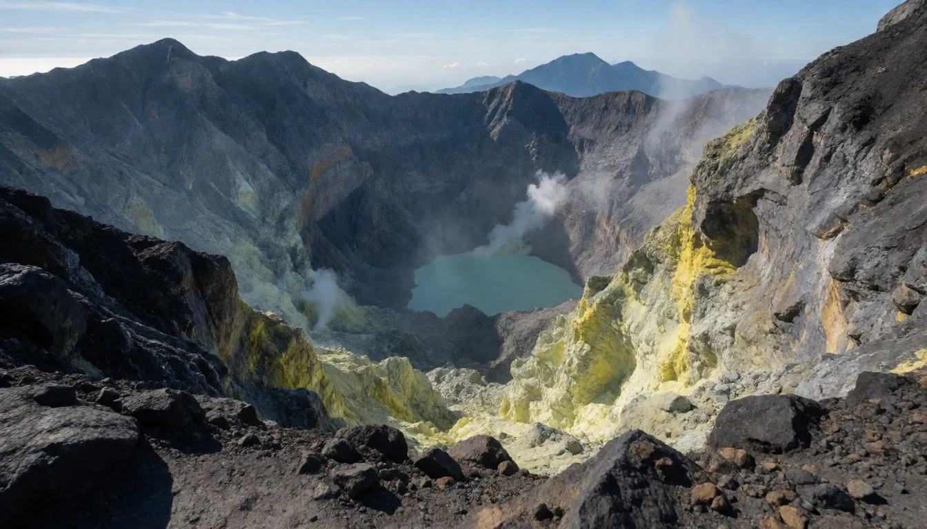
- Lake Gunung Tujuh — Kerinci Seblat National Park
Situated at 1,996 metres, this is the highest caldera lake in Southeast Asia. It lies behind the main peak within the national park. The lake is a popular resting point on the trek, offering a calm, scenic environment amidst the mountainous terrain. Visitors are encouraged to respect the natural surroundings and avoid leaving any waste behind. The clear waters reflect the surrounding peaks, making it an ideal spot for photography during the dry months.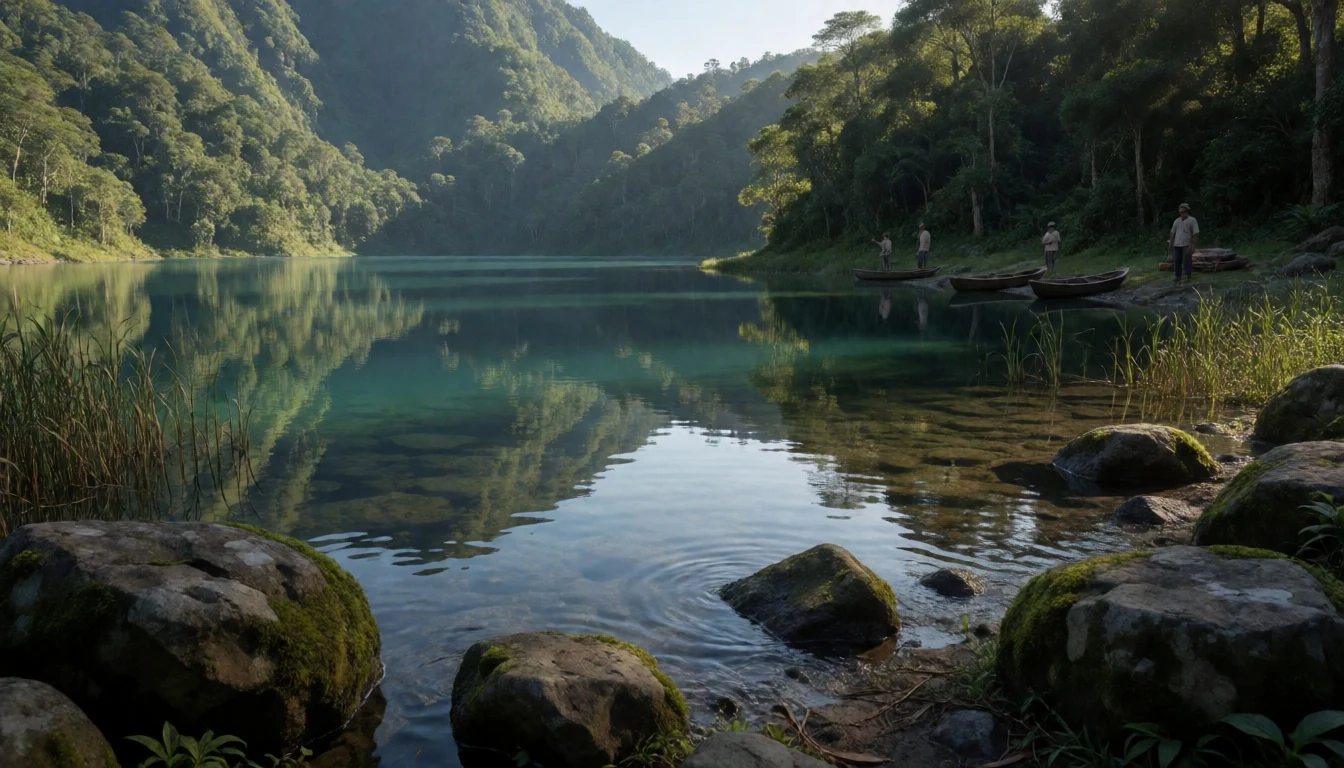
- Pine Forest Zones — Upper Slopes
Upper slopes between 2,400 and 3,300 metres are covered in pine forest. This zone provides a cooler climate and a distinct atmosphere compared to the lowlands. The trees form a dense canopy that filters the sunlight, creating a serene hiking environment. Birdwatchers often spot local species here, including the Sumatran Paradise Flycatcher. The trail through this section is manageable, with moderate gradients and well-defined paths. It serves as an acclimatisation phase for climbers heading to the higher rocky terrain.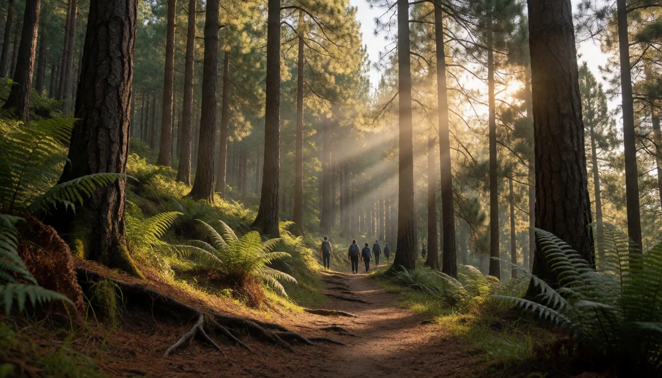
- Refuge Shelters — Trail Route
Basic stone shacks with hammocks are located along the main route. They provide necessary rest points after long days of walking. The shelters are simple, offering protection from wind and rain but minimal comfort. Climbers should bring their own sleeping bags and warm clothing. These structures are essential for the trek, allowing hikers to break up the journey and recover. The atmosphere in the shelters is social, with climbers sharing stories and checking weather forecasts.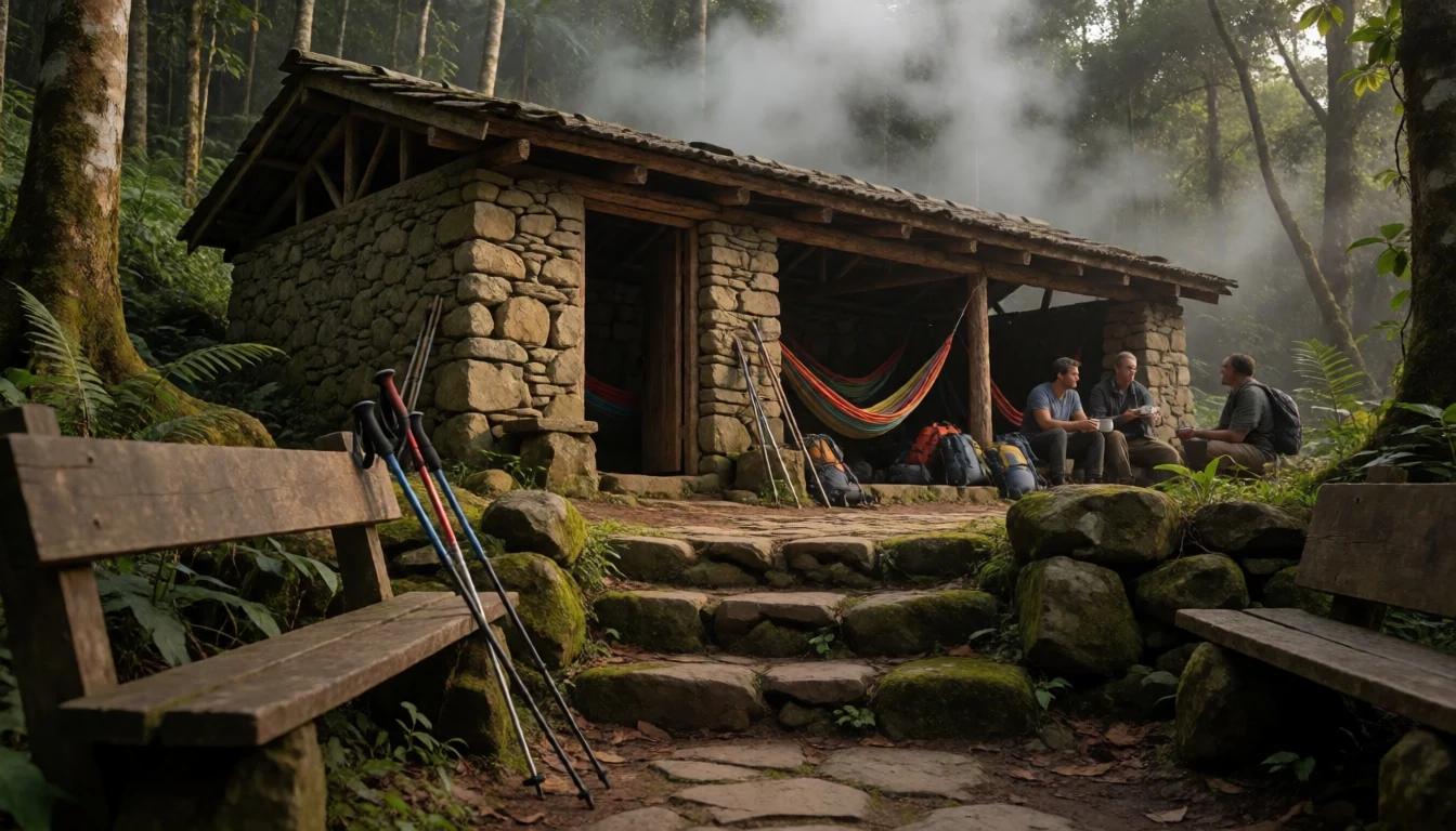
- Base Village — Sungai Penuh
Sungai Penuh serves as the administrative and logistical hub for the park. It is a quiet town with a rural atmosphere, located at the foot of the mountain. The town offers limited accommodation and food options suitable for hikers. Guides and porters are typically arranged here before embarking on the trek. The local market provides fresh produce and supplies for the journey. It is the last place with reliable mobile signal and banking facilities. Visitors should prepare all necessary documents and permits in this town.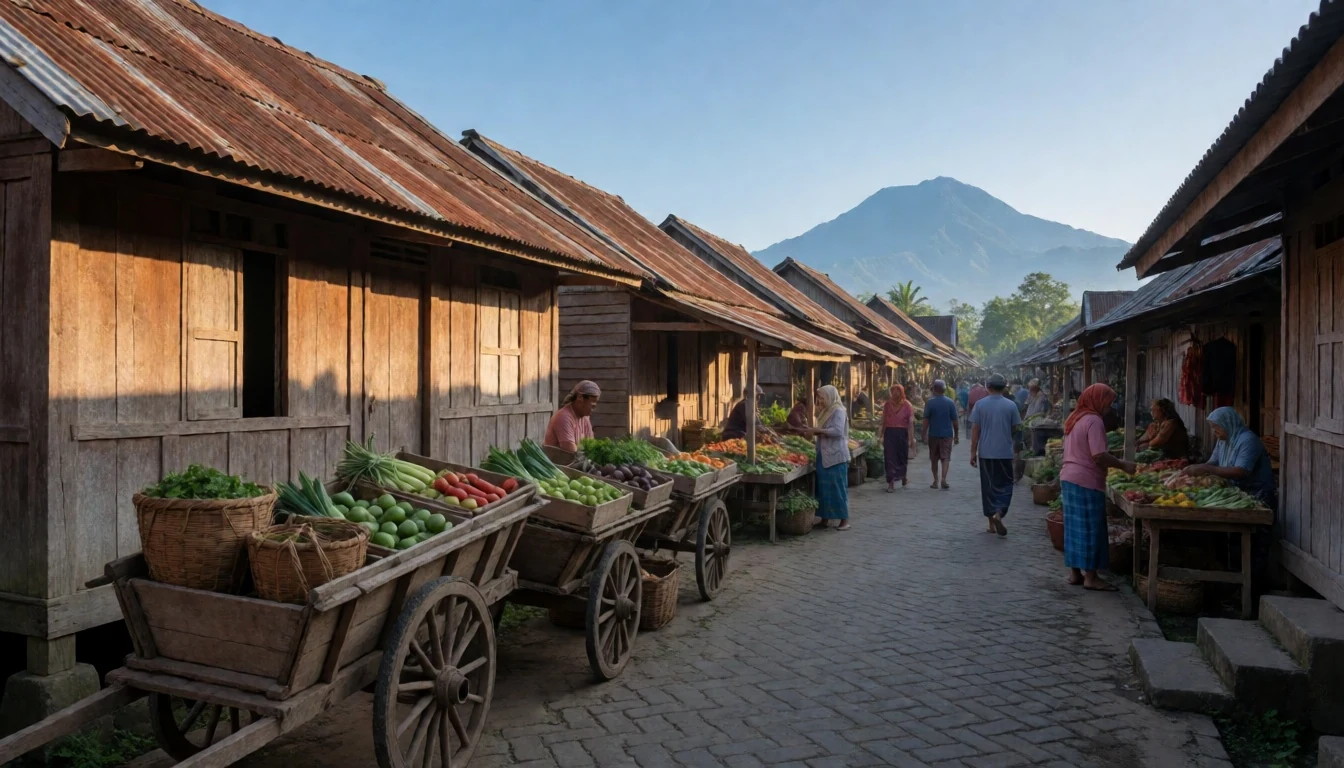
Culture
The culture of Mount Kerinci is deeply rooted in the traditions of the Kerinci people, who have inhabited the region for centuries. Their society is matrilineal, which is unusual in Indonesia, particularly within the broader Minangkabau cultural sphere. Women often hold significant roles in property ownership and social decision-making. The local language, Kerinci, is a dialect of the western Malay group, with its own unique scripts and oral histories. Traditional ceremonies, known as ritual adat, are still performed to honour the spirits of the land and ancestors. These events involve elaborate feasts, music, and dance, and they mark important life transitions. The community has a strong connection to the forest, which is viewed as a sacred resource. Agricultural practices often involve shifting cultivation, carefully managed to prevent erosion. Craftsmanship, particularly in weaving and handicrafts, is a notable aspect of local culture. Visitors to the base villages may encounter households that maintain these traditions. It is important to approach these cultural practices with respect and curiosity. Asking permission before photographing people or private rituals is essential. The cultural landscape is distinct from the沿海 areas, offering a glimpse into an isolated way of life. Respect for local customs ensures a positive interaction and supports the preservation of heritage. Engaging with local guides provides insight into these traditions. The etiquette of the region emphasizes humility and patience. Do not rush through village visits, as building rapport is valued. Dress modestly, especially when entering homes or religious sites. Avoid touching sacred objects without explicit invitation. This respectful approach allows for a deeper understanding of the community. Always ask before photographing individuals, as some may consider it inappropriate. Tipping is not customary but appreciated for local services. Bear in mind that the rural pace may differ from urban expectations.
What to wear
Traditional dress in the Kerinci region reflects the blended Malay and Minangkabau influences. Men often wear the songkok, a black pipeless cap, paired with a sarung and a shirt. Women may wear the baju kurung and a selendang shawl, often made of silk or cotton. These garments are vibrant, featuring intricate patterns that signify status or occasion. However, daily wear has shifted towards practical, modern clothing. Locals in the town of Sungai Penuh typically dress in casual, breathable fabrics suitable for the tropical climate. T-shirts, trousers, and simple dresses are common. The transition to traditional dress occurs during festivals, weddings, and religious ceremonies. For hikers, the fashion choice is dictated by the mountain environment. The climate changes rapidly from humid lowlands to cold, windy alpine zones. Visitors should layer their clothing to adjust to temperature drops. A warm fleece, a waterproof jacket, and sturdy hiking boots are essential. The footwear must be capable of handling rocky, uneven terrain and occasional mud. Headgear, such as a beanie, is useful for the summit. In the base village, comfortable shoes are sufficient. As you ascend, the need for water-resistant materials grows. Avoid cotton for the upper slopes, as it retains moisture and causes chilling. A hat for sun protection and a glove pair for the wind are practical additions. The clothing hierarchy is functional: base layer for sweat, insulation for warmth, and a shell for weather. This layering system ensures comfort during the lengthy trek.
What to eat
- Rendang Kerinci — Sungai Penuh town centre
A slow-cooked beef dish with coconut milk and spices, distinct for its sweetness. It is a staple in local homes and restaurants. The flavour is deep and rich, developed over hours of cooking. It is often served with rice and side vegetables. The version in Kerinci differs slightly from the Minangkabau counterpart. Look for it in family-run eateries near the base village.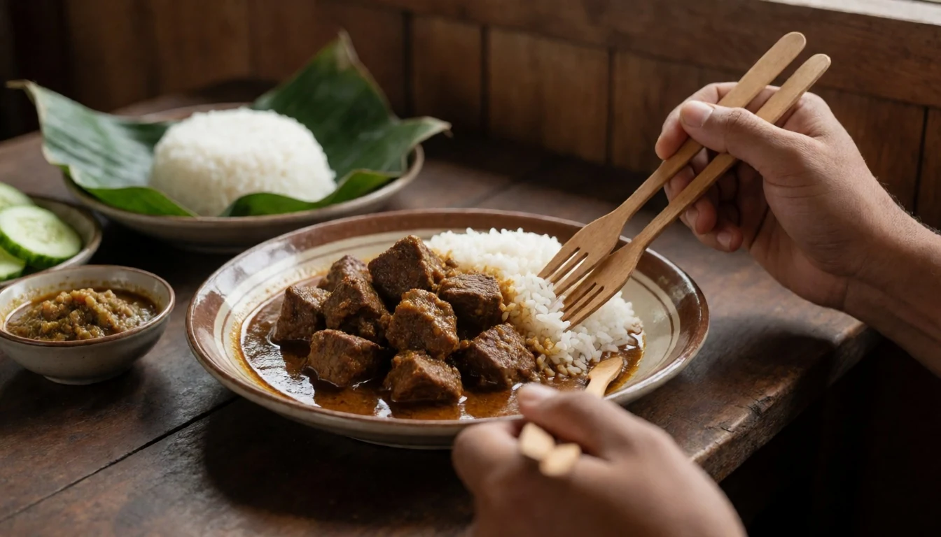
- Nasi Kuning — Local markets
Yellow rice cooked with turmeric, served with ayam goreng and spices. It is a traditional celebratory dish, also available for daily meals. The colour comes from the turmeric, adding an earthy taste. It is commonly found at market stalls and local canteens. The accompanying fried chicken is usually crispy and well-spiced. This dish provides energy for the start of the day.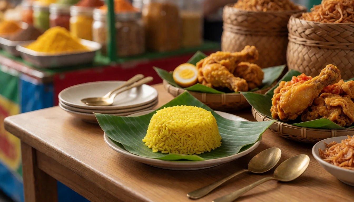
- Kerinci Tea — Tea estates near Kayu Aro
High-altitude tea grown in the surrounding pine forests. It is less tannic than lowland teas and has a milky, smooth taste. Many tea estates in the area sell fresh leaves or packaged tea. It is a popular beverage among locals and visitors. The ritual of drinking the tea is often accompanied by conversation. It can be found in homestays and small farms in the district. - Gejampang — Homestays and local homes
A local rice dish often accompanied by vegetable relishes and fried sides. It is a comfort food for the mountain climate. The preparations vary by household but generally feature simple, fresh ingredients. It is a hearty option for hikers needing sustenance. The dish is typically served warm and eaten with a small spoon. It reflects the agricultural roots of the community. - Ikan Asin — Street vendors and markets
Preserved salted fish, often grilled or fried. It is a common accompaniment to rice meals in the region. The fish is usually mackerel or threadfin, cured in salt for preservation. It has a strong flavour and is often eaten with a slice of tomato and chili. It is an affordable and filling part of the local diet, found in almost every household.
Plan it
Best time. March to April and October to November offer the driest conditions. The rainy season brings heavy downpours and slippery trails. Avoid extreme heat, which is slightly cooler at altitude but persistent in the lowlands.
How long. 3-4
Getting there. Fly to Jambi City's Sultan Thaha Airport (DJB) or Sungai Penuh's Depati Parbo Airport (KRC). From there, take a vehicle to the park entrance. The last leg involves a 4x4 or local car for rough roads.
Budget. mid
Tips
- Acclimatise to the altitude before summitting, as the air is thin near the crater.
- Carry a headlamp for early morning starts and evening descents.
- Bring sufficient cash, as ATMs are scarce in the region.
- Hire a local guide to navigate the trails and ensure safety.
- Check the trail conditions with park authorities before departure.
Etiquette
- Pack out all waste, including biodegradable items, to protect the ecosystem.
- Do not feed wildlife, as it alters their natural behaviour.
- Respect the silence of the alpine zone, as the landscape is fragile.
- Obey park regulations regarding campfires and swimming in certain lakes.
Nearby
Sources
- Wikidata Q827728 (CC0)
- Wikipedia (CC BY-SA 4.0)
- Wikivoyage (CC BY-SA 4.0)
- Photo: Uprising-mount_kerinci.jpg (CC BY 3.0)
- Photo: MtKerinchi_view_into_crater.jpg (CC BY 3.0)
- Photo: Burung_hitam_gunung_kerinci_3805mdpl.jpeg (CC BY 3.0)
- Photo: Danau_Gunung_Tujuh_in_Kerinci_Seblat_National_Park.jpg (CC BY-SA 4.0)
- Photo: Danau_Gunung7_TNKS.jpg (CC BY-SA 4.0)
- Photo: Ekspedisi_ke_Gunung_Kerinci_3805mdpl.jpg (CC BY-SA 4.0)
- Photo: Gunung_kerinci_-_Jambi.jpg (CC BY-SA 4.0)
- Photo: Gunung_Kerinci_dan_Bukit_Tengah_dilihat_dari_Desa_Hamparan_Pugu,_Semurup.jpg (CC BY-SA 4.0)


