Mount Agung
Mount Agung, Indonesia
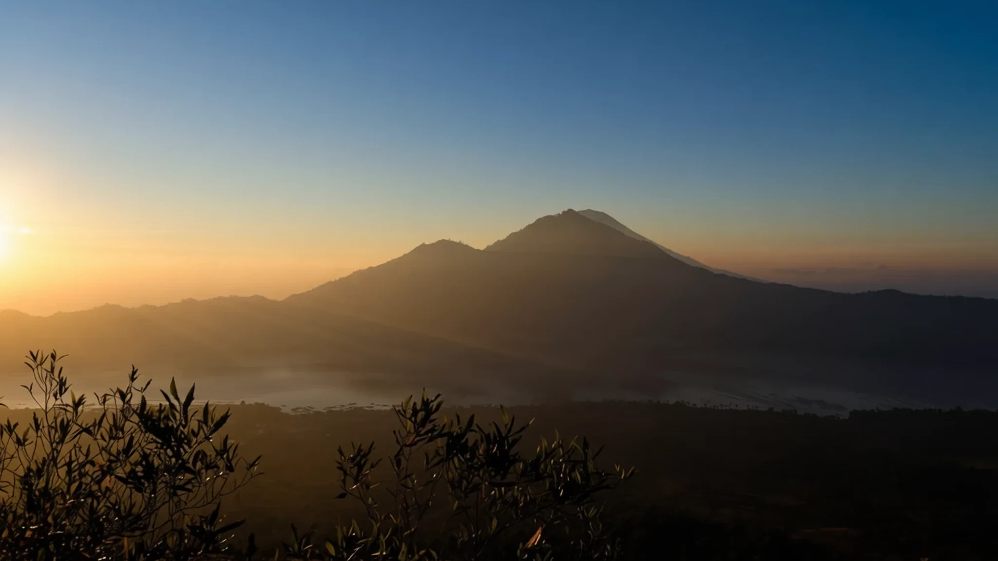
The highest peak in Bali, where the mountain is the island's spiritual centre and daily life revolves around its eruptions.
The place
Mount Agung, known locally as Gunung Agung, defines the geography and spirit of Bali. Rising to an elevation of 3,142 metres, this stratovolcano is the island's highest point and dominates the landscape from a great distance. The cone is remarkably symmetrical, a shape that has held the attention of Balinese people for centuries. It sits in Karangasem Regency, southeast of Mount Batur, and acts as the backbone of a volcanic chain that shapes the island's rainfall and climate. The area around the mountain is lush, with the volcanic soils supporting dense forests and the agricultural terraces that feed the local population. Travelers often see the peak capped in clouds, a common feature due to its height and the island's tropical humidity. While the summit is a significant climb, the mountain's influence extends far beyond the trailheads. It anchors the northern part of the island, affecting road access and daily routines in nearby villages. The surrounding terrain is a mix of rugged slopes and fertile valleys, particularly in the Sidemen and Selat areas where the greenery is most vibrant. Because it is an active volcano, the mountain's status can change, occasionally requiring closures for safety. For visitors, this means checking local updates before planning a trip. The visual dominance of Agung is a constant reminder of the natural forces that shaped the island, making it a focal point for both spiritual practice and geological study. Walking through the foothills, one notices the integration of nature and nurture, where rice paddies meet wild forest and the mountain looms over all. It is a place where the physical presence of the volcano is felt in the weather, the land, and the lives of the people who live in its shadow.
Its story
The history of Mount Agung is marked by powerful eruptions that have shaped both the landscape and human memory. A significant event occurred in 1843, recorded by Heinrich Zollinger, who described the mountain awakening after a long silence. He noted the initial earthquake shocks followed by the release of ash, sand, and stones. However, the eruption that defined the mountain for the modern world happened in 1963. Beginning in February, the volcano unleashed lava flows that travelled down the northern slope, covering a distance of 7 kilometres over the following weeks. The most destructive phase arrived in March, when debris was sent high into the air, generating massive pyroclastic flows. These flows devastated villages and resulted in a high death toll, with estimates ranging from 1,100 to 1,500 people killed directly. Additional fatalities came later from cold lahars triggered by heavy rainfall. The drama of the 1963 event includes the fact that lava flows missed the Besakih Temple, at the foot of the mountain, by mere metres. Repeated eruptions occurred again in 2017–2019, reminding residents of the ongoing risk. Balinese legend offers a different explanation for the mountain's existence. Stories tell of the Hindu God Pasupati splitting Mount Meru, the axis of the universe, to create Agung from a fragment. This myth underscores the volcano's spiritual weight, making it not just a geological feature but a sacred entity. The tension between the mountain's destructive power and its revered status is central to the local narrative.
What to see
- Besakih Temple — Karangasem Regency
The Mother Temple of Bali is a complex of 23 shrines situated on the southern slopes of the mountain. It is the holiest site on the island, attracting pilgrims and visitors alike. The main temple is named Pura Penataran Agung, meaning the Great Temple. The location is dramatic, with views of the crater and the surrounding valleys. Visiting hours may be restricted during specific religious days or if the volcano status is elevated, so checking local guidance is essential before making the trip.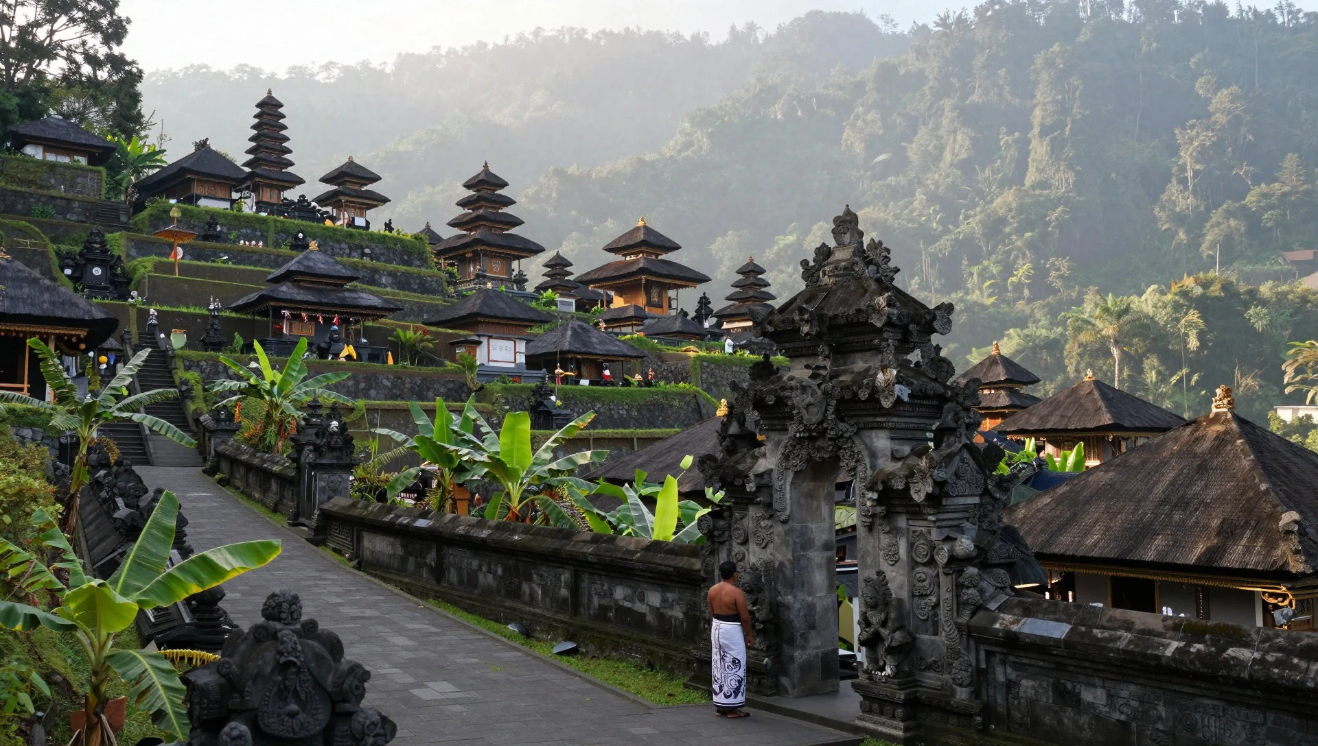
- Sidemen Valley — Karangasem Regency
A scenic area in the foothills of Mount Agung, known for its lush landscapes and rice terraces. The drive through the region between Karangasem and Rendang is widely regarded as one of the most beautiful in Bali. Stops in villages like Selat offer opportunities for gentle hikes and interaction with local guides. The valley provides a cultural contrast to the volcanic peak, showcasing the agricultural lifestyle that has sustained the area for generations.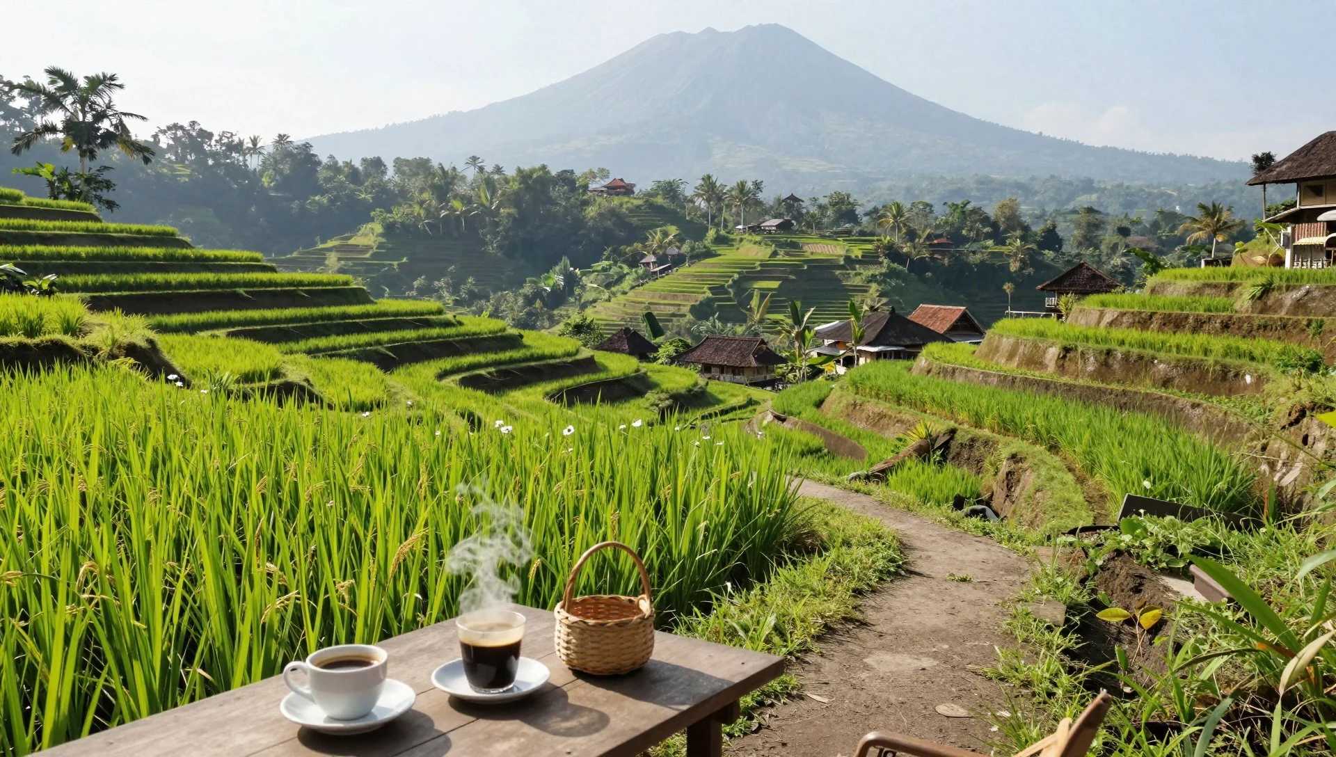
- Pura Pasar Agung — Selat, Karangasem
Located in the village of Selat, this temple is one of Bali's nine directional temples. It serves as a spiritual marker and is situated close to the start of several ascent routes up the mountain. The architecture is typical of Balinese temple design, with intricate carvings and open courtyards. Visitors can observe daily rituals and learn about the temple's role in the regional religious calendar. It is a quieter alternative to the busier sites on the southern coast.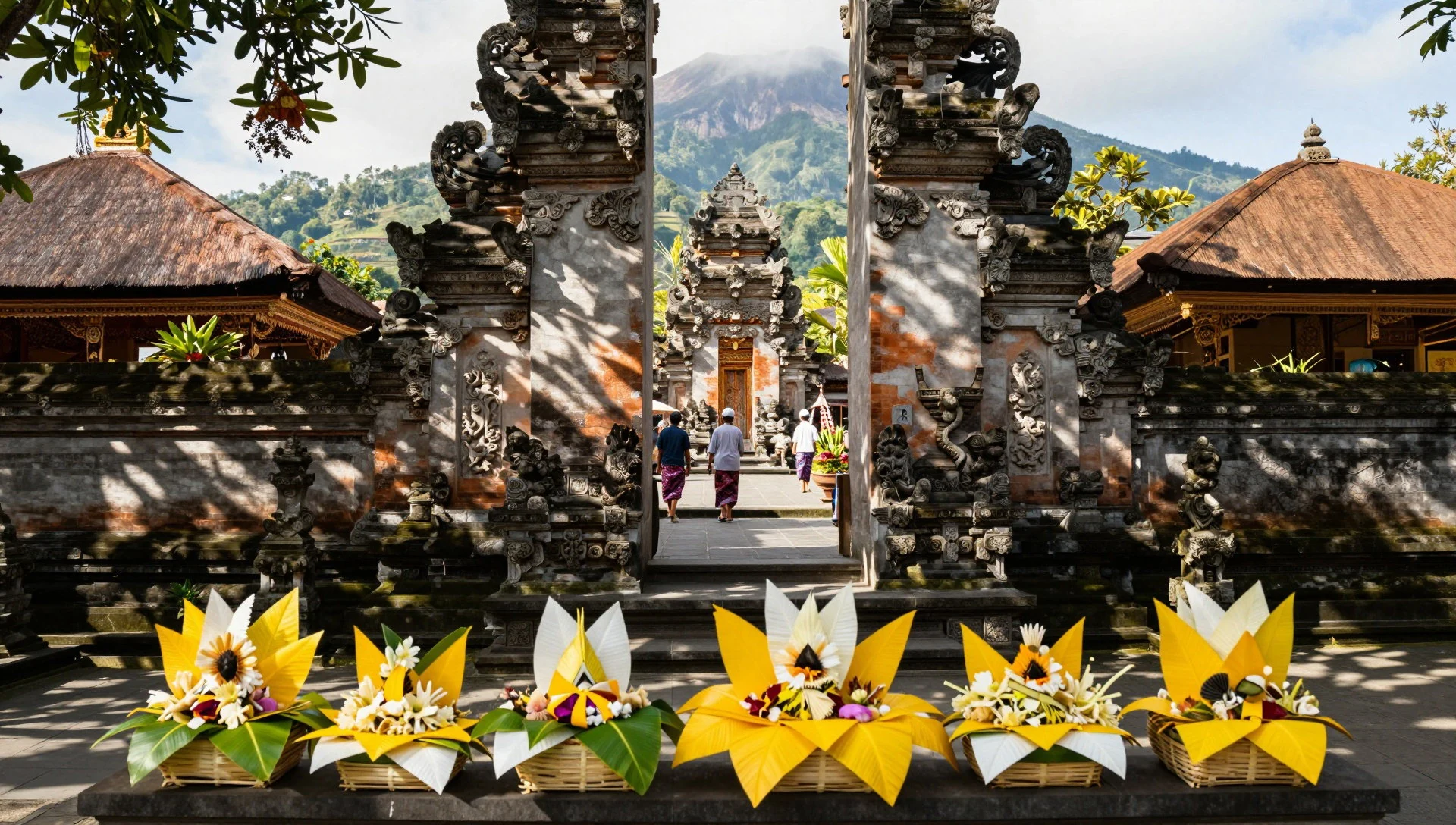
- Summit Ridges — Mount Agung
For those undertaking a guided climb, the upper ridges offer panoramic views across Bali and, on clear days, the distant peak of Mount Rinjani in Lombok. The terrain is rugged and the weather can change quickly, often cold and windy. Access is strictly controlled by park authorities, and permission must be obtained in advance. The experience is demanding, requiring good fitness and proper equipment, but the perspective from the top is unique.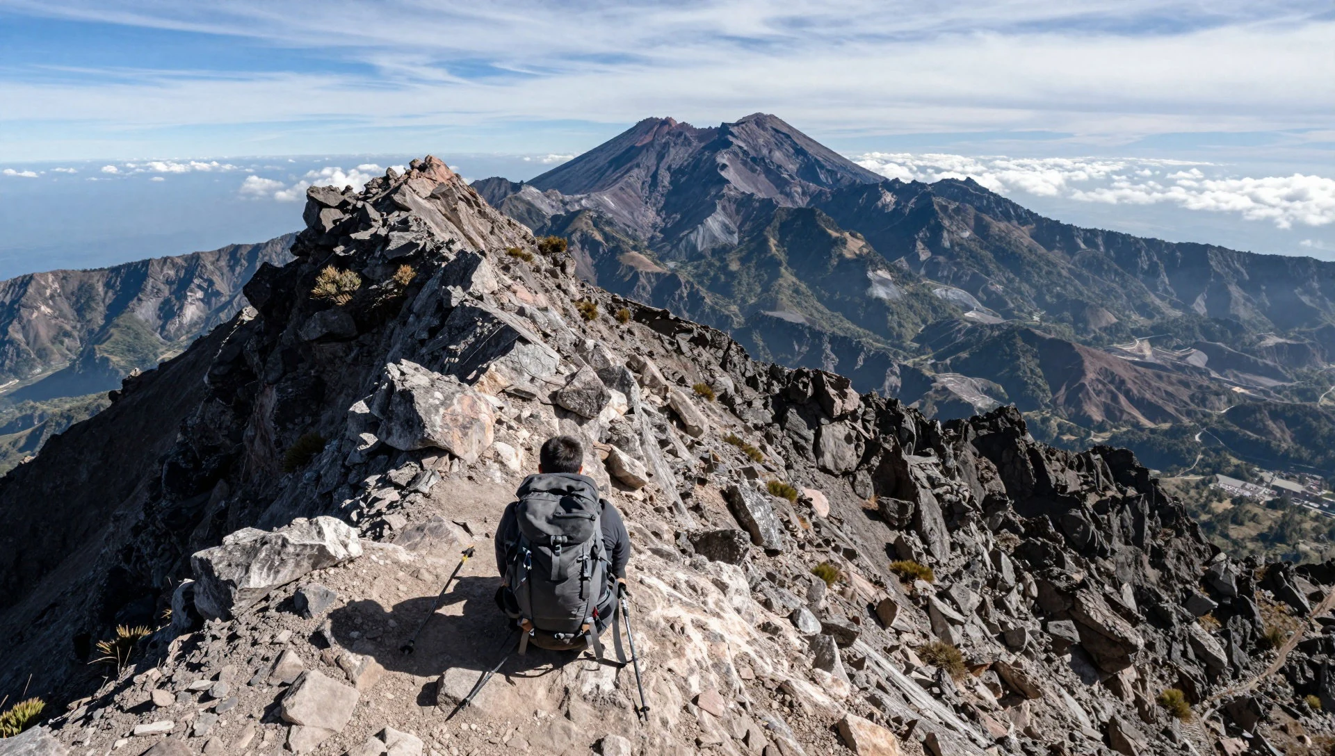
- Mount Batur — Karangasem Regency
Located to the northwest of Agung, this active volcano provides a contrast in shape and scale. The crater lake at its base is a popular destination for short treks and morning walks. The drive between the two mountains offers varied scenery, from highland plateaus to dense tropical forests. Understanding the relationship between these two volcanic peaks helps visitors appreciate the dynamic geological history of the island.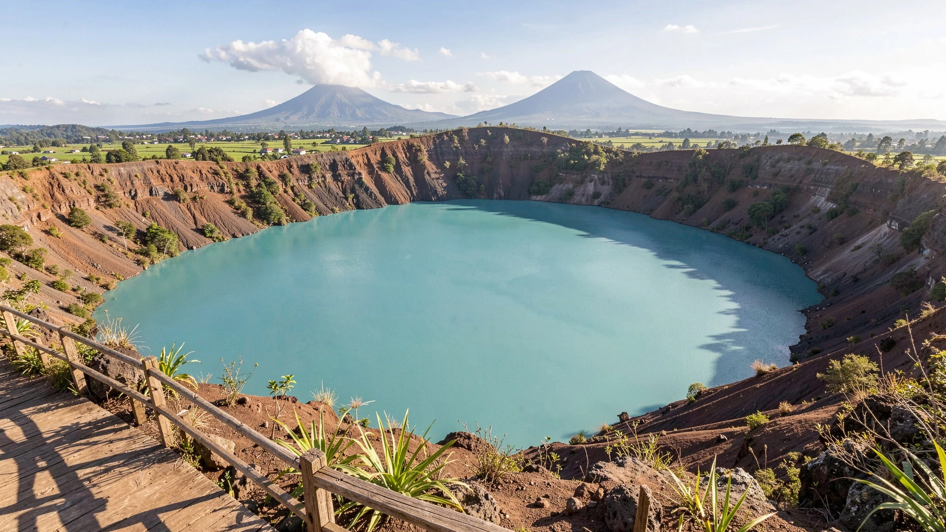
Culture
Mount Agung is inseparable from the spiritual life of Bali. As a stratovolcano, it is not just a geographical feature but a living entity in the Balinese Hindu belief system. The mountain is considered the abode of the gods, and this belief dictates how people interact with it, from the layout of villages to the timing of agricultural activities. The 1963 eruption is a pivotal event in modern memory, reinforcing the idea that the mountain's moods must be respected. Communities live in a state of cautious coexistence with the volcano, performing rituals to maintain harmony and seek protection from its destructive potential. The influence of Agung extends to the Balinese calendar, with specific days avoiding travel to the mountain or engaging in certain activities. For visitors, understanding this cultural context is essential to interacting with the mountain and its people with sensitivity and awareness. The relationship is one of deep reverence, where nature and spirituality are intertwined. Visitors should observe local practices and seek guidance from residents when planning activities near sacred sites. Dressing modestly and behaving respectfully in temple areas is a key part of this cultural etiquette.
What to wear
Traditional Balinese dress involves specific garments for ceremonial occasions, such as the kebaya, a fitted blouse often paired with a sarong. These outfits are typically made from batik orsongket textiles, featuring intricate patterns that hold symbolic meaning. In daily life, in the highlands around Mount Agung, clothing shifts as weather changes. Residents now commonly wear practical shirts and trousers suitable for the cooler altitudes and agricultural work. They use local cotton fabrics that breathe well in the humidity but provide warmth when temperatures drop. For visitors, the recommended attire should respect local norms and the ambient conditions. Wear lightweight, breathable clothing during the day, but bring a warm layer for the night, especially if heading above 2,000 metres. Sturdy footwear is essential for the uneven terrain, particularly near the summit. Modest dress is required when visiting temples, covering shoulders and knees. Avoid overly casual or revealing clothing in sacred areas, as this is considered disrespectful. Comfort and respect for the local environment should guide clothing choices.
What to eat
- Nasi Campur — local eateries in Sidemen
A mix of rice and various side dishes, reflecting the island's agricultural abundance. This hearty meal is perfect for fueling a day of exploration. Served with vegetables, meat, and sambal, it offers a balanced taste of the local diet.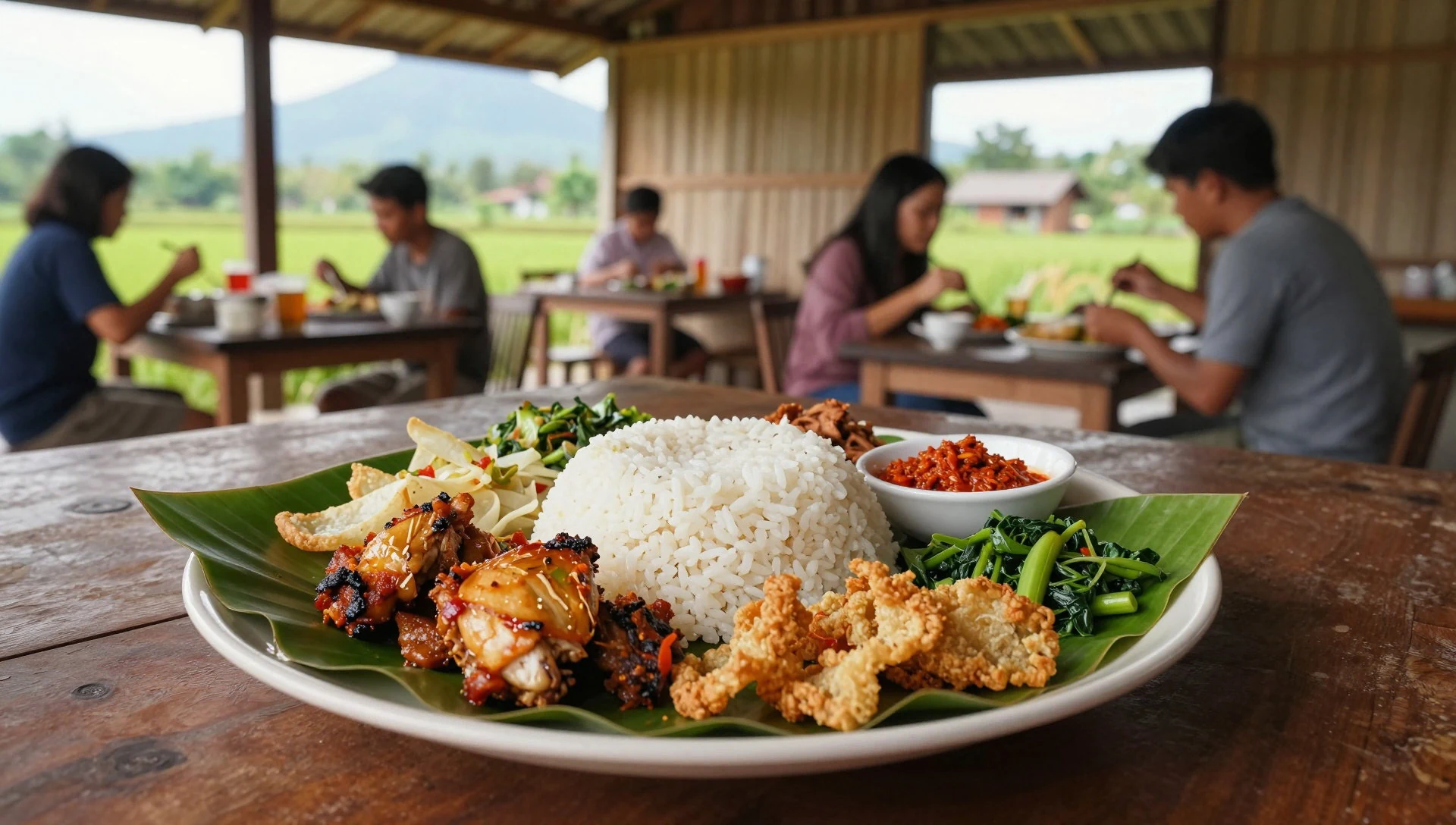
- Sate Lilit — street vendors in Amed
Minced fish or meat mixed with spices and wrapped around a lemongrass stick, then grilled. The smoky flavour is distinct and pairs well with a dipping sauce. It is a popular street food among locals and visitors alike during evening hours.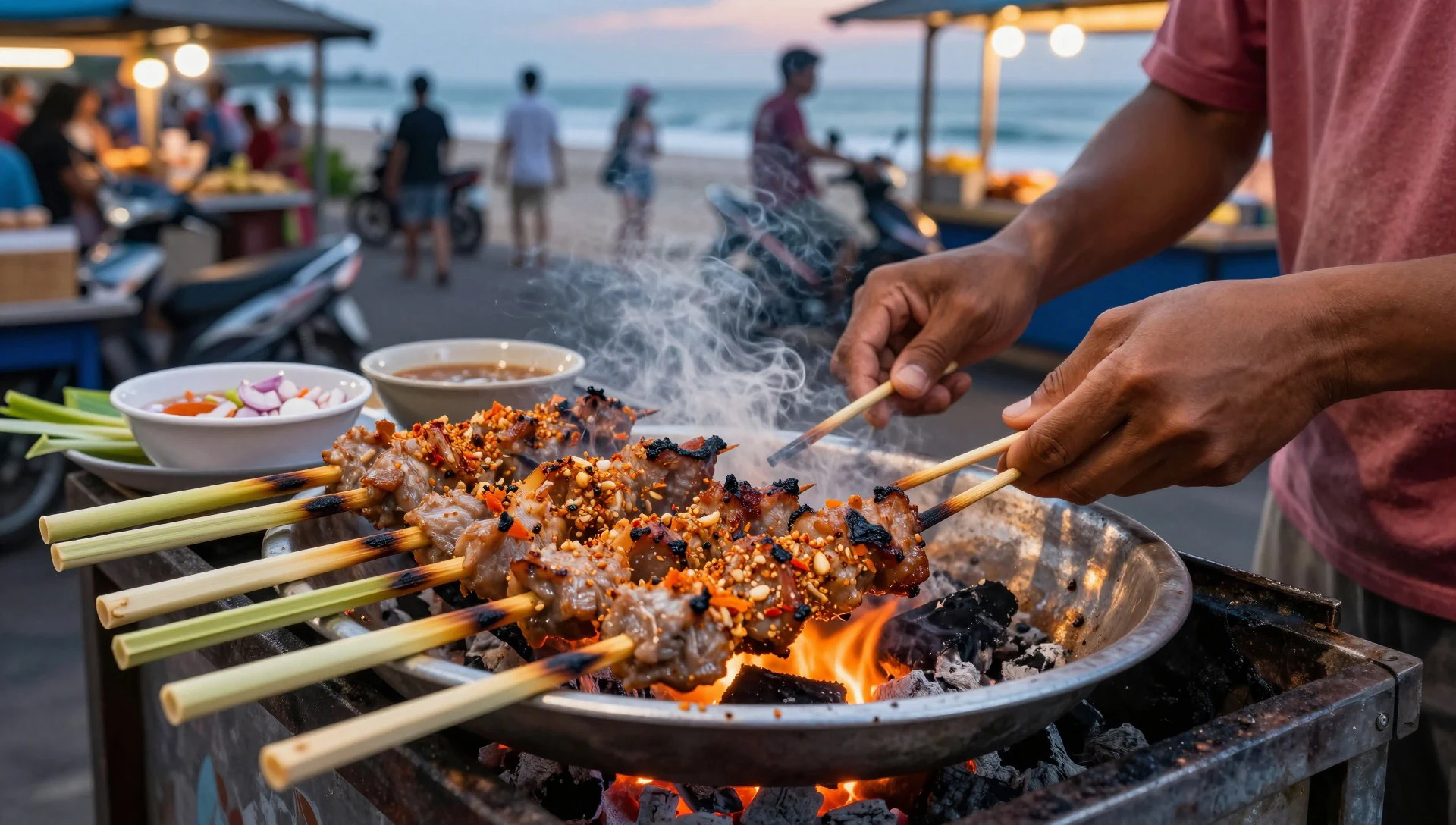
- Plecing — family-run restaurants in Candidasa
Cassava leaves sautéed with chillies and coconut, finished with a touch of lime. This dish brings a spicy, sour complexity to the table. It is often served as a side to rice or other central components of a traditional Balinese meal. - Babi Guling — main street of Karangasem
Whole roasted pig stuffed with spicy rice and herbs, with crisp skin that shatters at the bite. This celebratory dish is a staple for festivals and is also served in dining establishments. It offers a rich, savoury experience unique to the island's culinary heritage.
Plan it
Best time. The drier months from July to September are ideal for climbing when rainfall is lowest, while January is the wettest month and the warmest period spans November to December.
How long. 2–3
Getting there. Fly into Ngurah Rai Airport in the south, then drive three hours north to Karangasem or Candidasa. Local guides are required for the ascent.
Budget. mid
Tips
- Hire a certified local guide, as the routes are difficult to follow.
- Avoid climbing in the rainy season, particularly January and February.
- Bring ample water and food, as there are no facilities on the mountain.
- Carry a warm jacket, as it is often cold and windy at the summit.
- Check the current volcanic safety status before planning any ascent.
Etiquette
- Do not stand on the stone carvings or climb on temple structures.
- Keep noise levels down, especially near the temples.
- Seek permission before photographing locals in village settings.
Nearby
Sources
- Wikidata Q158470 (CC0)
- Wikipedia (rev 1382106844) (CC BY-SA 4.0)
- Wikivoyage (rev 5411569) (CC BY-SA 4.0)