Melville Island
Melville Island, Canada
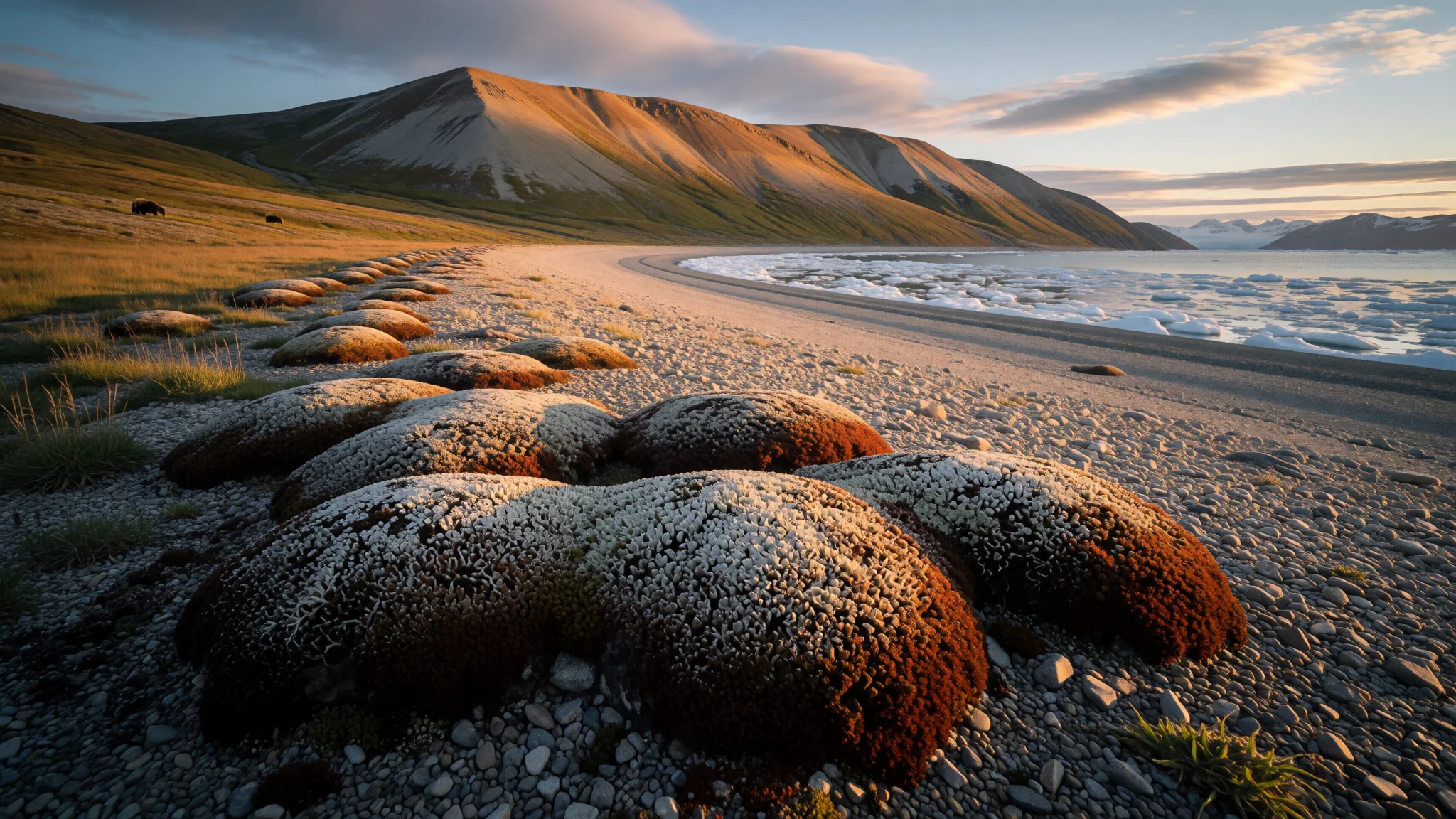
Melville Island is an empty, treeless slab of the high Arctic where British naval ships once froze in, and almost nobody goes.
The place
Melville Island belongs to the Queen Elizabeth Islands, the northern cluster of Canada's Arctic Archipelago, and nobody lives on it. Two territories share it: the Northwest Territories administers the western half, Nunavut most of the eastern half, and a line of longitude marks the boundary. One oddity is that two small pockets of Northwest Territories land sit on the eastern side and can be reached overland only from Nunavut. Prince Patrick Island lies to the northwest, Eglinton Island to the west and Byam Martin Island to the east, while Viscount Melville Sound separates the island from Victoria Island to the south. The landscape is stark. Hills and low mountains rise to about 776 metres, and the ground carries very little vegetation, mostly hummocks of moss and lichen with grasses and sedges where the cover is continuous. There are no roads, no shops, no villages and no scheduled services. Anyone who goes is part of an expedition, a research party or a specialist charter, and the nearest practical gateway for the wider territory is Yellowknife, far to the south. Honest expectations matter here. This is a place to read about, or to visit only with an experienced operator, a large budget and a willingness to be overruled by the weather. Summer brings long light and open ground; winter brings darkness and sea ice that locks the channels.
Its story
Melville Island entered European records in 1819, when the British naval officer Sir William Parry pushed his ships west through the Arctic channels. The sea froze around him before he could turn back, so his crews sat out the winter at a bay now called Winter Harbour and were not free until the following summer. The island carries the name of Robert Dundas, 2nd Viscount Melville, who was First Sea Lord at the time. A generation later it became a stage in the hunt for Sir John Franklin's missing expedition. Abraham Bradford explored the east coast as far as Bradford Point, and a team including Francis Leopold McClintock, Richard Vesey Hamilton and George Henry Richards surveyed the north and west coasts. Captain Edward Belcher's rescue ships then wintered at Dealey Island, just off the south coast, and HMS Resolute was among them. From there a sledge party reached HMS Investigator, which had been stuck in the ice at Mercy Bay on Banks Island for two years. Her survivors hauled their way north to Dealey in stages. The ships that had come to help, Investigator and her steam tender HMS Pioneer among them, also failed to break out, and Belcher finally ordered every vessel abandoned. Little in the landscape has changed since.
What to see
- Winter Harbour — South coast of Melville Island
Winter Harbour is the sheltered bay on Melville Island's south coast where Parry's ships sat frozen in through a whole winter. Nothing is built for visitors. The draw is the quiet shoreline, the open view over the sound and the sense of standing where a famous voyage stalled. Reach it only with a specialist operator. - Dealey Island — Off the south coast
Dealey Island lies just off the south coast and served as a wintering base for Belcher's squadron during the Franklin search. HMS Resolute was among the ships kept here, and sledge parties from this base reached the stranded crew of Investigator. Landings depend on ice and weather, so treat it as a possibility, not a plan. - Viscount Melville Sound — South of Melville Island
Viscount Melville Sound is the broad channel that separates Melville Island from Victoria Island. Nineteenth-century Admiralty charts show how slowly naval surveyors pieced it together. Today it is mostly ice, then open water in a short summer. Seen from the coast, it gives the island its sense of enormous scale and silence.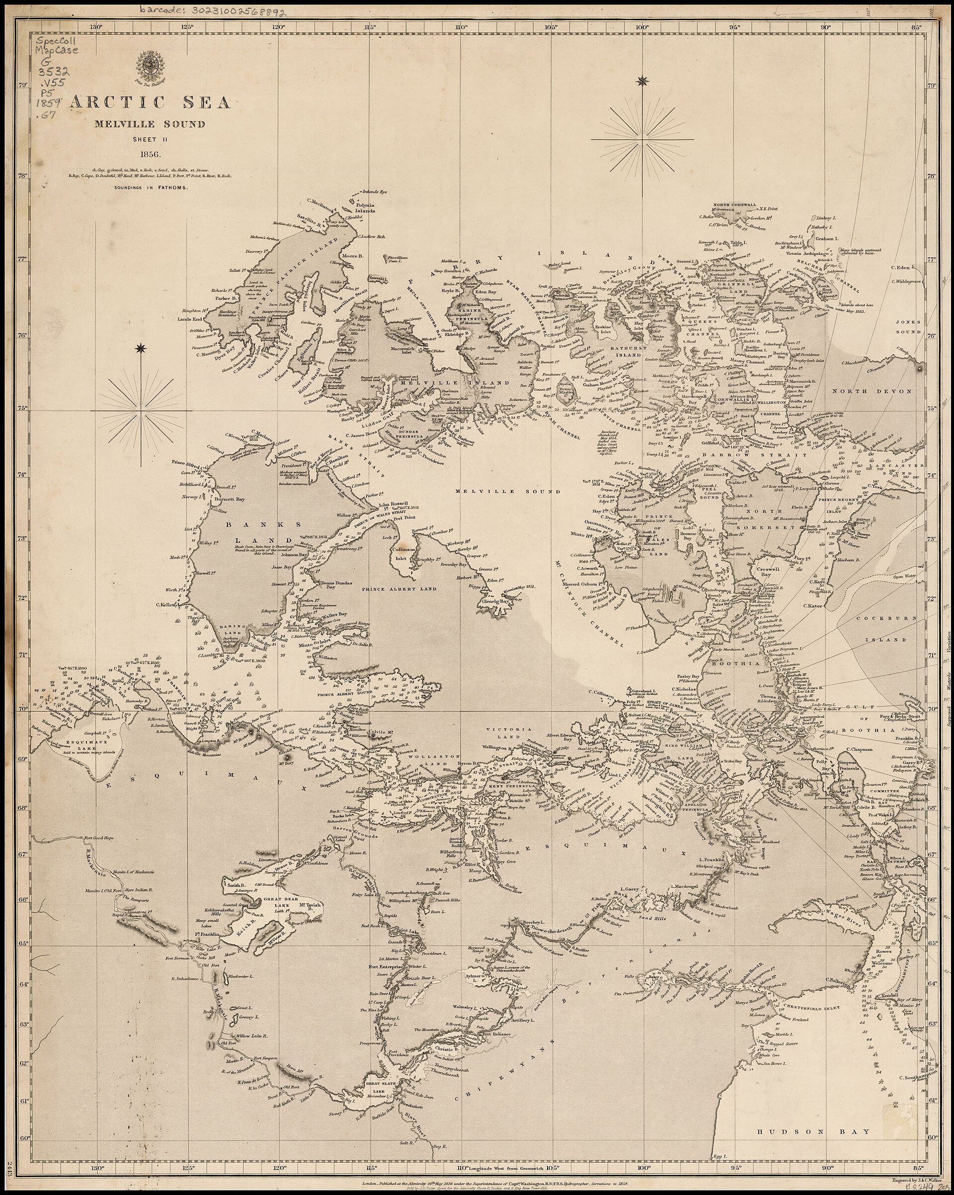
- Interior tundra and uplands — Interior of the island
Away from the coast, Melville Island is a plain of pale gravel and low hills, with moss, lichen and sedge softening the ground in patches. Wildlife such as muskoxen may be spotted at a distance. Walking is slow and exposed, with no trails, no shelter and no help nearby, so it suits only well-equipped, guided parties.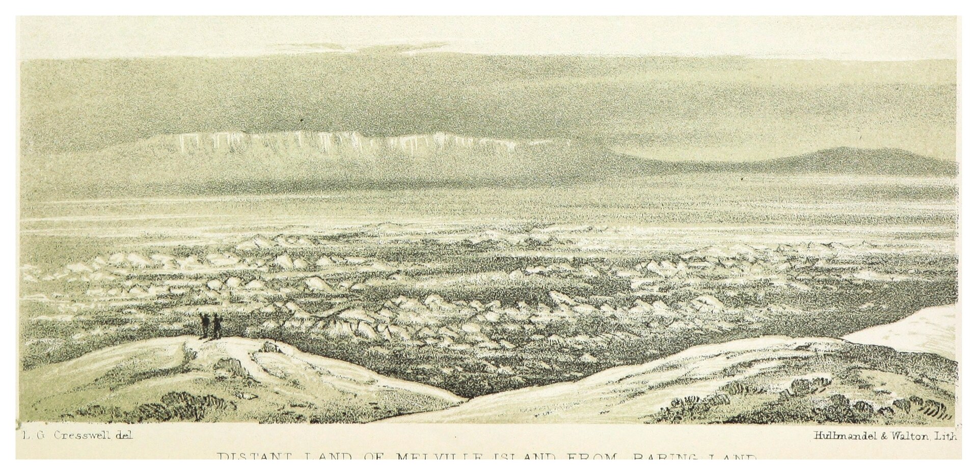
- Northern lights from Yellowknife — Yellowknife, Northwest Territories
Most travellers who want the Arctic sky go to Yellowknife instead. Winter's long nights are best for the aurora, and the short white nights around midsummer hide it entirely. Local tour companies run snowmobile trips, dog-sled outings, photography workshops and tractor rides to dark viewing spots outside town. - Northern Life Museum, Fort Smith — Fort Smith, Northwest Territories
The Northern Life Museum in Fort Smith shows traditional work by Inuit, Inuvialuit, Dene and Métis makers. It is the easiest way to meet the living cultures of the territory, since Melville Island itself has no permanent residents. Check the museum's own channels for opening arrangements before planning a visit.
Culture
Melville Island has no resident community, so its culture is really the culture of the wider Canadian Arctic that surrounds it. The northern territories are home to Inuit, Inuvialuit, Dene and Métis peoples, whose knowledge of ice, animals and weather made the long Arctic expeditions of the nineteenth century possible, often without credit. Their skills in sledging, snow-house building and hunting are still taught and practised in the communities to the south. For visitors, northern manners are quiet and practical: people are generous with time and practical help, and the land is treated as a working landscape, not a backdrop. Hunting, fishing and sharing food remain central to daily life. The old expedition sites on and around Melville Island, from wintering camps to cairns and abandoned supplies, are historic remains. They are left where they lie. Alcohol rules also vary by community. Some settlements have banned it entirely and others restrict importing or possessing it, so check before arriving. Humour, patience and flexibility count for more than schedules, because weather decides when planes fly and boats sail. Winter darkness and midsummer light shape the rhythm of the year, and many northern events are timed around them. Before photographing a person, a household or a hunting camp in any northern community, ask permission first and respect a refusal.
What to wear
Traditional dress across the Canadian Arctic was designed around survival. Inuit and Inuvialuit made hooded parkas and trousers from caribou and sealskin, with fur-lined boots called kamiks, mittens and sometimes a woman's amauti, a parka with a pouch for carrying a baby. Dene and Métis communities further south are known for moosehide, fine beadwork and woven sashes. Ceremonial and festive dress still uses these materials and patterns, and today they appear at community gatherings and cultural events. Everyday clothing in northern towns is practical and modern: down jackets, insulated boots, wool hats, snow pants and fleece, with traditional pieces added for identity and warmth. A visitor to Melville Island, which means a guided expedition, should dress for wind, wet and long cold exposure. Think layers: a wool or synthetic base, an insulating mid layer, and a windproof, waterproof shell. Insulated, waterproof boots with a good grip are essential on stony, boggy or icy ground, along with warm gloves, a face covering and sunglasses against glare off snow and sea ice. Even summer needs a warm hat and a heavy jacket. In Yellowknife and other towns, dress is casual, and there is no special dress code for museums or restaurants beyond modest, comfortable clothing.
What to eat
- Arctic char — Restaurants in Yellowknife and Inuvik
Arctic char is a cold-water fish related to trout and salmon, and it is closely tied to the northern coast. Order it pan-fried or smoked in restaurants in Yellowknife or Inuvik, or try it at a community feast if invited. - Lake trout and pickerel — Lakeside eateries in Yellowknife and Hay River
Great Slave and Great Bear lakes supply lake trout, pickerel, northern pike and grayling. Fresh fillets are usually pan-fried or grilled with simple seasoning. Look for them on menus and at fish stalls around the lakeside towns, especially in summer. - Muskox — Restaurants in Yellowknife
Muskox is a rich, lean red meat, often served as a stew, a steak or a burger. Some restaurants cook it with local morels or add a spruce-bud note. It is a northern speciality, so ask a Yellowknife restaurant what is on offer. - Moose steak — Lodges and restaurants across the territory
Moose steak is a staple of northern cooking, with a flavour somewhere between beef and venison. Cooks sometimes pair it with spruce buds or local mushrooms. It is hearty fare, best after a cold day outdoors. - Bannock with berries — Cafés, lodges and community events
Bannock is a dense, comforting tea biscuit, traditionally baked over a wood fire and often mixed with local berries. It turns up with soup, at cafés and at community events, and is an easy, cheap introduction to northern flavours.
Plan it
Best time. July and August, when the ground is clear and daylight is almost constant; winter brings darkness, deep cold and ice-bound channels, and the northern lights are best seen from Yellowknife in the long winter nights.
How long. 7–10
Getting there. No scheduled flights, roads or rail reach Melville Island. Fly to Yellowknife via Edmonton, Calgary or Vancouver, with seasonal links from Whitehorse, Toronto and Ottawa, then arrange a specialist charter or expedition for the last leg.
Budget. high
Tips
- Book an experienced Arctic operator many months ahead, since access depends on charters and ice conditions
- Allow spare days, because fog, wind and ice regularly delay flights and boats
- Carry a satellite communication device, as the usual emergency number does not work in most high Arctic communities
- Bring all fuel, food and medicines, and pack cash as well as cards for small northern towns
Etiquette
- Leave historic expedition sites and artefacts exactly as found
- Ask before photographing people or their camps
- Check local alcohol rules before bringing any into a northern community
Nearby
Sources
- Wikidata Q134116 (CC0)
- Wikipedia: Melville Island (Northwest Territories and Nunavut) (CC BY-SA 4.0)
- Wikivoyage: Northwest Territories (CC BY-SA 4.0)
- Photo: Wfm melville island canada.jpg (Public domain)
- Photo: DISTANT LAND OF MELVILLE ISLAND FROM BARING LAND.jpg (Public domain)
- Photo: Admiralty Chart No 2118, Discoveries in the Arctic Sea (Public domain)
- Photo: Admiralty Chart No 2443, Arctic Sea Sheet II Melville Sound (Public domain)
- Photo: Admiralty Chart No 261, Plans in Arctic America (Public domain)
- Photo: Melville_island.jpg (CC BY 3.0)
- Photo: Men standing on a snowhouse near Melville Island (50693) (CC BY-SA 4.0)
- Photo: Palva-in-Canada-1972.jpg (Public domain)


