Landmannalaugar
Landmannalaugar, Iceland
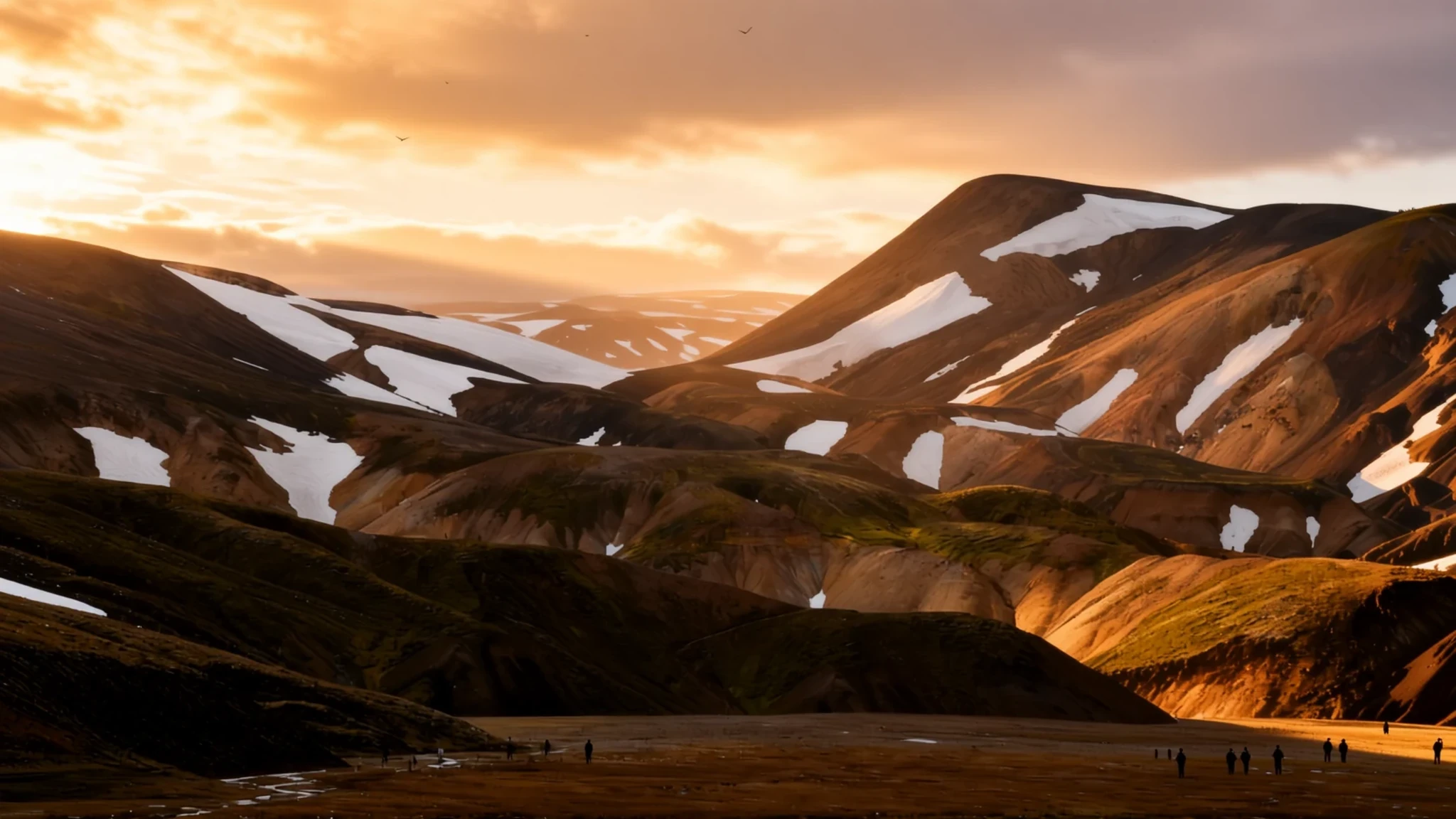
Landmannalaugar offers steaming hot springs, raw lava fields and the northern start of Iceland's famous Laugavegur hike, reachable only in summer.
The place
Landmannalaugar sits inside the Fjallabak Nature Reserve in Iceland's central highlands, on the edge of the Laugahraun lava field. That field was formed by an eruption around 1477, and the ground still looks freshly poured: black and ochre slopes, bare ash and patches of moss that take years to recover. The valley is known above all for its geothermal hot springs, which run close to the camp, and for the coloured rhyolite mountains that rise around it.
The settlement is really a small encampment. It has a campsite, a mountain hut run by the Iceland Touring Association, and a few basic service buildings, including a shower block that visitors rate well and a tiny shop. A steep rhyolite cliff backs the camp and gives some shelter, but the rest of the valley is wide open, and wind can be fierce. Local practice is to anchor tents with stones taken from large wooden boxes called rock corrals.
Landmannalaugar is also the northern start of the Laugavegur trail, which is why many people arrive here on foot after a multi-day walk, or leave by bus at the end of one. In summer the place fills with walkers, campers and the occasional horse-riding group, so the mood shifts from quiet dawn to busy afternoon within hours. Expect cold nights, changeable weather and cloud that can hide the views for days at a time.
Its story
Landmannalaugar's story starts underground. The area sits on volcanic ground, and the heat that feeds its springs is the same heat that once poured out as lava across the Laugahraun field. The eruption that formed that field is usually dated to around 1477, which makes the lava young by Icelandic standards, and its bare, broken surfaces still show it.
For centuries the highlands were a route for travellers and herders rather than a destination. The rough tracks that cross the interior were used long before anyone thought of them as scenery, and the hot water was a known resource, useful for washing and warmth. The valley was remote enough to be left alone for most of the year.
The change came with walkers. Once the Iceland Touring Association began operating a hut here, the valley became a base for people who wanted to cross the interior on foot. The Laugavegur route, which runs south from here toward Thórsmörk, grew into one of the best-known walks in the country. Its popularity is why huts fill months ahead, and why the trail is now marked with stakes about every 200 metres.
Today the story is about access. The roads open only when the snow has cleared, usually by mid-June, and close again before winter. Each season the valley is busier, and in some ways cleaner and in others more crowded. The hot springs and rock formations are the same ones that drew people here generations ago. What has changed is who arrives, and how they pack.
What to see
- The hot spring by the campsite — Beside the campsite, in the valley floor
The hot spring runs right past the campsite and is the reason most people come. It is warm enough to soak in, and it gets busy at peak times, so go just after sunrise, when you may have it largely to yourself. Bring a swimsuit and a towel, and expect a cold walk back to the tent afterwards.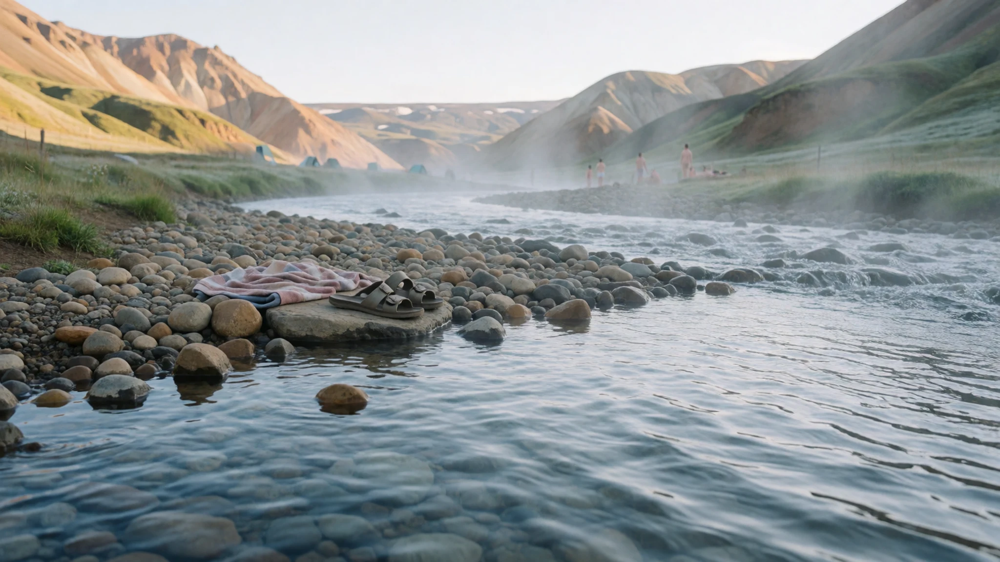
- Brennisteinsalda and the sulphur pots — The hills and lava field behind the camp
Brennisteinsalda, the Sulphur Wave, is a hike through the Laugahraun lava field and up into the hills behind the camp. Steaming sulphur pots sit among the slopes, and the views back over the valley are worth the effort. The smell can be overpowering on a still day, so keep that in mind when you plan the walk.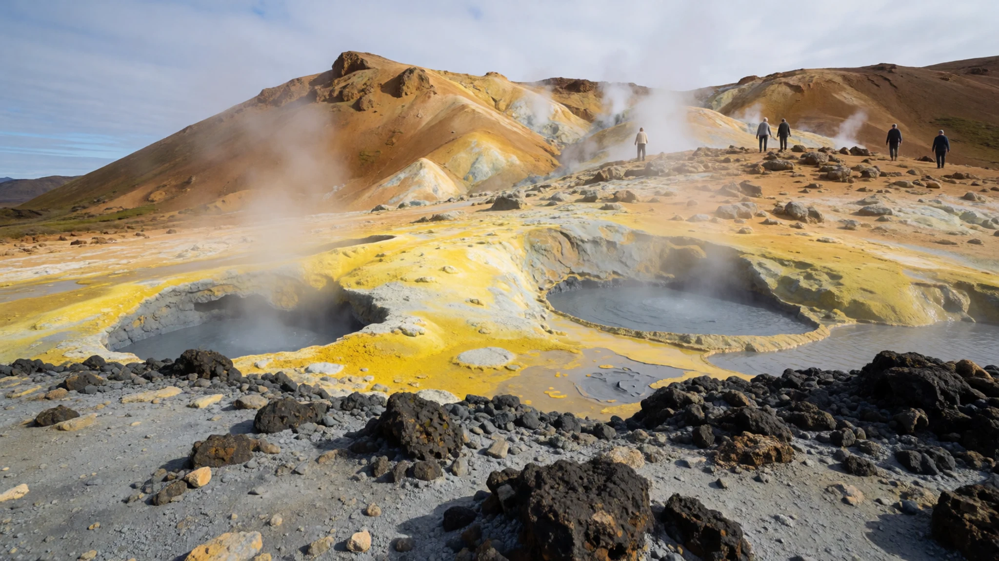
- Bláhnjúkur, the Blue Peak — The peak rising above the valley
An hour's climb takes you up Bláhnjúkur, the Blue Peak. The ascent is steep in places but short enough to fit into a half day. From the top the mountains show their orange, green and rust bands, and on a clear day the views are the reason to go. Cloud can close in quickly, so check the forecast before you set off.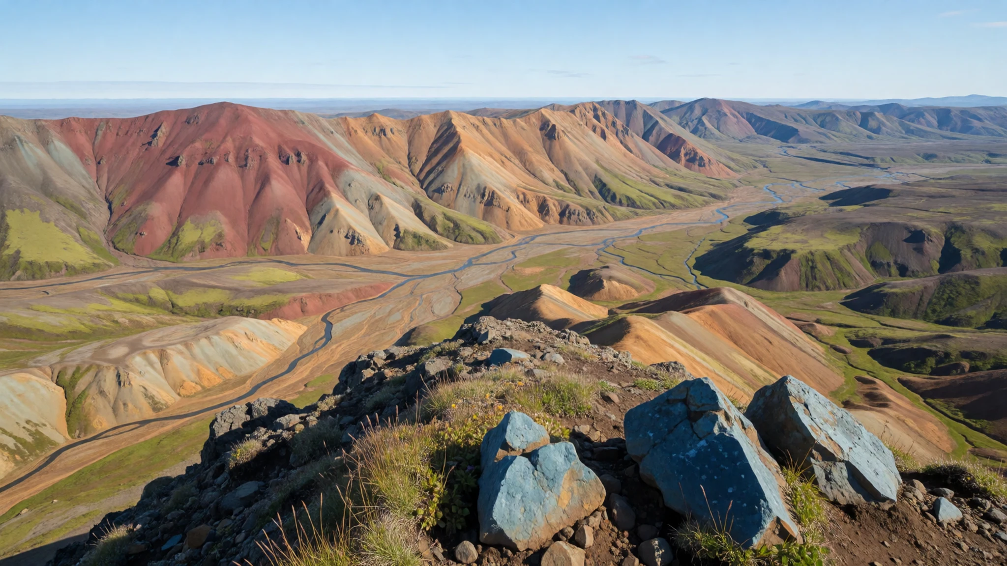
- Ljótipollur, the Ugly Puddle — A crater lake reached on foot from the camp
Ljótipollur is a crater lake reached by a longer walk, about four hours each way from the camp, so allow most of a day for the round trip. The name translates as Ugly Puddle, which is a modest description of a dark, still lake set in a crater rim. The route crosses rough ground, so wear proper boots and carry water, and turn back early if the weather turns.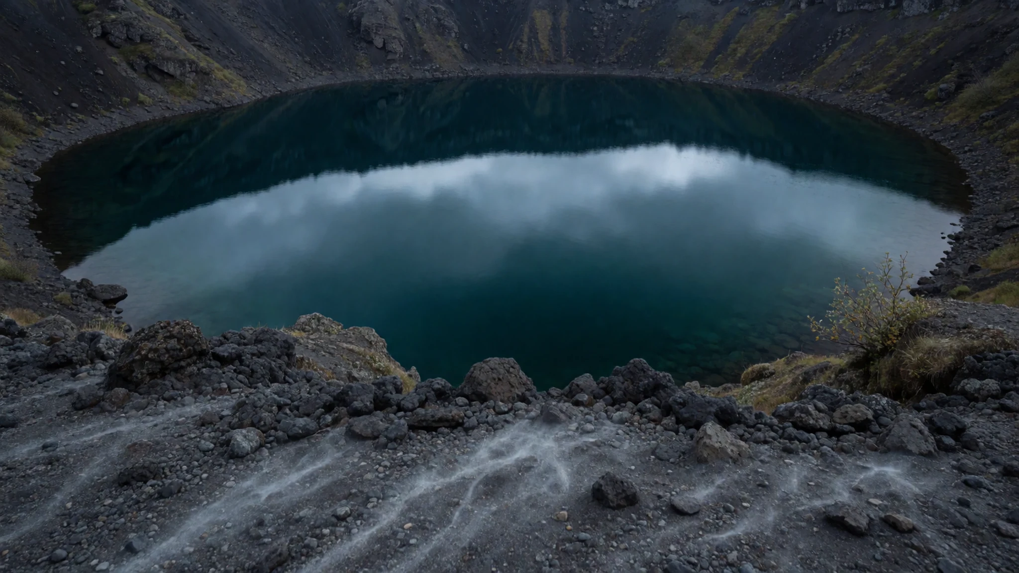
- The Laugavegur trail toward Hrafntinnusker — The start of the Laugavegur trail, south of the camp
The marked Laugavegur trail heads south from the camp, and a few hours' walk takes you toward Hrafntinnusker. It is a useful taste of the wider route, with the marker sticks guiding you across the ground. Go prepared for wind, cold and rain even on a bright morning, and carry enough food for the day.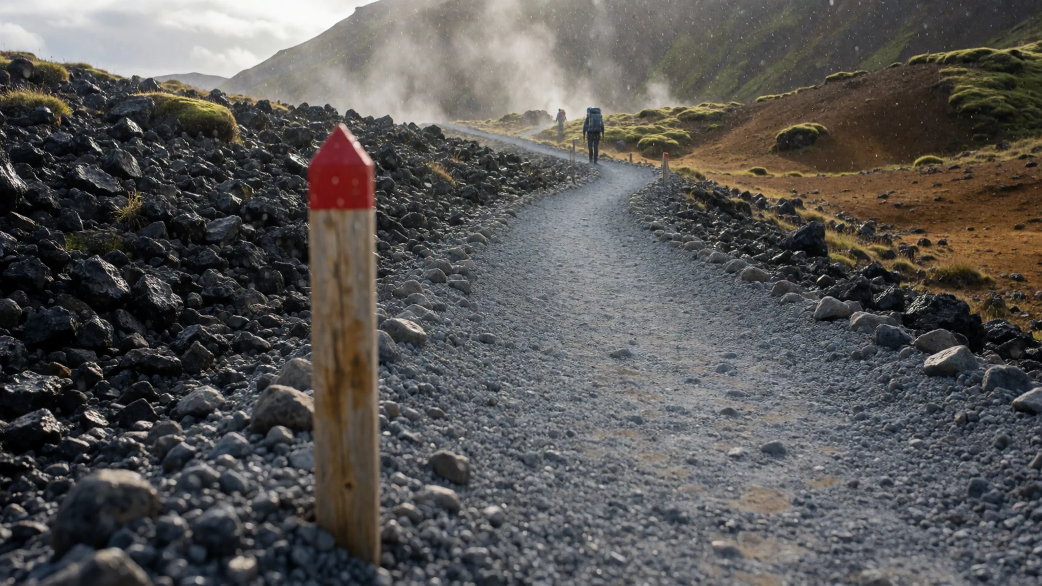
Culture
Landmannalaugar is a fragile landscape rather than a managed attraction, and most of the good manners here come down to leaving it as you found it. Stay on the marked paths across the lava and moss, because a single set of boots can scar ground that takes decades to heal. The campsite is shared, so keep noise low in the evening, cook away from other tents where you can, and be patient at the shower block and the hot spring during busy hours. Icelandic bathing culture expects a proper wash before anyone enters a shared pool, so rinse off at the facilities first. Changing areas are shared too, so keep your belongings tidy and give others room. Use only the anchoring stones you need, and put them back in the rock corral when you leave, along with every scrap of litter.
What to wear
Landmannalaugar has no dress tradition of its own, but the clothing most associated with Iceland's highlands is wool. The lopapeysa, a pullover knitted from unspun lopi yarn in a yoke pattern, is the best-known garment, and it is suited to cold, wet weather that rarely lets up for long. Wool is central to the country's textile story because it stays warm even when damp, and you will see its traditional patterns in shops across Reykjavík and beyond.
Most people in the highlands wear practical modern outdoor gear: shell jackets, fleece, wool base layers, waterproof trousers and sturdy boots. Bright colours help in mist and low cloud. Visitors from warmer places often arrive underdressed, and nobody dresses up for a hut or a campsite here.
For a visit, dress in layers. Pack a waterproof shell and trousers, a warm mid-layer of wool or fleece, a hat and gloves, and boots with good ankle support for rocky ground and stream crossings. Summer days can be mild and then turn wet and windy within an hour, so keep a spare set of dry socks in your pack. Modesty is not really a dress issue at the camp, but staying dry and warm is essential.
What to eat
- Arctic char — The mountain supermarket in high season, when fish is available
Arctic char is the local catch you may find when the season is in full swing. It is occasionally sold fresh, sometimes through the mountain supermarket, a converted school bus that also serves coffee. Stock is unpredictable, so do not plan a meal around it.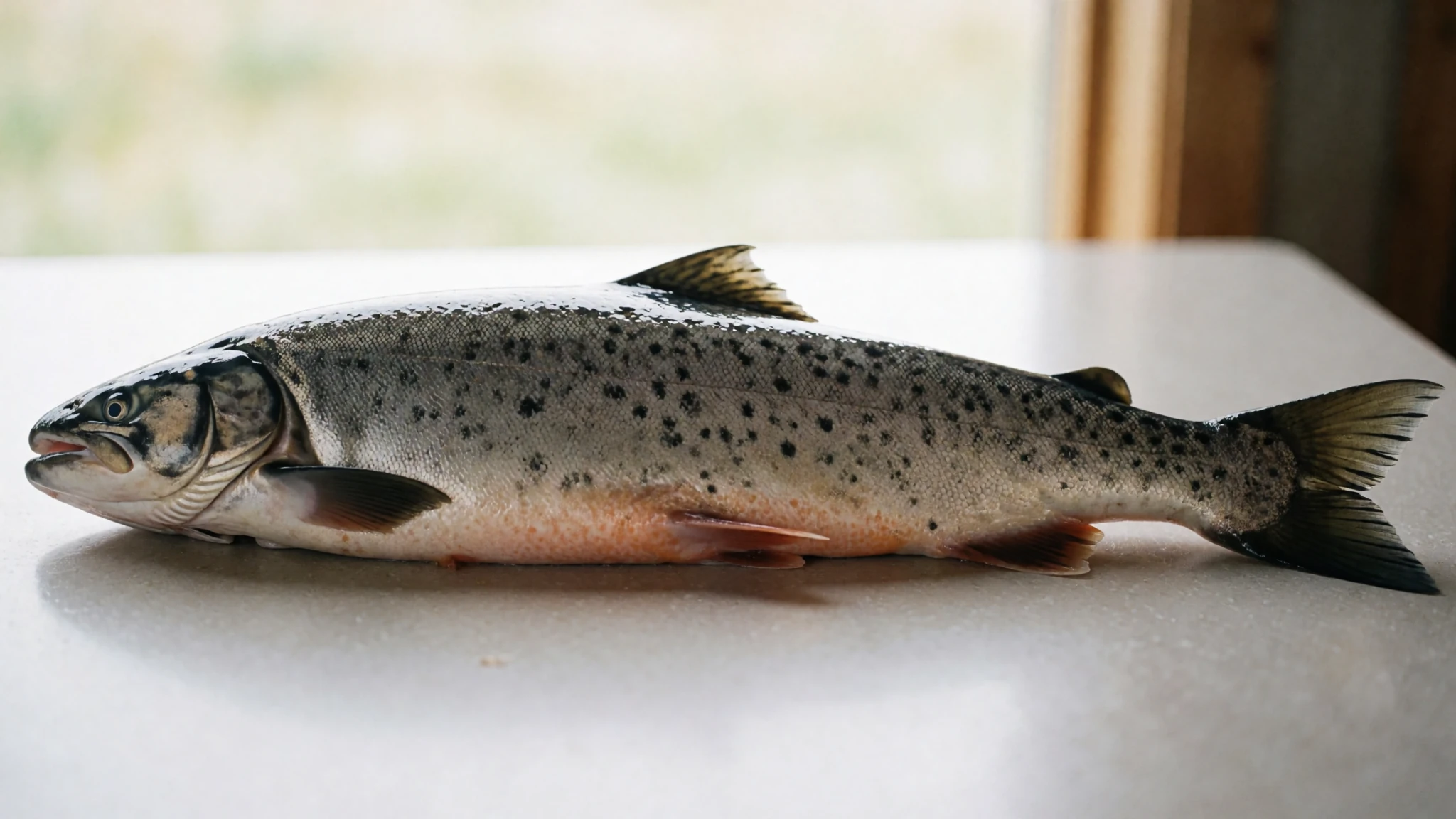
- Coffee and snacks from the bus — The converted school bus at the camp, in high season
In high season, the converted school bus acts as both a café and a modest grocery shop. Prices are very high, so treat it as a backup rather than your main source of food. A hot drink and a sweet bun make a welcome break after a long walk, but do not rely on it for the whole trip.
- Stream water — Clear streams along the valley and the trail
Streams here are generally safe to drink, which saves carrying water over long stretches. Check the riverbed stones. If they are much redder, orange or yellow than the banks, sediment may make the water taste odd, though it is usually still fine. Carry a one-litre bottle and refill it at every clear stream. - Packed trail food — Your own pack, bought before you reach the camp
Bring everything you plan to eat on the trail, because there is nothing to buy on the route itself. Dried meals, nuts, cheese and chocolate are common choices, and they keep well in cold conditions. Pack a little more than your plan says, in case weather delays you by a day.
Plan it
Best time. Late June to early September, when the roads are open and the huts are staffed. July and August bring the most walkers and the most reliable access, while June and September can still bring snow and closed tracks. Weather is changeable in every month, so plan with flexibility.
How long. 2–4
Getting there. A bus from Reykjavík runs daily in summer from about late June, taking several hours and starting on the coast before moving onto rough tracks across lava and ash plains. Driving needs a high-clearance off-road vehicle, and you should check that your hire car insurance covers the highlands. In peak season buses also run from Akureyri, Myvatn and Skaftafell.
Budget. mid
Tips
- Book huts many months ahead for July and August, since camping is not reserved
- Visit the hot spring just after sunrise to avoid the crowds
- Carry all your food, because the only shop is small and expensive in high season
- Pack a waterproof shell and warm layers, even on a sunny morning
- Check the road opening dates for the year before you travel, as they vary
- Carry a one-litre bottle and refill it at clear streams
Etiquette
- Use the shower block before you bathe in the shared spring
- Return anchoring stones to the rock corral when you leave
- Take all litter out with you, as the lava field is fragile
Nearby
Sources
- Wikidata Q950447 (CC0)
- Wikipedia: Landmannalaugar (rev 1372657196) (CC BY-SA 4.0)
- Wikivoyage: Landmannalaugar (rev 5235096) (CC BY-SA 4.0)
- Landmannalaugar Iceland 2005 (Chris 73) (CC BY 3.0)
- Landmannalaugar Campsite (Anjali Kiggal) (CC BY-SA 4.0)
- Vondugil and Háalda (David Karnå) (CC BY 3.0)
- Landmannalaugar camp site (David Karnå) (CC BY 3.0)
- Landmannalaugar, South Iceland (Pjt56) (CC BY-SA 4.0)
- The mountains at Landmannalaugar in June (Anjali Kiggal) (CC BY-SA 4.0)
- Islanda, Landmannalaugar (Mario Falcetti) (CC BY 4.0)
- Iceland, impressions from Landmannalaugar (Hansueli Krapf) (CC BY 3.0)


