Lake Tekapo
Lake Tekapo, New Zealand
A glacial lake the colour of sea glass beneath the Southern Alps, with dark night skies and a small stone church on its shore.
The place
Lake Tekapo sits on the northern edge of the Mackenzie Basin in the South Island of New Zealand. It is one of three long lakes that lie roughly north to south in the same basin, alongside Lake Pukaki and Lake Ōhau. Tekapo is the second-largest of the three, covering 83 km² and lying at 713 m above sea level. Its colour is what most people remember. Two rivers, the Godley and the Macaulay, carry meltwater from the Southern Alps into the northern end. That meltwater carries fine glacial silt, and the silt gives the lake its pale turquoise tone. The colour looks strongest in bright weather, when the sun lights the shallows and the water appears almost milky. Mountains close in on both sides. The Two Thumb Range rises to the east, while Mount John stands to the west, close to the township. On a clear day the higher peaks of Aoraki / Mount Cook National Park can be seen in the distance. The water stays cold for most of the year, peaking at around 17 °C in January, so swimming is a brave choice outside summer. Lake Tekapo ranks among New Zealand's sunniest spots. At its southern end you'll find a small township with resorts, and a regional park stretches along the shoreline.
Its story
Lake Tekapo's Māori name, Takapō, is older than any European map of the basin. European settlement arrived later. Canterbury was settled by colonists from England in the 1850s, and sheep runs spread across the Mackenzie Country behind the mountains. Early settlers saw a dry, open plain with huge skies and little shelter, and the lake was valued mainly for the land around it. That changed in the twentieth century, when engineers linked the lake to its neighbour through a man-made canal to feed hydroelectric power stations. The lake's level and outflow now answer to the power network as much as to the weather, and the long straight cut of the canal is a reminder of that engineering. Astronomy came later. An observatory was built on Mount John, north of the township, where the clear skies suited night-time observation. The township grew into a stop for stargazers as well as walkers and anglers. Today the small stone church by the water, the Church of the Good Shepherd, is a favourite subject for photographers, and a statue of a collie dog stands in the township. Together these details show a place shaped by farming, power and the sky.
What to see
- Lake shore and Regional Park — Southern shore, beside the township
The lakeshore is the easiest part of Tekapo to enjoy without a plan. The Lake Tekapo Regional Park, run by Environment Canterbury, lies along the southern shore, with grassy paths and open views towards the mountains. Walk the shore early, when the wind is still and the colour is clearest. Bring a warm layer even in summer, because the air cools quickly once the sun drops behind the peaks.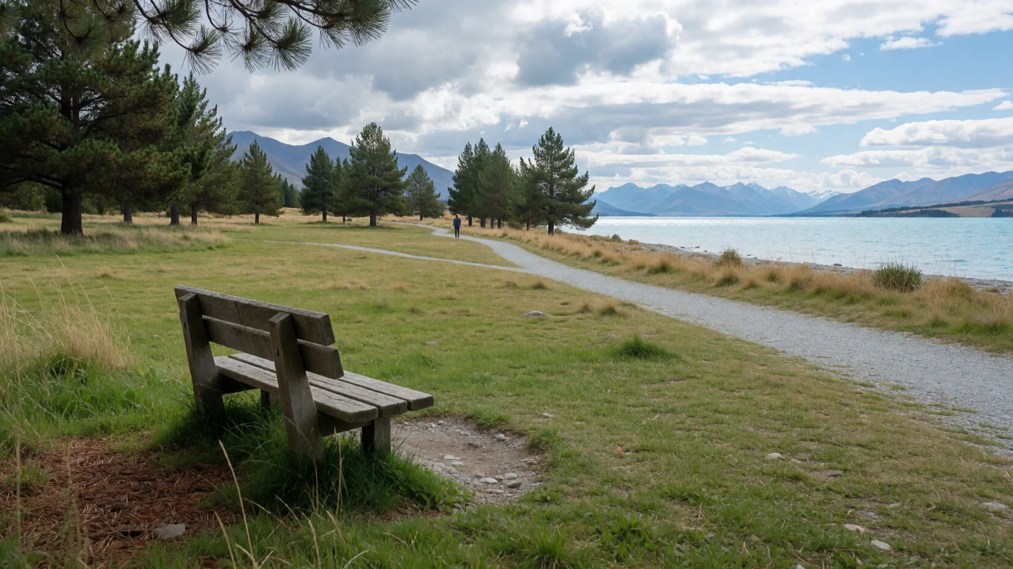
- Mount John observatory — Mount John, north of the township
Mount John rises north of the township and carries an astronomical observatory. The climb is a steady walk or drive up the access road, and the view from the top takes in the lake, the town and the peaks to the east. Observatory tours and stargazing sessions run at set times, so check the official site before you go. Come after dark on a clear night for the sky, and wear warm clothes even in summer.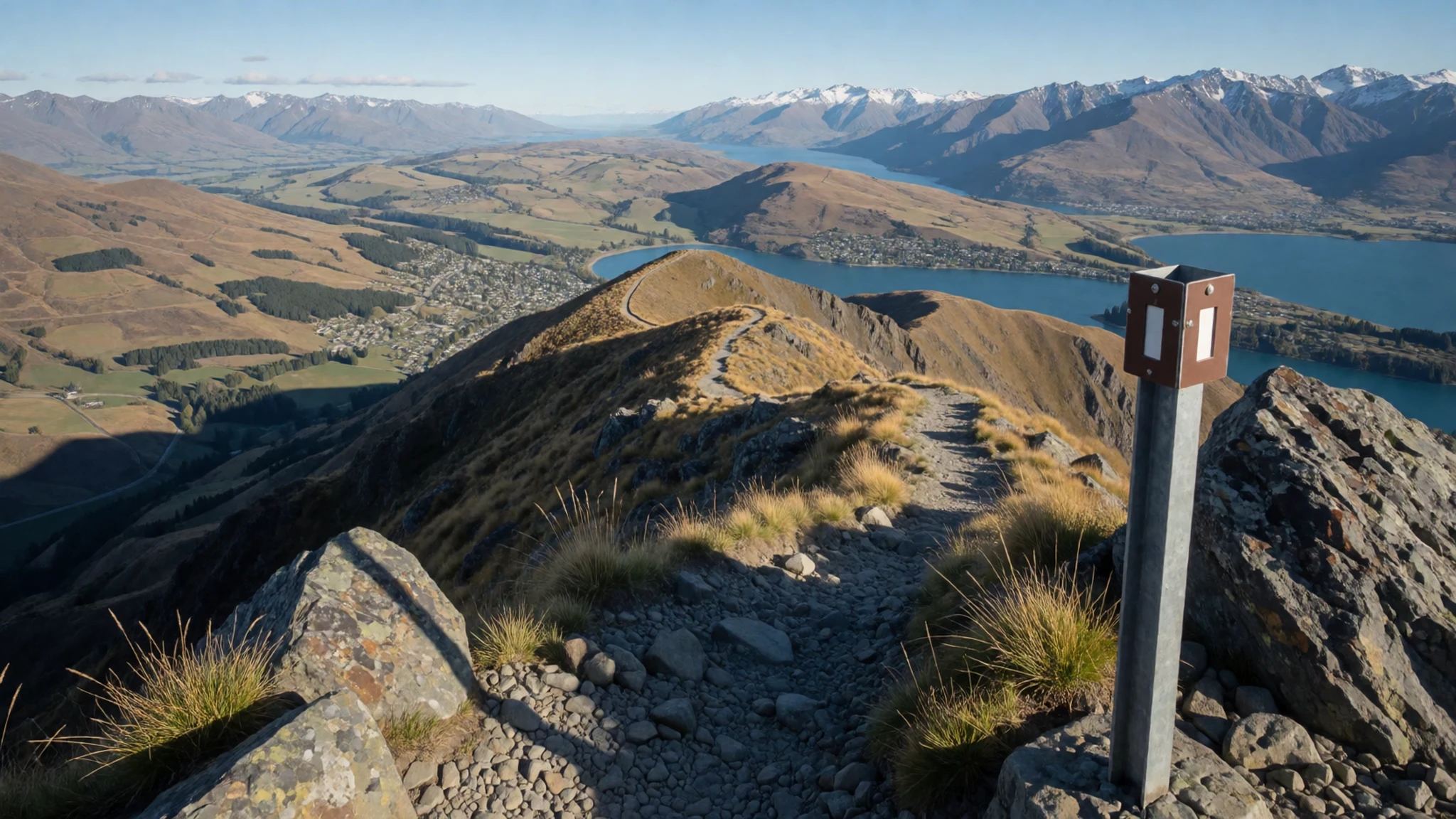
- Church of the Good Shepherd — Lake shore, in the township
A plain stone church stands on the lake shore near the township, and it is the building most people photograph here. It is small and simple, with the mountains and the blue-green water behind it. It is a working place of worship, so keep your voice low inside and step quietly around any service. Early or late light gives the best view from the shore path.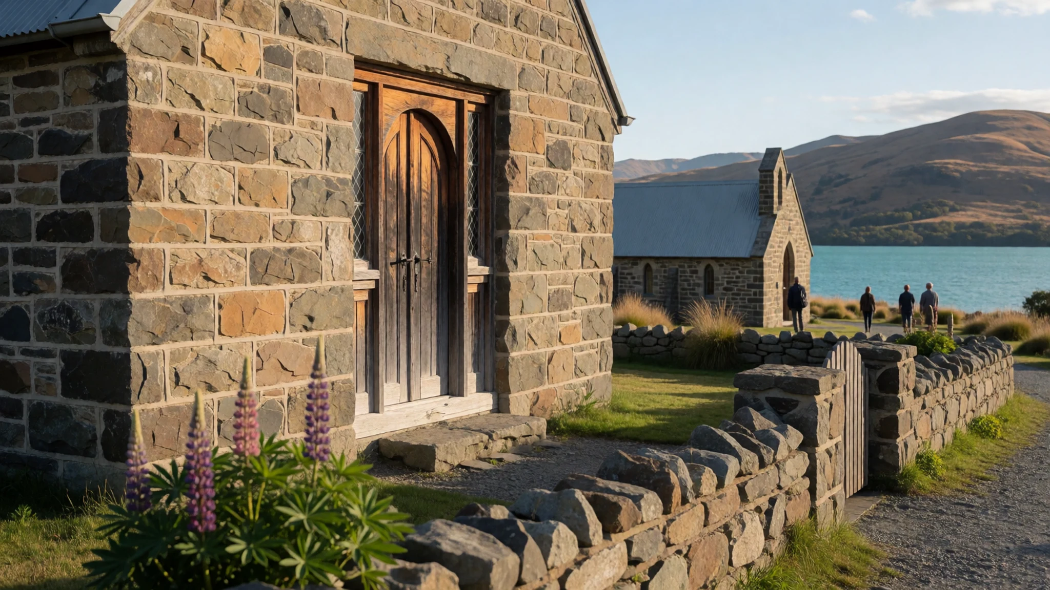
- Tekapo-Pukaki canal — East of the township, across the Mackenzie Basin
The Tekapo-Pukaki canal is a long, straight hydroelectric channel that carries water east from the lake towards its neighbour. It is an engineered line through the basin, and many visitors find its geometry striking against the natural shapes around it. You can view it from the roadside, but stay clear of fences and do not climb the banks. A quiet walk along the road beside it leads into open country.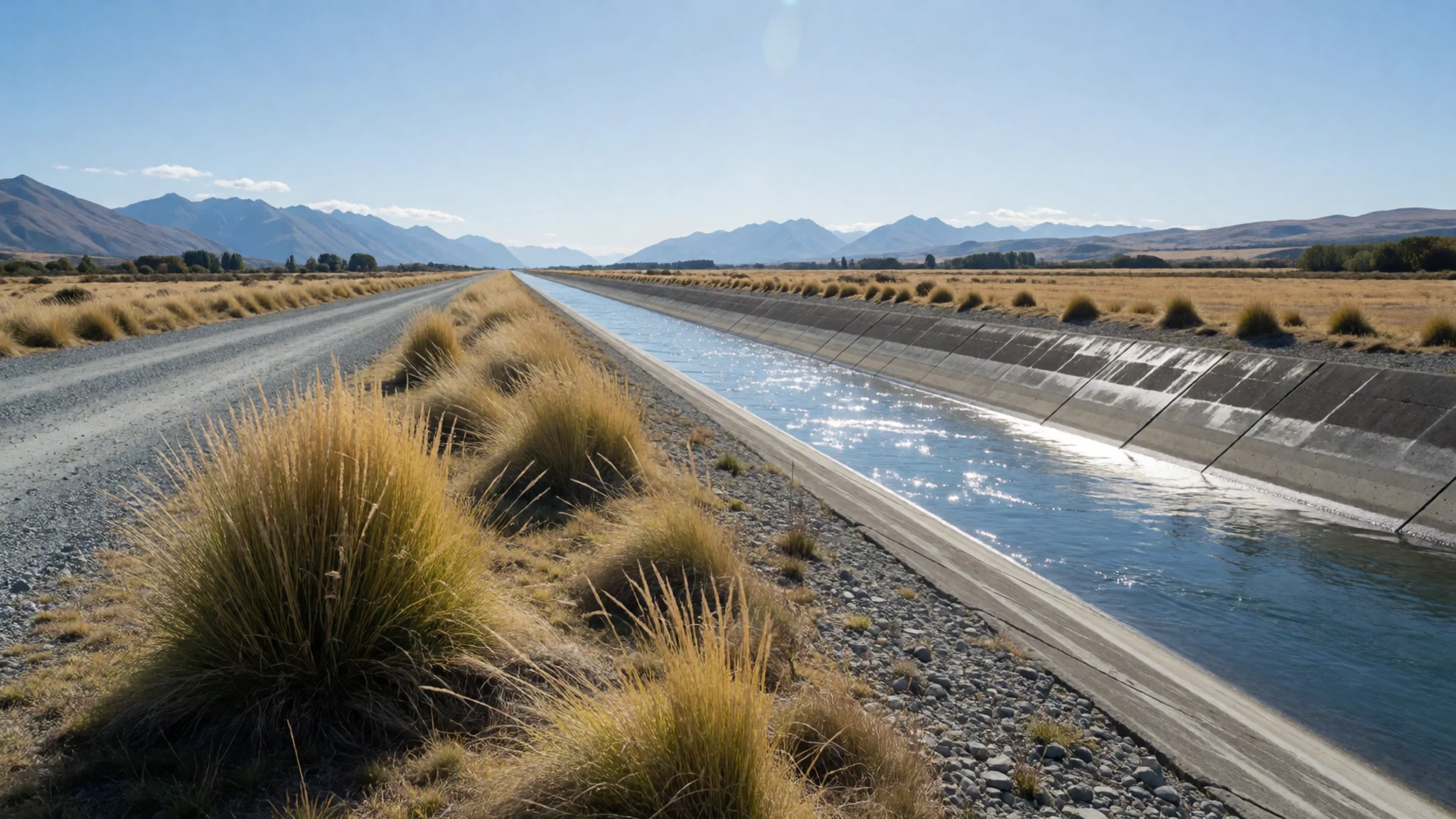
- Aoraki / Mount Cook views — Road along Lake Pukaki, east of Tekapo
You can spot Aoraki / Mount Cook, New Zealand's tallest peak, from the road running along the shore of Lake Pukaki, the neighbouring lake to the east. The view opens across the water to the jagged, snow-capped summit. The mountain often hides behind cloud, so treat a clear view as a bonus. Lookouts along the drive offer the best angles, and the national park village is a good base for walks.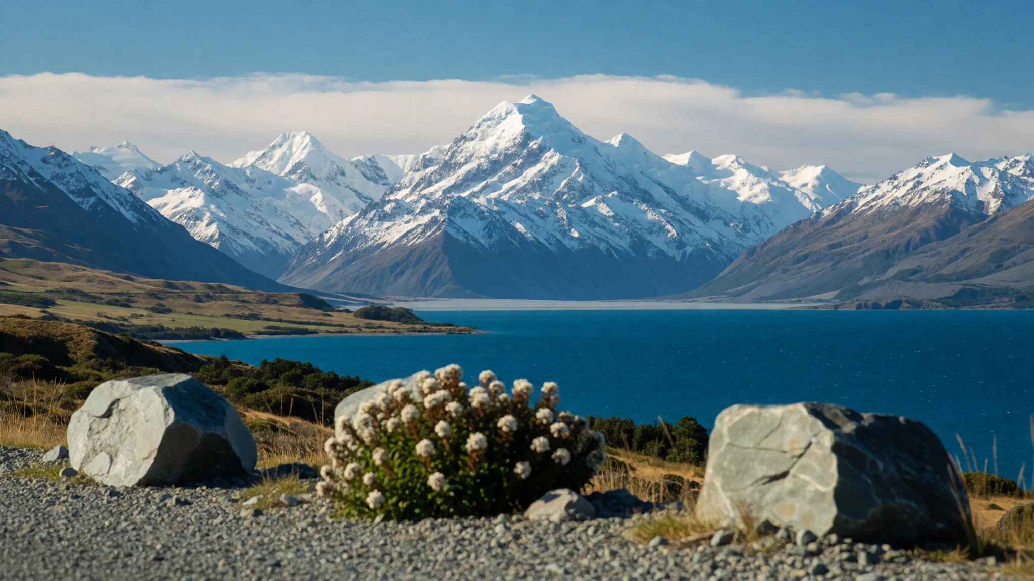
Culture
Lake Tekapo is a working landscape as much as a tourist one. The Mackenzie Basin is sheep country, and farms, hydro works and conservation land sit side by side. Locals tend to be friendly and matter-of-fact about the visitor crowds that arrive each summer, and a short chat at a café counter goes further than any phrase book. The lake's Māori name, Takapō, appears on signs and in conversation, and saying it carefully is a small courtesy that many people notice. The township is small, so plan fuel and supplies before you reach the basin rather than expecting full services at every stop. Noise carries a long way across still water, so keep music and car horns low at dawn and after dark, when people are sleeping or stargazing. Sheep and farm dogs are common on the roads, and an open gate can cost a farmer a whole afternoon, so close any gate you pass through. Ask before using lights near the observatory, and keep to the marked paths rather than crossing the grassy shore verges.
What to wear
Lake Tekapo's traditional dress comes from Māori textile traditions across Aotearoa, not from the basin itself. Cloaks called kākahu were woven from harakeke flax and sometimes finished with feathers or dyed fibres, and they were worn for ceremony and warmth. Today people here dress for weather and work. Wool and fleece layers, merino base layers, sturdy jackets and sheepskin boots are common, because the basin is a farming district with cold winds and sharp temperature swings. A visitor should dress in layers that can be added or removed. Summer days can be warm and bright, but the air cools quickly once the sun drops behind the mountains, and the lake breeze can be sharp at any hour. Pack a windproof and waterproof jacket, a warm fleece or jumper, and a hat and sunglasses for strong sun at altitude. Wear sturdy walking shoes with good grip for gravel tracks and shoreline paths. Religious sites such as the stone church ask for no particular dress, but modest, tidy clothing is appreciated.
What to eat
- New Zealand lamb — Township restaurants and eateries; butchers and supermarket meat counters
Lamb is the regional staple, and you will find it on menus across the township, roasted, as chops or in slow-cooked dishes. Mutton also appears in some farmhouse-style cooking. Restaurants and eateries in the township are the easiest place to try it, and any butcher or supermarket meat counter in Canterbury stocks the same cuts for cooking yourself.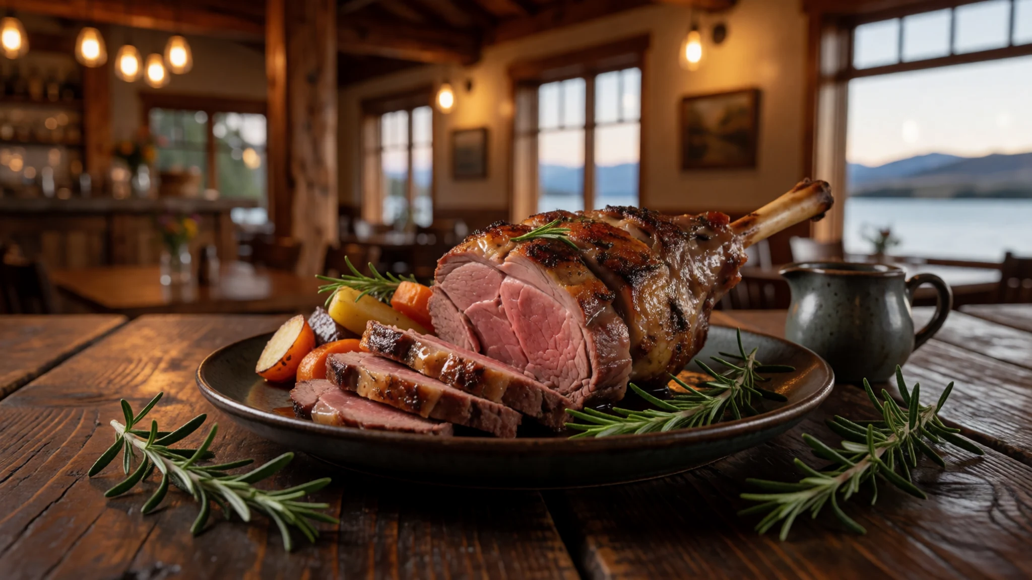
- Farm-gate produce — Roadside farm stalls on the Canterbury plains
Roadside stalls on the plains sell fresh produce and occasional rare varieties grown in small quantities. Prices are not always lower than city supermarkets, so do not expect a bargain. The reward is the seasonal and unusual, the produce that does not reach a mass market.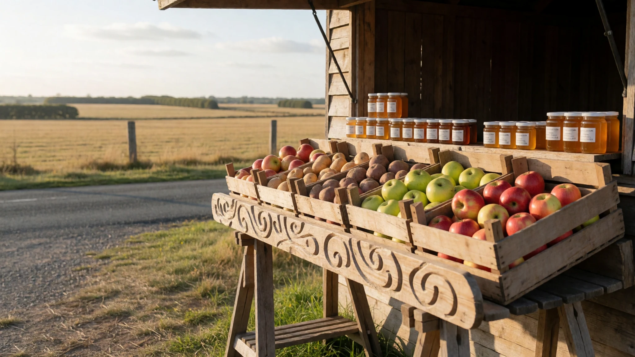
- Canterbury wine — Tasting rooms of small Canterbury wine producers
A few small wine producers in Canterbury work with the particular climate and soils of their own properties. Their wines are worth tasting in person, and a tasting room visit suits a slower afternoon. Ask about the vineyard and the vintage rather than choosing by label, because the small producers often explain their own land well. - Breakfast and coffee at a township café — Cafés in the township, near the lake
The township cafés are the easiest place to start the day before a lake walk. Order at the counter, sit by the window if you can, and have a flat white with something from the baked goods case. Mornings are quieter than midday, when coaches and day trippers arrive.
Plan it
Best time. Late December to February brings long days and the warmest water, though the lake is cold year round. March and April bring autumn light and calmer roads. Winter is clear and dry but cold, with frequent frost and some roads needing care.
How long. 2–3
Getting there. Christchurch International Airport (CHC), then a drive of several hours across the Canterbury plains on the main highway and onto the Mackenzie road to the lake.
Budget. mid
Tips
- Book accommodation early for the summer months, because the township is small
- Carry cash for small shops and farm stalls, and check card acceptance before you buy
- Fill your fuel tank before the basin, since services are limited
- Start your lake walk early for calm water and the clearest colour
- Carry water and sun protection, because the air is thin and the sun is strong
Etiquette
- Keep your voice low near the church and the observatory
- Close farm gates behind you
- Stay on marked paths and off the shore verges
Nearby
Sources
- Wikidata Q1194022 (CC0)
- Wikipedia, Lake Tekapo (rev 1374631086) (CC BY-SA 4.0)
- Wikivoyage, Canterbury (New Zealand) (rev 4826980) (CC BY-SA 4.0)
- Lake Tekapo, Hagai Agmon-Snir, photo 01 (CC BY-SA 4.0)
- Lake Tekapo, Hagai Agmon-Snir, photo 02 (CC BY-SA 4.0)
- Lake Tekapo in New Zealand, NASA Johnson Space Center (Public domain)
- Lake Tekapo in the twilight, Wildman NZ (CC BY-SA 4.0)
- Motuariki island, Lake Tekapo, Wildman NZ (CC BY-SA 4.0)
- Tekapo-Pukaki canal, Avenue (CC BY 3.0)
- Statue of Collie Dog at Lake Tekapo, edwin.11 (CC BY 2.5)
- Lake Tekapo church, W. Bulach (CC BY-SA 4.0)


