Kunoy
Kunoy, Faroe Islands
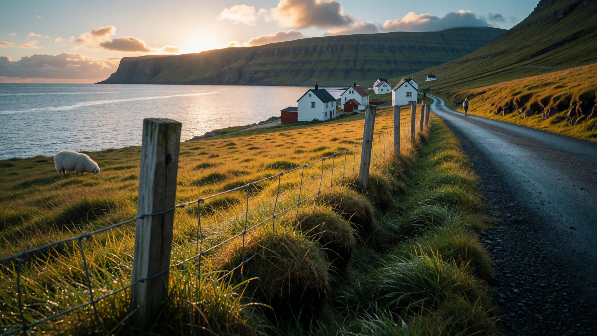
Kunoy is a steep, nearly empty Faroese island of tall mountains, a long one-lane tunnel and sheep-cropped slopes, reachable by road from Klaksvík.
The place
Kunoy lies in the north-east of the Faroe Islands, a narrow, mountainous island whose name is usually translated as 'Woman island'. Kalsoy sits across the water to the west, with no road or bridge between them, while a causeway ties Kunoy to Borðoy on the east, so you can drive or take the bus over from Klaksvík. Only 134 people live here, spread over two villages: Haraldssund on the east coast and the village of Kunoy on the west. The land is so thin and steep that there is little room for anything else. The highest summit, Kúvingafjall, reaches 830 m, and the slopes fall quickly to the sea, grazed by sheep. A road tunnel of about 3100 metres, one lane wide, links the two villages through the rock. The northern coastline matters for birds. It is recognised as an Important Bird Area for seabirds that nest on its cliffs, including storm petrels and black guillemots. Rats, brought deliberately from Klaksvík in the early twentieth century, have hurt the colonies, puffins most of all. Weather decides everything here: cloud can drop over the ridges within minutes, then lift again, and the light changes by the hour. Kunoy suits people happy with walking, silence and a short list of things to do, rather than anyone wanting cafés and shops.
Its story
Kunoy's story is mostly one of a small place holding on. The name means 'Woman island', and the island supports few people now: about 134, in two villages. Skarð, on the far side of the mountain from Haraldssund, is the clearest sign of how that came about. It was once a settlement and is now abandoned, reached on foot by a long hike or over a mountain pass from the village of Kunoy, a reminder of how hard it is to live where the land runs out so quickly. Roads changed the picture for those who stayed. A causeway joined Kunoy to Borðoy and the regional centre of Klaksvík, and a tunnel through the rock joined Haraldssund to the west-coast village, so an island that was awkward to reach became somewhere a bus can go. Nature has its own history here as well. In the early twentieth century people from Klaksvík released brown rats on the island on purpose, and the damage to the seabird colonies, puffins above all, has lasted ever since. Folklore sits close by. Across the water on Kalsoy, a statue called Kópakonan honours the seal woman of Faroese tale, a being who slips off her skin to walk on land and is pulled back to the sea. Kunoy keeps quieter stories of its own: an abandoned settlement, sheep paths and a dam that made an island into a place with a bus stop.
What to see
- Haraldssund — East coast of Kunoy
Haraldssund is the east-coast village and the way in for most visitors, close to the causeway from Borðoy. Houses sit tight between the shore and steep mountain walls, and the road tunnel to the far side of the island starts nearby. It is a good place to begin short walks, and the usual start for the hike to Skarð.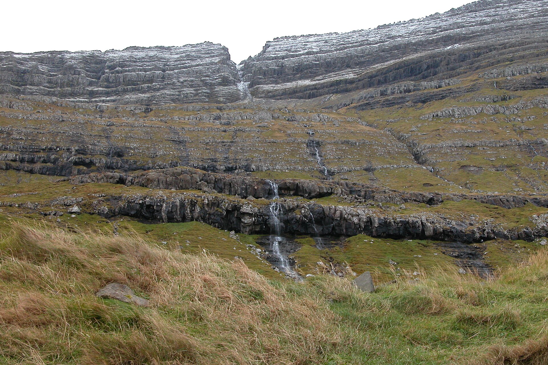
- The Borðoy causeway — Between Borðoy and Kunoy
The causeway between Borðoy and Kunoy is the reason the island is a road trip rather than a boat trip. A safe pull-in gives a view across the water, with Kunoy rising sharply on one side and Haraldssund's houses at its foot. It is a short, easy stop, best on a clear morning when the mountain tops show.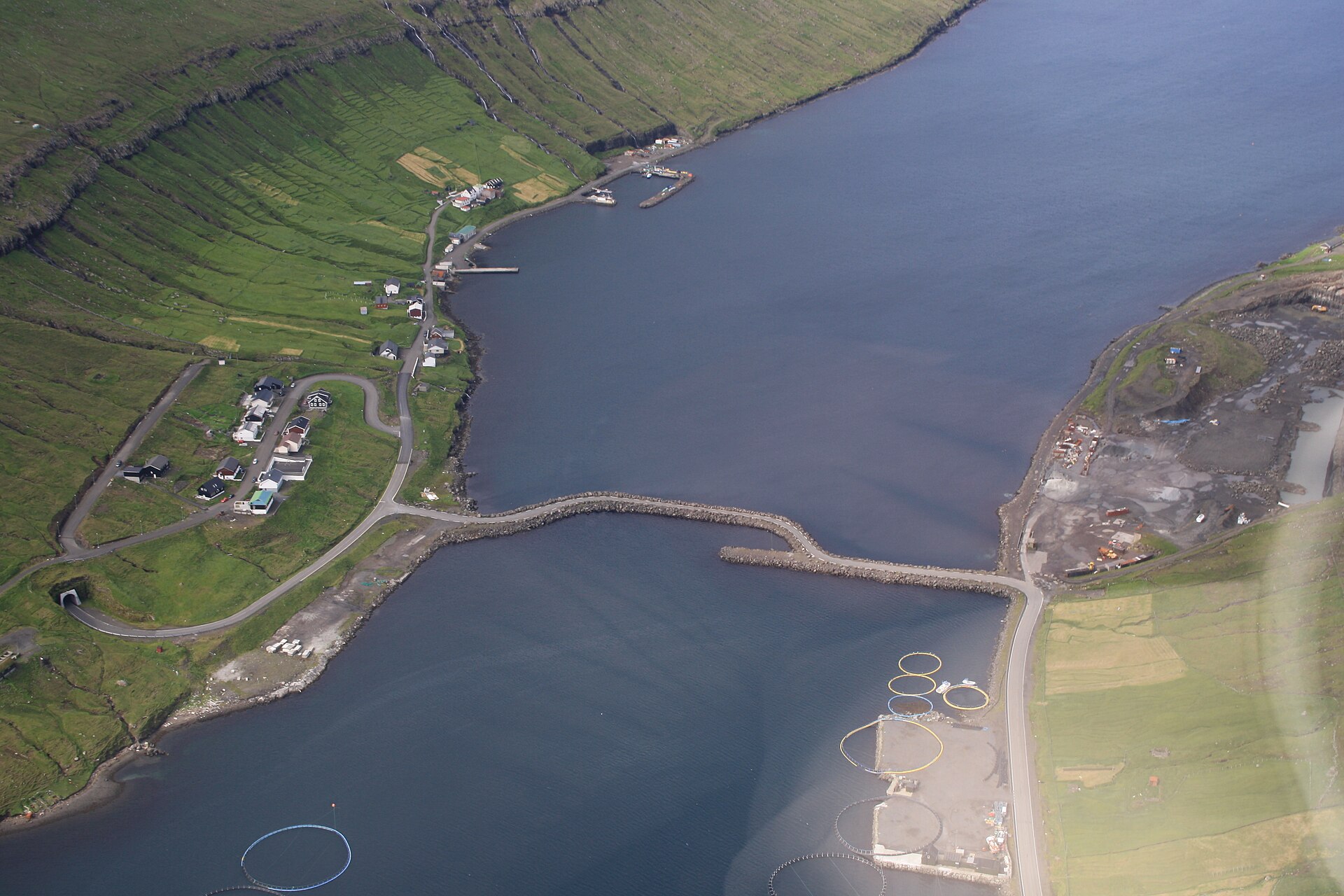
- Skarð — Kunoy, on foot from Haraldssund
Skarð is an abandoned settlement on Kunoy, reached by a hike of around three hours from Haraldssund or over a mountain pass from the village of Kunoy. The walk is the main reason to come: grass, loose stone, weather that changes quickly and no services at the end. Waterproof boots and a charged phone matter. - Kúvingafjall — Kunoy, central ridge
Kúvingafjall, at 830 m, is the highest peak on Kunoy and a landmark from across the sound. Its steep flanks are for experienced hikers in clear weather, since cloud can close in fast. Most visitors are content to admire it from the roadside; anyone climbing should check the forecast and ask locally first.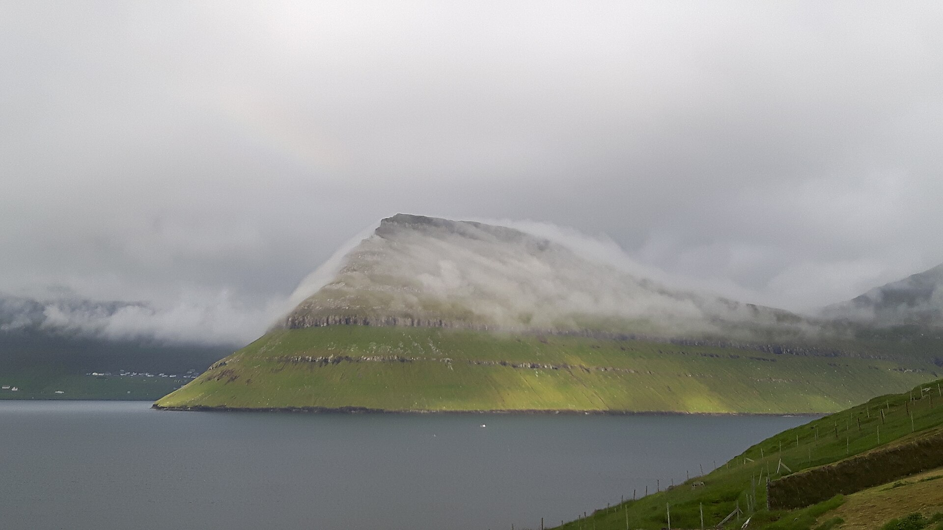
- Klakkur viewpoint — Above Klaksvík, Borðoy
Klakkur, the hill above Klaksvík on Borðoy, gives a clear view of Kunoy beside its neighbour Kalsoy, the two islands standing like long ridges in the sound. It is a simple way to understand the island's shape before driving over, and Klaksvík is also where the area's eateries are found.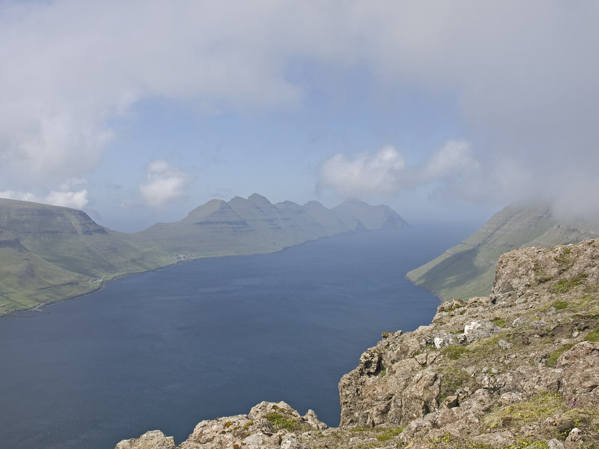
Culture
Kunoy's culture is that of a Faroese outer village: small, practical and closely tied to land and sea. With only 134 residents, nearly everyone knows everyone, and the island's rhythms follow sheep, weather and the road to Klaksvík. Faroese is the language of the home, and a greeting in it is noticed and appreciated. Sheep matter more than their numbers suggest; the slopes are working pasture, which is why the mountains look so closely cropped and why walls and gates appear in unexpected places. Stories carry weight too. The seal woman tale, remembered with a statue on neighbouring Kalsoy, belongs to a wider body of folklore, and trolls are written into the map in names such as Trøllanes. Village churches, such as the one at Viðareiði on the next island with its old silver, reward a quiet look when open. Seabirds are part of local identity as well as the landscape, and the north coast's status as an Important Bird Area reflects that. Hospitality is understated rather than showy: expect a nod and a friendly word rather than a performance. Kunoy has very little tourist infrastructure, so respect for private homes and fields is the main thing a visitor can offer. Stay on established paths, close any gate you open, and keep well away from grazing sheep and nesting seabirds, because every slope here is somebody's pasture.
What to wear
Fashion on Kunoy starts with wool, since sheep are the island's most visible residents. The traditional Faroese national dress is made of wool and worn with silver buttons and clasps; the women's version is layered with a shawl, and the men's has breeches and a knitted cap. It appears at celebrations such as weddings, church confirmations and the national festival in late July, rather than on an ordinary day. Knitted jumpers and shawls with patterned yokes remain the best-known Faroese textile craft, and many are still made at home from local wool. What people wear now is practical: waterproof jackets, wool or fleece mid-layers, sturdy boots and a hat, chosen for wind more than for style. Locals dress for weather that can shift several times a day, and a good jumper is as normal as a raincoat. For visitors the advice is layers. Bring a proper waterproof shell with a hood, windproof trousers if hiking, a warm hat and gloves even in summer, and waterproof walking boots with good grip for wet grass and loose stone. Walking sticks help on steep slopes. There is no dress code for villages or churches beyond ordinary modesty; shorts and a light top are fine on a rare warm day, but pack for cold.
What to eat
- Skerpikjøt — Eateries in Klaksvík, or a home meal if invited
Wind-dried mutton, hung in a ventilated wooden hut until it turns dark and intensely savoury. It is sliced thinly and eaten with boiled potatoes. The taste is salty and gamey, and many first-timers find it an acquired one. - Ræstur fiskur — Traditional-menu eateries in Klaksvík
Fish aged in cool air until the flavour turns pungent, then boiled and served with potatoes. It is a way of keeping food through a damp climate, and it divides opinion among visitors and locals alike. - Lamb soup — Cafés and eateries in Klaksvík
Lamb soup with root vegetables, a plain, warming dish suited to cold days after a hike. Expect tender meat, potatoes and sometimes barley or rice in the broth, with bread on the side. - Fresh fish and shellfish — Harbour-side eateries in Klaksvík
Fresh fish and shellfish, landed at the nearby harbour town and served simply, boiled or pan-fried with potatoes and butter. Cod, haddock and langoustine are common choices, though what is on offer depends on the day's catch and the season. - Rhubarb cake — Cafés in Klaksvík and home kitchens
Rhubarb grows well in Faroese gardens and turns up in cakes, crumbles and jams, a tart counterpoint to heavy meals. Worth trying with coffee after a walk, where a café is open.
Plan it
Best time. May to August for the longest days and the best chance of clear views; spring and autumn bring more wind, cloud and shorter daylight. Rain and mist can arrive in any month, so plan flexible days.
How long. 1–2
Getting there. Fly to Vágar Airport, then drive or take the bus via the Northern Islands tunnel (Norðoyatunnilin) from Eysturoy to Klaksvík on Borðoy; cars pay a toll, so check current details before travelling. The causeway from Borðoy leads onto Kunoy and Haraldssund. Buses connect the islands with Tórshavn.
Budget. mid
Tips
- Eat in Klaksvík or carry food and water, because Kunoy has almost nowhere to buy a meal
- Check the weather and cloud level before any hike; cloud can close in within minutes
- Wear waterproof boots and bring walking sticks for Skarð and other steep ground
- Check visitnorth.fo and https://www.kunoy.fo for current transport and local information
- Expect single-lane tunnels with lay-bys for letting oncoming traffic pass
Etiquette
- Close gates behind you and keep clear of grazing sheep
- Stay well back from nesting seabirds along the cliffs
- In one-lane tunnels, use the lay-bys and give way to oncoming traffic
Nearby
Sources
- Wikidata Q212033 (CC0)
- Wikipedia: Kunoy (rev 1376580021) (CC BY-SA 4.0)
- Wikivoyage: Northern Islands (rev 5412829) (CC BY-SA 4.0)
- Photo: Kunoy 2019 (kallerna) (CC BY-SA 4.0)
- Photo: Causeway Kunoy (R. Hokwerda) (CC BY 3.0)
- Photo: Faroe Islands (Mirek237) (CC BY-SA 4.0)
- Photo: Faroese ram on Kunoy (Tofts) (CC BY 3.0)
- Photo: Fjall í Føreyjum (Gn0s) (CC BY-SA 4.0)
- Photo: Haraldssund (Erik Christensen) (CC BY 3.0)
- Photo: Kalsoy from Klakkur (Ymblanter) (CC BY-SA 4.0)
- Photo: Kittiwakes at Kalsoy (Arne List) (CC BY 3.0)


