King William Island
King William Island, Canada
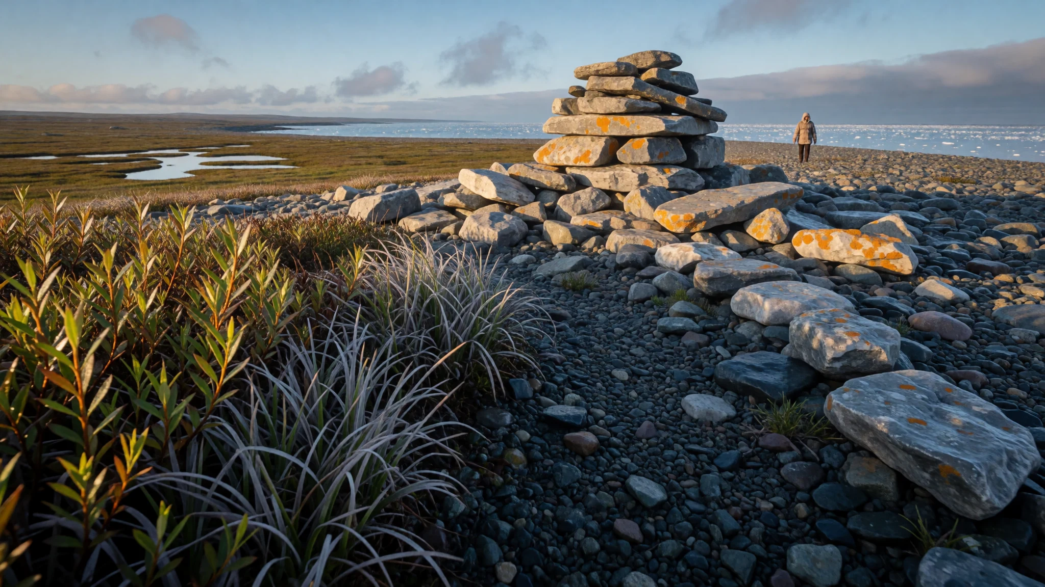
King William Island is a flat, silent Arctic island in Nunavut, where Franklin-era history and living Inuit communities share the midnight sun.
The place
King William Island lies in the Kitikmeot Region of Nunavut, in Canada's Arctic Archipelago, and it is flat, treeless and open to the sky. Its only community, Gjoa Haven, sits on the east side and holds just over a thousand people. The rest of the island is empty tundra, gravel ridges, small lakes and long, low shorelines. Water surrounds it: James Ross Strait and Rae Strait lie to the east, Victoria Strait to the west with Victoria Island beyond it, and Simpson Strait along the south, with Queen Maud Gulf to the south-west. The climate is tundra, a cold desert in effect. Precipitation is low, winters are long and bitterly cold, and summers are cool enough that the sea ice only partly melts. In midsummer daylight lasts almost around the clock; in winter the dark takes over, and the aurora shows well on clear nights, best a short walk from the lights of the settlement. Nunavut means 'our land' in Inuktitut, and the territory's official languages are English, French, Inuktitut and Innuinaqtun. No road or rail reaches the island, so every visitor comes by air or by expedition ship. Services are basic and anything shipped in is expensive. This is a place for people who want space, quiet and history rather than comfort, and who accept that the weather, not the itinerary, decides each day.
Its story
King William Island is known to the wider world mostly through the search for the Northwest Passage, the sea route through Arctic Canada that European navies pursued for generations. Several polar explorers visited or wintered here, because the island sits squarely in the way. The best known is Sir John Franklin, whose 1845 expedition set out with two ships, Erebus and Terror, and never came home. The ships were caught in ice off the island's north-west, and the crews eventually set off on foot across the land. Cairns, campsites and scattered relics along the coast, from Cape Felix to Victory Point and Erebus Bay, have drawn searchers ever since, and Inuit accounts of what their families saw were central to piecing the story together. Later the Norwegian explorer Roald Amundsen wintered beside the island and learned from local Inuit how to travel, dress and hunt in the cold, knowledge that helped him complete the passage. Gjoa Haven takes its name from his ship. For the Inuit, none of this was an empty frontier. The island has long been hunting and fishing country, and it still is. The explorers' ordeal is one chapter in a much longer story of people who knew how to live here.
What to see
- Gjoa Haven — East coast
The island's only community is the base for everything else. Visitors can learn about the Franklin search and Roald Amundsen's winter stay, and meet local guides and outfitters who know the coast. Walk out of town on a clear dark night in the colder months for a better view of the aurora.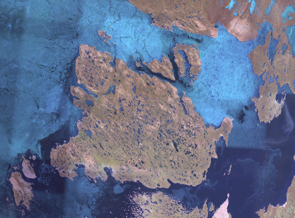
- Cape Felix — Northern tip
The northern tip of the island is a bare, wind-scoured headland with long views over the ice. Expedition parties have found cairns and camp traces here. It is remote, reached only with a guide, and the sense of exposure explains the Franklin story better than any museum label.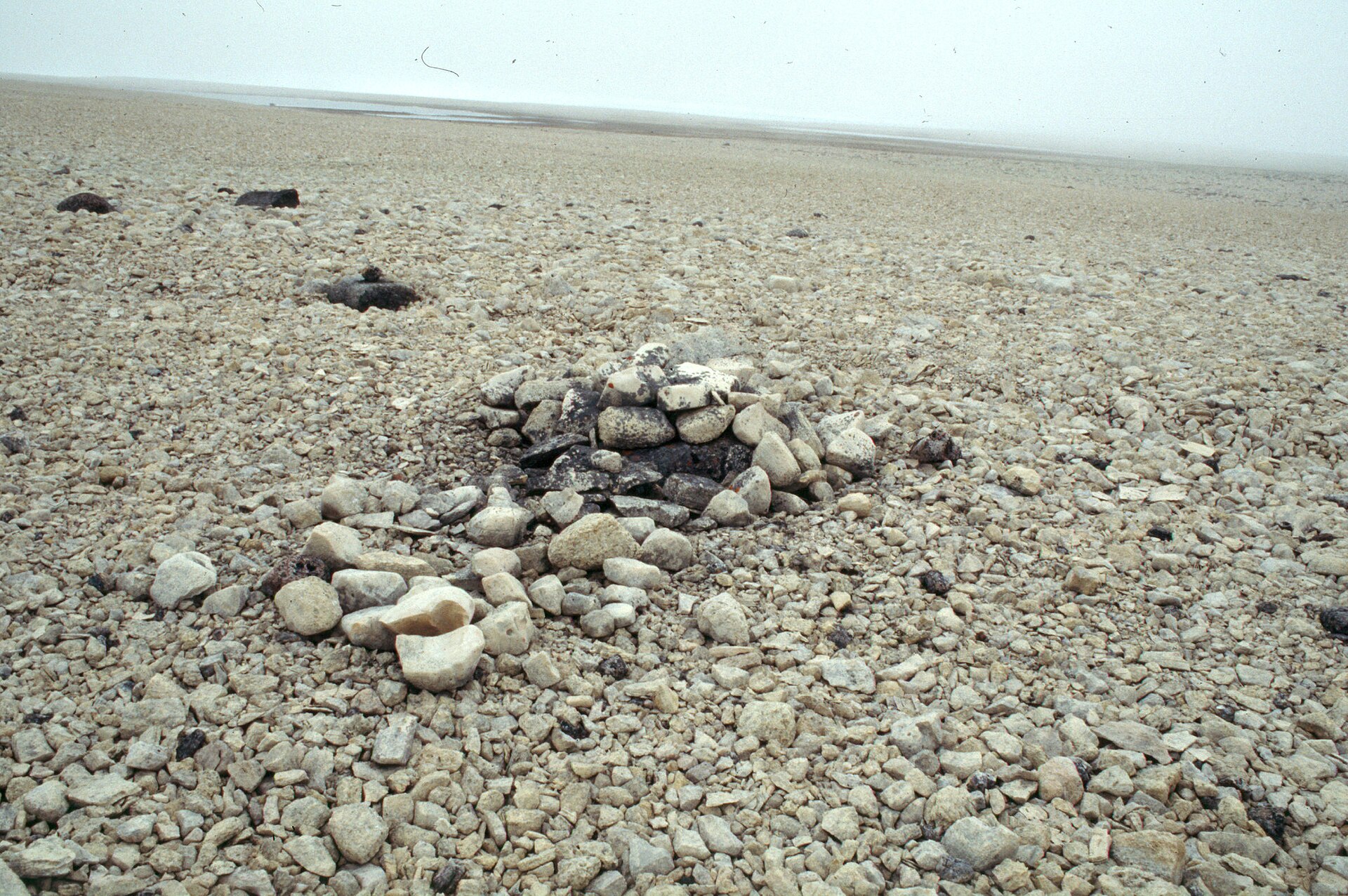
- Franklin summer camp site — North-west coast
A short distance south of Cape Felix, scattered remains mark a camp linked to the lost expedition. There is little to see beyond stones and low tundra, which is the point. Leave everything exactly where it lies, since the site is protected and the ground is fragile.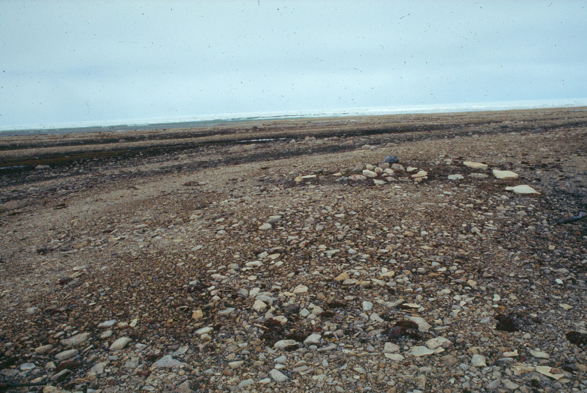
- Victory Point and Erebus Bay — West coast
These stretches of the western coast figure large in the Franklin searches, because relics and human remains were found along them. The shoreline is low gravel and meltwater pools, and the walking is slow. Trips here are usually part of a guided expedition rather than a day out from town. - Simpson Strait and the southern shore — South coast
The channel along the south of the island, with Todd Island and the Adelaide Peninsula beyond, is a good place for a boat trip with local guides. In summer, the open water brings seabirds and sometimes seals, and the shoreline gives a fair view of how the land meets the sea.
Culture
King William Island is Inuit land, and daily life in Gjoa Haven still turns on hunting, fishing and family. Many northern foods come straight from the land and are shared among households, and visitors may see meat drying, boats being repaired or sleds loaded for a trip. Inuktitut and Innuinaqtun are spoken alongside English, and a few words of greeting go a long way. The explorers' history can overshadow the people who have always lived here, so it helps to listen to local guides and elders on how they tell it. Traditions such as drum dancing, throat singing and traditional games continue across Nunavut, and some are performed at community events, which are open only when the community says so. The Inuit population faces real disadvantages in income, health and services compared with the rest of Canada, and it is kinder to avoid raising these as a topic of casual conversation. Many communities in Nunavut restrict alcohol, and some ban it outright, with police sometimes checking luggage at the airstrip. Space is large, but community is small and everyone knows everyone, so a courteous manner counts for more than any gear. Ask before photographing people, their homes or their hunting catch, and check Gjoa Haven's alcohol rules before travelling so that you bring none that is not allowed.
What to wear
King William Island's traditional Inuit dress was built for the cold and still shapes what people wear. Parkas were sewn from caribou skin, with the fur turned inwards for warmth, and sealskin was used for waterproof boots called kamiks. Women's parkas, known as amauti, have a large hood and pouch for carrying a small child. Mitts, trousers and boot liners were also cut from skins and sewn with sinew. Today most people in Gjoa Haven wear modern outdoor clothing: insulated parkas, snow boots, fleece and wool layers, and hats with ear protection, often with embroidered or hand-sewn touches. Traditional garments appear at celebrations and community events, and are often made by family members. Visitors should dress for a cold desert with wind. In summer, bring waterproof boots, a windproof shell, a warm mid-layer, thin gloves and a hat, plus insect netting for the tundra. In winter, a proper expedition-grade parka, insulated boots, face covering and layered thermals are necessary, not optional. Ordinary modest dress is fine in town. Sturdy, broken-in boots matter most, since the ground is rough gravel, wet tundra or deep snow depending on the season.
What to eat
- Arctic char — From local fishers, or at a community gathering
A fish related to salmon and trout, eaten here fresh, dried or frozen, and a staple for thousands of years. Local fishers sometimes sell fillets, and families may offer it boiled or pan-fried. It has a delicate flavour and a pink flesh. - Caribou — Local hunters and household meals
Caribou meat is eaten roasted, boiled, dried or in stews. It is lean and strongly flavoured, and it is a core part of the country-food tradition. Ask in the community about what is available, since supply depends on the hunt. - Seal — Shared at household or community meals
Seal meat is a traditional food, eaten cooked or raw. If you are offered it, trying a small piece is a courtesy, and declining politely is also fine. It is a food of the sea ice and open water. - Country food platter — Community feasts and family tables
In Nunavut, anything the land provides is called country food, including caribou, char, musk ox, seal, Arctic hare and ptarmigan. Sauces may be traditional, or imported items such as soy sauce. Eating it with a local family is the best way to try it. - Tundra berries — Open tundra near town in late summer
Cloudberries, blueberries, crowberries and cranberries ripen in the short summer, and people pick them by hand on the open ground. They are eaten fresh or mixed into desserts. Foraging for wild plants has long supplemented the diet.
Plan it
Best time. July and August are the most practical months: daylight is near-constant, temperatures are as mild as they get, and coastal travel is easiest. Late winter suits snow travel and aurora watching if you are properly equipped. Outside summer, expect long cold and darkness.
How long. 4–6
Getting there. There is no road or rail, so travel is by air to Gjoa Haven's landing strip, normally connecting through larger Nunavut and southern gateways such as Yellowknife or Winnipeg. Check current routings with airlines. Expedition cruises along the Arctic coast are a pricey alternative.
Budget. high
Tips
- Book flights and accommodation well ahead, since choices are few and prices are high
- Arrange guides or outfitters in advance for any trip beyond the settlement, including visits to Franklin-era sites
- Bring cash and cards, and expect high prices for fresh food, which is flown in
- Pack for wind and sudden weather changes, and carry insect protection in summer
- There is no 9-1-1 in Nunavut, so find the local emergency numbers on arrival
Etiquette
- Leave any relics, cairns and campsites exactly as found, since they are protected
- Ask permission before photographing people or hunting catch
- Check local alcohol rules before bringing anything into the community
Nearby
Sources
- Wikidata Q143246 (CC0)
- Wikipedia: King William Island (CC BY-SA 4.0)
- Wikivoyage: Nunavut (CC BY-SA 4.0)
- Wfm king william island.png (Public domain)
- Operational Navigation Chart C-11, 2nd edition (Public domain)
- Franklin Summer Camp, Stephen Trafton (CC BY-SA 4.0)
- Adolf Lindstrøm with fish samples, Nasjonalbiblioteket (CC BY 2.5)
- Bottle with Schwatka's note, Stephen Trafton (CC BY-SA 4.0)
- Remains of the cairn containing Schwatka's note, Stephen Trafton (CC BY-SA 4.0)
- Base Camp for the 1989 King William Island Expedition, Stephen Trafton (CC BY-SA 4.0)
- Franklin's Summer Camp site south of Cape Felix, Stephen Trafton (CC BY-SA 4.0)


