Khara-Khoto
Khara-Khoto, People's Republic of China
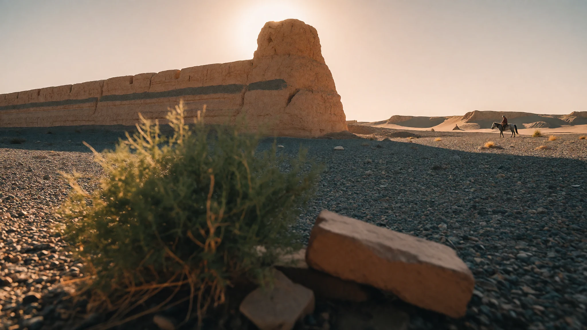
Khara-Khoto is a walled Tangut and Mongol-era trading city left to the Gobi, where silence, sand and crumbling ramparts carry the story.
The place
Khara-Khoto, also called Heicheng, is a ruined city at the western end of Inner Mongolia, about 25 km south of the seat of Ejin Banner in Alxa League. The name means Black City, and what remains is a walled rectangle of earthen rampart enclosing low mounds, collapsed lanes and a few brick stupas. Beyond the walls there is gravel plain, drifting sand and the dry basin around Juyan Lake. The ramparts still rise well above head height in places, and from the top the whole layout reads clearly, which is rare for a site this old.
The setting explains both why the city was built and why it was lost. It stood on a trade route, with water close enough to support a garrison and a market, and the desert has simply taken it back. Nothing here is restored. There are no souvenir rows, and the sense of scale comes from emptiness rather than monuments.
Inner Mongolia is an autonomous region of China, and most of its people are Han Chinese, with a minority of ethnic Mongols. The Ejin area feels remote even by regional standards. Crowds are almost never the problem; distance, heat, wind and the lack of shade are. Summer afternoons on the open plain are punishing, winter nights are bitterly cold, and the light is best in the early morning and late afternoon, when the wall shadows lengthen and the dust settles. Photographers and history readers tend to come away happiest, as do people who enjoy silence.
Its story
Khara-Khoto was founded in 1032 and grew into a trading centre of the Western Xia state, the realm of the Tangut people. Its walls enclosed a compact city, and its position on the edge of the desert made it a stop for caravans and soldiers alike. Genghis Khan's forces took the fortress in 1226. A common story says the conquest ended the city, but the record points the other way: it kept thriving under Mongol rule.
Under Kublai Khan the city was enlarged until it covered about three times the area it had held under the Tangut. It sat at a crossroads linking Karakorum, Shangdu and Kumul, so it mattered for both trade and strategy. Later, the Northern Yuan court under Toghon Temür made it a base for planning a return to the Central Plain. Eventually the people left, and the sand moved in.
Marco Polo seems to describe it. His Etzina, a day's ride from the desert edge in the Tangut province, is generally identified with Khara-Khoto, and Ejin Banner takes its name from that old form. He mentions camels, cattle and fine hunting falcons.
The site became known to the wider world through explorers. The Russian officer Pyotr Kozlov dug here and wrote about the 'dead city', and Aurel Stein followed with his own survey and photographs. Much of what they carried away, including Tangut books and Buddhist paintings, now sits in museum collections far from the desert, which is why the ruins themselves feel so bare.
What to see
- The rampart circuit — Khara-Khoto ruins, south of Ejin Banner
The earthen walls of Khara-Khoto form a rough rectangle and are the clearest thing to see. Walk the outside first to judge their scale, then find a safe place to look across the interior. Gaps and gateways show where the city opened to the desert. The best light is early or late, when the layers in the earth show.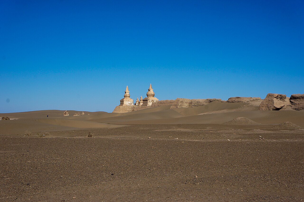
- The south-west corner tower — South-west corner of the walls
A tower survives at the south-west corner of the walls, and early expedition photographs show it much as it looks now: a stubby, weathered shape against empty sky. It is a good marker for orientation and a fair place to compare old pictures with the present state of the earth, which is worn but standing.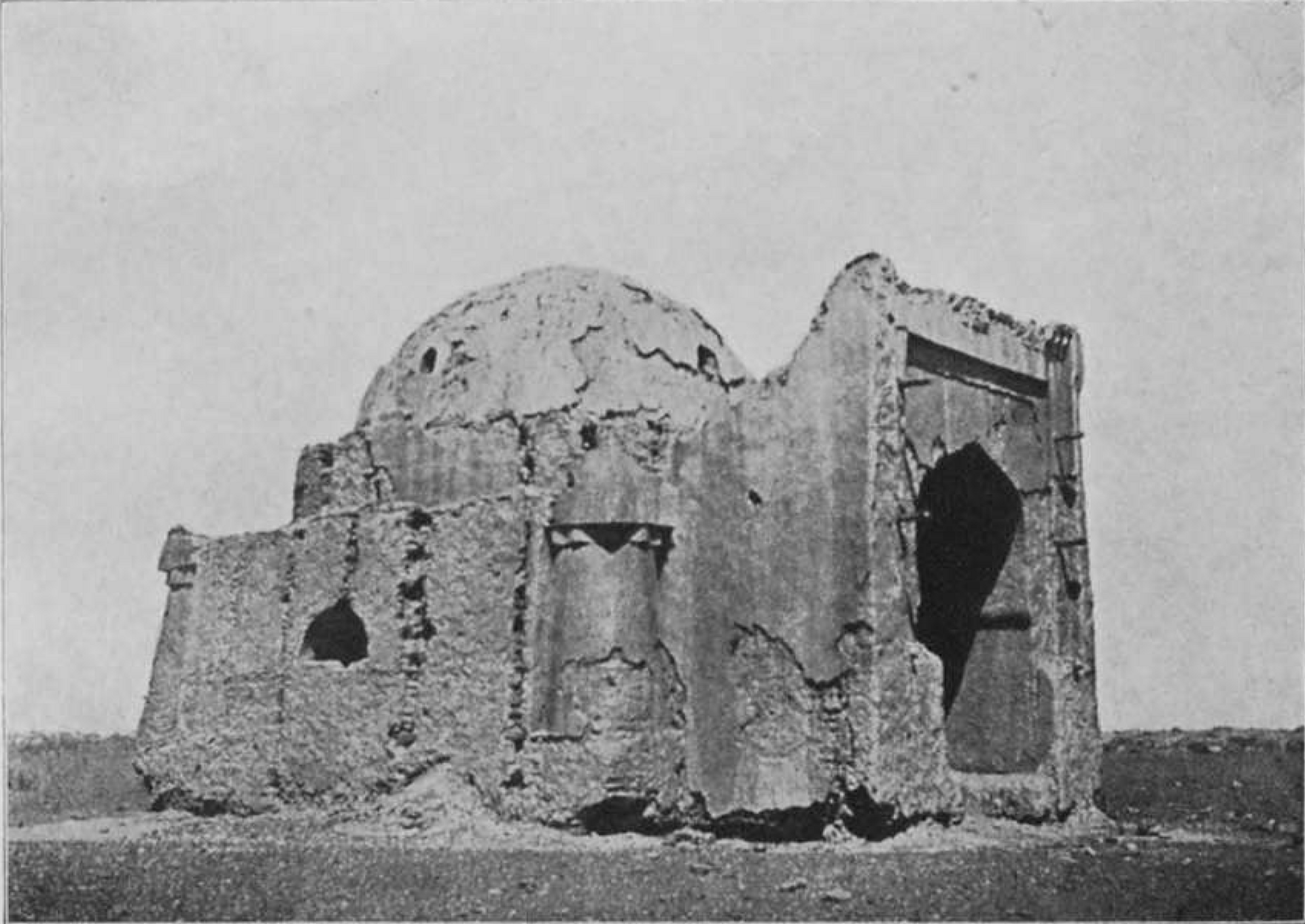
- The interior streets and mounds — Inside the ruined city
Inside the walls the plan of the city can still be traced in low ridges, rubble and the stubs of buildings. The old expedition plan is useful for matching what you see to the original layout. Take care on loose ground and keep to paths, since the surface is fragile and the foundations are easily damaged.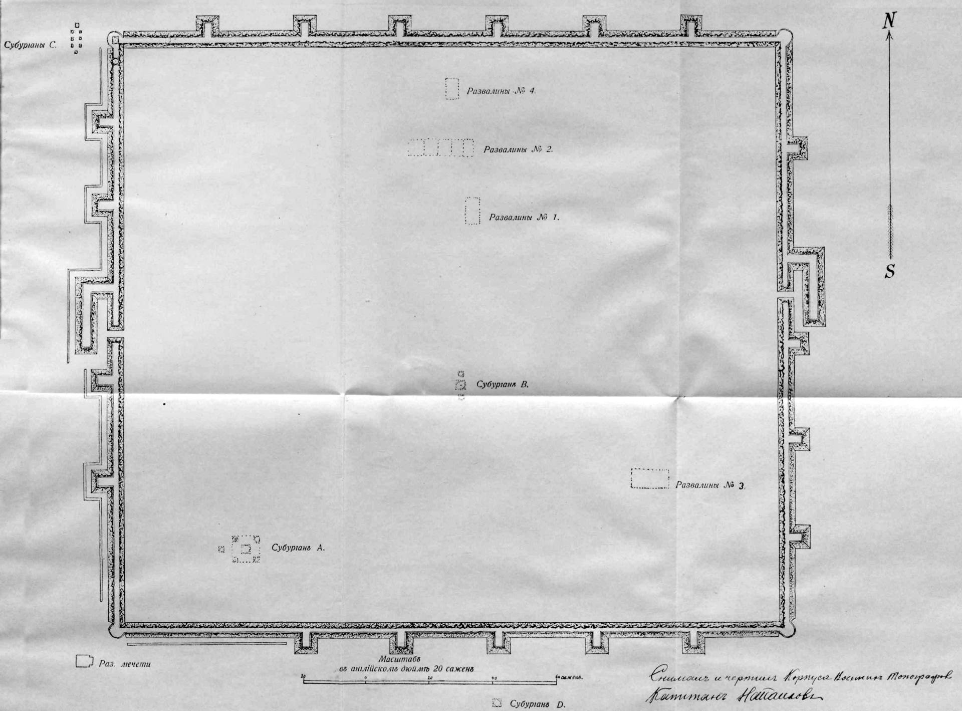
- The tomb at the south-east corner — South-east corner, outside the main wall line
A Muslim tomb stands at the south-east corner of the site, photographed by Aurel Stein in 1914. It is a reminder that the city drew a mixed population as a crossroads, and that its later life under Mongol rule was not confined to one faith. It is small and quiet, and worth a few minutes.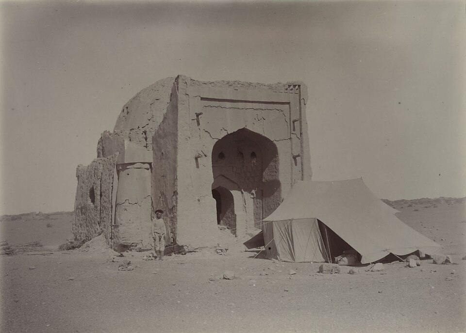
- Ejin Banner and the Juyan basin — Ejin Banner, Alxa League
The town that serves as the seat of Ejin Banner is the practical base for the ruins, and its name preserves the old Etzina of Marco Polo. The surrounding country is dry basin, riverside poplar and open Gobi, which helps explain why anyone built a city here. Allow time for the drive as part of the experience.
Culture
Khara-Khoto belongs to several overlapping cultures. The Tangut built it, and their Western Xia state had its own script, Buddhist institutions and law. Later the Mongols made it a working city, and the finds recorded by early expeditions show Buddhist art alongside the signs of a mixed trading population. A Muslim tomb at the edge of the site fits that picture.
Today the area belongs to Inner Mongolia, an autonomous region of China, and many local people are Mongol herders and townspeople. Mongolian milk tea, hospitality to guests and a strong sense of the open land are part of daily life in the Alxa region. Visitors should know that Inner Mongolia is a Chinese region and not a part of the Republic of Mongolia. Treating the two as one place can cause offence, and political talk of that kind can be taken as separatist, so it is best avoided in conversation.
The ruins themselves have a quiet, almost funerary feel, and most local visitors treat them with respect. There are no ceremonies for tourists, and the experience is more of reflection than of spectacle. If you meet herders or townspeople, a little patience and friendliness go a long way, and interest in their home is usually welcome.
Do not climb on the walls, stupas or tomb, and do not pick up or take away any fragment of brick, pottery or bone, however small it looks.
What to wear
In Khara-Khoto's region the traditional garment for Mongol people is the deel, a long wrap robe fastened at the side and tied with a sash, made in cotton for summer, silk or brocade for festivals and padded or sheepskin-lined for winter. It is worn with leather boots, often with upturned toes, and a hat that changes with season and occasion. Silk deels in strong colours appear at weddings and at gatherings such as Naadam, while herders still wear plainer, heavier versions for work in cold weather. For the Tangut period, only fragments of textile and painted images survive, so little can be said about everyday dress with confidence.
Day to day, people in Ejin and the nearby towns wear what most people in northern China wear: jackets, trousers, fleeces and sturdy shoes, with the deel kept for events and for those who ride or herd. Clothes are practical first, because the climate swings hard between seasons.
Visitors should dress for sun, wind and dust more than for custom. Wear long, loose, light layers, a wide-brimmed hat, sunglasses and a scarf that can cover the face in blowing sand. Closed shoes with a good sole suit the uneven ground. Bring a warm layer even in summer, because desert evenings cool fast, and proper winter gear from late autumn. No special dress code applies at the ruins, though modest clothing is sensible in towns.
What to eat
- Mongolian milk tea — Guesthouses and family eateries in Ejin Banner
Mongolian milk tea is the region's signature drink, usually a salted, milky brew rather than a sweet one. It is served at breakfast in many guesthouses and offered to guests in family homes. It is warming after a cold morning on the plain and worth trying even if the salt surprises you. - Roast lamb — Local Mongolian restaurants in Ejin Banner
Lamb is the centre of most Mongolian meals, and the roasted version comes with a spiced coating that gives it a strong, distinct flavour. It is usually shared at a table as a main dish. Portions are generous, so it suits a group better than a solo traveller. - Mongolian hotpot — Hotpot restaurants in the main town streets
Hotpot is popular across China, and the Mongolian style uses a well-flavoured broth without the fierce chilli heat of the central provinces. Thin slices of lamb and vegetables are cooked at the table. It is a sociable, warming meal after a day in the cold or wind. - Yoghurt and fresh cheese — Small shops and family kitchens in Ejin Banner
Dairy runs through traditional Mongolian eating, with milk, yoghurt and cheese appearing on many tables. Quality varies by season and by maker, so it is best to buy from a place that looks busy. Plain yoghurt is a gentle option if the heat or travel has unsettled your stomach. - Dried milk curd — Local shops and markets, and herder households
Dried milk curd is a hard, sour snack made on the steppe and kept for months. It is chewy rather than pleasant at first, and many people grow to like it. It travels well in a bag, which makes it a practical item to carry on a long desert drive.
Plan it
Best time. April–May and September–October are the most comfortable months, with lighter heat and gentler wind. Summer afternoons on the open Gobi are very hot, and winter is bitterly cold and exposed, so both need serious preparation.
How long. 1–2
Getting there. Fly to a major Chinese city and then take a domestic connection towards the Alxa area, since most Inner Mongolian airports handle only domestic flights. The last leg is a road journey of about 25 km south from the seat of Ejin Banner. Ask a local operator about current road and access conditions.
Budget. mid
Tips
- Arrange a driver or local guide in Ejin Banner, because the final stretch crosses open desert
- Carry plenty of water, food and sun protection, as there is little shade or help at the ruins
- Visit early in the morning or late in the day to avoid heat and get better light
- Check current access rules and opening arrangements with a local operator before you go
- Keep some cash as well as cards, since small places may not take cards
Etiquette
- Do not climb on walls, stupas or the tomb, and leave all fragments where they lie
- Do not describe Inner Mongolia as part of the Republic of Mongolia
- Ask before photographing local people, especially herders
Nearby
Sources
- Wikidata Q1584528 (CC0)
- Wikipedia: Khara-Khoto (rev 1376656756) (CC BY-SA 4.0)
- Wikivoyage: Inner Mongolia (rev 5293903) (CC BY-SA 4.0)
- Photo: Khara-khoto exterior, Fandorine1959 (CC BY 3.0)
- Photo: Moon-Water Bodhisattva Kuanyin, detail of entertainers (State Hermitage Museum) (Public domain)
- Photo: Muhammadan Tomb K.K.VI, Aurel Stein (CC0 1.0)
- Photo: Map from Kozlov's Mongolia and Amdo and the Dead City of Khara-Khoto (Public domain)
- Photo: Khara-Khoto from south-west (Public domain)
- Photo: Khara-Khoto from north-west (Public domain)
- Photo: Tower in south-west corner of Khara-Khoto (Public domain)
- Photo: Plan of Khara-Khoto city ruins (Public domain)


