Joya de Cerén
Joya de Cerén, El Salvador
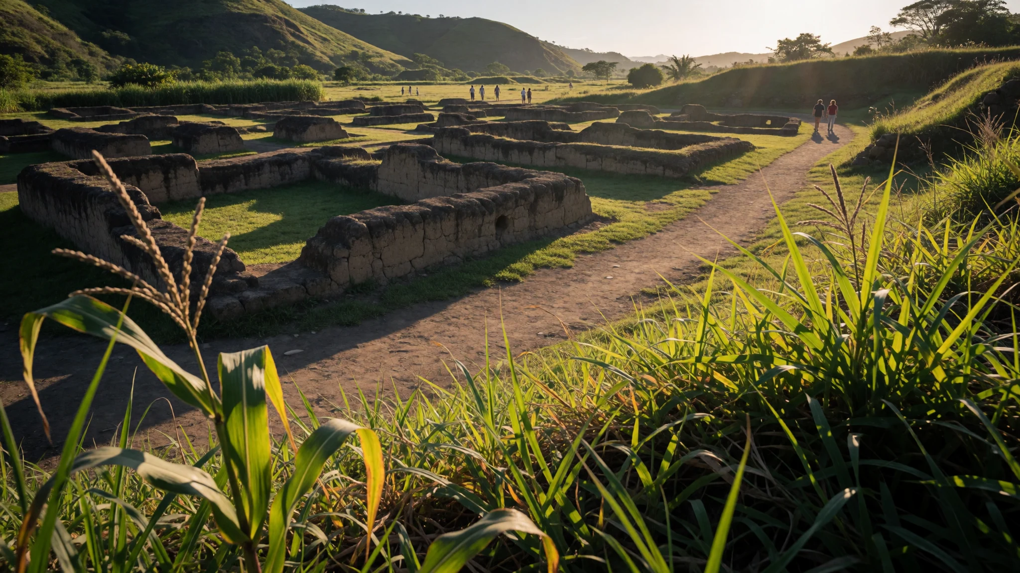
Joya de Cerén is a Maya farming village preserved under volcanic ash, where everyday spaces survived like a time capsule.
The place
Joya de Cerén (Jewel of Cerén) is an archaeological site in the La Libertad Department of El Salvador, in the Zapotitán Valley. What makes it feel different from many ruin sites is the “whole village” atmosphere: excavated homes, work areas, and communal space are laid out in clusters, so the place reads less like a monument and more like an actual settlement.
The village was engulfed by ash after a volcanic eruption from the Loma Caldera region, and that fast burial helped preserve fragile traces of daily life. Instead of only stone architecture, researchers also find plant remains and farming evidence, turning the site into a rare kind of evidence for how Classic period Maya agricultural communities lived.
A visit works best with a slow walk through the mapped areas. The central open courtyard, the plaza-style space, gives a sense of how households faced inwards. Nearby, different buildings were interpreted in distinct ways, including structures thought to support food preparation and other household tasks, and areas linked to ritual life.
Crowds are usually lighter than at the region’s headline ruins, but the site is still popular enough that mid-morning can feel busy—especially if cruise groups or bus tours arrive together. The terrain is outdoors and exposed, so heat builds fast; bringing water and decent footwear makes the walk much more comfortable.
Its story
Joya de Cerén’s story starts with a farming community caught by geology. A volcanic eruption around the Loma Caldera buried the settlement quickly, sealing households under ash and preserving the layout of homes and the surrounding fields. The result is a rare archaeological window into how a Maya village functioned as an everyday place, not only as a ceremonial stage.
The site later became known in a very practical, almost ordinary way: construction work for an agricultural project cut through the area, and that accident uncovered buildings and artefacts. Excavations then moved in phases. Work was carried out in the late 1970s under the supervision of Anthropology Professor Payson Sheets, but the broader political situation disrupted research during the early 1980s. Excavations resumed later in 1988, and since then, careful study of the preserved spaces has shaped the interpretation.
Because ash preserved so much more than walls, the site is often associated with the idea of “life preserved”: mapped households, gardens, and farming zones where crops were grown. Scholars have focused on what these traces say about work, routine, and the practical skills needed to farm the Zapotitán Valley. Even the fact that human remains were not found is part of the mystery travellers feel on site—how the community left, how quickly, and what everyday moments were interrupted when the eruption turned ordinary life into archaeology.
What to see
- Plaza (central courtyard) — central plaza area
Joya de Cerén’s Plaza is the open, communal courtyard space where household structures sit around the edges. Walking the perimeter helps explain daily rhythms—movement between rooms, work areas and indoor-outdoor transitions—without needing big explanations.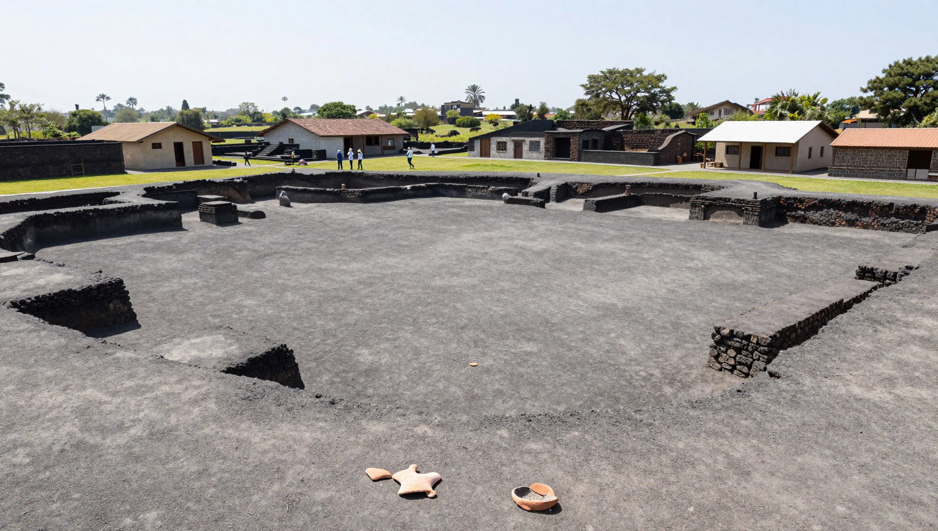
- Structure 9 (Tamazcal) — Area 2
Structure 9 is the Tamazcal: a steam-bath or sauna-style space linked with Mesoamerican water-on-heated-rock traditions. The preserved layout makes it feel hands-on—like a working room rather than a symbolic monument—so it stands out on a circuit through Area 2.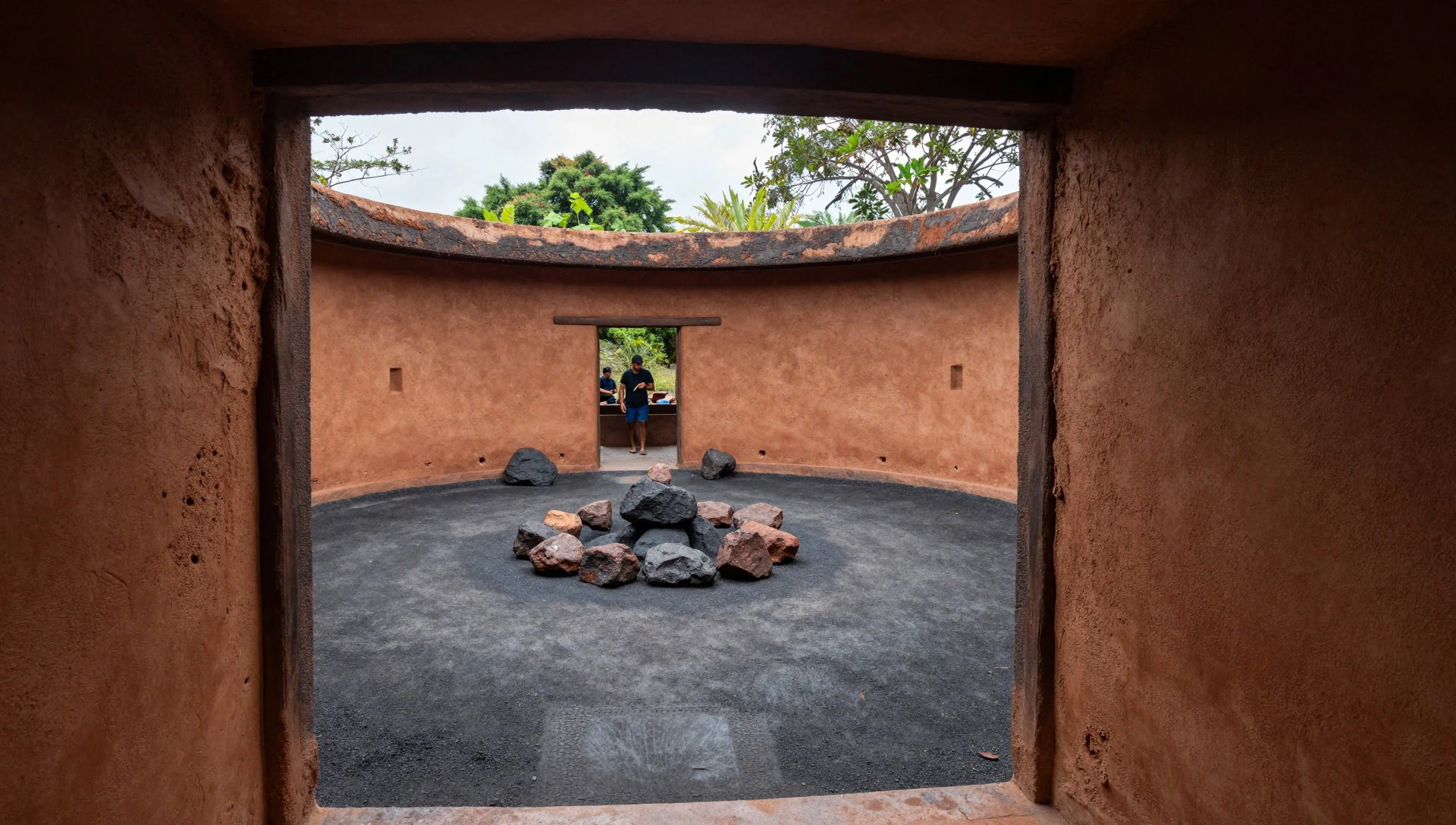
- Structure 12 (ceremonial centre) — Area 1
Structure 12 is interpreted as a religious and ceremonial centre, with evidence suggesting rooms used for gender-specific rituals. Even in ruins, the building’s internal organisation reads clearly; it’s one of the places where the settlement feels most “purpose-built”.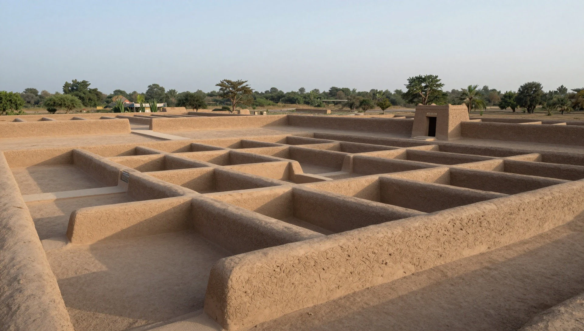
- Structure 10 (community ceremonial functions) — Area 2
Structure 10 is thought to have served community ceremonial purposes, with rooms that may also connect to food preparation and social activities. This is a good stop for understanding how spaces blurred between “gathering”, “cooking” and “hosting” inside one compact village plan.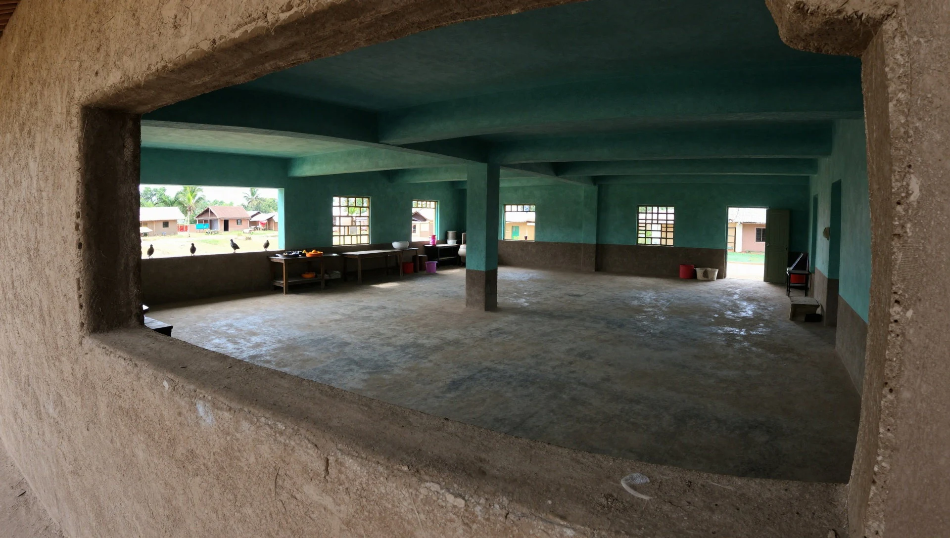
- Household clusters and milpas (fields) — site map areas (households and milpas)
Joya de Cerén’s mapped household clusters and the “milpas” areas show the farming side of village life. Seeing the distance between homes and field zones gives context for why food work mattered as much as architecture—an essential part of why the site feels different from typical ruins.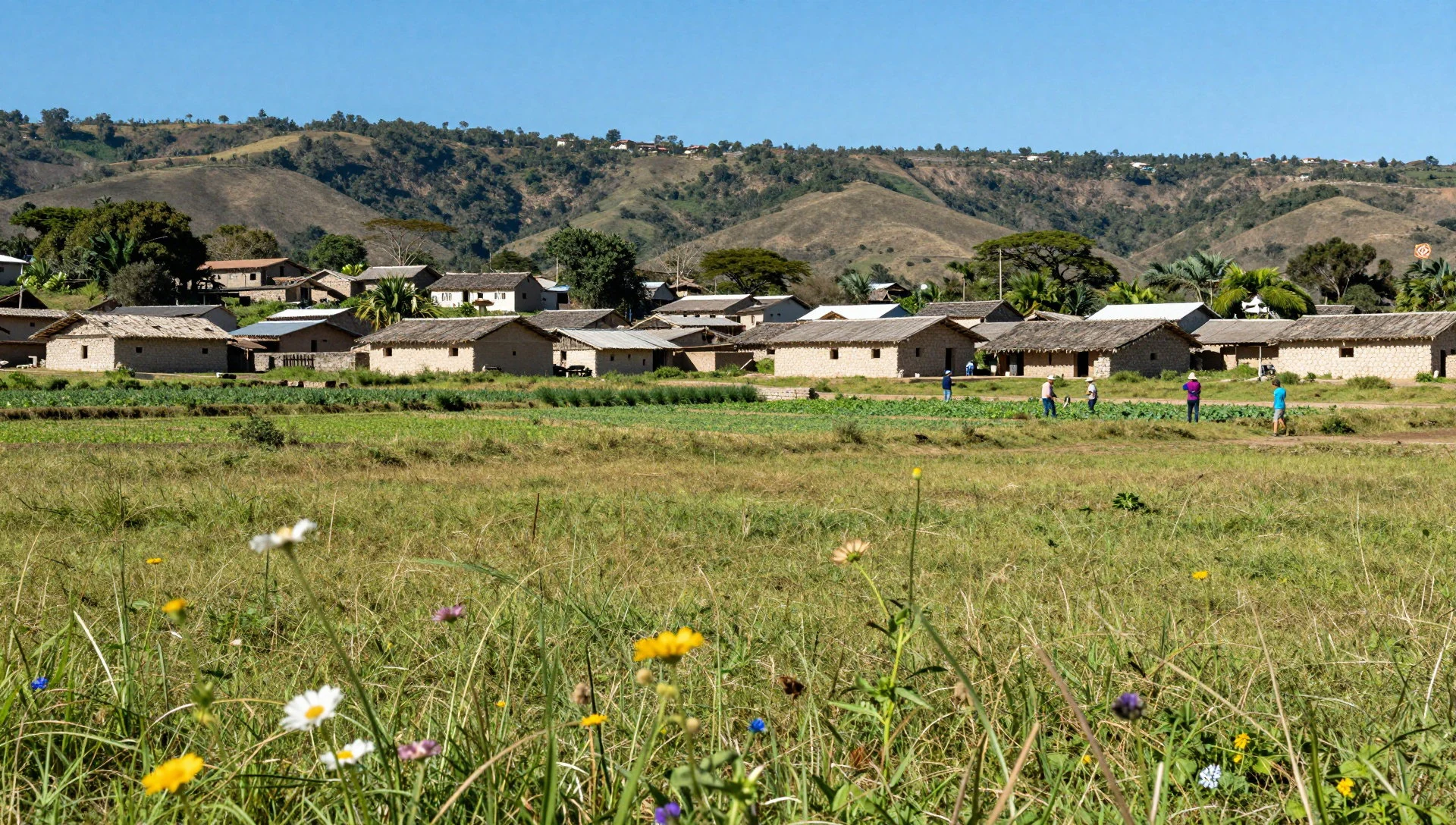
Culture
Joya de Cerén is a working archaeological site, so treat it like a place where excavated rooms deserve calm attention. The ruins are outdoors, with paths that can be dusty after dry weather; slow down near ramps and uneven ground, because people tend to bunch up around the most visually clear structures.
Photography is generally fine, but avoid blocking routes inside open courtyards, especially around the plaza area where visitors naturally pause. If a guide is explaining building features, keep your voice low and give them a clear line of sight—what looks like “just stones” has a lot of interpretation behind it, and the atmosphere improves when everyone listens together.
Dress practically: the site sits in a warm, exposed valley setting. Long sleeves and a light hat help with sun and dust, and sturdy shoes matter because you’ll be on foot for a while. Bring water and don’t assume you’ll find quick snacks on-site.
Visitor etiquette: Keep to marked paths, avoid stepping into excavated areas, and wait your turn before photographing other visitors inside courtyards.
What to wear
At Joya de Cerén, the climate and the walking do most of the dictating. Expect warm conditions and dusty outdoor paths, so a breathable top, lightweight trousers or knee-length shorts, and sun protection (a hat or cap) are the smart baseline. Since several spaces are religiously interpreted, visitors should also aim for modesty: shoulders covered on exposed days feels more respectful and helps with sun.
There isn’t a single “temple uniform” here, so most people wear everyday clothes, but choosing neutral colours and comfortable layers keeps things practical. Footwear matters: choose closed shoes with grip for uneven, dusty ground. If it’s rainy, bring a light waterproof layer or poncho-style cover rather than something bulky that will trap heat.
Traditional dress in El Salvador is worn for cultural events and ceremonies, often involving woven textiles and garments suited to local styles, but at the archaeological park the norm is casual. For visitors, the main “dress code” is simply to look after the site (no trampling, no intrusive handling) and look after yourself (sun, dust, and the long walk between structures).
What to eat
- Moros y cristianos — casual Salvadoran eateries in San Salvador
Moros y cristianos—black beans with rice—shows up as a classic Salvadoran side or main plate. Look for it in casual places around San Salvador, where it’s commonly paired with grilled items and simple salads.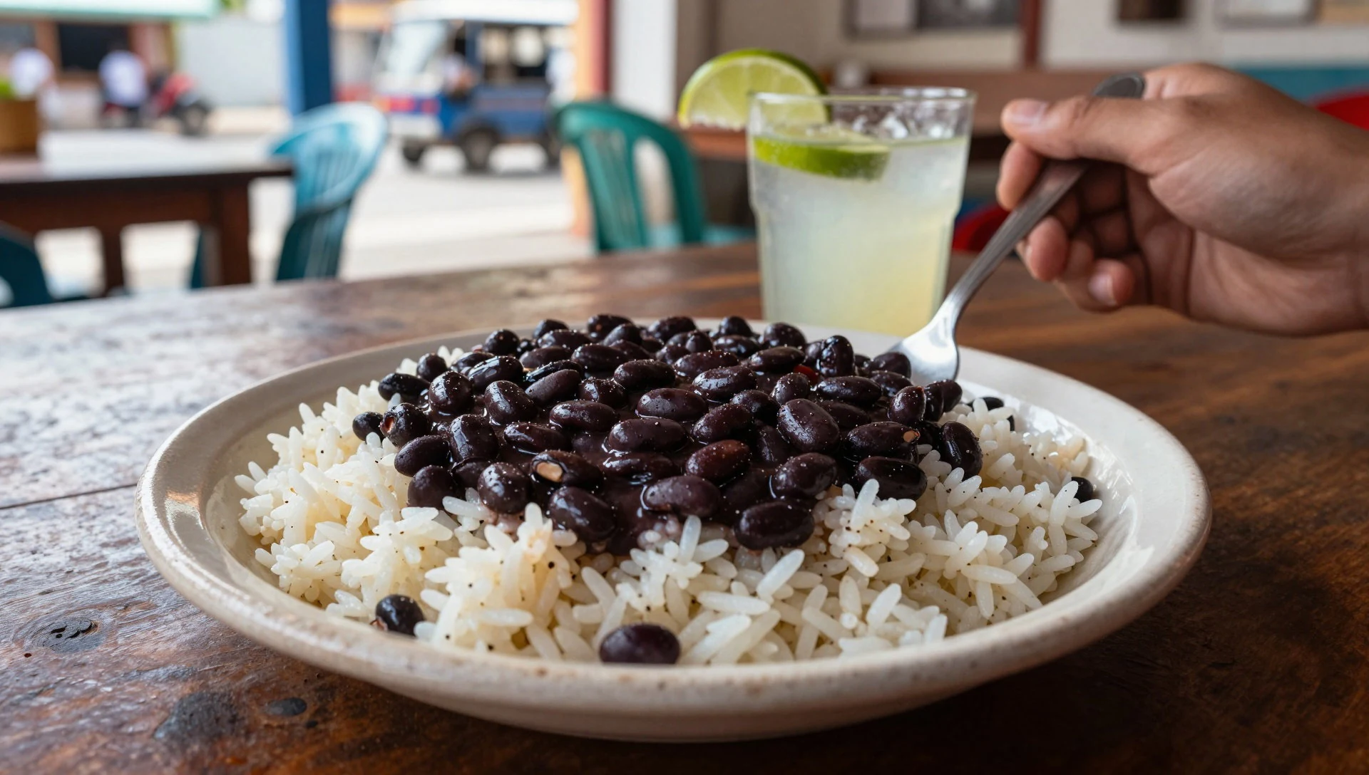
- Grilled chicken — casual family-friendly eateries in San Salvador
Grilled chicken is a reliable, straightforward option when visiting archaeological sites. It’s usually served with rice or beans and comes with basic garnishes, so it’s an easy way to refuel between tours.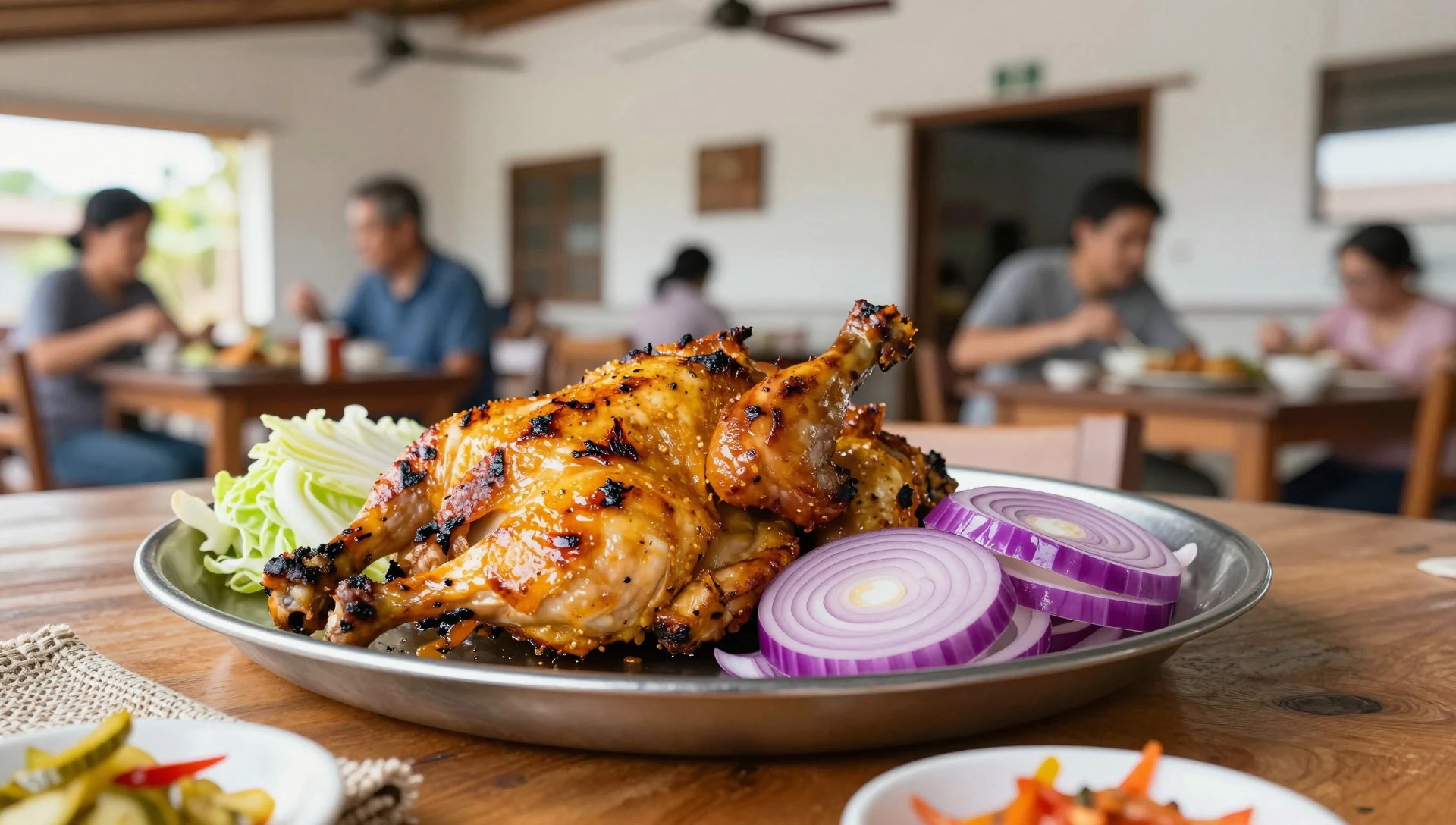
- Marinated onion salad — typical Salvadoran plate lunches and family-style eateries
A simple salad with marinated onions is a common accompaniment in Salvadoran meals, adding crunch and a tangy edge. It’s typically served alongside richer plates like beans and rice. - Casual set lunches near the park — near the archaeological park
There’s at least one small local place close to the archaeological park, good for a quicker stop without returning fully to the city. It’s the kind of place to grab something simple and keep the day moving. - Simple café-style drinks — neighbourhood cafés and casual spots in San Salvador
After walking around the ruins, a cold drink helps more than another snack. In El Salvador, you’ll often find basic, café-style beverages alongside plates, which suits travellers who don’t want a long sit-down.
Plan it
Best time. November for the coolest, driest daytime weather, and January–March for generally easier walking; the hottest months are June through September, and the wettest stretches are from May to October.
How long. 2–3
Getting there. Joya de Cerén is about 36 km northwest of San Salvador; the easiest approach is a taxi or Uber for the whole trip (around 30 minutes), or a bus as far as Puente Seco (Cd. Arce) followed by a taxi for the last stretch (about 10 km).
Budget. mid
Tips
- Start early to keep the outdoor walk cooler and avoid the busiest arrival waves.
- If using public transport, plan for an extra wait time when switching from the bus to a taxi.
- Wear closed shoes with grip; the ground can be dusty and uneven around excavated areas.
- Bring cash for small purchases at roadside or nearby stops, even if some places take cards.
- Carry water and a hat; there’s limited shade while moving between structures.
Etiquette
- Stay on marked paths and don’t enter excavated rooms or sensitive areas.
- Keep voices down in the plaza area so explanations and visitor flow stay comfortable.
- Ask before photographing people up close, especially around pause points.
Nearby
Sources
- Wikidata Q27985 (CC0)
- Wikipedia (rev 1373778366) (CC BY-SA 4.0)
- Wikivoyage (rev 5100521) (CC BY-SA 4.0)
- Photo: ES_Joya_Ceren_05_2012_Estructura_9_Area_2_Tamazcal_wide_angle_1479.JPG (CC BY 3.0)
- Photo: Plan_of_Joya_de_Cer%C3%A9n.jpg (CC BY-SA 4.0)
- Photo: ES_Estructura_1_Area_1_Joya_Ceren_05_2012_1513.jpg (CC BY 3.0)
- Photo: ES_JoyadeCeren_06_2011_Estructura_2_Area_2_2107.jpg (CC BY 3.0)
- Photo: ES_Joya_Ceren_structure_4_Area_3_05_2012_1462.JPG (CC BY 3.0)
- Photo: ES_Joya_Ceren_structure_11_y_6_y_1_Area_1_1491.jpg (CC BY 3.0)


