Heligoland
Heligoland, Germany
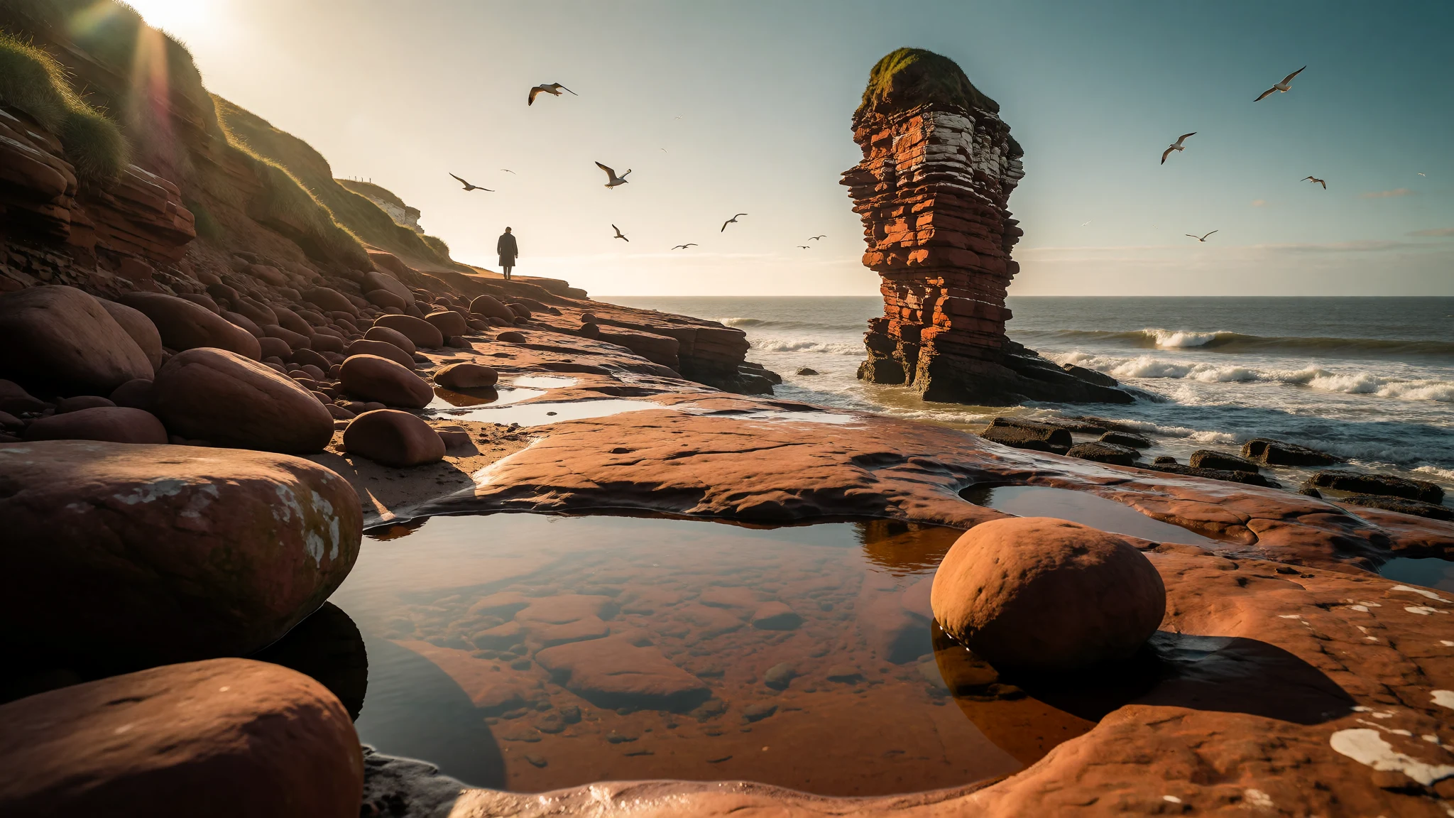
Heligoland is Germany's remote North Sea island, with red cliffs, crowded seabird ledges and a sandy neighbour island where seals haul out.
The place
Heligoland (German: Helgoland) is a small archipelago in the North Sea, politically part of Schleswig-Holstein. It is the only German island group that does not sit near the mainland. Open water separates it from Cuxhaven, at the mouth of the Elbe, by roughly 69 kilometres of sea route, so the crossing is part of the experience rather than a formality.
There are two islands. The main island is triangular, about a square kilometre in area, and home to nearly all of the 1,297 residents. Its elevation is given as 40 metres, which is enough to make the sandstone edge feel like a proper cliff. A lower town clusters around the harbour, while the flat plateau above, the Oberland, holds the Upper Town, walking paths and the cliff-top viewpoints. To the east lies the Düne, a low sandy island with beaches and a regular seal presence, reached by a short hop from the main harbour.
The islanders are ethnic Frisians. Alongside German they speak Halunder, a North Frisian dialect, and the island's own name for itself translates roughly as 'the Land'.
The climate is oceanic and gentle for its latitude. Winters rarely dip below freezing, and can run warmer than Hamburg because the sea softens cold air blowing in from the east. Spring is cool, but autumn tends to hang on here after the mainland has cooled, and the air is almost free of pollen, which suits hay-fever sufferers. Sunshine totals are decent for the North Sea, though wind and sudden showers are part of the deal at any time of year.
Its story
Heligoland has been visited for a very long time. Flint tools have been dredged from the seabed around it, and until the late nineteenth century burial mounds still stood on the Oberland; digging them out revealed skeletons and grave goods. Copper plates found underwater nearby were very probably made on the plateau, and finds from the twelfth to fourteenth centuries suggest copper ore was later worked here too.
Written history starts with a story from Alcuin's life of Willibrord: in 697 the Frisian king Radbod is said to have fled to the island after losing to the Franks. By the thirteenth century it was listed as property of the Danish crown. The name is usually read as 'holy land', though other explanations circulate, including a Danish king called Heligo, a Frisian word for a salt-marsh island, and 'land of banks' that vanish and reappear with the tide.
Life depended on the sea: fishing, hunting seals and seabirds, salvaging wrecks, and guiding merchant ships into the Hanseatic ports of Bremen and Hamburg. In some seasons herring catches were rich.
Denmark lost the island to Britain in the early nineteenth century, and British rule lasted until the island passed to Germany near the end of that century. After the Second World War, Britain administered it again within its occupation zone until 1952, when it returned to West German control. It was here in 1841 that the poet Hoffmann von Fallersleben wrote the words of the song that later became Germany's national anthem.
What to see
- Lange Anna — Northern tip of the main island
The island's best-known landmark is a slender red sandstone sea stack, 47 metres high, standing just off the northern tip. It is best seen from the clifftop path on the Oberland, where the rock, the harbour mole and open sea fit into one frame. Wind and spray are constant, so bring a windproof layer.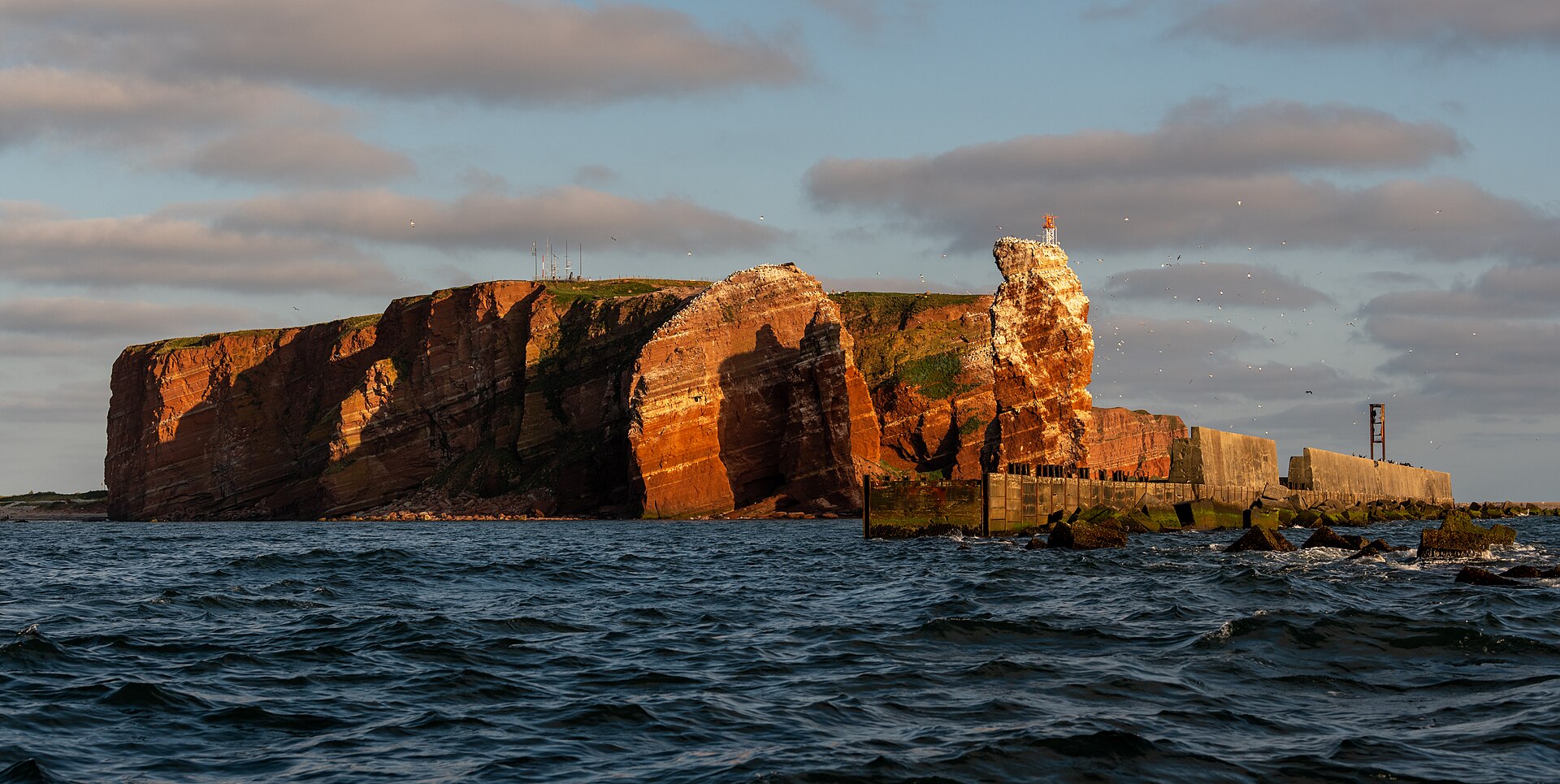
- Lummenfelsen — North-western cliffs, main island
These crowded cliff ledges are a major seabird colony, and the main reason many birdwatchers make the crossing. Telephoto lenses help, as the best views are from marked paths well back from the edge. Nesting season is noisy and busy; check with the island's ornithological station about timing and guided walks. - Düne — East of the main island
The smaller island to the east is a flat, sandy contrast to the red cliffs, with broad beaches and, quite often, seals resting on the sand. A small boat links it to the main harbour. Keep a respectful distance from the animals, and check the operator's site for crossing times.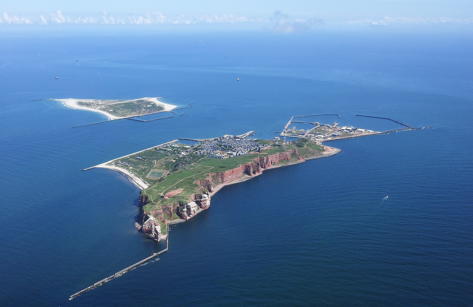
- Aquarium and Helgoland Museum — Lower Town and Oberland
When the wind is too sharp for the clifftops, two indoor stops help. The aquarium shows North Sea marine life, while the local museum covers the island's seafaring, its Frisian identity and its changing flags. Opening hours vary by season, so check the official site before planning around them. - Oberland walk and the old bunkers — Oberland (Upper Town)
A loop around the plateau edge gives sweeping sea views, the Upper Town's gardens, and an old mulberry tree. Wartime bunker tunnels beneath the island recall the twentieth-century military role of the place. Tours are run by local guides, so check the official site for how to join one.
Culture
Heligoland's culture is shaped by its Frisian roots, its place at the edge of the sea, and a long habit of changing hands. Halunder, the local North Frisian dialect, is still spoken by islanders and appears on signs and in museum displays, though German is the language of daily business. For centuries the community lived from fishing, piloting ships, wreck salvage and bird and seal hunting, and traces of that practical sea-going life show up in the harbour, the museum and the old family names.
The island has also lived through Danish, British and German rule, and each left some mark: the British period in particular is part of local memory, as is the wartime damage and the post-war British administration. Today the island is quiet and small-scale. Many visitors arrive as day-trippers, so the rhythm of the place follows the boat times: busy in the middle of the day, calm in the evening, when the residents and overnight guests have the paths largely to themselves.
Bird conservation matters here. The ornithological station ringing birds, the marked paths at the cliff colonies and the care around the seals on the Düne all reflect a community that treats wildlife as part of its identity, not just an attraction.
Stay behind the marked paths and fences at the cliff colonies and keep well back from seals on the Düne, because disturbing nesting birds and resting animals is the quickest way to upset the islanders.
What to wear
Heligoland's historic dress belongs to the wider North Frisian world, where island communities wore dark, practical wool for working on boats and in the wind, with finer garments, silver fastenings and embroidered trims kept for church and festival days. Specific local patterns and textile names are best learned from the Helgoland Museum, which keeps the island's own record; check its official page before visiting. Traditional costume is not an everyday sight, and appears mainly at heritage events and in museum cases.
What people wear now is straightforward seaside practicality. Residents and visitors alike favour windproof jackets, fleeces, jeans or walking trousers, and sturdy shoes. In winter the layers get heavier, though the climate is milder than on the mainland. Smart clothes are unusual, and no one expects them.
For a visit, dress for wind and changeable weather rather than for the calendar. A waterproof, windproof outer layer is the most useful item, even on bright days, because the clifftops are exposed and the boat deck can be cold. Wear shoes with a grip for damp paths and the harbour steps; flat trainers or light walking boots are fine. Bring a hat that stays on, sun cream for summer glare off the water, and swimwear if the Düne beaches tempt. There are no strict dress codes at the island's few churches and museums, but modest, tidy clothes are sensible when entering a church.
What to eat
- Lobster — Harbour-side restaurants in the Lower Town
Heligoland was once the centre of German lobster fishing, and lobster remains the island's signature plate. It is served simply, usually boiled and with bread or potatoes. Expect it to be a treat rather than an everyday meal. - Knieper (crab claws) — Harbour-front eateries and snack counters
Knieper are the claws of local crabs, cracked and eaten with the fingers. They are a traditional island snack with a sweet, mild flavour, usually served with a dip or bread, and a good way to try local seafood without a full meal. - Plaice — Restaurants around the Lower Town
North Sea plaice is a staple of island menus, often pan-fried and served whole or in fillets with potatoes. It is a straightforward, filling plate and a reasonable choice for a late lunch after a cliff walk. - Herring — Snack stalls and bakeries near the harbour
Herring was a mainstay of the island's economy in good seasons, and it is still served here, often pickled or in a bread roll. It is quick, cheap by island standards and suits a short day-trip schedule. - Helgoländer Eiergrog — Cafés and bars in the Upper and Lower Town
A hot, egg-enriched rum drink, this is the island's traditional warming tipple and very strong. Order a small one, drink it slowly and treat it as a dessert in cold weather rather than a casual refreshment.
Plan it
Best time. June to September is the easiest window: boats and island services run most fully, the Düne beaches are usable and seals are often seen. Late summer into autumn can be mild and fairly sunny, while winter is gentler than on the mainland but rougher at sea.
How long. 1–2
Getting there. Boats run daily from Cuxhaven and Büsum, and a high-speed catamaran runs from Hamburg; the last leg is simply a sea crossing into the main harbour. Day trips allow a stay of up to four hours, so overnight guests get a much calmer island. Check the operators' sites for current schedules.
Budget. mid
Tips
- Book accommodation well ahead, since there is no way to travel on once the afternoon boats have left
- Day-trippers should go straight to the cliffs and the Düne, as time on the island is short
- Bring a windproof layer and sturdy shoes, even in summer
- Check the official municipal site at https://www.helgoland.de/rathaus for current services and opening hours
- Ask the ornithological station about guided walks and seasonal bird viewing
Etiquette
- Stay on marked paths near the seabird cliffs
- Keep your distance from seals on the Düne beaches
- Take litter back with you; the island is small and fragile
Nearby
Sources
- Wikidata Q3038 (CC0)
- Wikipedia: Heligoland (rev 1379032034) (CC BY-SA 4.0)
- Wikivoyage: Heligoland (rev 5403892) (CC BY-SA 4.0)
- Helgolandpanorama / Helgoland 2909 (Dionysos1970) (CC BY-SA 4.0)
- Aerial image of Heligoland (Carsten Steger) (CC BY-SA 4.0)
- Helgolandpanorama vom Pinneberg 2018 (Jörg Braukmann) (CC BY-SA 4.0)
- Heligoland in 1919 (New York Tribune) (Public domain)
- Insel Helgoland um 1929-30 color (CC BY-SA 2.0 de)
- Birdseye view of Heligoland, ca. 1890-1900 (Public domain)
- Cist grave from Helgoland (Ethan Doyle White) (CC BY 3.0)
- Rudolf Jordan, Heiratsantrag a Helgoland (Public domain)


