Garajonay National Park
Garajonay National Park, Spain
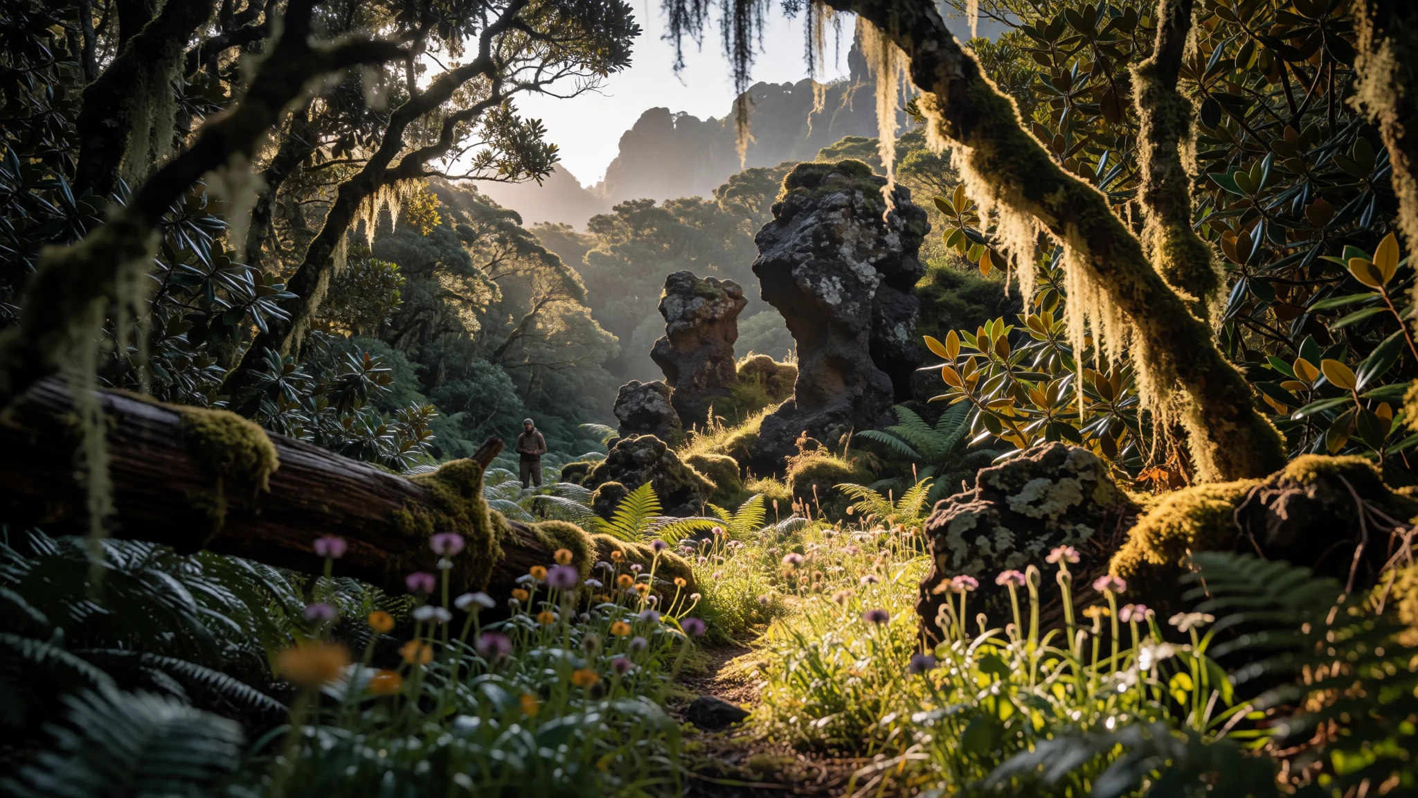
Garajonay National Park feels like hiking through a cloud-softened mountain forest, with views that appear only when the mist loosens.
The place
Garajonay National Park (Parque nacional de Garajonay) sits in the centre and north of La Gomera, one of Spain’s Canary Islands. It’s the island’s main protected landscape, declared a national park in 1981, and it’s also on the UNESCO World Heritage list.
The park is named after Garajonay, the highest point on La Gomera, and the trails climb into an upland world that can feel greener up on the slopes than it does lower down. Around the summit, the vegetation turns lush, while the flanks show drier plant life—so the environment changes noticeably as the altitude and exposure shift.
The geology is part of the atmosphere. The park’s dramatic rock features are the remains of volcanoes, shaped over time by erosion. Some places were meaningful to the island’s original inhabitants and also offered shelter during difficult periods.
Practically, Garajonay is a trekking park. There’s a network of walking routes through forest and viewpoints, and you’ll spend a lot of time walking under a canopy or following paths that open out toward the Atlantic. The climate is generally mild through the year, which helps: a lot of visits aren’t about beating extreme cold or heat, but about timing fog and cloud so the views land.
It’s also good to be realistic about crowds. Most visitors arrive from the wider Canaries tourism circuit, so popular viewpoints can get busy in peak periods, while longer walks away from the main access points feel calmer.
Its story
Garajonay National Park on La Gomera has a habit of changing its mood mid-hike. One moment the landscape looks muted and intimate under mist; the next, a gap in the cloud reveals a wide valley and far horizon edges. That shifting visibility is part of why people come back—because the forest isn’t just scenery, it’s weather in motion.
The park’s character starts with the uplands. The summit area is where the greenery thickens, and the trail network threads through mountain forest rather than open scrub. The trees create a cool, shaded rhythm for walking, and the air can feel damp even when conditions elsewhere on the island seem brighter.
As the route bends, you’ll notice that La Gomera isn’t one single landscape. Lower slopes drift toward drier vegetation, while higher ground holds onto a more humid forest feel. That contrast makes the climb feel meaningful: you’re not just gaining elevation, you’re moving between two ecological moods.
Then there are the rocks—sturdy reminders that the island has a volcanic past. Some of the formations associated with the park are dramatic enough to sound like local legends, and they also help explain why certain spots mattered to earlier island communities. Even today, those same features frame the viewpoints and resting places along the walks.
By the time the trail reaches its higher vantage points, the day becomes about small decisions: whether to pause and wait for the mist to lift, whether to take the safer, marked route when conditions shift, and how much time to give the forest before heading back down.
What to see
- Garajonay National Park (forested summit area) — Around the park’s summit paths
Garajonay National Park is the extensive, forested high ground on La Gomera, centred on protected woodland that draws hikers into a dense, green atmosphere. - Alto de Garajonay (island summit) — Central highlands, near Garajonay summit routes
Alto de Garajonay is the island summit point. On clearer stretches it rewards patience with a wide panorama, and when mist lifts you can make out distant outlines across the Atlantic. - Laurisilva Forest (cloud-forest mood) — Upper forested zones and connective hikes
Laurisilva Forest is the park’s cloud-forest feel: thick growth, misty pauses, and a sense of walking in an older, quieter woodland. Spring can bring vivid plant carpets when conditions suit. - La Laguna Grande (clearing area) — Around the clearing known as La Laguna Grande
La Laguna Grande is the open clearing within the park landscape. It breaks the forest rhythm and gives you a calmer place to look around before continuing onto the next stretch of trail. - Mirador de Abrante (cliffside perspective) — Agulo-side viewpoints and cliff edges
Mirador de Abrante is a viewpoint area with cliffside panoramas, including views out towards Tenerife. It also connects hiking energy to a place where you can stop and take the wind seriously. - Roque Agando (Agando rock) — Near the park’s rock viewpoints around La Gomera
Roque Agando is a standout rock feature tied to Garajonay National Park, with dramatic forms shaped by volcanic history. It’s the kind of landmark that makes the landscape feel sculpted rather than simply wild.
Culture
Garajonay National Park is protected land, so most of the “culture” you’ll notice is how visitors move through it. The trails encourage a slow style of hiking—pausing to read the weather, stepping aside to let others pass, and sticking to marked routes when the ground is slick or fog thickens. In a landscape shaped by erosion and volcanic rock, small impacts add up, so it’s common to see people carefully managing where they stop and how long they linger.
If you’re into the island’s deeper layers, remember that the park’s geology connects to earlier island life. Certain formations were considered meaningful and also useful as refuges, so the landscape carries stories even when there’s no signage telling you everything.
In practice, this means bringing respect into the everyday bits: keep noise low in quiet forest areas, don’t pick plants or disturb mossy surfaces, and take litter out even if bins look close. Photography is great here, especially when mist clears, but don’t treat resting spots like a stage.
Visitor etiquette: stay on marked paths and keep quiet in the forest, because the ground is fragile and the atmosphere is part of the experience.
What to wear
For Garajonay National Park, dressing is about layers and grip rather than style. The summit and forest zones can feel cooler and more humid than the lower island, and mist is common enough that a light waterproof layer becomes genuinely useful. A breathable base layer helps if the weather flips between cloud and sun.
Traditional dress on La Gomera exists more in festivals and cultural events than on everyday trails. When you see traditional outfits, they usually centre on island-made textiles and classic clothing forms worn for local celebrations; day-to-day wear around the park tends to look practical and understated.
What visitors wear now is very hiking-led: long trousers to handle undergrowth and uneven ground, a comfortable walking shirt or fleece, and sturdy footwear with a grippy sole for damp patches. Avoid sandals—paths can be muddy or slippery after passing through fog. If visiting viewpoints and stopping at places near cliffs, bring a hat or cap for wind, and consider sunglasses for moments when the mist finally clears.
For religious or ceremonial areas outside the park (if you’re also exploring towns), keep to modest layers and remove hats indoors where appropriate—otherwise, aim for functional, weather-ready clothing.
What to eat
- Watercress soup with gofio — Mountain restaurants in La Gomera
Try watercress soup with gofio, a local-style bowl that blends greens with maize flour. It’s associated with mountain eating, so look for it at restaurants serving Canarian meals near the park-side areas. - Palm honey (Miel de Palma) — Desserts and sweet menus in La Gomera
Palm honey, made from palm tree sap and used in local sweets and desserts, is a handy taste of the island’s plant-based flavours. It often appears on dessert menus or as a sweet topping in Gomeran eateries. - Mojo sauce (red or green) — Typical Canarian meals at local restaurants
Mojo is a sauce served with many meals, coming in red and green versions. Red tends to go with meat and can be spicy; green is commonly paired with fish, based on garlic and coriander. - Papas arrugadas — Local Canarian restaurants and eateries
Papas arrugadas are wrinkly small potatoes, traditionally cooked until they’re tender and salted, then served with red or green mojo. You’ll find them as a side at many local Canarian-style places. - El Silbo (whistling-demonstration meal experience) — A restaurant on La Gomera
El Silbo is known for typical Canarian meals plus Silbo Gomero whistling demonstrations. It’s the kind of place where the food and the performance come as one package.
Plan it
Best time. March–April and October–November are good bets because the park is generally comfortable through the year, and these shoulder months tend to avoid the harshest extremes; summer months can feel hotter and wetter conditions may arrive later in the year’s cycle.
How long. 3–4
Getting there. Fly to Tenerife South (TFS, Reina Sofia), then take a ferry from Los Cristianos to San Sebastián de la Gomera (or, when operated, directly to Playa Santiago or Valle Gran Rey). From there, it’s a local island transfer to La Gomera’s road network and onward to your starting trail area.
Budget. mid
Tips
- Plan around mist: start with a flexible mindset and give yourself time for visibility to improve before committing to long viewpoints.
- Bring footwear with grip; forest trails can be damp even on days that feel mild elsewhere.
- Use the marked footpaths as your backbone and keep route choices conservative when cloud thickens.
- If you’re combining the park with other La Gomera stops, build in extra travel time for ferry disruptions in windy conditions.
Etiquette
- Stick to marked trails and avoid walking off-path in mossy or fragile sections.
- Keep noise down in forest areas so other walkers can enjoy the quiet.
- Carry out litter and leave plants and rocks undisturbed for the next group.
Nearby
Sources
- Wikidata Q464942 (CC0)
- Wikipedia (rev 1368229781) (CC BY-SA 4.0)
- Wikivoyage (rev 5407887) (CC BY-SA 4.0)
- Photo photos/01-roque-agando-parque-nacional-de-garajonay-la-gomera-espa-a-2.jpg (CC BY 3.0)
- Photo photos/02-view-from-mirador-del-morro-de-agando-observation-deck-to-ro.jpg (CC BY 2.5)
- Photo photos/03-alone-in-the-dark-wle-spain-2015.jpg (CC BY 2.5)
- Photo photos/04-wiki-559-mmoramorales.jpg (CC BY-SA 3.0 es)
- Photo photos/05-roque-de-la-zarcita-wle-spain-2015.jpg (CC BY 2.5)
- Photo photos/06-bosque-encantado-parque-nacional-de-garajonay-la-gomera-espa.jpg (CC BY 3.0)
- Photo photos/07-cima-garajonay-19-07-2006.jpg (CC BY 3.0)
- Photo photos/08-bosque-encantado-parque-nacional-de-garajonay-la-gomera-espa.jpg (CC BY 3.0)


