Chapada dos Veadeiros National Park
Chapada dos Veadeiros National Park, Brazil
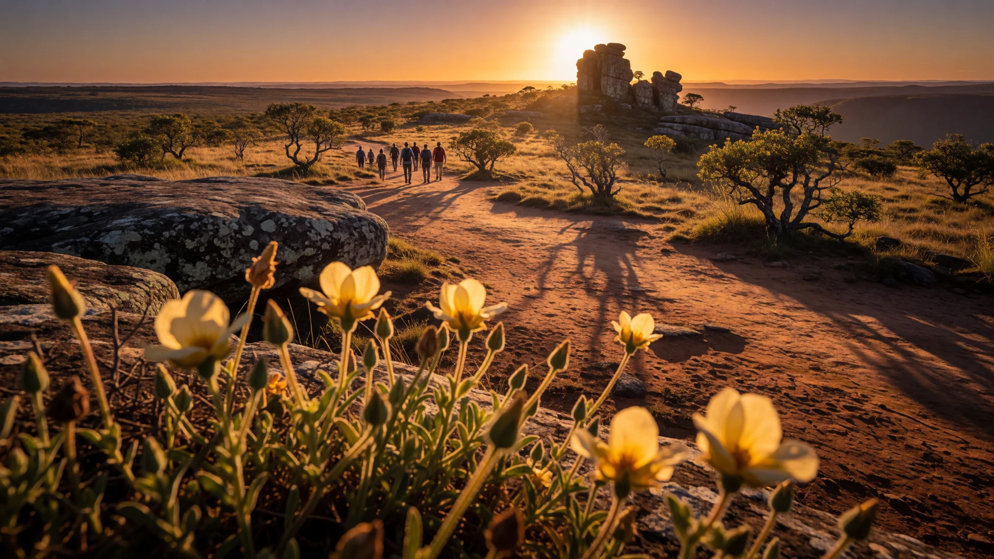
Chapada dos Veadeiros feels like a giant geology lesson—waterfalls, canyon paths, and ancient rock across a high Central Brazilian plateau.
The place
Chapada dos Veadeiros National Park (Parque Nacional da Chapada dos Veadeiros) sits in Brazil’s state of Goiás, high on an ancient plateau. The park’s story starts long before people: the plateau is estimated at about 1.8 billion years old, and the landscape shows it in the rock itself. In the ground and outcrops, you can find quartz—crystal-rich formations that hint at why local landscapes have always attracted curious visitors and collectors.
Practical travel reality: this is a place for walking and for planning around weather. Temperatures can swing widely over the year, with a typical average yearly range of 24–26 °C and heat that can reach 40–42 °C at its warmest. Nights and cooler spells dip as low as 4–8 °C, and the park’s altitude between 600 and 1,650 metres changes how “comfortable” feels from day to day.
The park is run by the Chico Mendes Institute for Biodiversity Conservation, and it was created in 1961. It also has World Heritage status tied to the UNESCO listing (with id 1035-001). Access is oriented around the gateway towns—particularly São Jorge—and from there the main experience is time on authorised trails, with guided entry required.
What ties everything together is the blend of geology, water, and cerrado vegetation: rocky steps, river-cut canyons, and clear viewpoints that make the park feel both wild and strangely organised—because the best areas are reached through routes you choose and guides you join.
Its story
Chapada dos Veadeiros National Park didn’t grow from tourism first—it grew from gold, and the after-effects of that rush still shape parts of the region. Development began around the gold rush in the 18th century. Towns such as Cavalcante were drawn in early and, at times, became major gold extractors. That kind of boom pulled in large-scale labour systems, and mining demands created conditions that later influenced today’s communities.
One reason the region matters culturally is the strong presence of Quilombo communities—Afro-Brazilian communities made up of people who escaped slavery from plantations and mines. Within Chapada dos Veadeiros there is a specific subgroup called the Kalungas. The name Kalunga was once used in a way that meant “something of smaller value”, but it has been reclaimed as a term of pride.
With the “golden period” fading, many areas shifted away from mining, leaving only scattered settlements for a while. Later, rediscovery brought renewed attention: tourism became one way to support Kalunga communities. That’s an important detail for travellers, because it changes how encounters can feel. The park and its surroundings aren’t just scenery; they’re connected to livelihoods, local knowledge, and community resilience.
In the background, the park’s geology keeps doing its own work—century after century, rocks and crystals sit quietly beneath paths and waterfalls, linking today’s walks to an ancient landscape that predates the gold rush by a country mile. Even when the story is human, the ground underfoot stays older than any timeline people tell.
What to see
- National Park entrance and guided routes — São Jorge gateway area
Chapada dos Veadeiros National Park is the centre of the experience, reached via the entrance area near São Jorge. Entry is handled through authorised guides, with routes such as the canyons trail and the falls trail. Think “walk with a plan”: the park’s best sections are organised by trail choice and timing.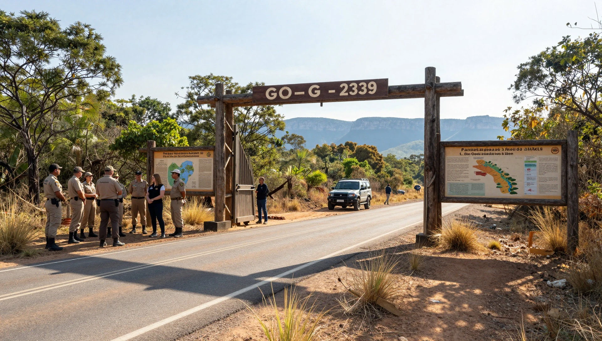
- Vale da Lua (Moon Valley) — São Jorge area
Vale da Lua is accessed on foot from São Jorge and is known for its moon-like terrain and sparkling rock textures. The landscape is paired with natural pools that invite a swim when conditions are right. It’s an area where the ground looks strange at first glance, then starts to feel completely natural.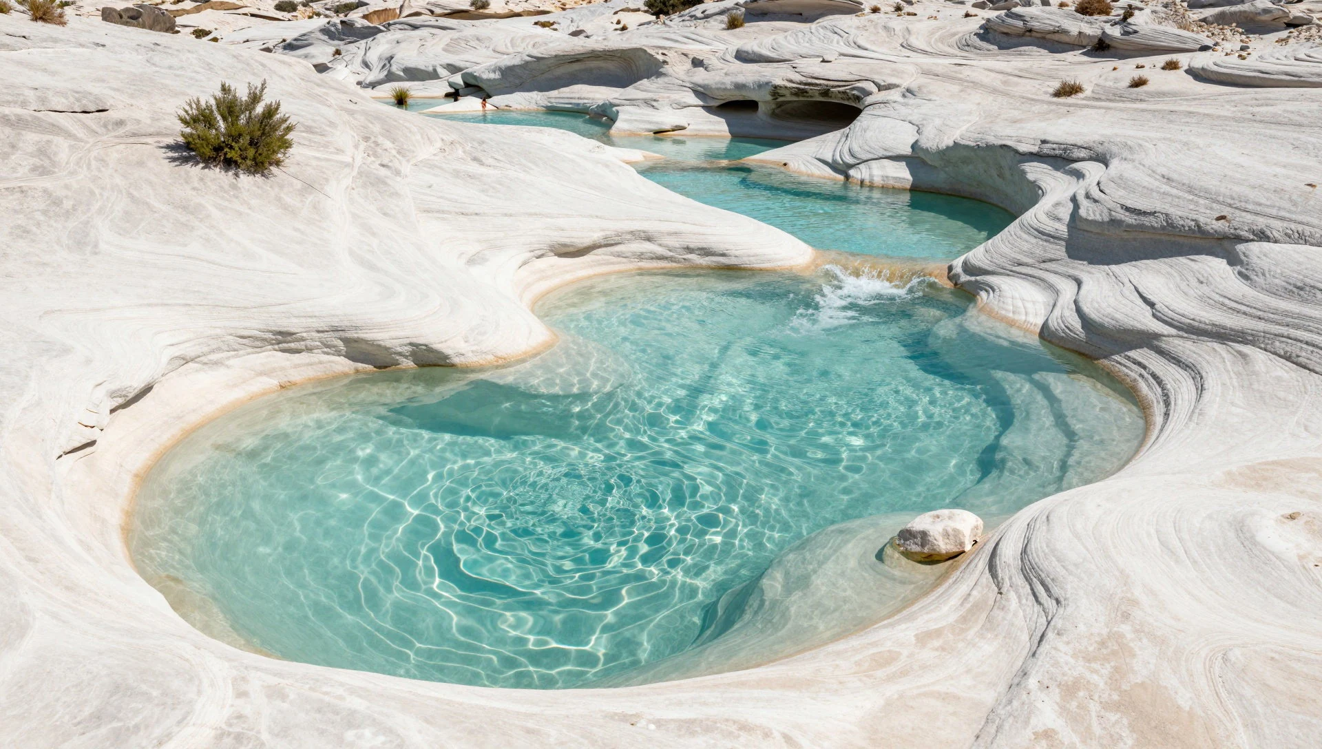
- Almécegas waterfalls — Along authorised park trails
Almécegas waterfalls are one of the park’s named waterfall stops, best approached via the authorised trails. The appeal is the combination of flowing water and rock edges that frame the views. Bring footwear for slippery sections—waterfalls mean wet stone and changeable footing.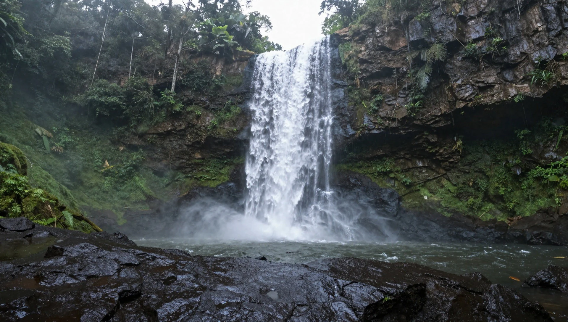
- Salto II do Rio Preto (water-and-light moments) — Rio Preto area
On the Rio Preto area, the falls and river can deliver strong light effects, including the kind of rainbow colour people talk about after rainy weather. The viewpoint experience is about short bursts of colour and the steady rhythm of water over rock. Go for the atmosphere, not just the photo.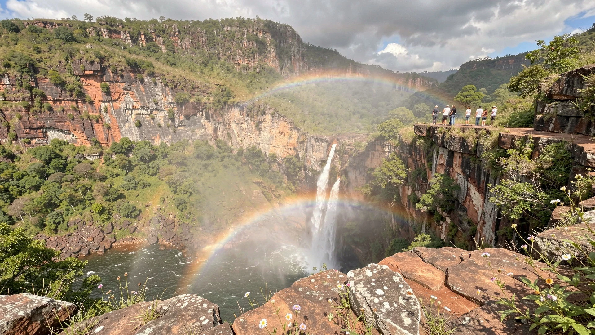
- River confluence jump area (São Miguel & Tocantinzinho) — Confluence area
A distinctive spot is the confluence of the rivers São Miguel and Tocantinzinho. The activity focus is on jumping into the river and floating with the current until close to the confluence. Conditions and safety depend on the river state, so treat this as an only-when-ready activity.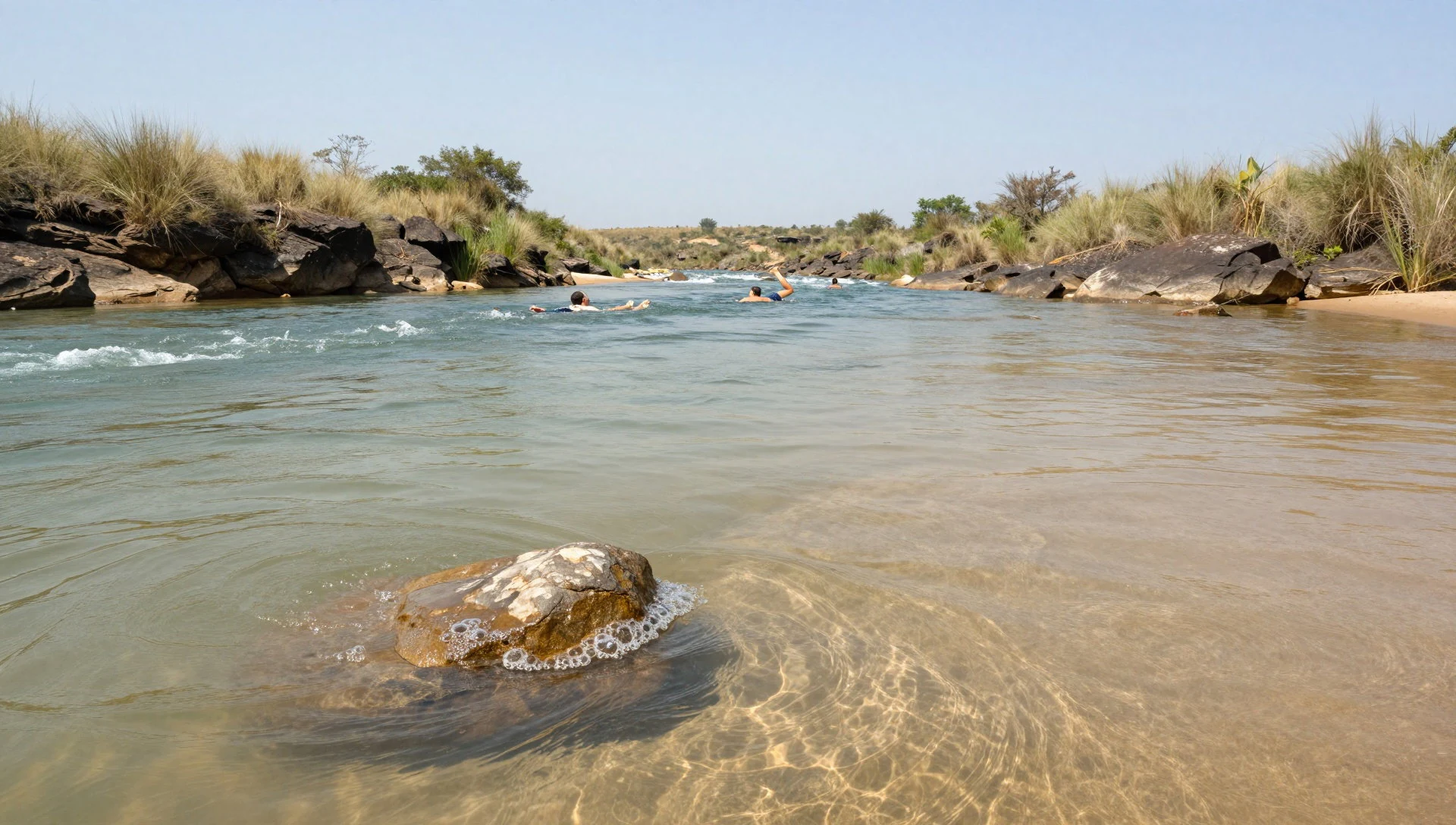
Culture
Chapada dos Veadeiros National Park is surrounded by communities whose history is closely tied to mining and escape from slavery. Quilombo communities in the region, including the Kalungas, are part of that living cultural landscape—particularly as tourism became a way to support local groups after the mining boom faded. When you meet local guides, shopkeepers, or family-run places, it’s worth recognising that the park’s protection and access rules aren’t separate from everyday life.
In practical terms, the park’s culture is also about respect for land and water. Trails are the way in, and authorised guidance helps protect habitats and keeps visitors safe around waterfalls, canyon edges, and river sections. In the region, the idea of community pride tied to the name Kalunga shows up subtly in conversations, so curiosity and patience go a long way.
Culturally, it’s also a region where people learn to live with altitude changes and the day’s temperature shifts—so you’ll often see locals timing their work around cooler mornings and quieter periods. Travel etiquette matters here because small adjustments make visits smoother for everyone.
Visitor etiquette: keep to authorised routes and listen to your guide—especially near waterfalls and river sections, where footing and safety depend on local knowledge.
What to wear
In Chapada dos Veadeiros National Park, clothing is mostly about heat management, sun protection, and wet, uneven ground. The traditional dress in the wider region is not the main expectation for visitors to the park, but modest, breathable fabrics tend to be the norm in everyday settings. Women’s traditional pieces in Goiás commonly include lightweight dresses with colourful details, while men often wear long shirts paired with trousers—think cottons that handle warm weather.
What people actually wear now around São Jorge and Alto Paraíso is practical: T-shirts, shorts or lightweight trousers, and sandals or trainers for walking. At the park entrance and on trails, visitors usually shift to closed shoes because rocks and wet stone can be slippery.
For a visitor, pack for temperature swings and water access: a light long-sleeve top for sun, a cap, quick-dry clothing, and a waterproof layer for sudden showers. Wear supportive footwear with grip. If planning to visit natural pools or waterfall viewpoints, bring a change of socks and a dry bag—cold mornings and wet afternoons can happen even when midday feels hot.
What to eat
- Varied local plates with wine and craft beer — São Jorge
At Casa das Flores, expect varied cuisine plus a good selection of wine and artisanal beers. It’s the kind of place that works for a relaxed sit-down after trail time—especially when the day’s walking has built up an appetite.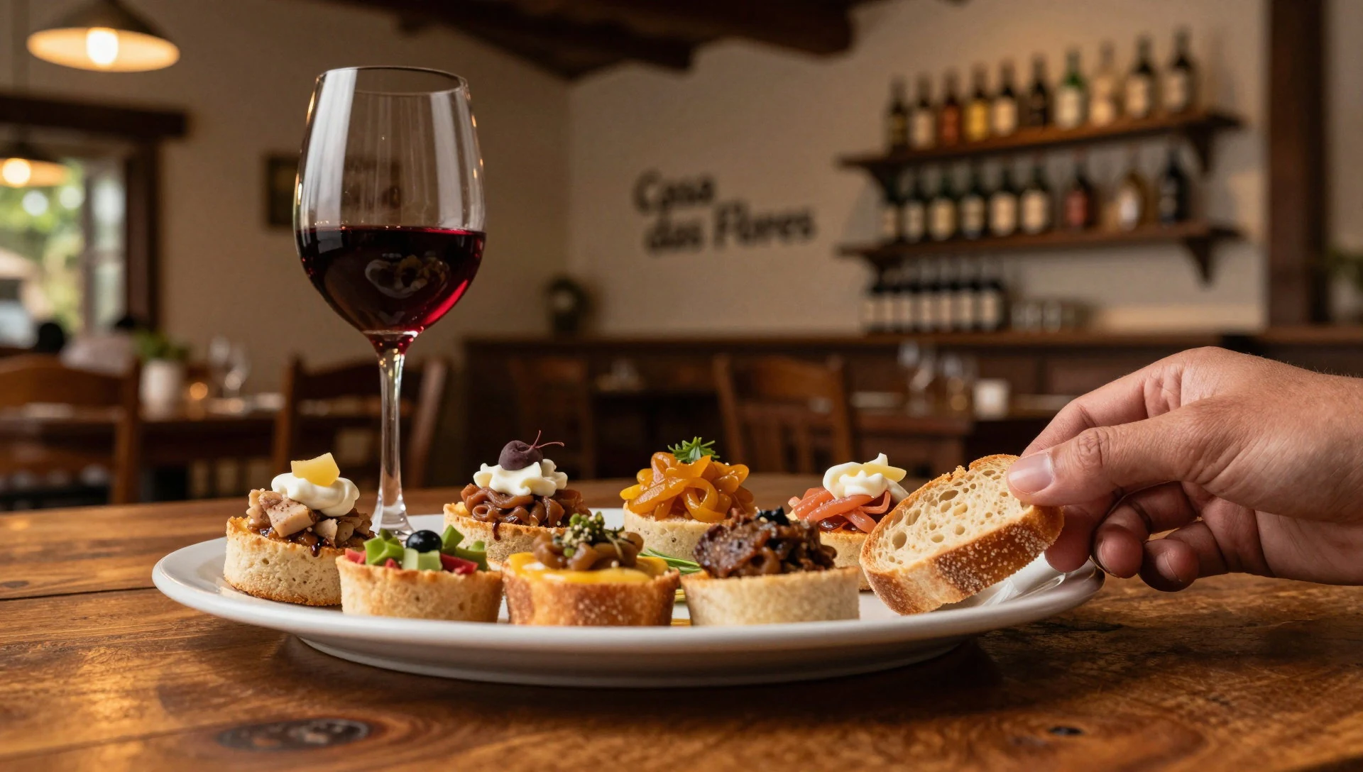
- Local food at Nenzinha — São Jorge
Nenzinha is a go-to option for local food—straightforward, regional plates rather than anything overly fussy. It’s well-suited to travellers who want to eat what’s normal in the area and keep the day’s schedule simple.
- Goiano comfort food: pizzas, crepes, empadão and soups — São Jorge
Papalua covers a broad range: pizzas, crepes, empadão goiano, pastas, and soups, with WiFi available and card payments accepted. It’s a handy choice when the weather turns and you want a filling meal without hunting around. - Cold beer and a relaxed hang-out — São Jorge centre
Bar do Pelé in the São Jorge centre is an easy evening stop for cold beer and a casual atmosphere, with billiard tables for distraction. After canyon or waterfall days, it’s a calm way to reset without needing a formal dinner plan. - Culture and occasional performances — São Jorge
Casa de Cultura Cavaleiro de Jorge (in Cavaleiro de Jorge street, São Jorge) is mainly about local events, with occasional shows and performances. Even when the day is quiet, it’s a useful landmark for understanding what’s on in town.
Plan it
Best time. May to August generally suit comfortable trekking: the park cools down through the dry season, with the mildest temperatures in July (mean daily highs around 34.5 °C and lows near 9.3 °C), while the wettest stretch is November to March and the hottest months are September and October (mean daily highs around 38–40.5 °C).
How long. 3–4
Getting there. Fly into Brasília (then travel overland to the gateway towns such as Alto Paraíso de Goiás or São Jorge). From there, the national park entrance is reached by road to São Jorge, followed by the final leg to the entrance area.
Budget. mid
Tips
- Plan around temperature swings: cooler mornings help for walking, while midday heat can be intense.
- Use the authorised guides for inside-the-park routes; they’re part of how access works.
- Start waterfall and canyon days early to reduce how long you’re exposed to heat and sun.
- Carry water and simple snacks for trail time, and pack sun protection for exposed viewpoints.
- Bring cash for small purchases and keep cards for bigger meals—small places are often where you’ll spend on the go.
Etiquette
- Follow your guide’s instructions closely on slippery rock, canyon edges, and river sections.
- Stay on authorised paths; do not “shortcut” between viewpoints.
- If joining a river activity at the confluence area, only do it when conditions feel safe and you’re properly prepared.
Nearby
Sources
- Wikidata Q750251 (CC0)
- Wikipedia (rev 1372237523) (CC BY-SA 4.0)
- Wikivoyage (rev 5397296) (CC BY-SA 4.0)
- Photo 01 — Vale do Rio Preto (CC BY 2.5)
- Photo 02 — ChapadaVeadeiros, Alto Paraíso (Public domain)
- Photo 03 — Arco-íris ornamenta o Salto II (CC BY 3.0)
- Photo 04 — Parque Nacional da Chapada dos Veadeiros (CC BY-SA 4.0)
- Photo 05 — Parque Nacional da Chapada dos Veadeiros (CC BY-SA 4.0)
- Photo 06 — Satélite CBERS-4 (CC BY-SA 2.0)
- Photo 07 — Parque Nacional da Chapada dos Veadeiros (CC BY-SA 4.0)
- Photo 08 — Parque Nacional da Chapada dos Veadeiros (CC BY-SA 4.0)


