Cape Cod
Cape Cod, United States
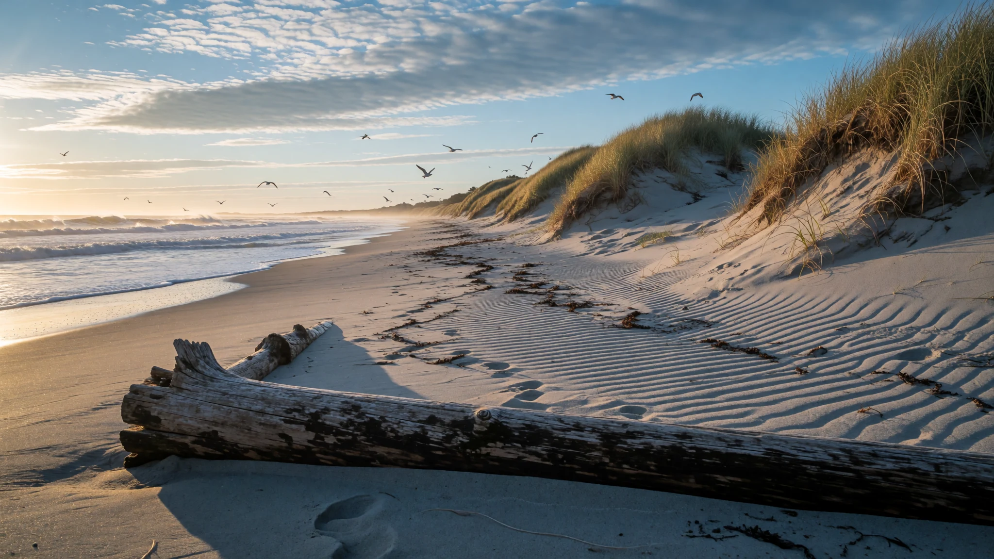
A sandy arm of New England coast with working harbours, quiet dune trails and beaches that suit a slow summer.
The place
Cape Cod is a hooked arm of sand and glacial debris reaching east from the south-eastern corner of Massachusetts into the Atlantic. The name dates from 1602, when Bartholomew Gosnold gave it to the very tip of the peninsula. That narrow meaning held for well over a century before the name spread to the whole land. Today it covers the entire peninsula, which matches Barnstable County and runs from Provincetown at the northern tip to Woods Hole in the south-west. Fifteen towns share the ground, and most are split into several named villages, each with its own harbour, white-steepled church and general store.
Since 1914 the Cape Cod Canal has cut across the base, so most of the peninsula lies on the far side of water from the mainland. Two road bridges, Sagamore and Bourne, carry traffic over it, and a rail bridge carries freight with a limited passenger service. Cape Cod Bay opens to the north-west, Nantucket Sound lies to the south, and the outer shore faces the open ocean. That split explains why the water varies so much from one side to another: the eastern beaches are cold and wild, while the sound side is warmer and calmer.
Most of the landscape is low and sandy, with scrub and pitch pine on the dunes, salt marsh along the bays, and freshwater kettle ponds left where glacial ice once sat. Summer is the peak season, when villages swell and traffic on the bridge roads crawls on Friday afternoons. In the off-season many restaurants and shops close, and the towns feel quiet, sometimes almost empty. Spring and autumn bring fewer visitors and cooler air, which suits walking and cycling better than the heat of midsummer.
Its story
The Wampanoag were living on Cape Cod long before any European ship appeared off its shore. They fished and gathered shellfish along the coast, grew crops, and managed the woodland with carefully set fires that kept the undergrowth low. When the Pilgrims came ashore in the autumn of 1620 and settled at Plymouth, Wampanoag people helped them through their first hard seasons, and the two peoples formed an alliance that lasted for a time.
The alliance did not hold. Through a long sequence of land sales, often made under pressure, and then open conflict with settlers, the Wampanoag lost most of their territory across the region. Their communities survived in smaller areas and kept their language and customs alive, a continuity that archaeological sites on the Cape help to document. In the twentieth century the Mashpee Wampanoag formed a tribal council to press their claim to recognition, and they campaigned for it over many years. Federal recognition came only in the twenty-first century.
European visitors had come earlier, at least according to the sagas. Norse voyagers spoke of a land they called Vinland, and some scholars have argued that the peninsula was that place, though the question is disputed. A stone wall found in Provincetown in the early nineteenth century has been put forward as evidence of a Norse crew repairing a ship in the harbour. Nobody has settled these claims, so they are best treated as intriguing rather than proven.
The shape of the land is the work of ice. As glaciers retreated they left gravel ridges, sandy outwash plains and the kettle ponds that dot the interior. The sea keeps reworking the outer beaches, moving sand from one stretch to another, so the coastline is never quite where the old maps placed it.
What to see
- Cape Cod National Seashore — Wellfleet and Truro, outer Cape
Protected by the National Park Service, this stretch of outer Cape holds long beaches, high dunes, cliffs and freshwater kettle ponds, all threaded with bike paths and short nature trails. White Crest Beach in Wellfleet is a good first stop. The surf is strong, parking fills early in July, and rangers post useful notes at the entrance. Arrive early on hot weekends, carry water, and expect the wind to be stronger than it looks from the car park.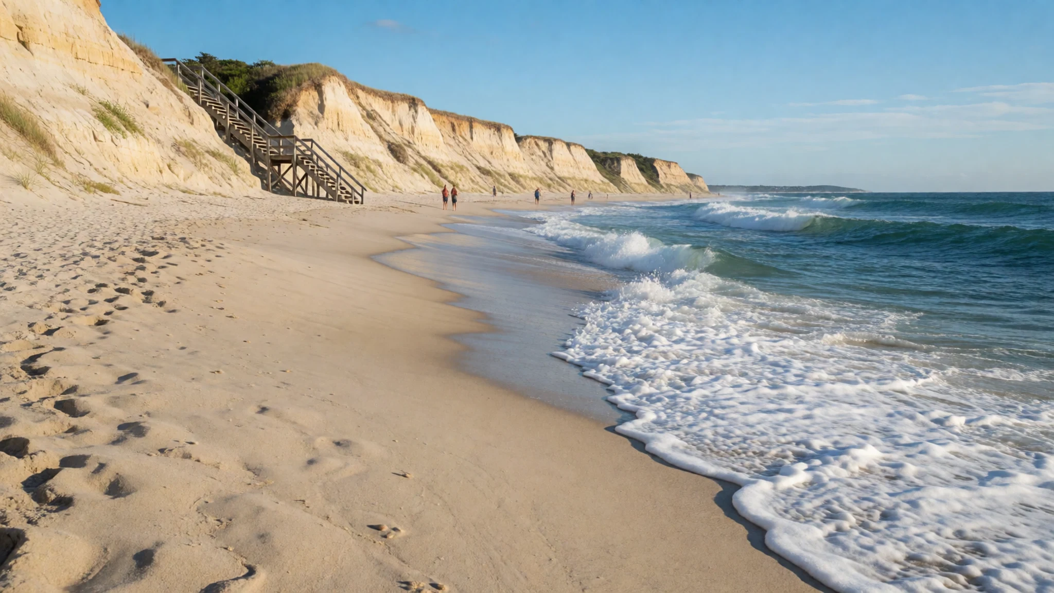
- Sandy Neck Beach — West Barnstable, north shore
Sandy Neck runs as a long spit of dune and grassland along Cape Cod Bay. A salt marsh lies on the harbour side, and the bay's shallow water warms earlier in summer than the outer shore. Walking the dune ridges gives views over both sides of the spit. The town manages parking and access, so visitors should check current rules before setting out, and bring water and sturdy shoes, because the sand is soft and the sun is strong.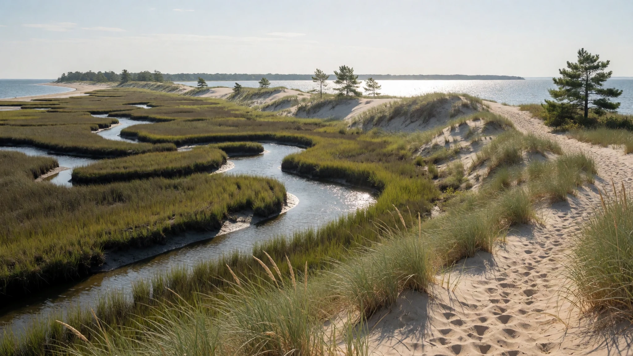
- Cape Cod Baseball League — Chatham and other Cape towns, summer evenings
On summer evenings the Cape Cod Baseball League, a collegiate league of ten teams, plays in towns across the Cape. Games are free to watch, and the crowds are local families, students and older fans with folding chairs. Ballparks range from small wooden grandstands to simple fields with a few benches. It is a relaxed way to spend an evening, and some of the league's players later reach professional clubs.
- Historic Beech Tree — Yarmouth, mid Cape
This English weeping beech spreads its drooping branches so widely that they form a leafy hall beneath the canopy. It draws people who simply love big trees, and it is a good stop for anyone interested in the older landscape of the Cape. Keep to the paths and stay off the root zone, which is easily compacted by visitors standing and sitting around the trunk.
- Bass River — Yarmouth and Dennis, mid Cape
Bass River nearly splits the Cape in two. It is a tidal waterway with sheltered coves, good for kayaks, small boats and paddleboards. Launch from public landings, check tide times before you set out, and expect shallow mud at low water. Boating, fishing and paddling are the usual pastimes, and the river is noticeably calmer than the open coast.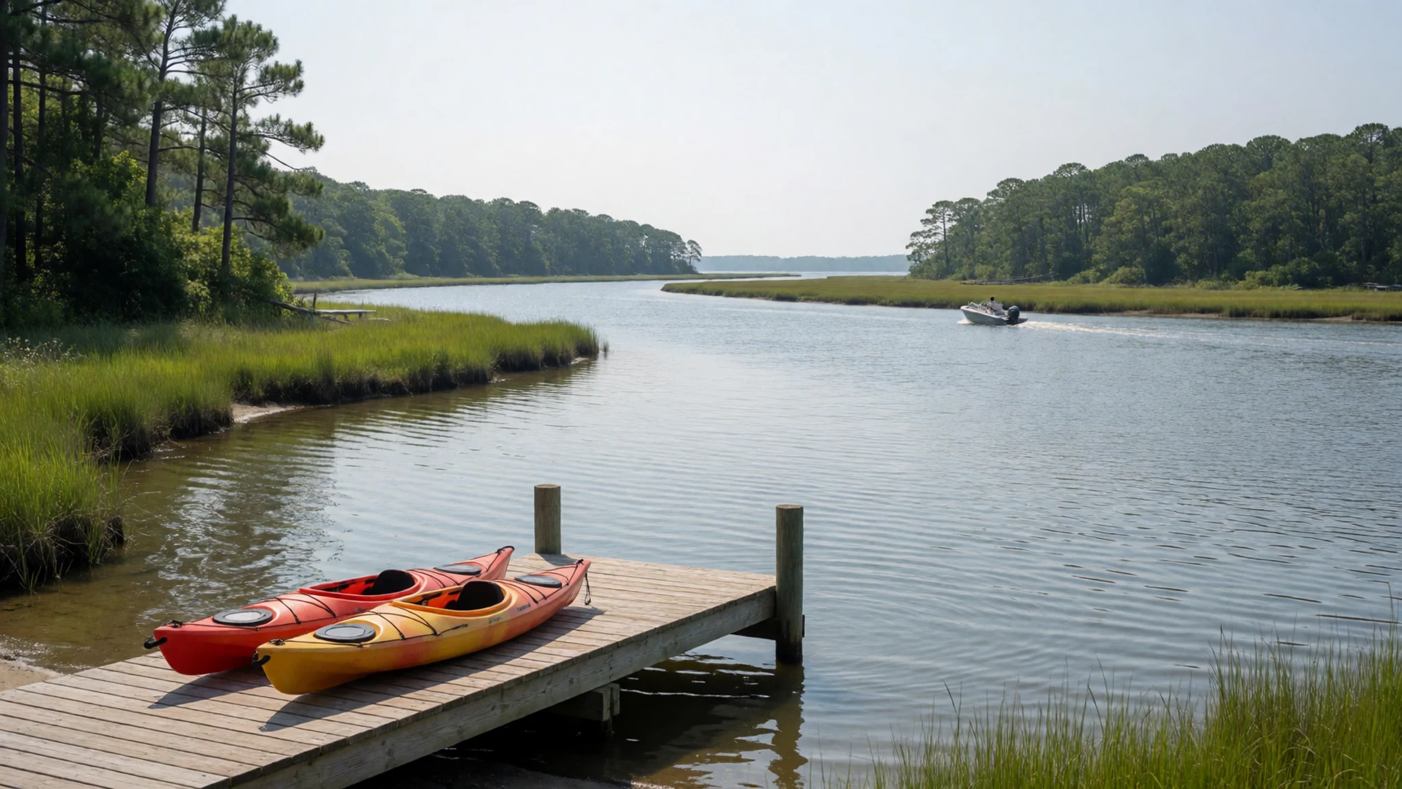
Culture
Cape Cod's first people were the Wampanoag, and the Mashpee Wampanoag are the federally recognised tribe based on the Cape today. Their history is part of the landscape. Archaeological sites, shell deposits and old place names are protected, so treat them with the care you would give a museum case. Much of daily life here still revolves around the water, and the working fishing boats in harbours such as Chatham and Provincetown are part of the community rather than a backdrop. In summer, shops and restaurants are staffed by seasonal workers, many far from home, so patience in queues is appreciated. Tipping follows American custom, and service is sometimes added to larger parties. Summer nesting areas for birds such as piping plovers are roped off, and the dunes hold together only while people keep off them. Stay on marked paths, and keep off the dune grass and out of fenced nesting areas, because trampling the dunes causes erosion that takes years to repair.
What to wear
Cape Cod's traditional dress is Wampanoag clothing, which before European contact was cut from deerskin and plant fibres and decorated with beadwork and quillwork that signalled status and identity. Ceremonial regalia at powwows today carries those forms forward, with beaded panels, fringe and carefully chosen colours, and the outfits are a living art rather than costume. The later Cape added its own textiles: heavy wool for the knitted sweaters fishermen called guernseys, cotton and oilskin for rain gear, and the yellow slickers still sold in harbour shops. Locals now dress for the weather and the setting. Shorts, sundresses, deck shoes and a fleece for cool evenings are typical, and nobody expects formal wear even in good restaurants. For a visitor, pack layers, because the ocean breeze turns chilly after dark and fog can roll in without warning. Sunglasses, a hat and reef-friendly sunscreen matter on open beaches. Sturdy shoes suit dune trails and sandals suit the sand, and a light cover-up is respectful at churches and memorial sites.
What to eat
- Wellfleet oysters — a raw bar or harbour shack in Wellfleet
Wellfleet is well known for its shellfish, and its oysters are the local pride. They are grown in the bay and served raw on ice, usually with lemon or a sharp vinegar mignonette. Shuck-your-own is not necessary, since a raw bar will open them for you. Eat them in season, when the water is coldest and the flavour is at its cleanest.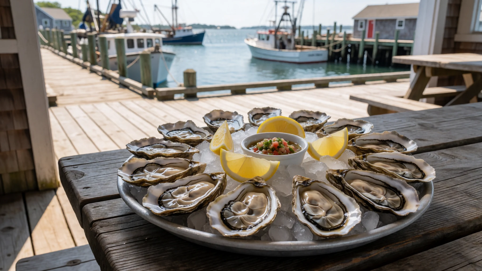
- Fried clams — any clam shack along a harbour road
Fried whole-belly clams are a New England classic, lightly coated and fried until golden, then served in paper boats with coleslaw and tartar sauce. The best are plump and freshly cooked rather than sitting under a heat lamp. Eat them at a picnic table with a view of the harbour, and expect a queue on summer evenings.
- Lobster roll — a dockside lobster shack in Chatham or Provincetown
A lobster roll is cold lobster meat, lightly dressed, piled into a split and buttered roll. Some places serve it with mayonnaise and others with melted butter, so ask which you prefer before ordering. It is one of the priciest things on a Cape menu, so it helps to check the day's price board before you queue.
- Clam chowder — a harbour-side eatery near the fishing piers
Chowder comes in two main styles here. The creamy version, thick with potato and clams, is the one most visitors expect. The thinner broth found in older eateries is closer to the original fishing-boat style. Both suit a grey afternoon after a long walk on the dunes. - Cranberries from the bogs — a farm stand or bog-side shop in autumn
The Cape's sandy, acidic bogs grow cranberries, and the autumn harvest turns up in sauces, juices and jams sold at roadside stands. The bogs are flooded for harvest, which makes a striking sight in October. Buy a jar of sauce to take home, since the flavour is hard to find once you leave the region.
Plan it
Best time. May and June for quieter beaches before the rush, and September and October for warmer water and fewer crowds. July and August bring full rentals and heavy traffic, though the sea breeze keeps the Cape cooler than the mainland in summer. Autumn storms can hit the coast, and winter brings closures and grey weather.
How long. 3–4
Getting there. Fly into Boston Logan, which is the main gateway, then drive south-east over the Sagamore or Bourne bridges. Hyannis is the Cape's main bus and ferry hub. A car is practical for reaching the outer beaches and the national seashore.
Budget. mid
Tips
- Book rentals and accommodation months ahead for July and August
- Start beach days early to find parking near the access points
- Check tide times before walking the flats or launching a boat
- Carry cash for farm stands and small shops, and check cards are accepted before ordering
- Call ahead or check online profiles before visiting restaurants in the off-season, since many close
Etiquette
- Keep to marked dune paths and off the dune grass
- Leave shells, stones and driftwood where they lie, and take all litter away
- Stay out of roped-off bird nesting areas in summer
Nearby
Sources
- Wikidata Q49152 (CC0)
- Wikipedia: Cape Cod (rev 1378294382) (CC BY-SA 4.0)
- Wikivoyage: Cape Cod (rev 5382649) (CC BY-SA 4.0)
- White Crest Beach, Wellfleet (Matt H. Wade) (CC BY 3.0)
- Cape Cod 432 pan crop 15 (Pierre Markuse) (CC BY 2.5)
- Dunes at Sandy Neck Beach (Mr Senseless) (Public domain)
- Map of Cape Cod towns (Kelisi) (CC BY-SA 4.0)
- Map of the towns on Cape Cod (unknown author) (Public domain)
- Old Harbor U.S. Life Saving Station, Sunset (JCefaly) (CC BY 3.0)
- Cape Cod Landsat 7 (NASA/Landsat 7) (Public domain)
- Geologic Map of Cape Cod (Robert N. Oldale) (Public domain)


