Canyon de Chelly National Monument
Canyon de Chelly National Monument, United States
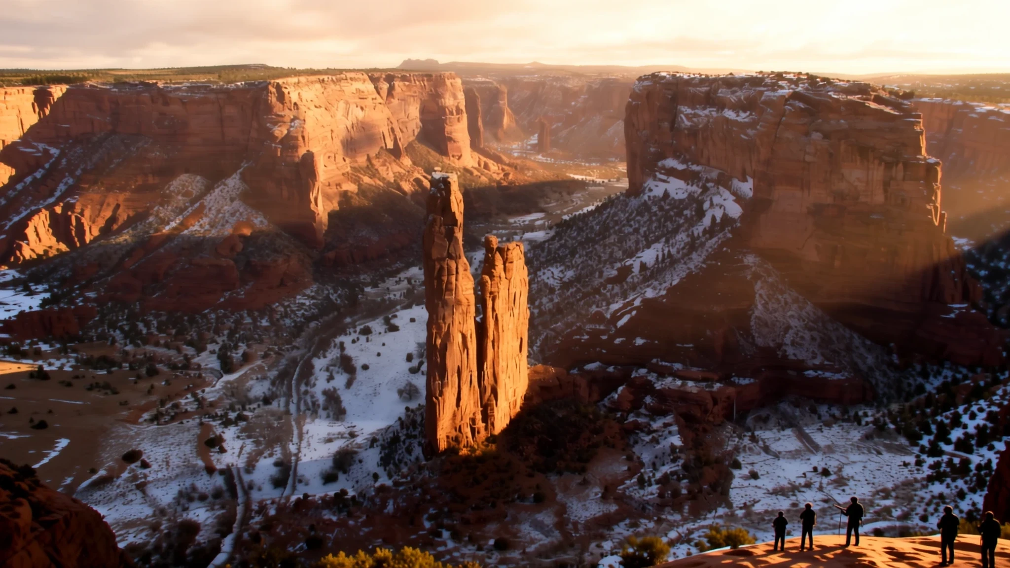
Experience one of North America's longest continuously inhabited landscapes, where ancient cliff dwellings meet the living culture of the Navajo Nation.
The place
Canyon de Chelly National Monument is a striking landscape of deep sandstone gorges located in northeastern Arizona. Unlike most units of the National Park Service, this monument is entirely owned by the Navajo Tribal Trust and is managed cooperatively. The site consists of three primary canyons—de Chelly, del Muerto, and Monument—which were carved over millennia by streams originating in the Chuska Mountains. This geological process created the towering, sheer walls and flat valley floors that define the region today.
Because the land remains Navajo territory, the experience is intimate and controlled. Access to the canyon floors is strictly regulated to protect the privacy of the families who still live and farm there. Most visitors remain on the rim drives, but those wishing to descend must be accompanied by an authorized Navajo guide or a park ranger. This arrangement ensures that the cultural integrity of the site is maintained while allowing guests to witness the enduring connection between the people and the land. The monument serves as a living museum, preserving the architectural remains of ancestral tribes alongside contemporary Navajo hogans, creating a powerful sense of temporal continuity in the high desert.
Its story
The history of Canyon de Chelly National Monument is a narrative of survival and displacement. Long before the Navajo arrived, the area was occupied by Ancestral Puebloans, who built intricate cliff dwellings into the sandstone walls. Later, Hopi people inhabited the canyons for several centuries before the Navajo moved into the region from northern New Mexico. For the Navajo, the canyons provided a sheltered sanctuary for grazing sheep and growing crops, making it a central part of their ancestral homeland.
However, the serenity of the canyons was interrupted by violent conflicts. In the early nineteenth century, military forces led by Antonio Narbona invaded the canyon, resulting in many Navajo deaths and captives. This pattern of conflict intensified during the mid-nineteenth century when Colonel Kit Carson led troops through the valley. Carson’s campaign focused on the total destruction of the Navajo economy; soldiers burned hogans and destroyed peach orchards to force a surrender. This period of devastation led to the forced removal of the Navajo people to Bosque Redondo in New Mexico. The eventual return of the Navajo to their homeland is a testament to their resilience, and today the monument stands as both a place of natural beauty and a somber reminder of the struggle to maintain indigenous sovereignty.
What to see
- White House Ruin Trail — Canyon floor
The White House Ruin Trail is the only site in the monument where visitors can explore the ancient Ancestral Puebloan ruins without a guide. This seasonal path leads to a striking white sandstone structure perched high on a cliff, offering a glimpse into prehistoric life.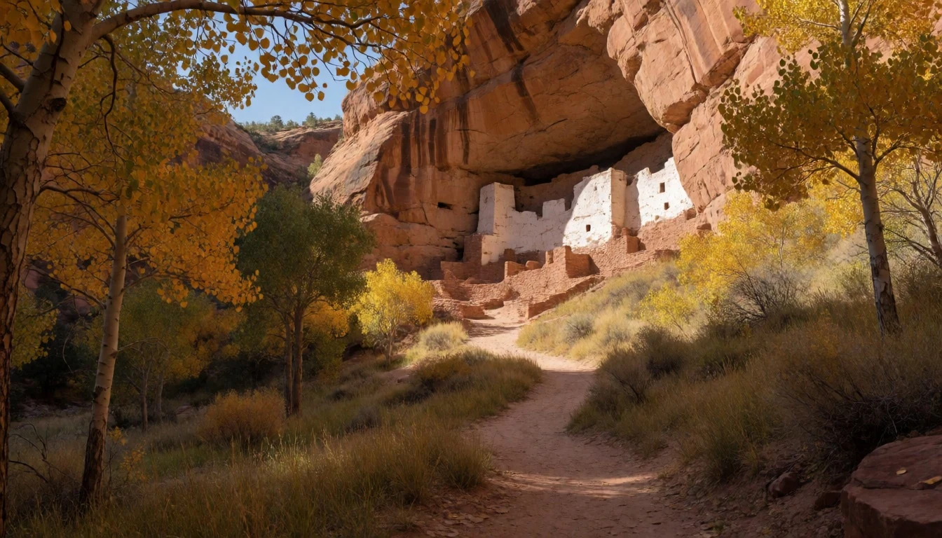
- Spider Rock — South Rim
Spider Rock is the most iconic landmark of the monument, appearing as a slender spire of rock rising dramatically from the canyon floor. It is best viewed from the overlooks on the south rim, where the scale of the sheer walls is most apparent.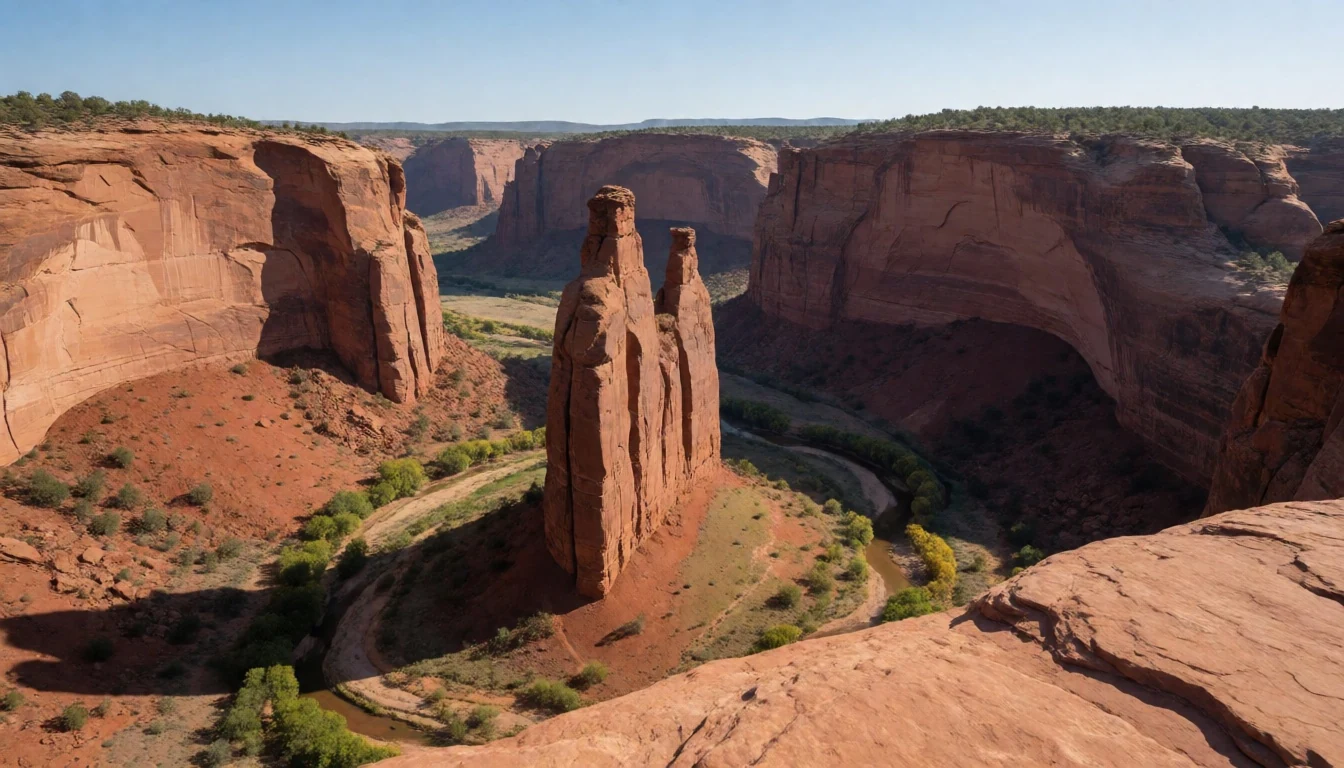
- Thunderbird Lodge Tours — Canyon interior
Thunderbird Lodge provides guided expeditions into the canyon interior using large six-wheel military transport vehicles. These tours are the primary way to see hidden petroglyphs and cliff houses that are otherwise inaccessible to independent travellers due to land restrictions.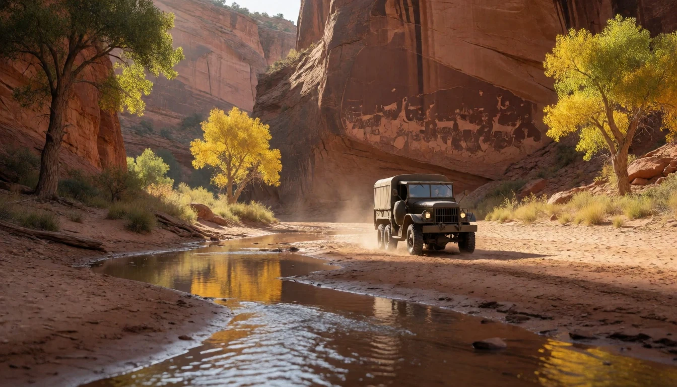
- North Rim Overlooks — North Rim
The North Rim offers a series of dramatic vantage points, including views of Antelope House and Mummy Cave. These overlooks provide a different perspective of the canyon's depth and are often less crowded than the popular south rim vistas.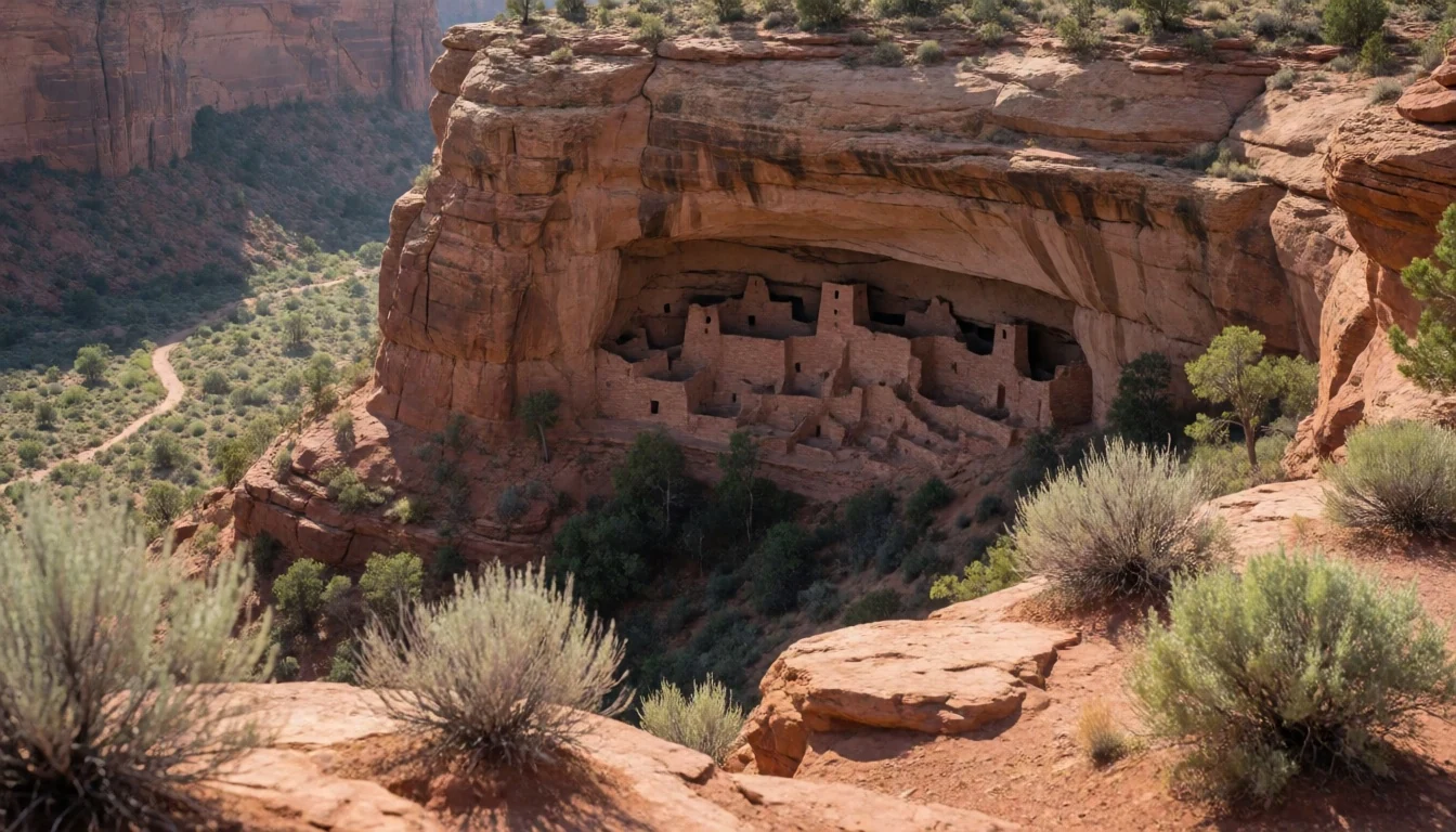
- South Rim Drive — South Rim
The South Rim Drive features several key stops such as Tsegi Overlook and Junction Overlook. These points provide a comprehensive panorama of the canyon floor, where one can see Navajo livestock grazing against the backdrop of red cliffs.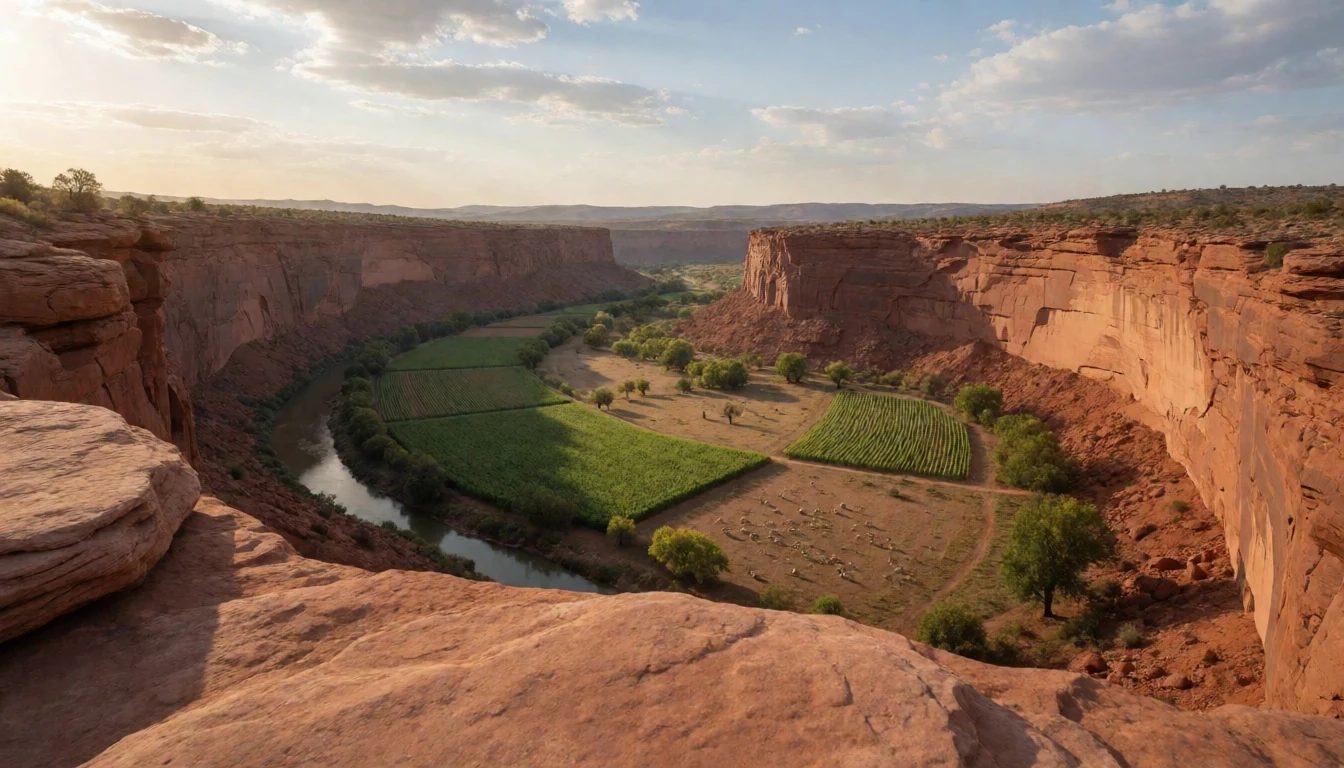
Culture
Canyon de Chelly National Monument is more than a scenic park; it is a sovereign space within the Navajo Nation. The culture here is deeply tied to the land, seen in the continued use of traditional hogans—earth-covered dwellings that remain central to Navajo spiritual and daily life. Visitors will notice a quiet, respectful atmosphere, as the area is a home for dozens of families. The presence of Navajo guides is essential not just for navigation, but for understanding the complex relationship between the environment and the indigenous people who have stewarded it for generations. There is a strong emphasis on the preservation of language and weaving traditions, with local artisans often sharing their craft with those who visit. Respect for tribal law and the privacy of residents is the guiding principle for all interactions within the monument's boundaries. Please remember that you are a guest on sovereign tribal land; always ask for permission before taking photographs of people or their homes.
What to wear
Fashion in Canyon de Chelly National Monument reflects a blend of ancestral heritage and practical desert living. Traditional Navajo dress is celebrated through the use of intricate weaving; wool rugs and blankets, often featuring bold geometric patterns, are highly prized textiles used for both utility and ceremony. In formal or ceremonial settings, traditional silver jewellery—including turquoise and coral—is worn as a mark of identity and status. In daily life, most residents wear contemporary western clothing, such as denim and sturdy work shirts, which are better suited for the demands of ranching and farming in the high desert.
For visitors, clothing must be chosen based on the extreme temperature swings of the Arizona plateau. During the summer, lightweight, breathable fabrics and a wide-brimmed hat are essential to protect against the intense sun. In winter, heavy layering is necessary, as temperatures can drop significantly. Sturdy, closed-toe walking shoes or hiking boots are required for the sandy and rocky terrain of the rim trails. Because the monument is on tribal land, modest dress is appreciated, particularly when visiting residential areas or interacting with local guides.
What to eat
- Cafeteria Comforts — Thunderbird Lodge
Hearty American-style cafeteria meals are available at the Thunderbird Lodge, where the dining area is decorated with local Navajo rugs, blending simple fare with regional artistry.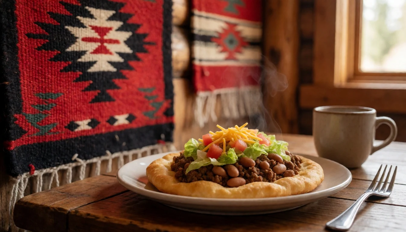
- Hotel Dining — Chinle area hotels
Full-service restaurant meals, ranging from classic breakfast plates to dinner entrees, can be found at the Holiday Inn and Best Western near the monument entrance.
- Regional Staples — Bashas' Diné in Chinle
A wide variety of groceries, fresh produce, and basic supplies for those camping can be sourced at the local supermarket in the nearby town. - Guide-Led Snacks — Guided tour vehicles
Light snacks and water are often provided or recommended during full-day guided tours to keep energy up while traversing the canyon floor.
Plan it
Best time. March–April and October–November are ideal for mild temperatures; summer is intensely hot and winter can be freezing with occasional snow.
How long. 1–2
Getting there. Fly into Albuquerque International Sunport, then drive west. Alternatively, take Amtrak to Gallup, New Mexico, and rent a car for the final leg to Chinle.
Budget. mid
Tips
- Book Navajo guides in advance as they are required for canyon floor access
- Carry plenty of water; the high desert air is extremely dehydrating
- Start your rim drives early in the morning to avoid the midday heat
- Keep valuables out of sight in locked cars to prevent theft
- Watch for livestock and deer on the roads, especially at dusk
Etiquette
- Strictly observe the ban on alcohol throughout the Navajo reservation
- Stay on marked trails and avoid trespassing on private residential land
- Ask for permission before photographing individuals or their hogans
Nearby
Sources
- Wikidata Q1034039 (CC0)
- Wikipedia (CC BY-SA 4.0)
- Wikivoyage (CC BY-SA 4.0)