Cameron Highlands
Cameron Highlands, Malaysia
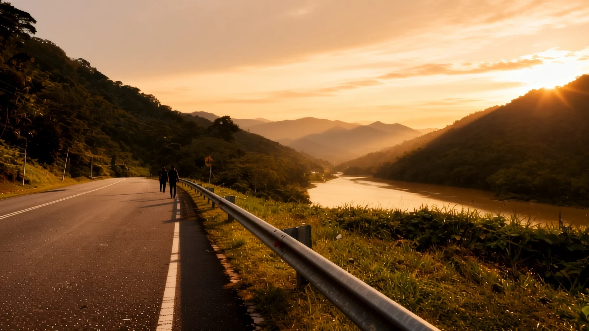
Cool air, tea terraces and misty forest trails, a few hours' drive up from the Malaysian lowlands.
The place
Cameron Highlands is a district of Pahang, in the northwest of that state, and it sits high in the Titiwangsa Mountains that form the spine of peninsular Malaysia. The district covers about 712 square kilometres and is divided into three subdistricts, with eight settlements between them. Tanah Rata is the administrative centre, and most of the trails begin there. The settlements sit at heights from about 800 metres up to 1,603 metres, and that elevation is the reason the place exists as a hill retreat. Surveyed in 1885, the tableland was developed in the 1930s and is one of the older tourist spots in Malaysia. Its cool air suited tea estates, which still cover the slopes, alongside vegetable farms, orchards, plant nurseries and a cream tea culture. Three river systems drain the plateau, and their upper reaches feed the Pahang and Perak rivers. Much of the land remains forested, and the trails lead to waterfalls and Orang Asli villages. Ipoh lies roughly 90 kilometres to the west and Kuala Lumpur about 200 kilometres to the south, so most journeys begin with a long climb up winding roads. Many visitors come from the capital, and weekend crowds are a real feature of the place, so midweek trips tend to feel calmer.
Its story
William Cameron, a government geologist and explorer, surveyed the Cameron Highlands in 1885. Before his survey, the plateau was known mainly to the Orang Asli, whose villages and forest paths still run through the hills. The survey opened the land to outside interest, and by the 1930s the British had developed it into a hill retreat, somewhere to escape the lowland heat. Tea was planted on the slopes, and the estates that grew from those early plantings still shape the scenery. Farms, orchards and nurseries followed, and visitors came to walk, rest and drink tea in the bungalows built for them. Roads brought Land Rovers and later tour buses, and the town of Tanah Rata grew up as the administrative centre. The British also built a radio and television transmitter on Mount Brinchang, which still stands at the summit. The hill station has changed with each decade, but its purpose has stayed much the same: cool air, slow walks and a long afternoon with a pot of tea. Today the story is shared between the colonial-era bungalows, the mixed Malay, Chinese and Indian communities that run the town, and the Orang Asli whose forest the trails cross.
What to see
- Gunung Brinchang — Brinchang, the north of the highlands
Gunung Brinchang is the high point of the Cameron Highlands, and Wikivoyage describes it as the highest point in Malaysia that can be reached by car. A radio and television station sits on the summit, built by the British, and an observation tower stands close by. The view across the tea slopes and valleys below rewards the drive. Go early, as cloud often rolls in by afternoon.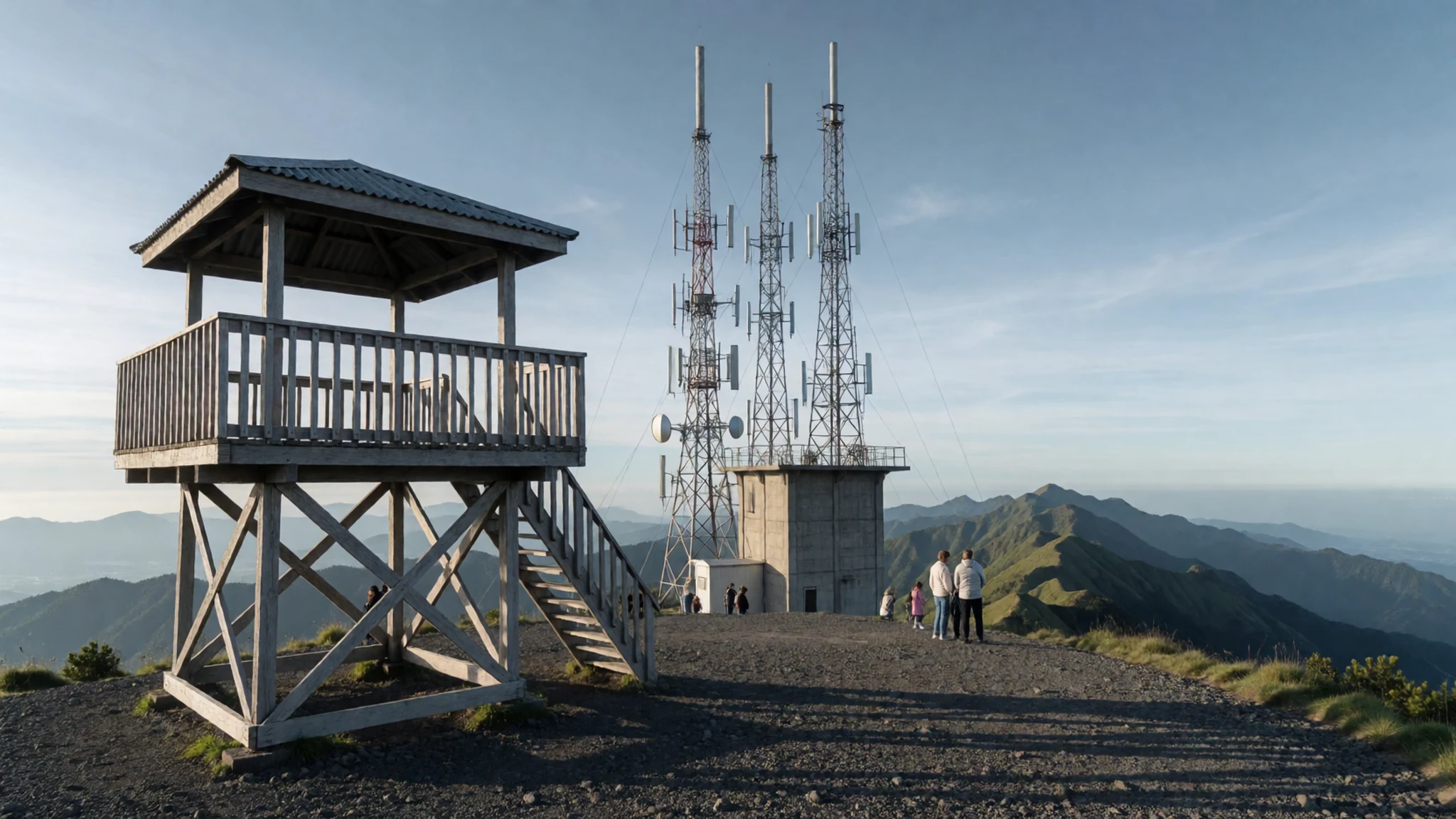
- Mossy Forest — Upper slopes above Brinchang
The Mossy Forest is a cloud forest on the upper slopes near Brinchang, reached by a boardwalk that threads through it. Its base is covered in a thick carpet of moss, which Wikivoyage notes makes it unlike any other reserve in peninsular Malaysia. The air stays damp and cool even on a sunny day. The boardwalk can be slick after rain, so wear shoes with grip.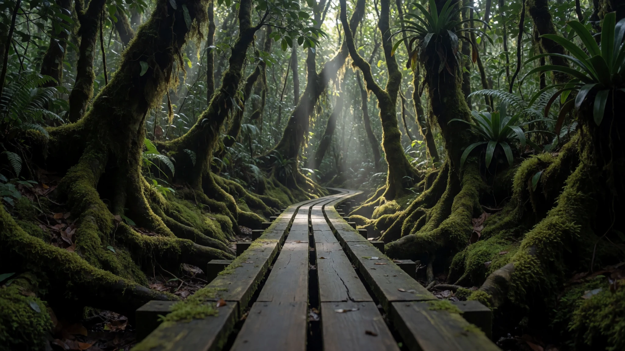
- Boh Tea Centre and Sungai Palas Plantation — Sungai Palas, on the road up from Tanah Rata
The Boh Tea Centre at Sungai Palas is run by Boh, a tea company that Wikivoyage describes as the largest in Malaysia. Tours take you through the factory, and there is an interactive educational studio, a shop and a café with wide views over the rolling plantation. Go in the late morning, when the light is clearest over the hills.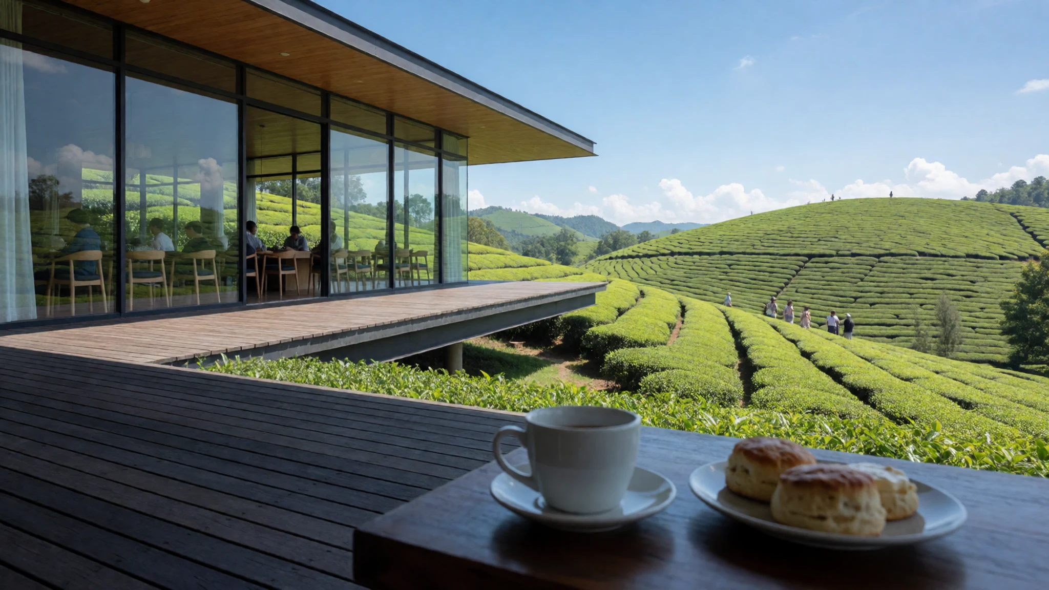
- Sam Poh Temple — Just outside Brinchang
Sam Poh Temple was built in 1972 and is a good stop if the hiking has tired you out. Wikivoyage ranks it the fourth largest Buddhist temple in Malaysia. The halls are calm and brightly decorated, a change of pace from the town centre. Dress modestly, and take off your shoes at the entrance to the halls.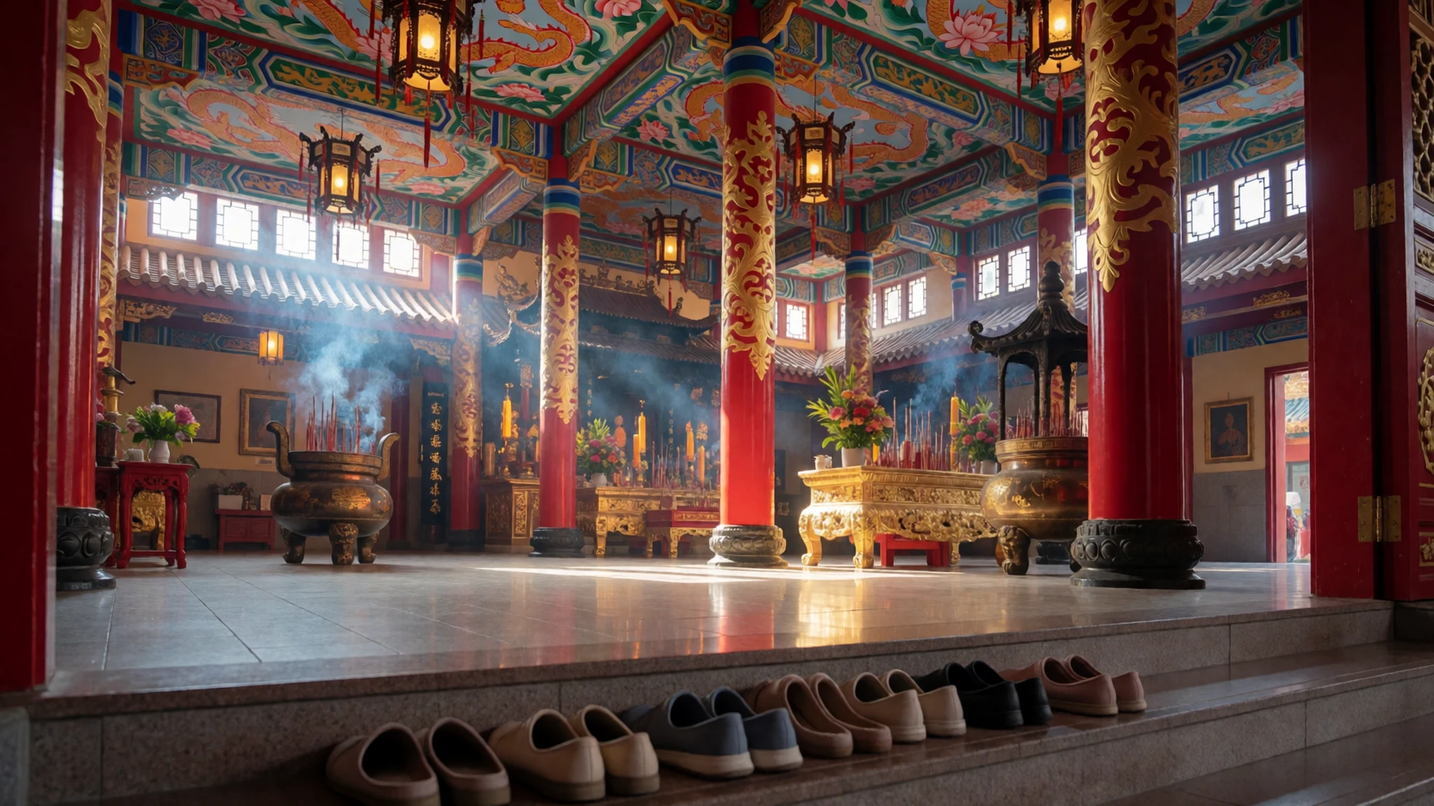
- Robinson Waterfall — Trails from Tanah Rata
Robinson Waterfall is a short distance from Tanah Rata, so it is one of the simpler walks from town. Wet weather makes the paths slippery, so check conditions before you go and tell your guesthouse which trail you plan to take. Water levels are higher after rain, so take care near the rocks.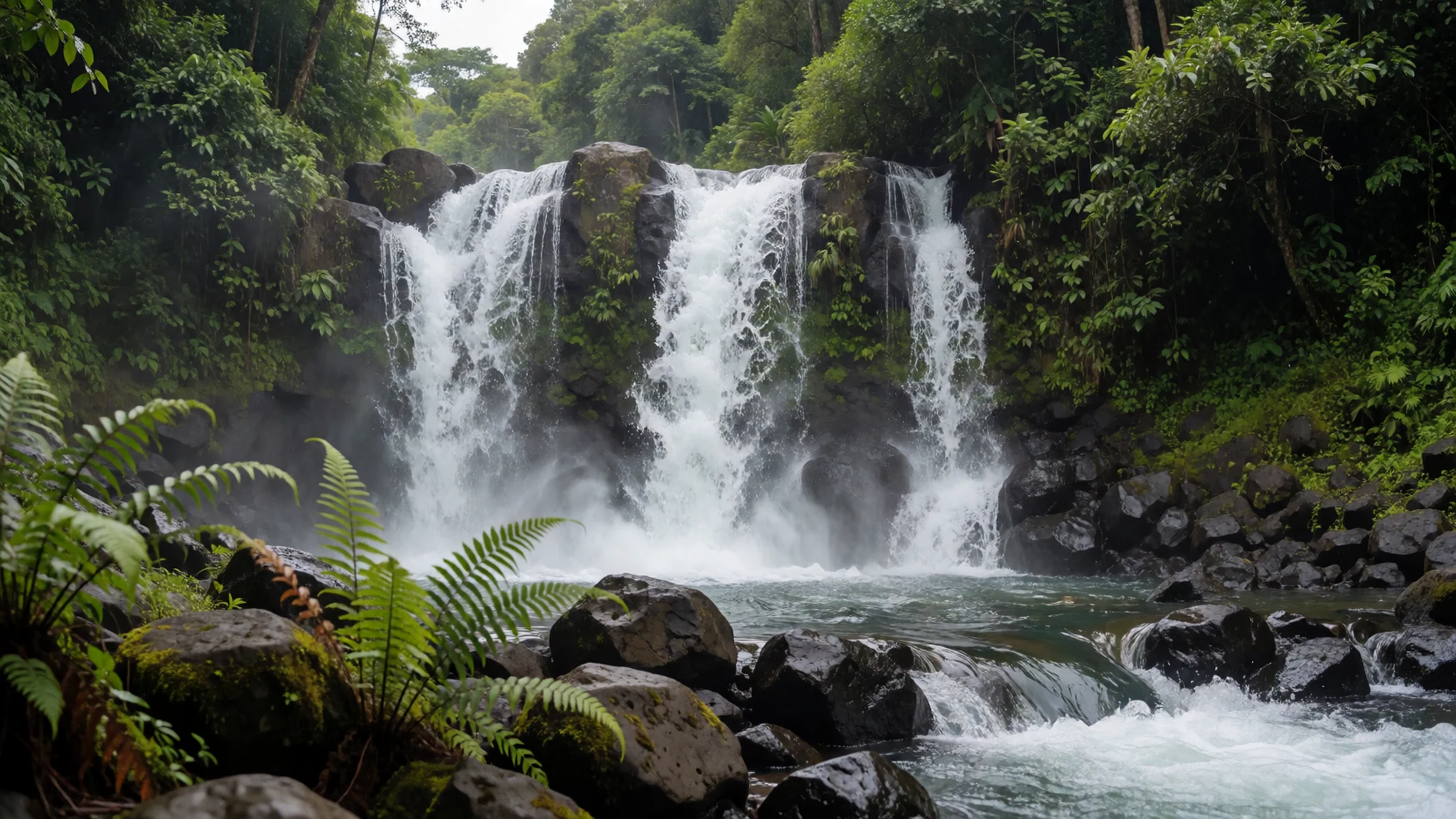
Culture
Cameron Highlands is a hill town where Malay, Chinese, Indian and Orang Asli communities live side by side, and the tone is relaxed rather than formal. Much of local life runs around markets, temples and family-run cafés, and the people who work the tea estates and nurseries are used to visitors with cameras. Malay is the national language and English is widely spoken in town, so a polite greeting goes a long way. Religious sites such as Sam Poh Temple are working places of worship, where people pray and make offerings, so quiet behaviour is expected. The Orang Asli, the indigenous peoples of the peninsula, live in villages along some of the trails. Ask before photographing them or entering their homes, and consider buying something from a community stall rather than taking pictures for free. Carry small change for markets and stalls, since many small vendors prefer cash. When you enter a temple, take off your shoes where you see the steps and keep your voice low.
What to wear
In Cameron Highlands, traditional dress is worn mostly at weddings, festivals and religious occasions. Malay women wear the baju kurung, a loose long tunic over a long skirt, often in cotton or silk, while men may wear a songket or batik shirt with a songkok. Songket is a brocaded weave with gold or silver thread, and batik is a wax-resist cloth with hand-drawn or printed patterns. Orang Asli dress varies between the groups who live on the peninsula, and many younger people now wear ordinary clothes. Day to day, most people in town wear jeans, T-shirts and practical shoes, with women in tudung at mosques and in more formal settings. For a visit, pack layers, because mornings and evenings can be cool. Bring a light rain jacket and sturdy shoes with grip for the trails. At temples and mosques, cover your shoulders and knees, and dress modestly in any village you walk through. Shorts are fine on the walks, but change before you go into a religious building.
What to eat
- Nasi lemak — Breakfast stalls in the smaller villages and near the town market
Nasi lemak, coconut rice with sambal, egg, anchovies and cucumber, is the classic breakfast here, usually from a stall that sells out early. Look for kampung-style versions in the smaller villages around the highlands. Go early, because the good ones run out by mid-morning.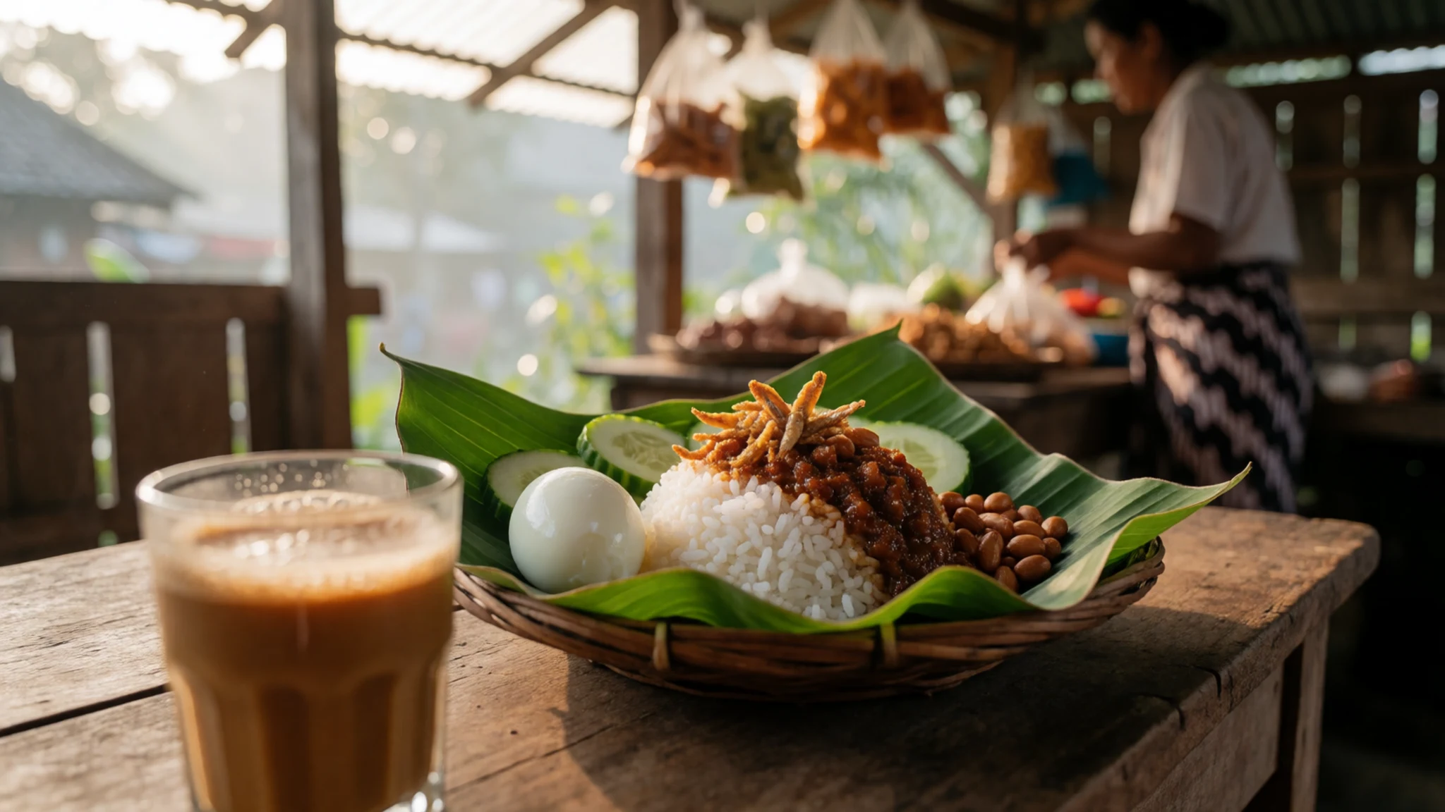
- Banana leaf rice — The Indian restaurants along the main roads in Brinchang and Tanah Rata
South Indian meals served on a banana leaf, with rice, curries, vegetables and pickle, are a strong choice in Tanah Rata's Indian restaurants. Order a set meal and ask for more rice if you want it.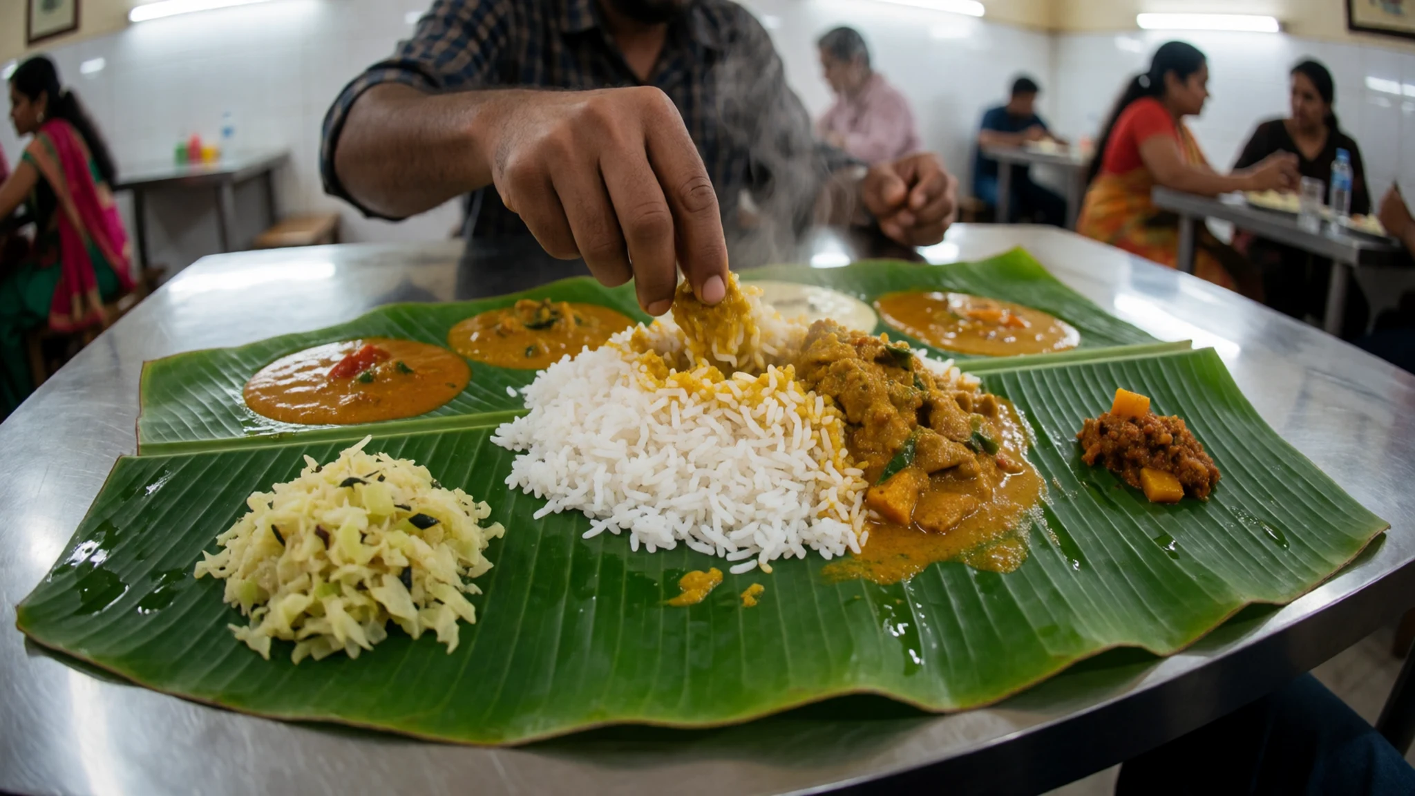
- Steamboat — Restaurants in Tanah Rata and Brinchang, especially on cool evenings
Steamboat is a pot of boiling soup set into the middle of the table, and you cook your own meat, seafood and vegetables in it. It is a shared meal, and it suits a cool evening in the highlands.
- Nyonya cooking — The one Nyonya restaurant in the town centre
Nyonya food blends Chinese and Malay cooking, with sour and spicy flavours and coconut-based dishes. Wikivoyage notes that the town has only one Nyonya restaurant, so it is worth booking ahead at busy times. - Boh tea and cream tea — Café terraces at the Boh plantations and tea centres
Boh tea is the local drink, and the best place to try it is at the plantations, where you can taste it with a scone and jam. Cream tea culture is part of life here, a legacy of the British.
Plan it
Best time. February and June to August suit walking best, when rain is lightest, while the northeast monsoon from November to December brings the heaviest downpours. Nights stay cool all year, so bring a warm layer and check the weather before any trail.
How long. 2–3
Getting there. Buses run from Ipoh's Amanjaya terminal up to Tanah Rata, a journey of about 2–3 hours. From Kuala Lumpur, buses leave from Terminal Bersepadu Selatan and take about 4½ hours. The last leg is a winding climb, so check operator timetables before you travel.
Budget. mid
Tips
- Start trails early, since cloud usually builds by the afternoon
- Book Kuala Lumpur buses online where the operator allows it, especially at weekends
- Carry cash for small stalls, markets and village purchases
- Carry water and a rain layer, and expect slippery paths after heavy rain
- Tell your guesthouse which trail you plan and when you expect to return
- Visit midweek if you want quieter trails and cafés
Etiquette
- Wear shoes with grip on the trails and remove them at temples
- Ask before photographing Orang Asli people or their villages
- Keep your voice low at temples and shrines
Nearby
Sources
- Wikidata Q64148189 (CC0)
- Wikipedia: Cameron Highlands (CC BY-SA 4.0)
- Wikivoyage: Cameron Highlands (CC BY-SA 4.0)