Borðoy
Borðoy, Faroe Islands
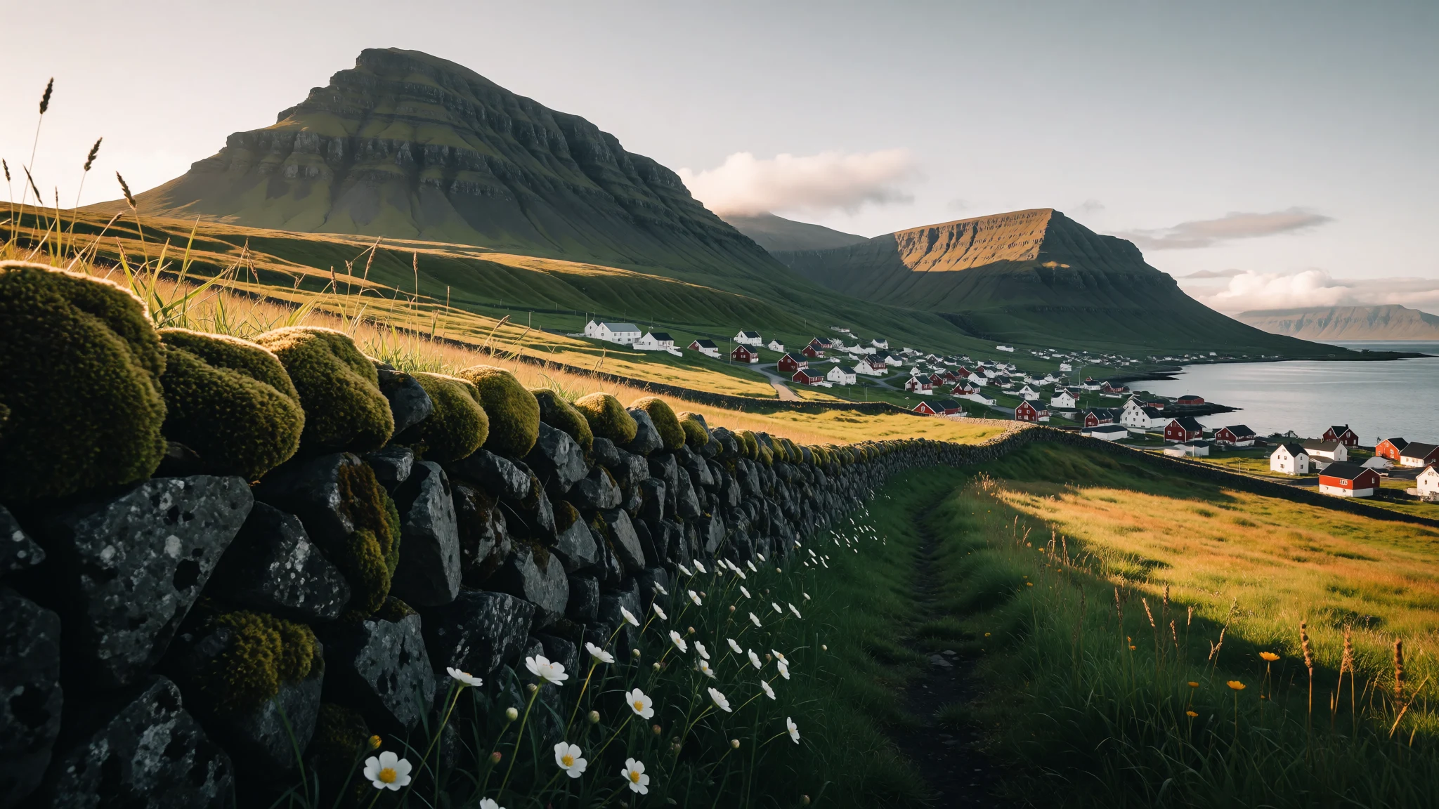
Borðoy is a steep, green island of fjords, tunnels and empty valleys, and a practical base for the wild Northern Islands.
The place
Borðoy lies in the north-east of the Faroe Islands, and its name is usually understood as 'headland island'. About 5,534 people live here, most of them in Klaksvík, the second-largest town in the archipelago and the working centre of the Northern Islands. The island has eight settlements in all, including Norðoyri, Ánir, Árnafjørður, Strond, Norðtoftir, Depil and Norðdepil, though outside Klaksvík these are small clusters of houses along the water's edge. The land climbs steeply to a highest point of 755 m, so the island feels like a ridge of green and grey mountains with the town set in a bay between them. Fjords cut in from both sides, which is why the roads here twist, tunnel and cross causeways. Borðoy is also the hinge of the region. A long tunnel links it to Eysturoy and the main road network, and from Klaksvík further roads, tunnels and short ferries lead to Kunoy, Viðoy, Kalsoy and beyond. Many visitors treat it as a base for the northern islands rather than a single destination, and that suits it well. The weather is changeable, often wet and windy, and cloud can drop onto the peaks within minutes. In return, the light after a shower is striking, and the harbour at Klaksvík offers a plain, working view of Faroese life, with fishing boats, a few shops and modest crowds even in summer.
Its story
Borðoy's recent history is easiest to read in the empty places on its northern edge. Three settlements there have been abandoned: Skálatoftir, Múli and Fossá. Múli was among the remotest villages in the Faroes. No road reached it until 1989, so supplies came by boat or, when the sea refused, by helicopter. The last residents left in 1994, and the houses now stand as a record of how hard it became to keep a community alive on a stretch of coast with no easy link to anywhere else. Fossá has a different story. A museum in Klaksvík bought the land in 1969 with the idea of rebuilding a typical medieval Faroese village there. The plan never came to fruition, which leaves the valley as it is, a place where an unfinished intention is as visible as the ruins. Older layers belong to the landscape and to storytelling. The mountains are stacked sheets of volcanic rock, cut by ice and the Atlantic into the steep fjords that make travel here a matter of tunnels and causeways. Folktale fills the gaps in the written record. The seal woman, commemorated by the statue Kópakonan on neighbouring Kalsoy, is a familiar figure in Faroese stories. In the tale she leaves her skin to take human form, and the trouble that follows when it is hidden is still told to children and visitors alike.
What to see
- Klaksvík harbour — Klaksvík
Klaksvík is the island's town and the centre of the Northern Islands, a harbour settlement wrapped around a bay with houses stepping up the slope. A walk along the quay shows working boats, a few cafés and the fjord of Borðoyarvík beyond. It is the one place on Borðoy with a real choice of eateries, so most visitors start and finish here.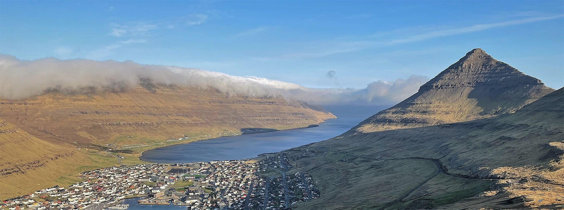
- Hálsur mountain pass — Above Klaksvík
The pass at Hálsur gives a wide view back over Klaksvík and its fjord. The steep ridge of Háfjall, 647 m, rises on one side, with Hálgafelli beside it. It is a good place to get your bearings on a clear morning. Cloud can swallow the peaks quickly, so go early and carry a windproof layer.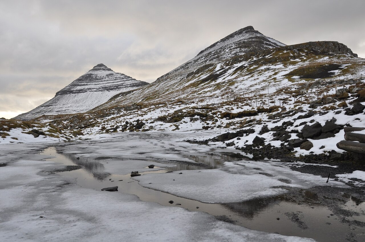
- The Kunoy causeway — Between Borðoy and Kunoy
A dam carries the road between Borðoy and Kunoy, with the village of Haraldssund visible on Kunoy's shore. Kunoy is mountainous and narrow, with only two active settlements, Haraldssund and Kunur, joined by a one-lane tunnel of 3100 m. Drivers give way to oncoming traffic as needed, so patience matters more than speed.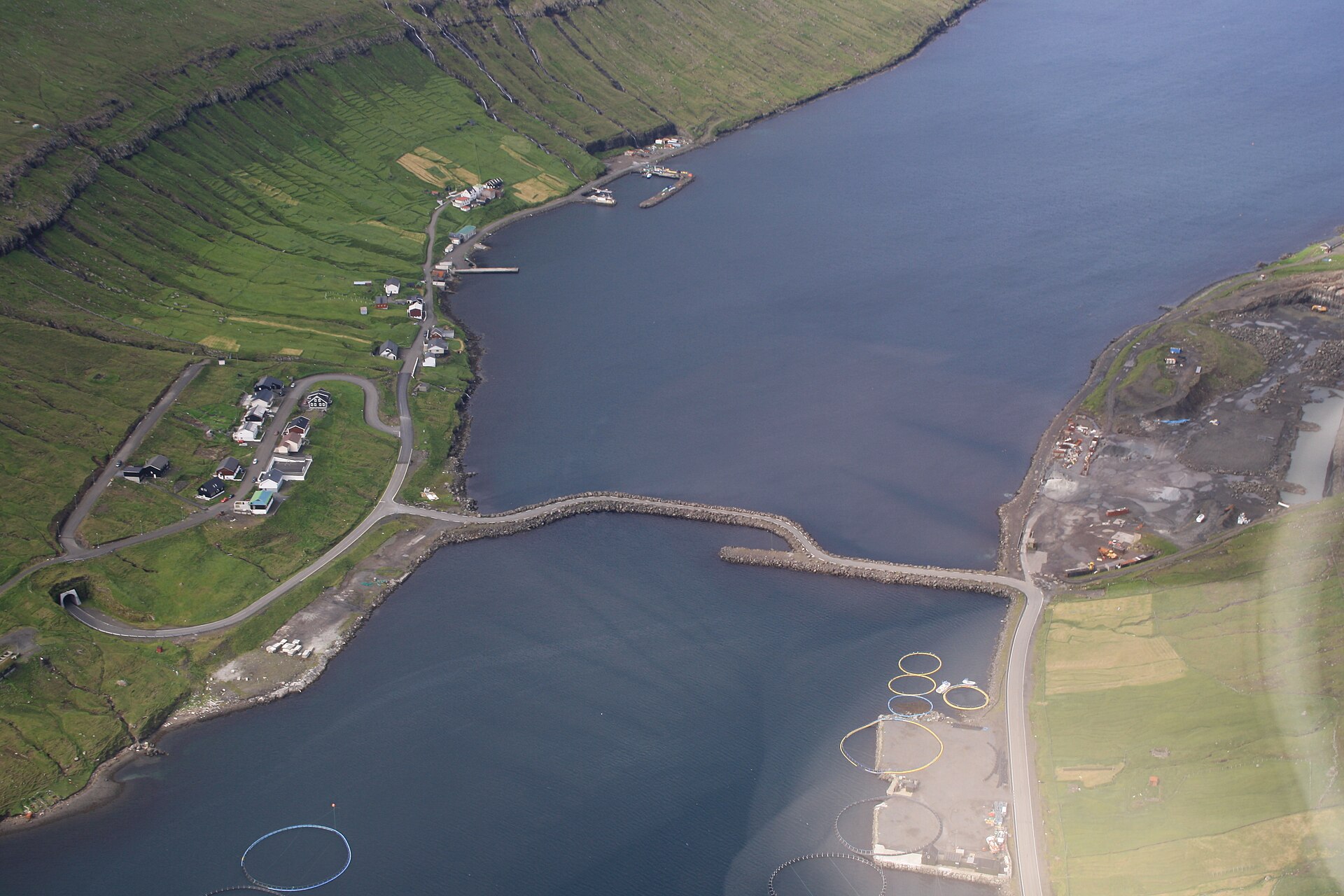
- Viðareiði church — Viðareiði, Viðoy
Viðareiði, on neighbouring Viðoy, is the northernmost village in the Faroes. Its church looks much like others in the islands from outside, but the silver inside is the draw, including a salver given by the British Government to thank islanders who helped shipwrecked sailors in the mid-nineteenth century. The sea is calm on the church side and rough on the other.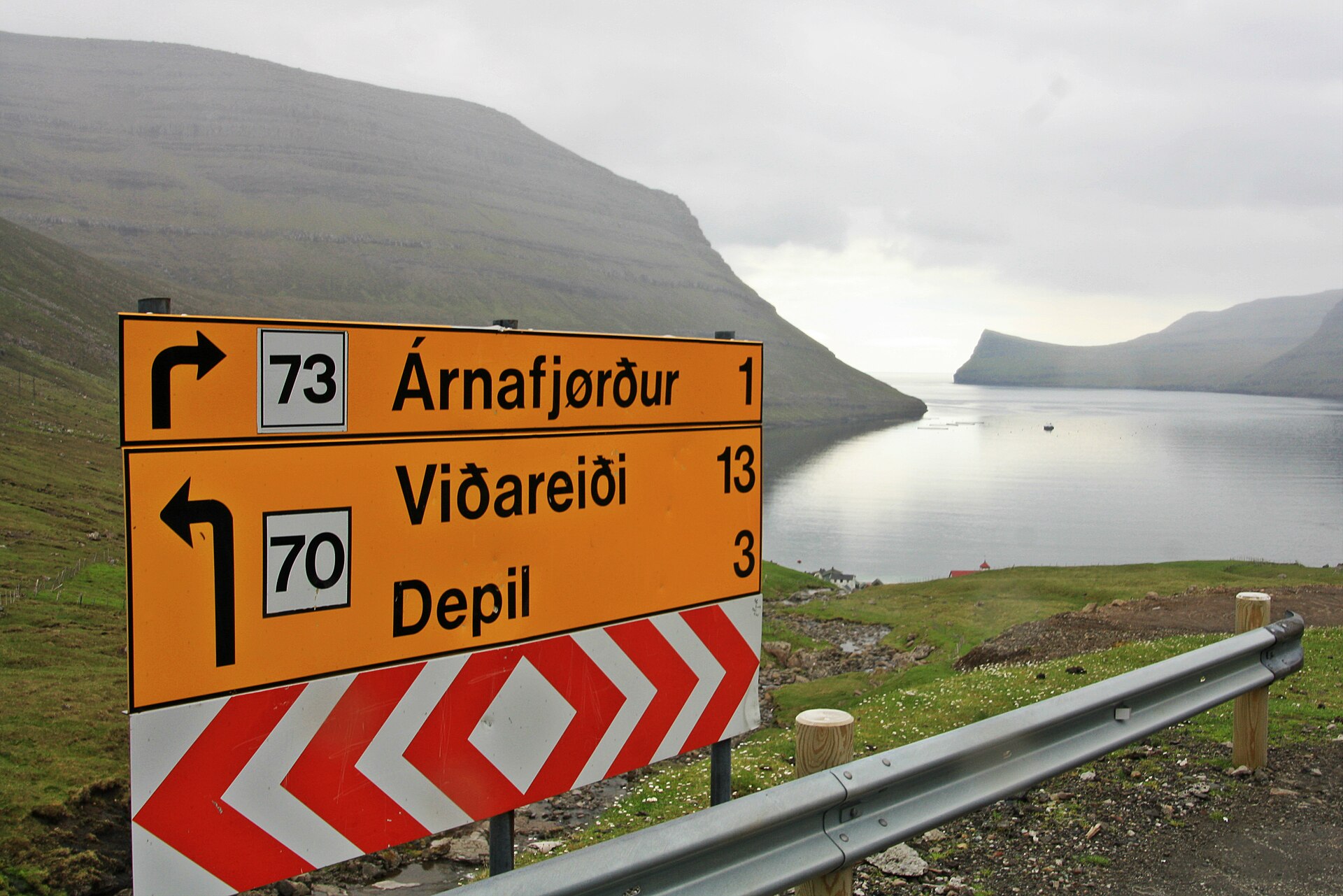
- Cape Enniberg — Near Viðareiði, Viðoy
Cape Enniberg, near Viðareiði, drops 754 m into the Atlantic and is described as one of the highest sea cliffs in Europe. A little-used hiking trail starts at the northern end of Garðsvegur in Viðareiði and crosses Villingardalsfjall. Expect strong wind and exposed edges, choose a clear day, and keep well back from the drop. - Skarð — Near Haraldssund, Kunoy
Skarð is an abandoned settlement on the Kunoy side, reached by a hike of about three hours from Haraldssund or over a mountain pass from the settlement of Kunoy. The ground is often wet, so boots and a map matter. The reward is quiet ruins in a steep valley, far from any road.
Culture
Borðoy's culture is that of a fishing and farming community in a small country with its own language. Faroese is spoken everywhere, and Danish and English are widely understood, so a few words of greeting in Faroese are warmly received. Klaksvík grew around its harbour, and the rhythm of boats coming and going still shapes the town more than tourism does. Outside the town, life is close to the land. Sheep graze the hillsides, hay and peat have long been part of the year's work, and many families keep links to outlying villages that are now much emptier than they once were. The loss of places such as Múli is part of local memory, and people speak of it with feeling rather than nostalgia. Churches are simple, mostly white or dark-timbered buildings with grass roofs or neat slate, and they remain in everyday use rather than being kept as museums. Storytelling is a living tradition: ballads, chain-dance songs and folktales about seal women, trolls and hidden people are still shared, and the statue of Kópakonan on Kalsoy is a reminder of how much of the landscape carries a story. Visitors will find Faroese people reserved at first but helpful, and happy to talk about weather, boats and football. Close farm gates behind you and keep to marked paths and tracks, because the hillsides are working grazing land.
What to wear
Dress on Borðoy begins with wool. The Faroese national costume is worn on festive and church occasions, and it is made from wool and cloth in dark tones, with silver buttons and clasps and, for women, a bodice, long skirt and a knitted shawl. Men's versions include a dark jacket and knee breeches. Knitwear is the best-known textile tradition, with patterned jumpers, caps and shawls made from island wool, and a hand-knitted piece is a typical gift. You will see the full costume at weddings, confirmations and national celebrations rather than in the street. Everyday clothing in Klaksvík is practical and weather-led: waterproof jackets, wool layers, rubber boots or sturdy shoes, and a hat that stays on in the wind. Fishermen and farmers wear work clothes in bright oilskin colours, while younger people dress much as they would in Copenhagen or Edinburgh, with a good coat on top. For a visitor, the rule is layers. Pack a base layer, a wool or fleece mid layer and a properly waterproof outer shell, plus a hat and light gloves even in summer. Hiking boots, ideally waterproof, are essential for the trails, and walking poles help on wet slopes because it is easy to trip. Churches have no strict dress code, but tidy, covered clothing is appropriate for services.
What to eat
- Skerpikjøt — Eateries in Klaksvík, or a family table by invitation
Wind-dried mutton, hung in airy huts for months until it turns dark, firm and strongly flavoured. It is served in thin slices with boiled potatoes. It is an acquired taste and usually a seasonal speciality, so ask at local eateries in Klaksvík what is available. - Ræstur fiskur — Traditional restaurants and home cooking in Klaksvík
Fish that has been fermented in the cool, damp air before it is dried, giving a pungent smell and deep savoury flavour. It is usually boiled and eaten with potatoes. Try a small portion first, and ask staff to explain it. - Fresh fish and salmon — Harbour-side eateries and cafés in Klaksvík
The fjords and the surrounding sea supply haddock, cod and farmed salmon, often simply pan-fried or baked with potatoes and butter. This is the easiest meal to enjoy on Borðoy, and the fish rarely travels far before it reaches the plate. - Lamb dishes — Klaksvík restaurants, and village meals on nearby islands
Faroese lamb grazes freely on the hillsides, and is served as roast meat, in soup, or smoked and dried. Trøllanes on Kalsoy has a local reputation for its meat. A bowl of lamb soup is a good answer to wet weather. - Rhubarb cake — Cafés and bakeries in Klaksvík
Rhubarb grows well in Faroese gardens, and appears in tarts, cakes and jams with cream or custard. It is sharp, sweet and homely, and fits well with strong coffee after a hike.
Plan it
Best time. June to August, when days are long and the weather is at its mildest, though rain and wind are possible in any month. Spring and early autumn are quieter but darker and wetter, and winter brings short days and rough seas that can disrupt ferries.
How long. 2–3
Getting there. Fly to the Faroe Islands (Vágar airport), then take a bus or hire a car towards Tórshavn and on through the long Northern Islands tunnel from Eysturoy to Klaksvík. Buses connect Tórshavn with the Northern Islands. From Klaksvík, onward trips to Kunoy and Viðoy are by road, while Kalsoy needs a ferry and Svínoy and Fugloy are served by helicopter or by ferry from Hvannasund.
Budget. high
Tips
- Check bus and ferry times in advance on the official sites, as services are limited and change by season
- Cars pay a toll to use the Northern Islands tunnel, so check the current rate on the official tunnel site
- Eat in Klaksvík, because other villages have few or no eateries and some have closed
- Start hikes early and check the forecast, since cloud and wind can change in minutes
- See visitnorth.fo, the official tourism website, for up-to-date local information
Etiquette
- Close gates behind you and keep to marked paths across grazing land
- Pull into lay-bys to let oncoming traffic pass in single-lane tunnels
- Do not enter abandoned houses or private land without permission
Nearby
Sources
- Wikidata Q202170 (CC0)
- Wikipedia: Borðoy (rev 1377949198) (CC BY-SA 4.0)
- Wikivoyage: Northern Islands (rev 5412829) (CC BY-SA 4.0)
- Photo: Klaksvik and Borðoyarvík, Vincent van Zeijst (CC BY-SA 4.0)
- Photo: Háfjall and Hálgafelli from Hálsur, Vincent van Zeijst (CC BY 3.0)
- Photo: Borðoy, road to Viðoy, DavideGorla (CC BY 2.5)
- Photo: Causeway to Kunoy, R. Hokwerda (CC BY 3.0)
- Photo: M/F Dúgvan, Erik Christensen (CC BY 3.0)


