Aranuka
Aranuka, Kiribati
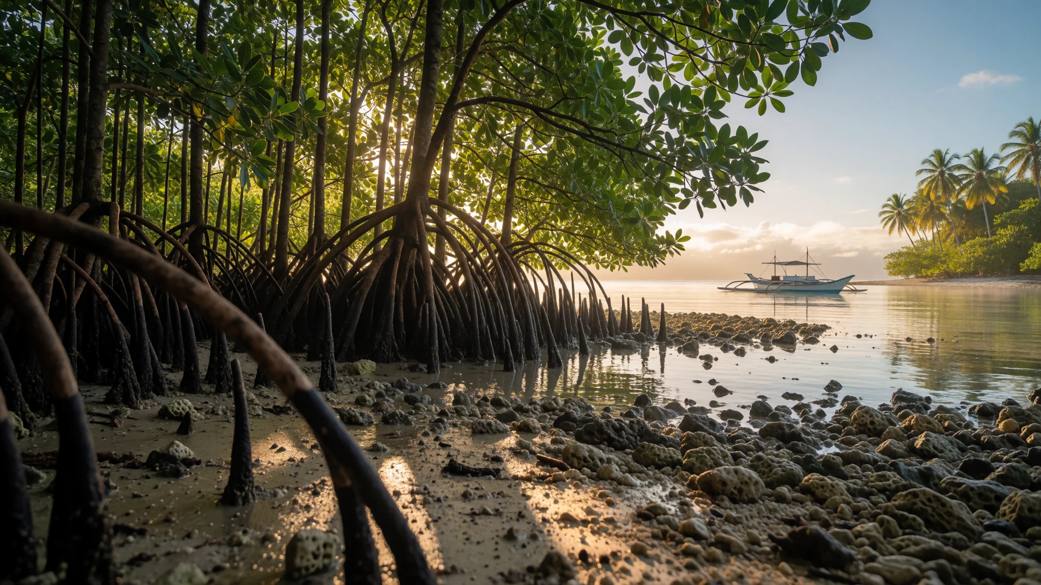
Aranuka is a remote atoll break where lagoon passages, reef islets and mangroves trade city crowds for real island time.
The place
Aranuka (Aranuka Atoll) sits just north of the equator in Kiribati’s Gilbert Islands, a small island world defined by its lagoon and reef. It’s a triangular atoll made from a few named islets—Buariki, Takaeang and Baurua—linked by sandbanks on the northern side and by an underwater reef crest to the south.
Life is clustered on the lagoon side. There’s basically one main road that runs alongside the villages, with feeder paths branching out from it. The walkability is part of the charm: villages sit close enough that you can move around on foot, and locals also use bicycles and motorbikes (but the paths aren’t designed for big trucks).
The lagoon itself isn’t a guaranteed seafood pantry, so expectations need to be modest. The real draw is the coastal scenery and the ecology: towards the northern end of the main island there’s a notable stand of Rhizophora stylosa mangroves—tall, dense and important for bird breeding.
For visitors, the practical reality is that facilities are limited and the island is remote. Transport can be slow or delayed, and boat access depends on conditions. If the sea looks calm, it’s a great day for lagoon and nearby islets; if it doesn’t, you shift to village walks, nature time and whatever the Island Council can arrange.
Aranuka isn’t built for ticking off sights quickly. It’s better for slow conversations, long walks and the quiet thrill of being somewhere genuinely far from home.
Its story
Aranuka is woven into Kiribati’s origin stories: by local tradition, it sits at the centre of the islands, linked to the way the rest of the archipelago was formed and separated. The same tradition is also where its older name is remembered, pointing to the idea of “the middle of it”.
European contact came later, when explorers described the atoll during a 1788 visit. The island was then charted during a later period of survey work in 1841. Aranuka’s political history also shifted as different leaders extended control across islands in the wider Gilbert group, including a time when it was conquered and subsequently ruled through local authority.
Daily life has long been practical rather than showy. Even when visitors come for nature—mangroves, lagoon edges and the connected islets—Aranuka remains firmly an inhabited place. That feeling is reinforced by the infrastructure: a small network of roads, village clusters and community-led hospitality.
One small landmark of the modern era is the post office, opened around 1924, which hints at how long Aranuka has been part of wider communication networks, even while staying remote. Overall, the story of Aranuka isn’t about grand monuments. It’s about centrality in a living geography—plus the steady work of communities that keep the lagoon-side routines going.
What to see
- Mangroves at Maungan Te Tongo — northern end of mainland Aranuka
Maungan Te Tongo is the place to focus on Aranuka’s characterful mangroves—tall Rhizophora trees rising where land meets the lagoon. It’s a calm nature walk zone, best when light is kind for birdlife and the shaded roots look almost sculpted.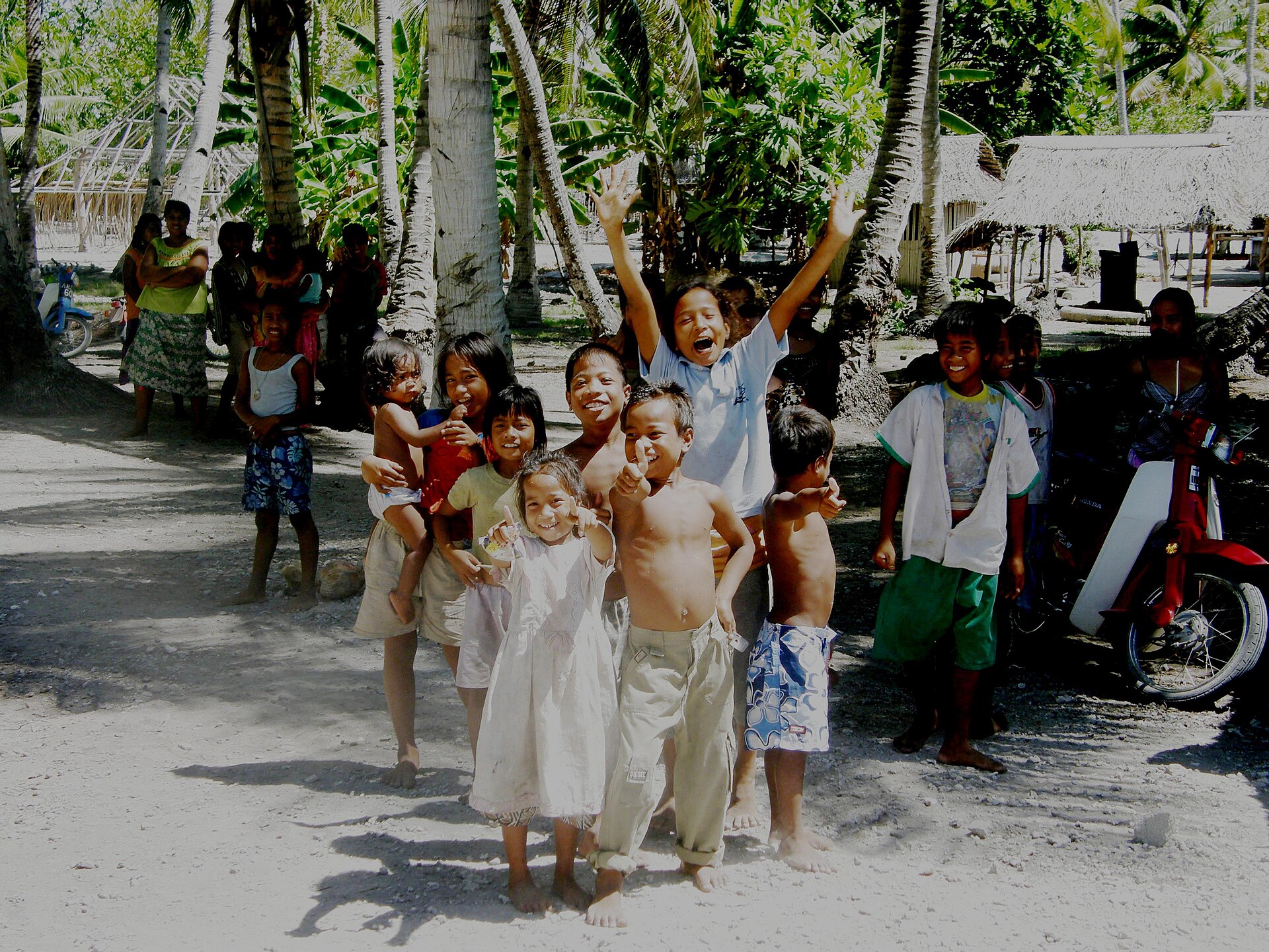
- Riiki’s remaining facilities at Kauake — Kauake village area
Kauake is referenced as a spot to see the remaining well, bathroom and toilet connected to Riiki and his sons. It’s not about scenery in the postcard sense; it’s more about understanding how daily water and sanitation needs were handled in village life. - Kainga mweaka offering before a tour — Ababoou or Atin Tabuariki kainga/clan areas
A tour around Aranuka is open, but the day often begins with a respectful gesture: bringing mweaka, a gift, to the kainga (clan) of Ababoou or of Atin Tabuariki. Think of this as the community “welcome protocol” before you move through the island with guidance. - Lagoon passage and reef-crest views — south-west side reef pass to the lagoon
Aranuka’s lagoon has a passage for boats through the reef on the south-west side. In moderate weather, it’s the gateway to lagoon time; the sea around the passage can be strong, so it’s very much an activity for those who understand the conditions. - Trip around the island and boat rides to islets — main island road-and-lagoon corridor, then outward to nearby islets
A trip around the island—often coordinated by local escorts—helps connect the dots between villages, sandbanks and lagoon edges. Boat trips to smaller islets can be arranged with the Island Council; be ready for extra cost and plan ahead.
Culture
Aranuka’s culture is mostly something you feel through rhythms: the fact that villages cluster on the lagoon side, that movement is guided by community escorting, and that certain activities require prior arrangement. When people set up visits, they don’t treat it as “just tourism”; they treat it as a social event with responsibilities.
One clear example is the offering of mweaka (gifts) at specific kainga (clan) places such as Ababoou or Atin Tabuariki. The guidance is also part of respect: visitors are escorted after leaving an offering. Even entertainment and demonstrations aren’t always “walk-in” activities—local dances or traditional skills may require arrangements through the Island Council when visitors want to participate.
Snorkelling and swimming exist, but the island’s setup matters: snorkeling is generally suggested with your own gear, and swimming and beach games are done only at the islets. Communications can be limited, and a public phone may be the best bet in villages, so being flexible keeps things smooth.
Visitor etiquette: leave the required offerings at the shrines/kainga you’re visiting, and follow the escort’s instructions for where and when it’s appropriate to go.
What to wear
Aranuka doesn’t have a single “official” visitor outfit, but the island setting and village access shape what works. Traditional dress on Kiribati islands is typically worn for cultural moments; for Aranuka visits, the key idea is modesty and comfort around people you’ve met through the Island Council.
What people wear now is usually practical for warm weather—light, breathable clothing for the day, with simple footwear for walking paths that can be sandy or uneven near the lagoon side. When you’re moving through villages and going on nature walks toward mangroves and islets, hats and sun protection help more than “dressy” clothes.
What a visitor should pack: loose clothing that covers shoulders and legs, quick-drying layers for sea breezes, and footwear that can handle wet sand and paths (avoid flimsy flip-flops if the ground is rocky). If you plan to snorkel, bring swimwear you’re comfortable in, plus reef-safe habits and a cover-up for moving between village and boat.
For cultural or arranged demonstrations, lean toward slightly more covered clothing so you can blend in and avoid drawing attention in a way that feels disrespectful.
What to eat
- Island-prepared meals (what’s available locally) — Island Council guesthouse and village eateries/household meals
Food on Aranuka is basic and varies by what the community can source at the time. Expect island-prepared meals served through local accommodation options; it’s more “local availability” than a menu. - Drinking water you’ve brought — your accommodation and day-pack
Aranuka is remote, and taking additional supplies of drinking water is advised. Even when local water is available, it’s smart to keep your own reserve for long walks and boat delays. - Sea-and-lagoon side snacks around islet swims — on islet day trips arranged by the Island Council
Swimming happens only at islets, and those same outings often come with small, practical snacks rather than full meals. Think of it as easy, portable food during sea time. - Village shared refreshments during escorted visits — between village areas during escorted tours
When escorted around the island, visitors often spend long stretches moving between village areas and nature spots. Shared refreshments and simple treats are part of that slower travel pace.
Plan it
Best time. March–April and October–November are the most comfortable months to aim for: Aranuka sits near the equator, so temperatures stay warm year-round and these shoulder months tend to be easier for walking, lagoon time and boat schedules.
How long. 3–4
Getting there. Fly to South Tarawa, then connect onwards; Aranuka has an airport near the northern tip of Buariki with service described as two flights a week from South Tarawa, and charter boats may also be an option for the last leg.
Budget. mid
Tips
- Plan for transport delays and build in flexible time; the island is remote and schedules can shift.
- Keep your days open for weather: boat passage into the lagoon and islet visits depend on conditions.
- Carry extra drinking water, because supplies can be limited on the islands.
- Bring your own snorkelling gear if you want to swim/snorkel comfortably.
- If you want demonstrations, dances or skills, arrange in advance through the Island Council.
Etiquette
- Leave gifts/mweaka at the shrines and kainga places you’re visiting, as directed by your escort.
- Follow escort guidance on where it’s appropriate to go and when to leave.
- Don’t assume swimming or beach games are permitted on the main island—those are done at the islets.
Nearby
Sources
- Wikidata Q626095 (CC0)
- Wikipedia (rev 1363881605) (CC BY-SA 4.0)
- Wikivoyage (rev 5362483) (CC BY-SA 4.0)
- photos/01-aranuka-kiribati.jpg (Public domain)
- photos/02-gilbertislandspos.png (CC BY 3.0)
- photos/03-aranuka-locals.jpg (CC BY 3.0)
- photos/04-air-kiribati-route-map.png (Public domain)


