Anholt
Anholt, Denmark
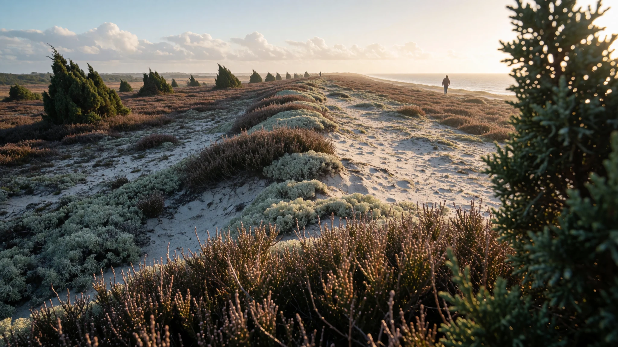
Anholt is a windswept Danish island of long empty beaches and a protected sandy heath, reached only by sea from Jutland.
The place
Anholt is a Danish island in the middle of the Kattegat, the sea between Jutland and Sweden, and it feels more remote than the map suggests. It is eleven kilometres long and about six across at its widest, small enough to understand in a day and varied enough to keep exploring for a week. Only 167 people live here year-round, and the island belongs administratively to Norddjurs Municipality on the Jutland side. It divides cleanly in two. The western fifth is hilly moraine left by the ice sheets, and it is the only part where anyone lives: the harbour, the inland village of Anholt Town and a scatter of holiday houses. The eastern four-fifths is Ørkenen, "the Desert", a flat, treeless sweep of raised seabed with low former dunes, lichen, heather and stunted juniper. It is protected and nothing may be built there, and because it has never been ploughed, old shorelines from the ice age can still be traced inland. Long sandy beaches with shallow water run around the whole coast. In midsummer the harbour fills with yachts from Denmark, Norway, Sweden and Germany, and the shops and eateries are busy. Outside the season the island is quiet and many services shut. The two highest points, Sønderbjerg and Nordbjerg, give views towards Jutland or Sweden on a clear day. Holiday houses, several hundred of them, far outnumber the residents.
Its story
Anholt's human story starts early. People have lived on or visited the island since the Stone Age, flint flakes can still turn up on the Desert, and a few Viking finds have been made. In the Middle Ages it was crown property: a royal land register of the thirteenth century records the king owning a house or hunting lodge on Sønderbjerg. A church was built in the middle of the sixteenth century, before which the islanders belonged to a mainland parish in Halland. When Denmark handed Halland to Sweden in the seventeenth century, Anholt stayed Danish. A local tale says a negotiator set a beer glass on the island on the map. The likelier reason is that Swedish forces never took the remote island and had little interest in it. It later passed into private hands, and the Rostgaard von der Maase family line has owned most of the protected land. The strangest chapter came during the Napoleonic Wars. A British bomb ketch, HMS Proselyte, had been stationed off the island to show a light for convoys after the Danes darkened the lighthouse. She was wrecked on Anholt Reef in winter ice, and the Danes rescued her crew and made them prisoners. Months later a British squadron landed seamen and marines. The small Danish garrison resisted briefly and then surrendered, and Britain held the island for several years. The reef still demands respect from passing ships.
What to see
- Ørkenen (the Desert) — Eastern Anholt
Ørkenen fills most of eastern Anholt: a dry, sandy heath of lichen, low plants and wind-bent juniper, with no buildings anywhere. The ground is open and the horizon wide, so it is best walked slowly with water and a hat. Look for faint inland ridges that mark ancient shorelines.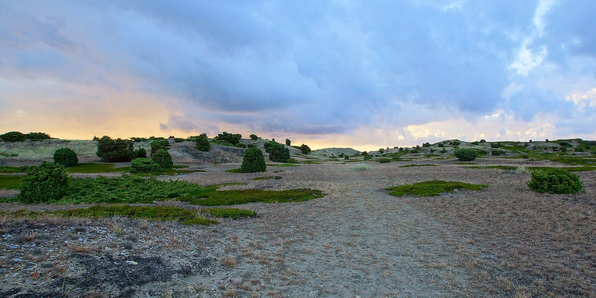
- Nordstrand — Northern coast
Nordstrand is one of the long sandy beaches on the island's northern side, with shallow water that warms up well in summer. Space is rarely a problem, even in high season, because the coast is so long. There is little shelter from the wind, so bring a windbreak and sun protection.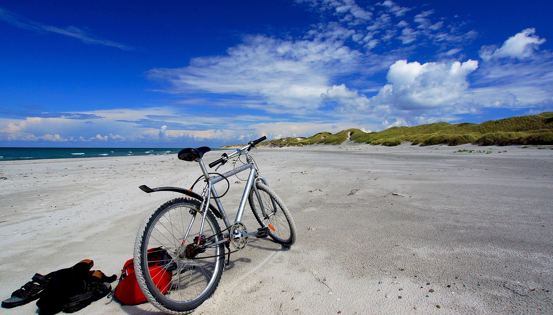
- The Harbour — The Harbour, western Anholt
The harbour is the island's front door and its busiest corner in summer, with ferries, a marina, yachts from several countries, shops and eateries. It works well as a base for the first hour. Moorings fill up in peak weeks, so sailors should confirm a berth before they set out.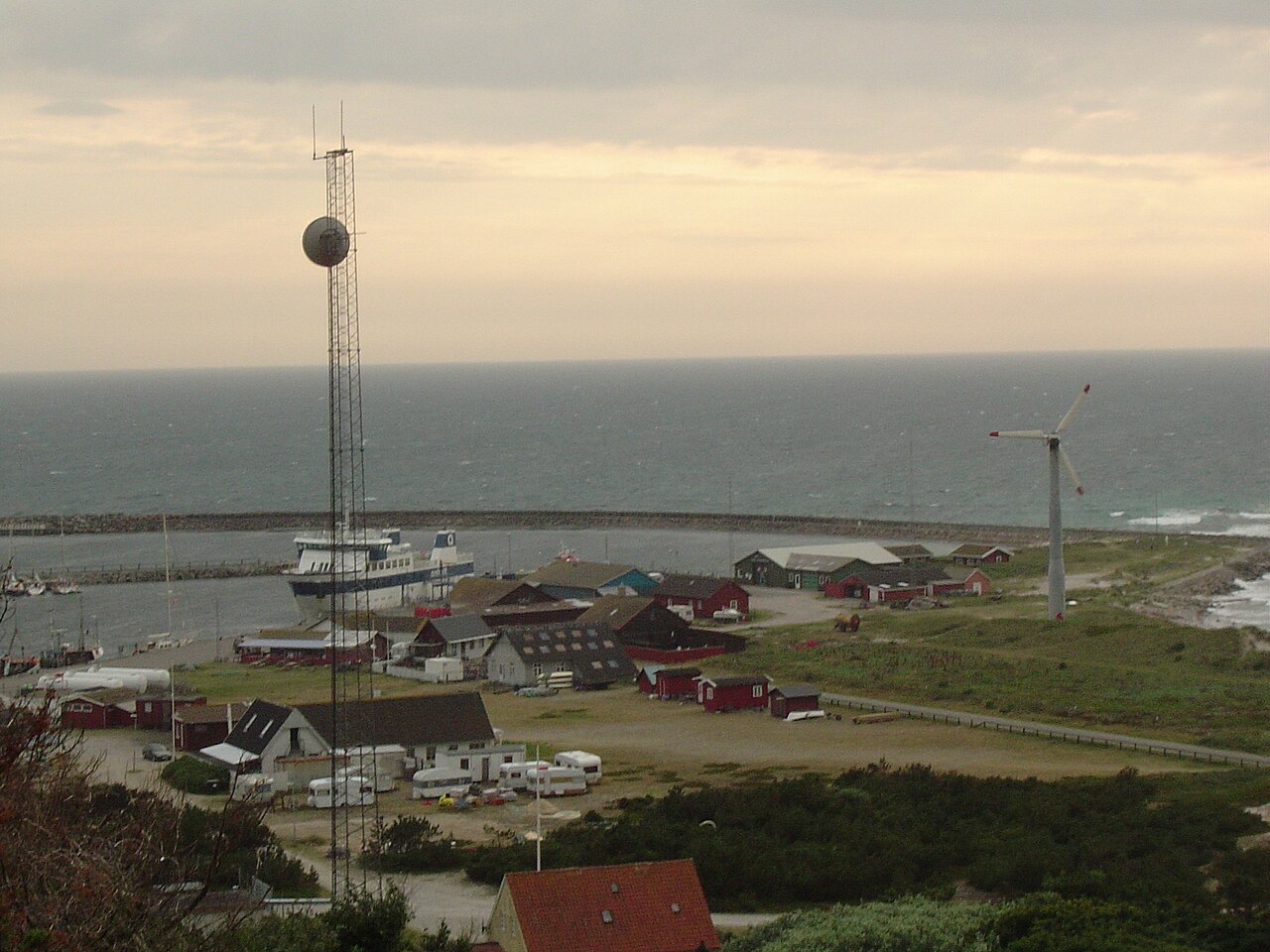
- Sønderbjerg and Nordbjerg — Western Anholt
These two moraine hills are the highest ground on Anholt. They are modest climbs, but on a clear day the view reaches across the water to Jutland or Sweden. They also show clearly how the wooded, inhabited west meets the bare Desert beyond. Choose a bright morning for the best visibility. - Anholt Sea Wind Farm — Offshore, Kattegat
Out in the water off the island stands a large offshore wind farm, visible from the shore on clear days as a line of turbines. It is a reminder that Anholt sits in busy, windy open sea. The same breezes that power it also draw kitesurfers to the island each summer.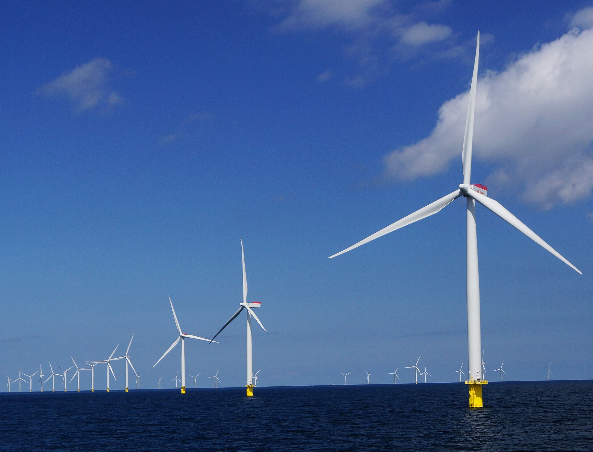
Culture
Anholt's culture is that of a very small island community that lives with the sea and with seasonal visitors. The population is tiny, the ferry is the lifeline, and daily rhythm follows the weather and the crossing. In summer the harbour becomes a social hub, with sailors from across northern Europe mixing with Danish holidaymakers and the few people who live here all year. The island has made room for music: small festivals are held each summer, and Anholt Festival and Langt Ude på Anholt are two of the better-organised ones. The community centre, Pakhuset, is the place to learn what is happening locally. Kitesurfers gather for an annual meet in high summer, and there are efforts to stretch the season with events such as a marathon. Land use here also shapes character. The Desert is protected and unbuilt, so the island has a deliberate, unhurried quality, and Danish habits of tidiness, informality and quiet consideration suit it well. Many houses are summer homes whose owners return year after year, which gives the place a close, neighbourly feel in season and a hushed one in winter. Keep to the marked paths on Ørkenen and carry your rubbish out with you, because the heath is protected and slow to recover from trampling.
What to wear
Anholt has no distinctive island costume that we could source, so the traditional picture is the wider Danish one. Folk dress, the nationaldragt, is made from wool, linen and cotton, with embroidered bodices, aprons and caps for women and breeches and waistcoats for men, and it is worn today mainly at festivals, folk dancing and national occasions. Fishing and sailing communities across the Kattegat have long favoured knitted wool jumpers and oilskins, and that practical heritage is still visible. What people wear now is simple and weatherproof: jeans or shorts, wool or cotton jumpers, windproof jackets, rubber boots or trainers, and swimwear on warm days. Sailors wear proper deck shoes and waterproofs. Nobody dresses up, even for dinner at the harbour. A visitor should pack layers, since the sea breeze can feel cool even on a sunny day, plus a windproof, showerproof jacket and a hat. Sturdy closed shoes or trainers suit the soft sand and heath of Ørkenen better than flip-flops. Sun protection matters on the open beaches, where shade is scarce. There are no strict modesty rules, but cover shoulders and knees if stepping into the church, and keep swimwear for the beach.
What to eat
- Smørrebrød — Harbour restaurants and cafés
Open sandwiches on dense rye bread are the standard Danish lunch, topped with fish, egg, cold meat or pickles. They suit a day on the beach or a harbour-side table. Expect them at the harbour eateries in season. - Fresh and smoked fish — Harbour eateries and fish counters
With the sea all around, fish is the obvious order: fried plaice, herring, or smoked fish eaten with rye bread and a sharp dressing. Availability follows the catch and the season, so ask what is fresh that day. - Rugbrød and bakery bread — The island shop and bakery counters
Dark, seeded rye bread is the base of Danish eating and a good picnic staple, served with butter, cheese or fish. Buy a loaf for the beach or the walk across the heath. - Wienerbrød — Island shop and harbour cafés
Danish pastry, the flaky, buttery kind called wienerbrød at home, comes with custard, cinnamon or remonce filling. It is the classic mid-morning sweet with coffee and sells quickly in summer. - Ice cream — Harbour kiosks
A cone eaten on the harbour wall is a ritual of the Danish summer. Kiosks sell soft-serve and scoops from late spring, and queues form on warm afternoons. Many kiosks close with the season.
Plan it
Best time. Late June to August brings the warmest weather, swimmable water, the festivals and full opening of eateries and shops, but also the biggest crowds at the harbour. Early September is calmer and still mild. In winter the island is quiet, windy and largely shut.
How long. 2–3
Getting there. Take the ferry from Grenaa on the Jutland coast; Aarhus is the nearest major airport and rail hub, with onward trains or buses to Grenaa. Check the ferry operator's official site for sailings and booking, especially for cars. Sailors can use the marina but should confirm a berth in summer.
Budget. mid
Tips
- Book the ferry and accommodation well ahead for July and early August
- Bring cash and a card, and stock up on essentials, as shops are few and close out of season
- Carry water and sun protection for the open heath and beaches
- Pack a windproof layer even in summer
- Check the Pakhuset community centre for events during your stay
Etiquette
- Keep to marked paths on the protected Ørkenen heath
- Take all rubbish with you and leave dunes undisturbed
- Respect quiet hours around holiday houses
Nearby
Sources
- Wikidata Q216845 (CC0)
- Wikipedia: Anholt (island), rev 1364428151 (CC BY-SA 4.0)
- Wikivoyage: Anholt, rev 5138568 (CC BY-SA 4.0)
- Aerial view of Anholt Island, Denmark — JialiangGao (CC BY-SA 2.5)
- Anholt, Ørkenen — Old Dane (CC BY-SA 4.0)
- Reconstruction of an old bascule light at Skagen — Henrik Jessen (CC BY-SA 2.5)
- Anholtfærgen — Old Dane (CC BY-SA 4.0)
- Port of Anholt — Tone (CC BY 3.0)
- Anholt Nordstrand — Old Dane (CC BY-SA 4.0)
- Anholt Sea Wind Farm — Old Dane (CC BY-SA 4.0)
- Anholt — Kristine Riskær (CC BY 2.5)


