Geirangerfjord
Geirangerfjord, Norway
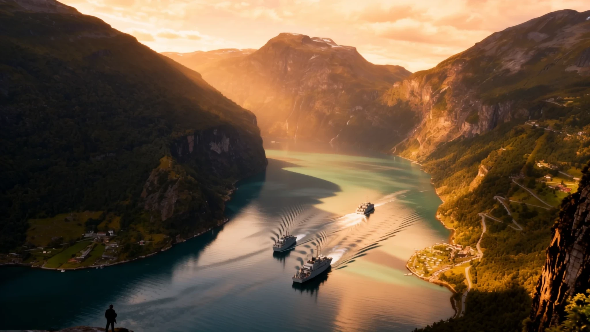
Carved by ancient ice, Geirangerfjord pairs sheer rock walls and plunging waterfalls with dramatic engineering marvels in Western Norway.
The place
Geirangerfjord forms a remarkable arm of the broader coastal waterway system in the Sunnmøre region of Møre og Romsdal county, Norway. Set entirely within Stranda Municipality, this deep water channel cuts inland as a branch of the Sunnylvsfjorden, which itself feeds off the larger Storfjorden. At the innermost tip of the fjord lies the small settlement of Geiranger, where the rushing waters of the Geirangelva river meet the tide.
The surrounding county presents a dramatic landscape of towering alpine peaks, deep valleys, green islands, and some of the highest waterfalls in the country. While the coastal fringes host bustling island communities and major towns, the interior landscape remains sparsely populated and intensely vertical. Rivers flow swiftly from high mountain plateaus down narrow valleys to the water's edge, contrasting sharply with the slow-flowing rivers of the eastern regions.
Visitors arrive to find a landscape defined by water and stone. The sheer rock faces rise steeply from the dark surface, broken only by historic mountain farms clinging precariously to ledges high above the waterline. Engineering achievements bring travellers into this rugged terrain, from serpentine mountain roads carved into cliff edges to a scenic railway ending at Åndalsnes. Weather shifts rapidly between bright sunlit fjords and low-hanging mountain mists, making every view distinct.
Its story
The history of Geirangerfjord is written in stone, ice, and the resilience of those who settled its high ledges. Long before roads pierced the region, farmers established homesteads on mountain shelves accessible only by steep footpaths and rope ladders. These isolated farms allowed families to graze livestock and keep away from tax collectors, though daily life demanded extraordinary physical endurance and carried constant risks from avalanches and rockfalls.
The modern chapter of the fjord began as travellers and artists discovered the raw grandeur of Western Norway during the nineteenth century. Early steamships brought curious visitors to the waters beneath the cliffs, transforming quiet fishing and farming settlements into favoured destinations. To accommodate the growing influx of travellers and connect remote interior communities, engineers undertook extraordinary public works.
Road builders carved daring mountain passes through solid rock, mastering gravity with hairpin bends and stone bridges that remain triumphs of Scandinavian engineering. Meanwhile, the region embraced modern hydroelectric power production, harnessing the rushing mountain streams in Tafjord and Sunndal to fuel local industry. Today, while the old mountain farms stand abandoned as silent heritage sites, the fjord continues to draw travellers who follow the historic routes carved by water and ice.
What to see
- Geirangerfjord from Flydalsjuvet — Flydalsjuvet
A dramatic roadside viewpoint perched high above the village and deep waters, offering one of the most classic vistas across the steep canyon walls and cruise ships resting on the fjord below.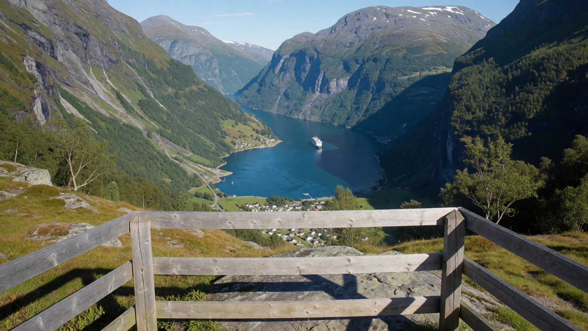
- Ørnesvingen — Ørnesvingen, Stranda
The Eagle's Bend features a succession of eleven hairpin turns climbing steeply up the mountainside, rewarding drivers with a panoramic viewing platform looking straight down the main channel.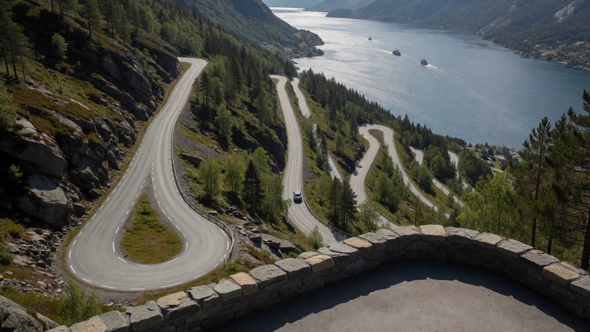
- Seven Sisters and Suitor Waterfalls — Geirangerfjorden
Legendary cascades plunging directly from the high cliffs into the fjord. The Seven Sisters drop as multiple distinct streams, while the Suitor faces them from across the deep channel.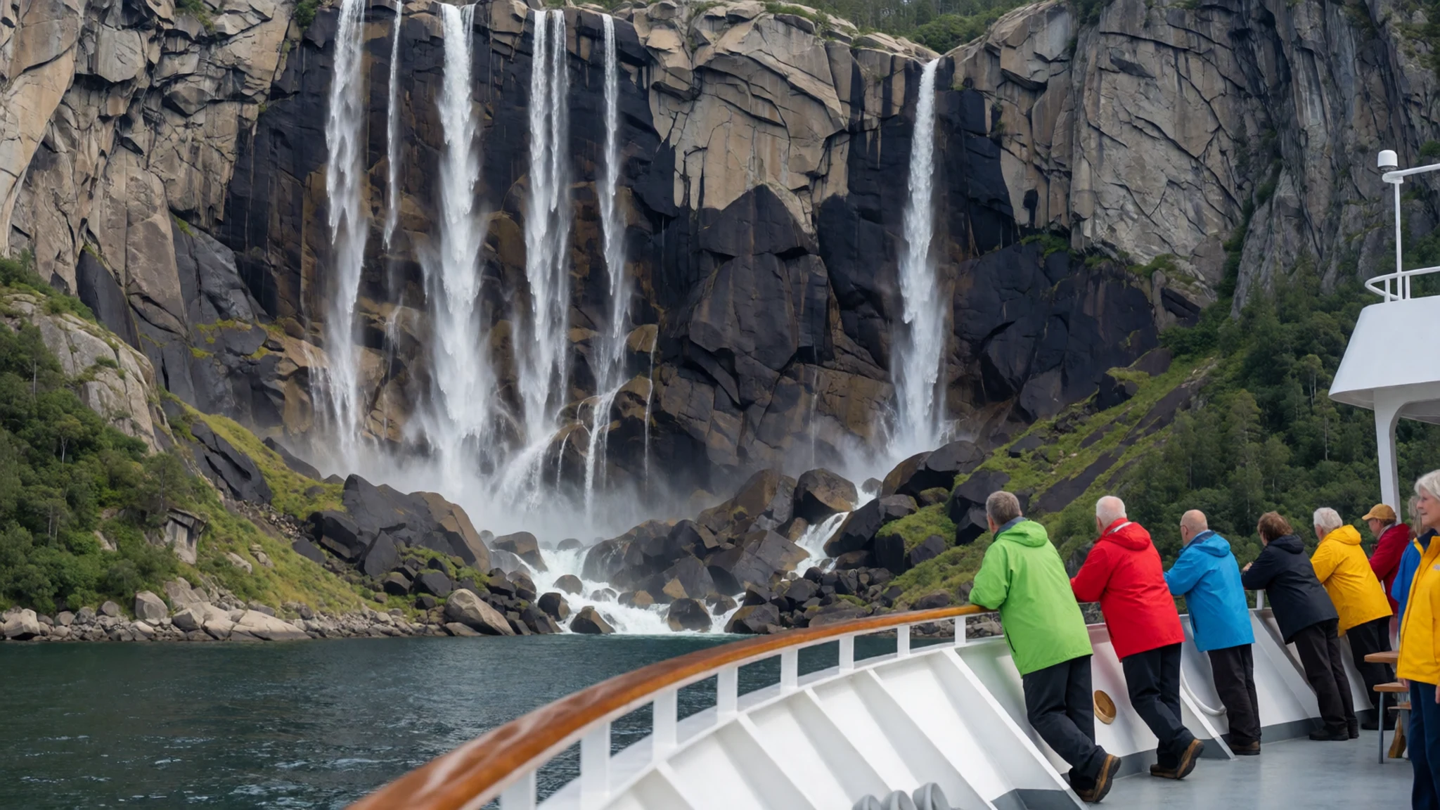
- Dalsnibba Viewpoint — Dalsnibba
A high mountain plateau reachable by toll road that places visitors high above the surrounding peaks, providing an extraordinary panoramic look down upon the entire fjord system.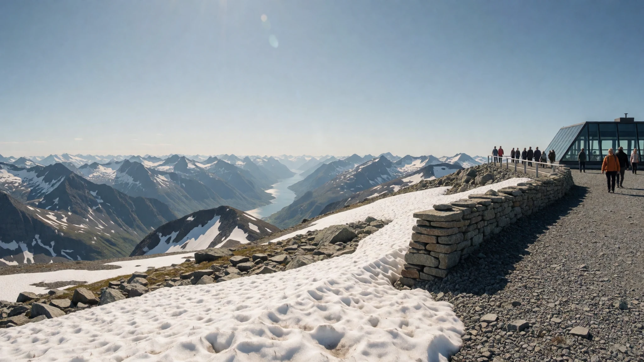
Culture
Life in Møre og Romsdal has long been shaped by the challenging terrain and the bounty of the surrounding sea and rivers. Communities in this western county developed resilient maritime traditions, pioneering deep-sea fishing, fish processing, and coastal trade routes that connected remote island settlements to international markets in Portugal and Spain. Music and local festivals hold an important place in regional life, ranging from major jazz gatherings in coastal towns to lively summer rock events in interior valleys.
Traditional craftsmanship and local food production remain matters of regional pride, from small-scale brewing in Liabygda to coastal fisheries. People here value quiet independence, outdoor pursuits, and a deep respect for the natural environment that frames their daily routines. Weather dictates much of the rhythm here, and locals are accustomed to adapting plans when mist rolls in or mountain passes close.
Keep noise levels low in quiet nature reserves and residential village areas to preserve the peaceful atmosphere of the valley.
What to wear
Traditional attire in Møre og Romsdal is represented by regional folk costumes known as bunad, featuring detailed embroidery, woolen waistcoats, tailored jackets, and silver brooches that signify family heritage and home districts. These garments are worn with great care during national celebrations, weddings, and local festivals.
In daily life, contemporary dress across the region prioritises comfort, warmth, and practicality. Because western Norway experiences changeable weather conditions, locals dress in layers regardless of the season.
Visitors should pack functional outdoor clothing, including windproof and waterproof outer layers, sturdy hiking boots with good grip for uneven mountain trails, and insulating wool or fleece garments. Even during summer months, high altitude viewpoints and boat trips on the water can turn remarkably cold and breezy.
What to eat
- Bacalao — Traditional coastal eateries and local restaurants throughout the county
Dried and salted cod prepared in a rich one-pot dish with tomatoes, onions, and potatoes, reflecting centuries of historic trade links between coastal Norway and the Iberian Peninsula.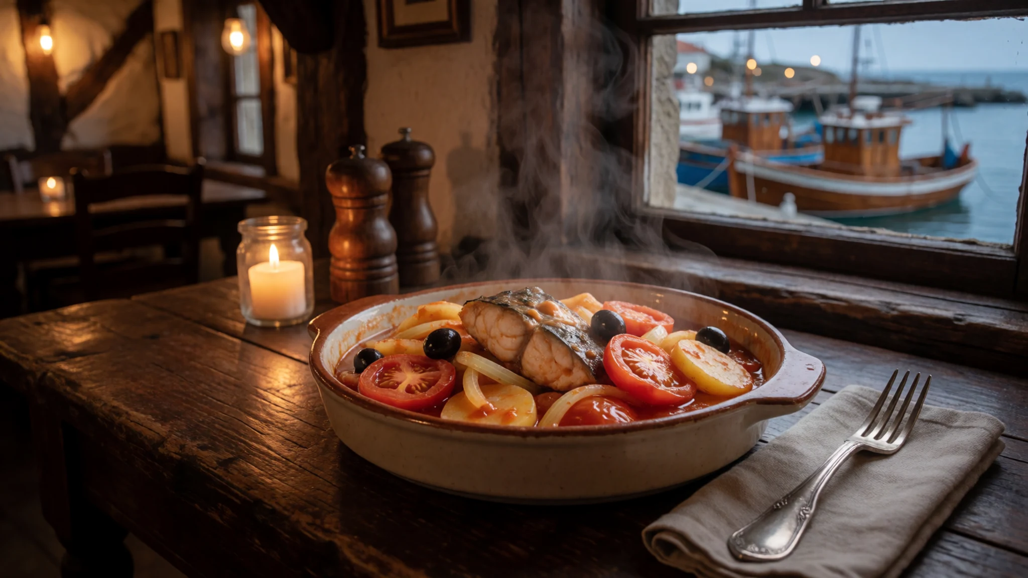
- Raspeball — Traditional Norwegian taverns and hearty home-style diners
Traditional heavy potato dumplings often served with salted meat, mashed swede, and melted butter. In local coastal variants, fish is added to create mixed dumplings known as blandeball.
- Svele — Ferry cafeterias and roadside cafes across Møre og Romsdal
A thick, folded sweet pancake traditionally served warm on coastal ferries and local bakeries, frequently slathered with butter, brown cheese, or sugar.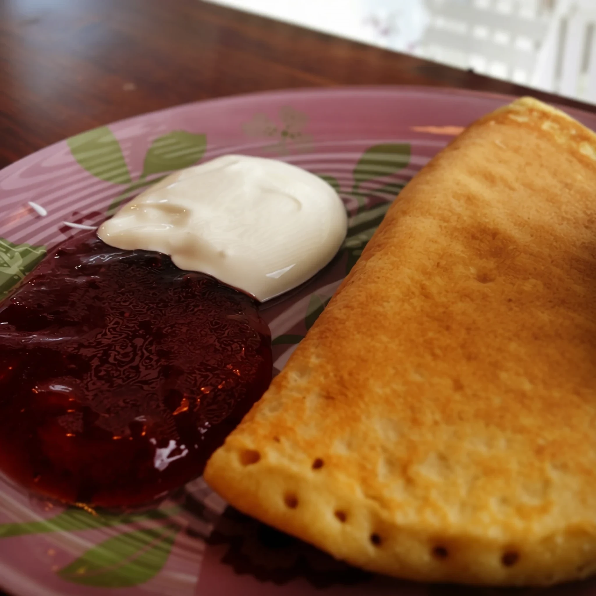
- Slogen Beer — Local pubs and regional beverage shops
A contest-winning regional craft beer brewed in Liabygda, prized for its crisp mountain-water base and rich malt profile.
Plan it
Best time. June through August offers accessible mountain passes, ferries, and milder hiking weather; late spring and early autumn bring fewer crowds but potential road closures due to snow.
How long. 2–3
Getting there. Fly into Ålesund Airport, Vigra, then continue by bus or rental car via Road 15 and Road 63 into the fjord region; scenic express buses and summer cruise ferries also link the coast to Geiranger.
Budget. high
Tips
- Book ferry crossings and accommodation well in advance if travelling during peak summer months
- Start excursions early in the morning to avoid heavy cruise ship crowds in Geiranger village
- Use engine braking carefully on steep mountain descents to prevent brake fluid from overheating
- Keep cards and some cash handy, though digital payments are widely accepted across Norway
Etiquette
- Respect private property boundaries when hiking near mountain farms
- Do not leave litter on walking trails or scenic viewpoints
Nearby
Sources
- Wikidata Q193989 (CC0)
- Wikipedia (rev 1366013015) (CC-BY-SA 4.0)
- Wikivoyage (rev 5399340) (CC-BY-SA 4.0)